Top 5 Weather Events of 2020
# 1: Record High Lake Levels & Flooding Along the Bay of Green Bay and Lake Michigan
The Lake Michigan-Huron basin established monthly record high levels from January through August. In July, Lake Michigan reached an all-time record high level of 582.20 feet eclipsing the old record of 581.99 feet set in 1986.
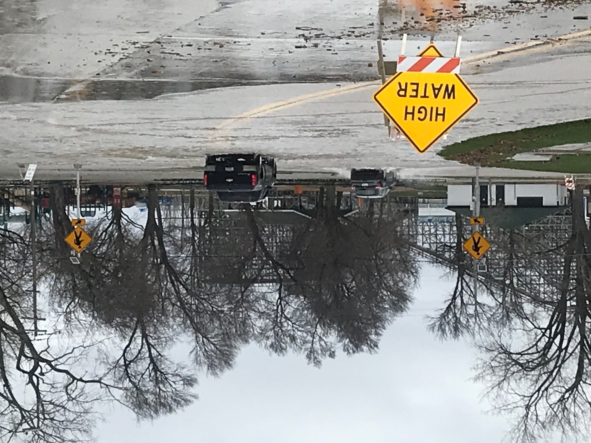
The record high lake levels led to several bouts of lake shore flooding and erosion on the Green Bay and Lake Michigan shoreline, along with long term flooding in southern Oconto County where roads (especially Highway Y) were closed at times. The Kewaunee boat launch was closed for much of the year as over 70% of the launch area was under water. The most notable lake shore flooding events occurred on April 29th and then again from May 17th through the 19th. The April 29th event was a shorter, but more pronounced with flooding noted in the Green Bay area including at the Bay Beach Amusement Park.
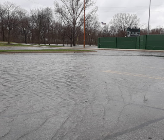
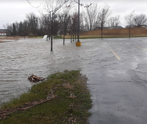
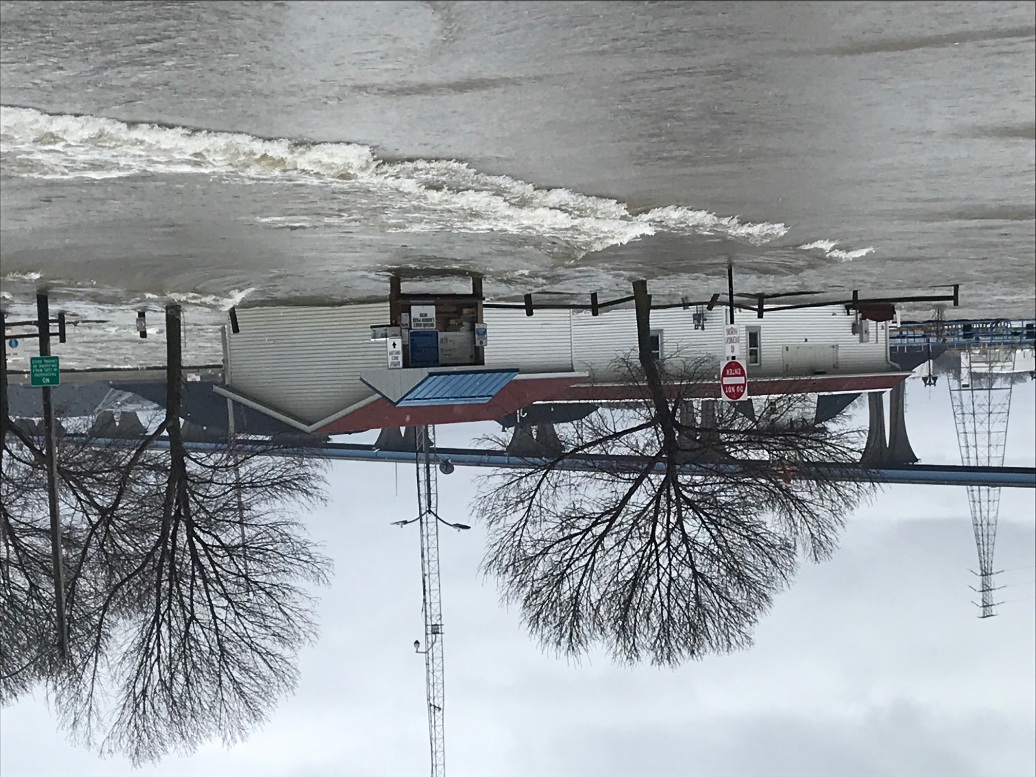
April 29th Flooding
| Near East High School - Green Bay | Near The Rite Place - Allouez | Optimist Park South - Green Bay |
 |
 |
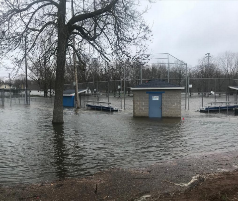 |
| Boat Launch - Green Bay | Near East River - Green Bay | Bay Beach - Green Bay |
 |
 |
 |
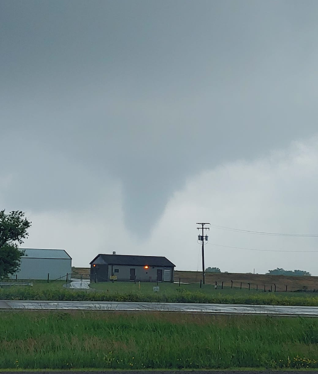
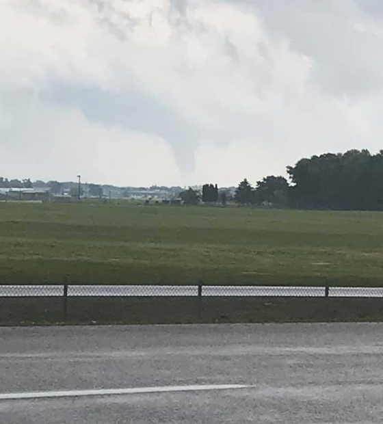
#2: June 20th Tornadoes
A cold front brought intensifying thunderstorms that caused scattered straight-line wind damage across east-central Wisconsin during the afternoon. There was one tornado near Butte Des Morts and two waterspouts (Lake Winnebago and Lake Butte Des Morts) reported across Winnebago County.
| Butte Des Morts - Off Highway 45 | SE of Wittman Regional Airport | Lake Winnebago |
 |
 |
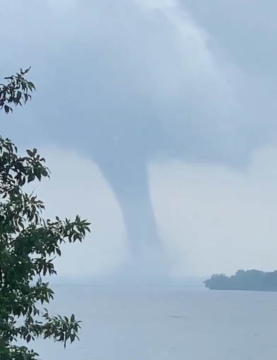 |
| Photo by: Hunter Bolssen | Photo by: Glenn Nelson | Video / Still Image by: Nate Laudolff |
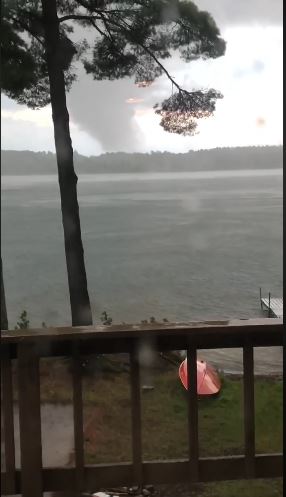
#3: Tornadoes Hit The Northwoods - August 9th
An EF-1 tornado touched down near Star Lake in Vilas County. The tornado was on the ground for six miles before dissipating 5 miles west of Conover. The tornado was photographed as it touched down near Star Lake. A second tornado touched down 4 miles east southeast of St. Germain and traveled nearly 6 miles before dissipating 2 miles southwest of Eagle River. The last tornado to strike Vilas County occurred on July 14,1995 when an EF-1 tornado touched down in Phelps.
A third tornado was reported on this date when an EF-1 tornado touched down about 4 miles east of Alvin in Forest County around 9:12 PM CDT, then into Florence County before entering Upper Michigan. The tornado dissipated 5 miles south of Caspian, Michigan or a tenth of a mile north of the Michigan border around 9:22 PM CDT.
In Florence County, there have only been 4 documented tornadoes to hit the county since 1950. The last tornado to hit the county occurred on April 10, 2011 when an F/EF-0 tornado touched down 3 miles southeast of Argonne and moved to 6 miles southeast of Long Lake. In Forest County, there have been only 7 documented tornadoes since 1950. The last tornado to strike Forest County occurred on April 10, 2011 when two tornadoes were reported.
| Star Lake - Vilas County |
 |
|
Video / Still Image by: Christopher Hofmeister |
#4: New Year’s Day Oconto County Ice Jam Flooding
An ice jam and high river stages produced flooding in the city of Oconto, beginning on December 31st and continuing through New Year’s Day into the morning of the 2nd. The flooding was called the worst in decades. Water surrounded many homes and some businesses and the city of Oconto declared a flood emergency. Oconto had similar flooding from ice jams in the late 1800s, 1922, and 1986. An estimated $480,000 worth of damage was reported during this event.
Tied #5: July 26th Flash Flood and Heavy Rain
An approaching cold front interacted with a hot and humid air mass to produce areas of showers and thunderstorms that brought heavy rain across portions of northern Wisconsin during the morning hours. Rainfall amounts ranged from 3 to 8 inches across northern Wisconsin, which produced some flash flooding, especially in Antigo. Some of the higher observed rainfall totals: Willow Reservoir 5.20 inches, Antigo 4.01 inches, 6 NW Rhinelander 3.69 inches, Suring 3.47 inches and 2 SSE Hazelhurst 3.38 inches.
Several roads and culverts were damaged as a result of the flooding with several towns declaring disasters in Langlade County. An estimated $318,500 worth of damage was reported from this event.
Tied #5: April 12th Winter Storm
A strong spring storm brought significant snow, sleet and gusty winds to northeast Wisconsin from the late morning of April 12th through the early morning hours of April 13th. The wet, heavy snow and strong winds produced some isolated power outages across north-central Wisconsin. A heavy band of snow generated 6 to 15 inches from north of a Marshfield to Wausaukee line, with lighter amounts to the south.
Some of the higher snowfall totals included 15.0 inches in Spread Eagle (Florence Co.), 13.0 inches in Gleason (Lincoln Co.), 12.8 inches in Pelican Lake (Oneida Co.), 12.5 inches near Merrill (Lincoln Co.) as well as Argonne (Forest Co.), 11.8 inches near Amberg (Marinette Co.), and 10.0 inches in Lac Vieux Desert (Vilas Co.).

