Below Average Spring Flood Risk in Northeast Wisconsin
Key Points
Flood Outlook

The risk of spring flooding is below average for much of northeast Wisconsin including the following river basins: Fox, Little Wolf, Menominee, Oconto, Waupaca, Wisconsin, Wolf and Yellow. The greatest risk of spring flooding is along the Wolf, Wisconsin and Yellow River, where minor low-land flooding may occur. The increased flows on the Wisconsin, Wolf and Yellow River will be due to melting of the remaining snowpack and recent rainfall. The greatest potential for flooding will occur with any additional heavy rainfall events that occur on top of frozen soil in addition to continued snowmelt across the Northwoods. Central, east-central and far northeast Wisconsin has lost all snowpack, which will help to limit overall flood threat in those locations.
River flooding in Wisconsin typically occurs in March and April when there is a rapid snowmelt and/or heavy rain. But, it can happen any time of year when there is heavy rain.
Shoreline flooding and river flooding near river mouths near Lake Michigan, due to the High Lake Michigan Water Levels is expected to continue into the summer. Impacts mainly occur due to strong storms with high winds and waves. Lake level will largely depend on the amount of precipitation. The greatest impacts occur near the mouth of the East, Fox, Oconto and Menominee River.
Seasonal Flood Probability Graphics
Seasonal Flood Probability Table
Current River Levels and Short Term Forecast River Levels
Flood Risk Factors
SnowPack
Snow cover and snow water equivalent has decreased significantly across all of northeast Wisconsin. Most notably, in areas from near Wausau to Shawano to Marinette and points south of that line, where there is no remaining snowpack. The Northwoods still maintains around 6 to 10 inches of snow depth, which is about 5 to 10 inches below normal for this time of year. Snow water equivalents in that area are around 1 to 4 inches, which is in the lowest 10th percentile for this time of year. The snow water equivalent for early to mid February in 2020, was around 4 to 8 inches, which was significantly greater than this year.
StreamFlow
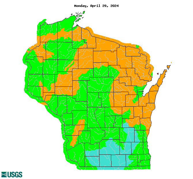
Seasonal streamflows remain near to slightly above average this year, mainly due to the well above normal precipitation that occurred in 2019 into early 2020. There has been improvement in the streamflow over the past month, with nearly all sections of northeast Wisconsin approaching normal levels. The exception is across far northeast and east-central Wisconsin, where rivers are still running close to the 90th percentile. This basically means that most of the rivers have some capacity to take runoff from typical rainfall events and any lingering snowpack.
Soil Moisture
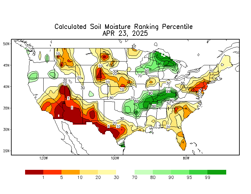
Soil moisture is much lower for the Spring of 2021 versus the very saturated soils that existed in 2020. In fact, much of northeast Wisconsin is running near to below normal for soil moisture, which has led to the area being labeled as "Abnormally Dry" in the latest drought outlook. This will allow the soils to absorb more melting snow and Spring rains, which would provide for only minor flooding at a few locations, pending any late season snow storms or significant rainfall events.
 |
 |
|
| Snow Water Equivalent | Streamflow Compared to Normal | Soil Moisture Percentile |
Looking Ahead
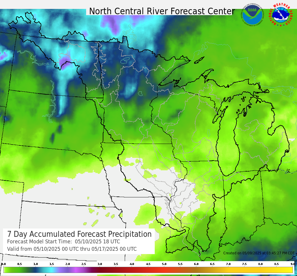
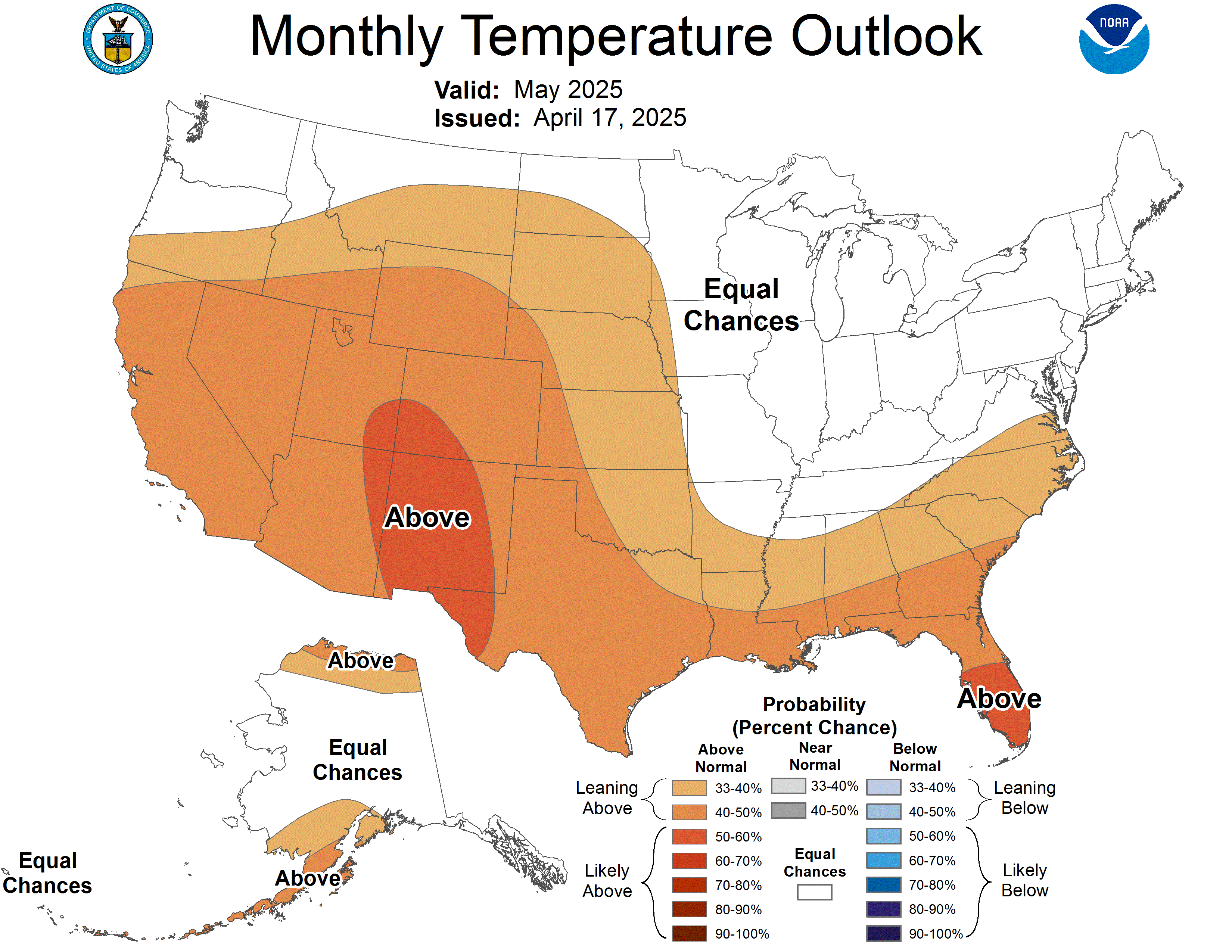
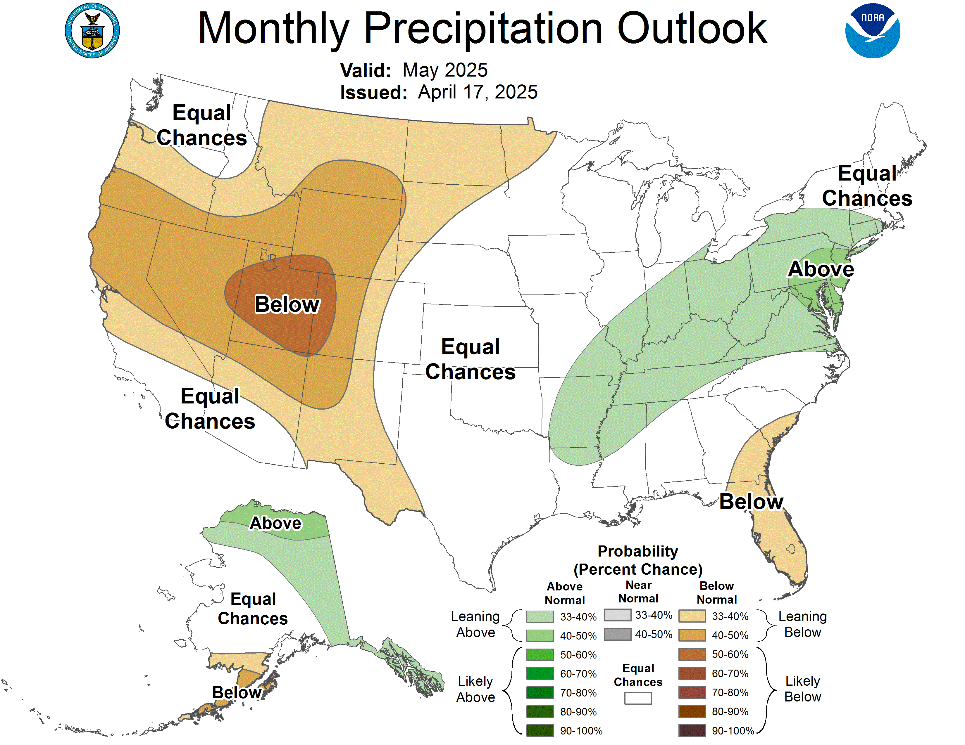
The above normal temperatures over the past couple weeks along with colder nights has allowed the snow to melt off at a more gradual pace. Any additional snowpack across the north will likely have limited impact as the depth and snow water equivalents remain below normal. The main flooding threat appears to hinge on any heavy rainfall events or late season snow storms that impact the area. Of course, any heavy rain that fall before all of the frost is out of the ground, will lead to increased runoff as well; however, conditions have improved across much of northeast Wisconsin. The outlook for March and the spring season shows increased chances for above average precipitation.
| 7 Day Precipitation Forecast |
 |
Extended outlooks from the Climate Prediction Center:
| 8 to 14 Day Temperature Outlook | 8 to 14 Day Precipitation Outlook |
 |
 |
| March Temperature Outlook | March Precipitation Outlook |
 |
 |
How To Prepare Safety
Preparedness/Early Actions:
How To Stay Safe During a Flood:
Additional Information
This is the final Spring Flood Outlook for this season.
If you have any questions or comments about this spring flood outlook please contact:
National Weather Service-Green Bay
nws.greenbay@noaa.gov
 |
Media use of NWS Web News Stories is encouraged! Please acknowledge the NWS as the source of any news information accessed from this site. |
 |