
Thunderstorms, some severe, may produce heavy to excessive rainfall and isolated flooding over portions of the Southern Plains through Saturday. Widespread showers and thunderstorms will spread east into the Great Lakes, Ohio Valley, Mid Atlantic and Northeast. Dry conditions, combined with gusty winds will continue to support an elevated fire weather threat in the Desert Southwest. Read More >
Green Bay, WI
Weather Forecast Office
Heat and Humidity
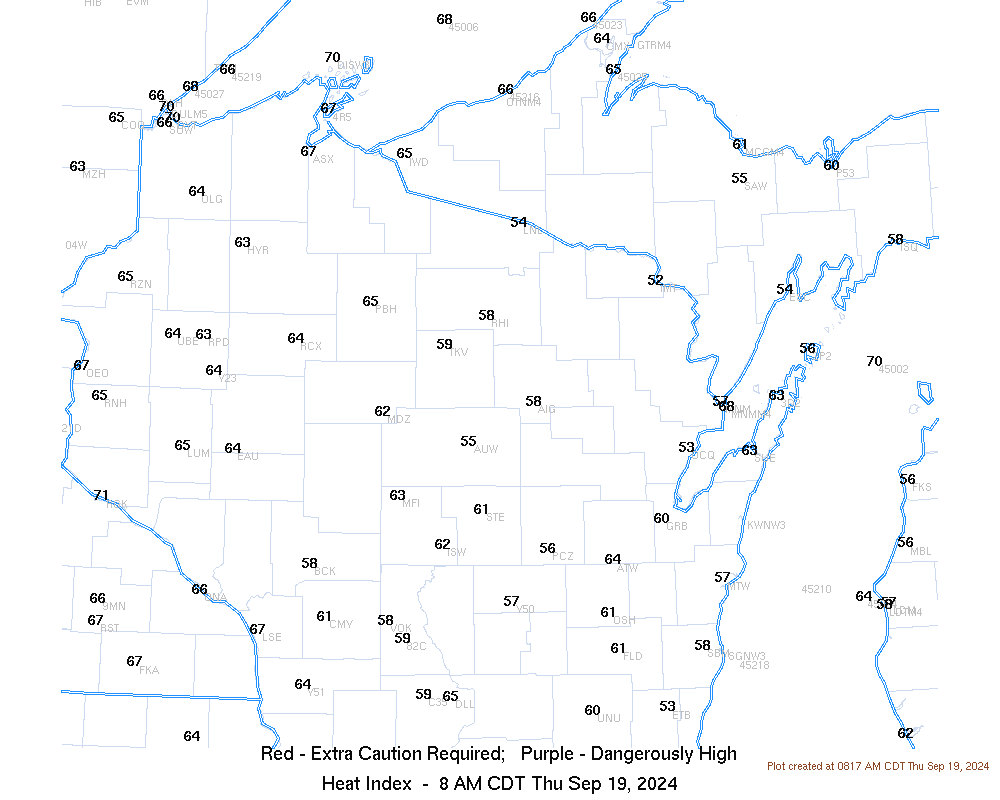
A very warm and humid air mass will settle over Wisconsin today. The combination of high temperatures in the upper 80s to lower 90s and high humidity will result in heat indices of 90ºF to 97ºF. Although the heat advisories have been cancelled for much of central and east-central Wisconsin, people working outdoor workers and those susceptible to heat (such as the elderly and people without AC) should take proper precautions to stay cool.
| Current Watches, Warnings and Advisories - Click for larger view |
Current Heat Index - Click for larger view |
 |
 |
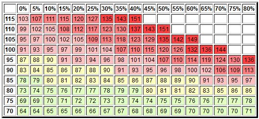
| Heat Index Chart | |
 |
 |
 |
 |
Additional storms may develop today as a front moves into the area from the west, but there is uncertainty as to how strong they may get. Keep up on the weather for today, especially if you have outdoor activities planned--the weather may become hazardous quickly.
 |
 |
Here are some additional links to help monitor the weather:
US Dept of Commerce
National Oceanic and Atmospheric Administration
National Weather Service
Green Bay, WI
2485 South Point Road
Green Bay, WI 54313-5522
920-494-2363
Comments? Questions? Please Contact Us.

