Green Bay, WI
Weather Forecast Office
|
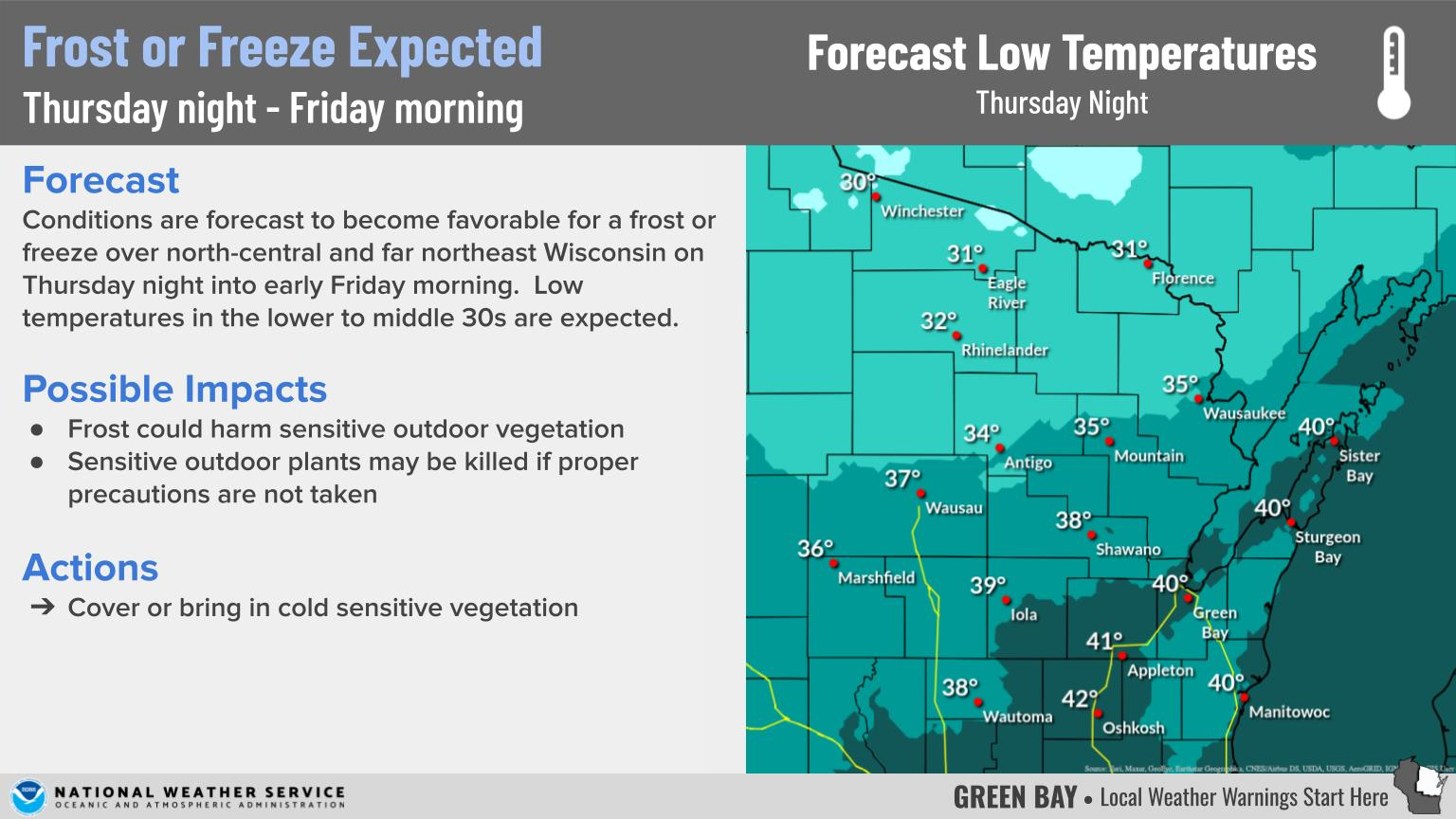
WHAT A winter storm will move across the southern Great Lakes region Friday night through Saturday, bringing periods of moderate snow to the area, with a chance for mix precipitation at times across the Fox Valley and Lake Shore regions. The graphics below breakdown what to expect (click to enlarge).
Light snow will overspread the area early Friday evening, and become moderate to heavy Friday night into Saturday morning. The snow may mix with sleet and freezing drizzle at times from the Fox Valley to the Lake Shore. Snow totals by Saturday night should range from 5 to 7 inches over most locations, with a few higher amounts possible. Gusty winds will also develop and cause some blowing and drifting of the snow at times. Roads across central and northeast will become snow covered and slippery Friday night into Saturday. Monitor road conditions by visiting the Wisconsin DOT site: https://511wi.gov/ CURRENT WEATHER HEADLINES Regional map shows current weather headlines in effect. Note that if a county is under multiple weather headlines only the highest ranked one will display.
|
RADAR
 |
|
 |
Media use of NWS Web News Stories is encouraged! Please acknowledge the NWS as the source of any news information accessed from this site. |
|
US Dept of Commerce
National Oceanic and Atmospheric Administration
National Weather Service
Green Bay, WI
2485 South Point Road
Green Bay, WI 54313-5522
920-494-2363
Comments? Questions? Please Contact Us.