|
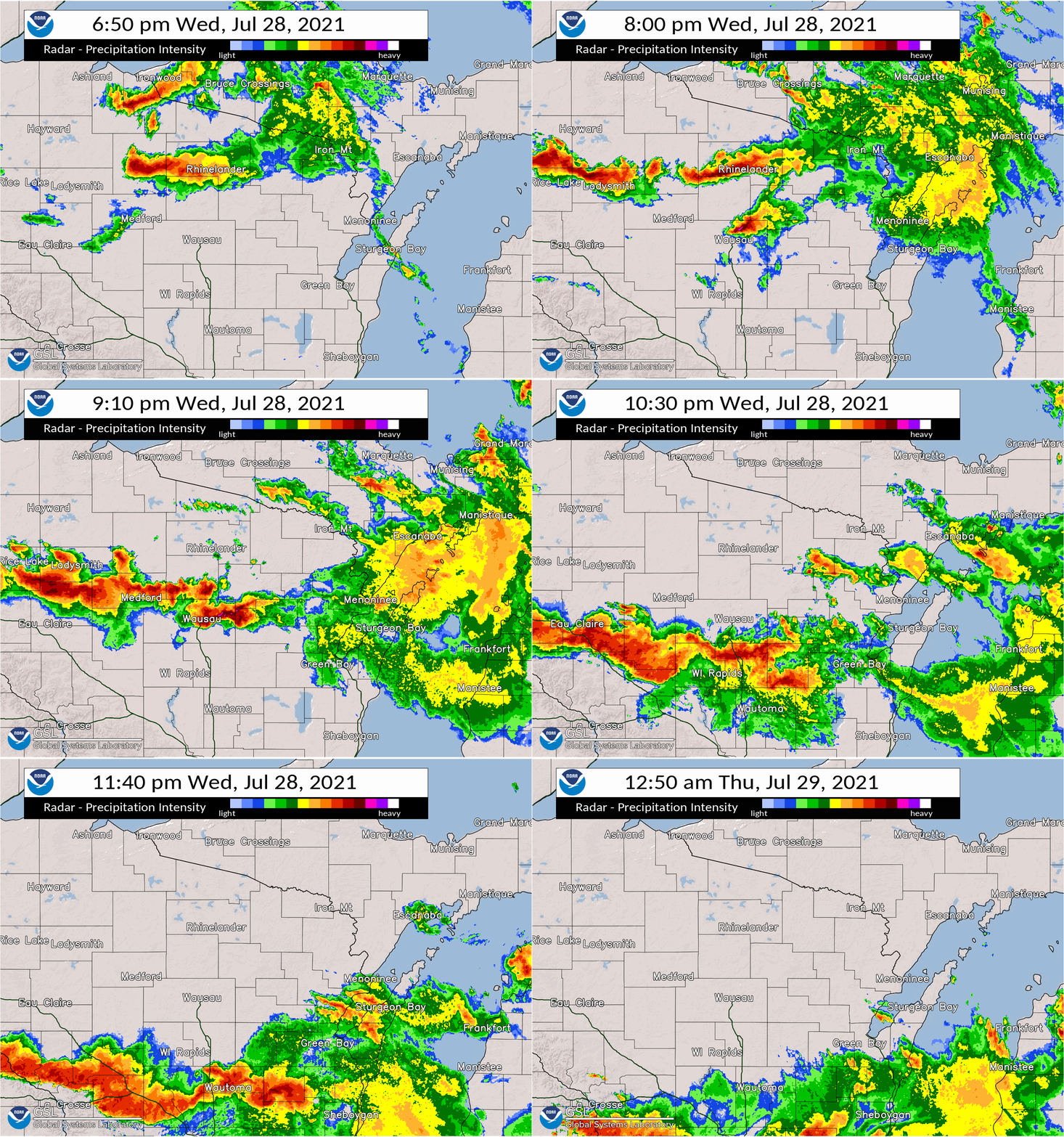
Damage survey data is still being analyzed. Check back for the latest info. A line of severe thunderstorms moved across much of central, north central, and eastern WI during the evening on July 28, 2021. Widespread tree and power line damage was reported from north-central Wisconsin (near Tomahawk) south and southeast to Wausau and southern portions of the Fox Valley. Some of the highlights of the event included an EF1 Tornado just southeast of Merrill, and a dramatic storm collision (cell merger) that initiated an intense storm outflow (surge), which produced widespread straight-line wind damage, impacting the city of Ripon and nearby communities. Wisconsin Public Service (WPS) and We Energies reported a combined total of more than 35,000 power outages at the height of the storm.
Please see the tabs below for more information. |
 |
Tornado Summary / Radar
The Enhanced Fujita (EF) Scale classifies tornadoes into the following categories:
| EF0 Weak 65-85 mph |
EF1 Moderate 86-110 mph |
EF2 Significant 111-135 mph |
EF3 Severe 136-165 mph |
EF4 Extreme 166-200 mph |
EF5 Catastrophic 200+ mph |
 |
|||||
Straight-Line Winds Summary / Radar
|
Preliminary radar analysis associated with scattered, concentrated wind damage (based on both ground and aerial surveys) discussed below. Wind speeds are estimated and will be refined as additional analysis continues. It is important to keep in mind that when reviewing the preliminary radar discussion below, that the storms were located anywhere from 40 to 70 nautical miles (nm) from the GRB WSR-88D radar. At these distances, the lowest radar elevation scan can only sample the mid-levels of the storms (approximately 4000 to 6000 feet above the ground). Thus, important storm features and characteristics evolving closer to the ground are not able to be sampled by the radar. |
West of Bevent (Marathon County)
| Date | July 28, 2021 |
| Time (Local) | 0915 pm - 0930 pm |
| Est. Peak Winds | 70 to 80 mph |
| Injuries/Deaths | None |
|
Summary: See radar discussion below for more details. |
|
|
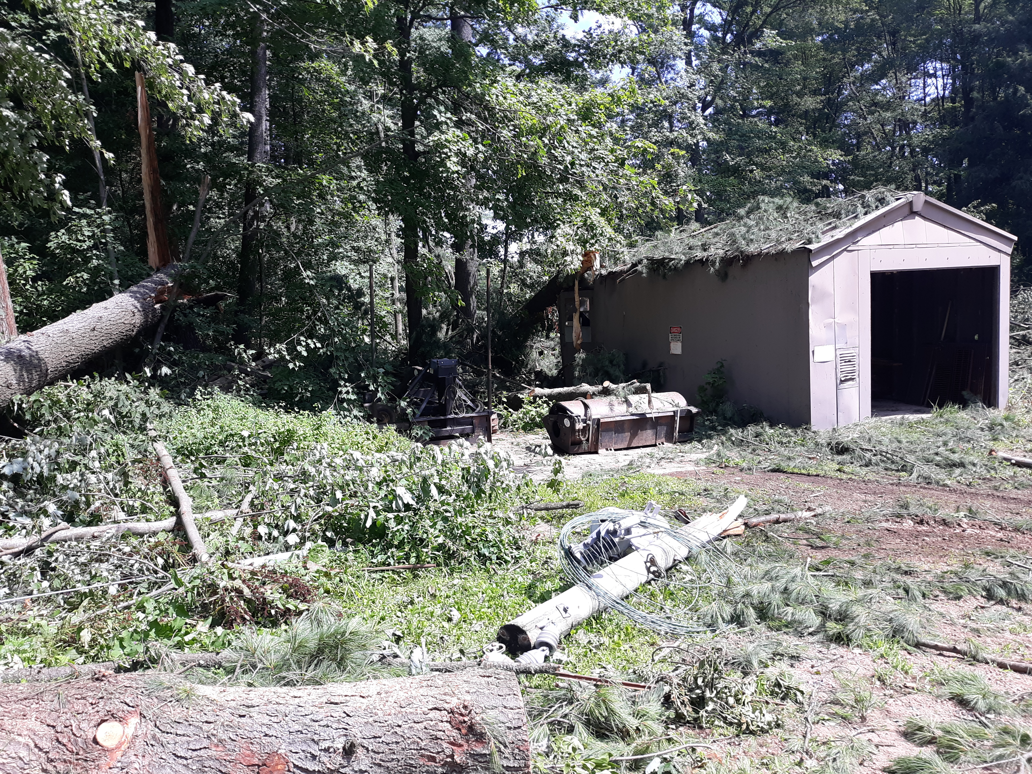
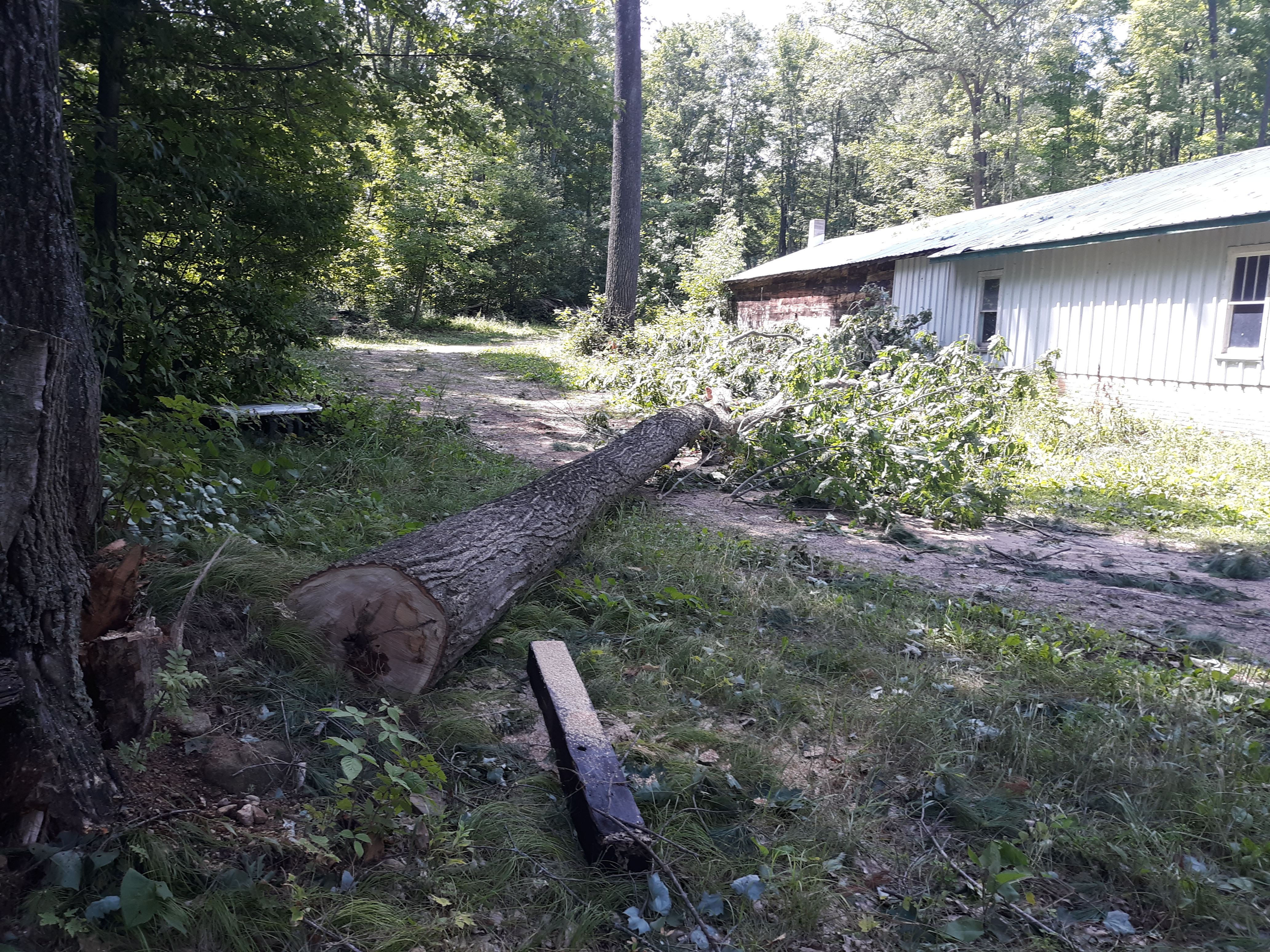
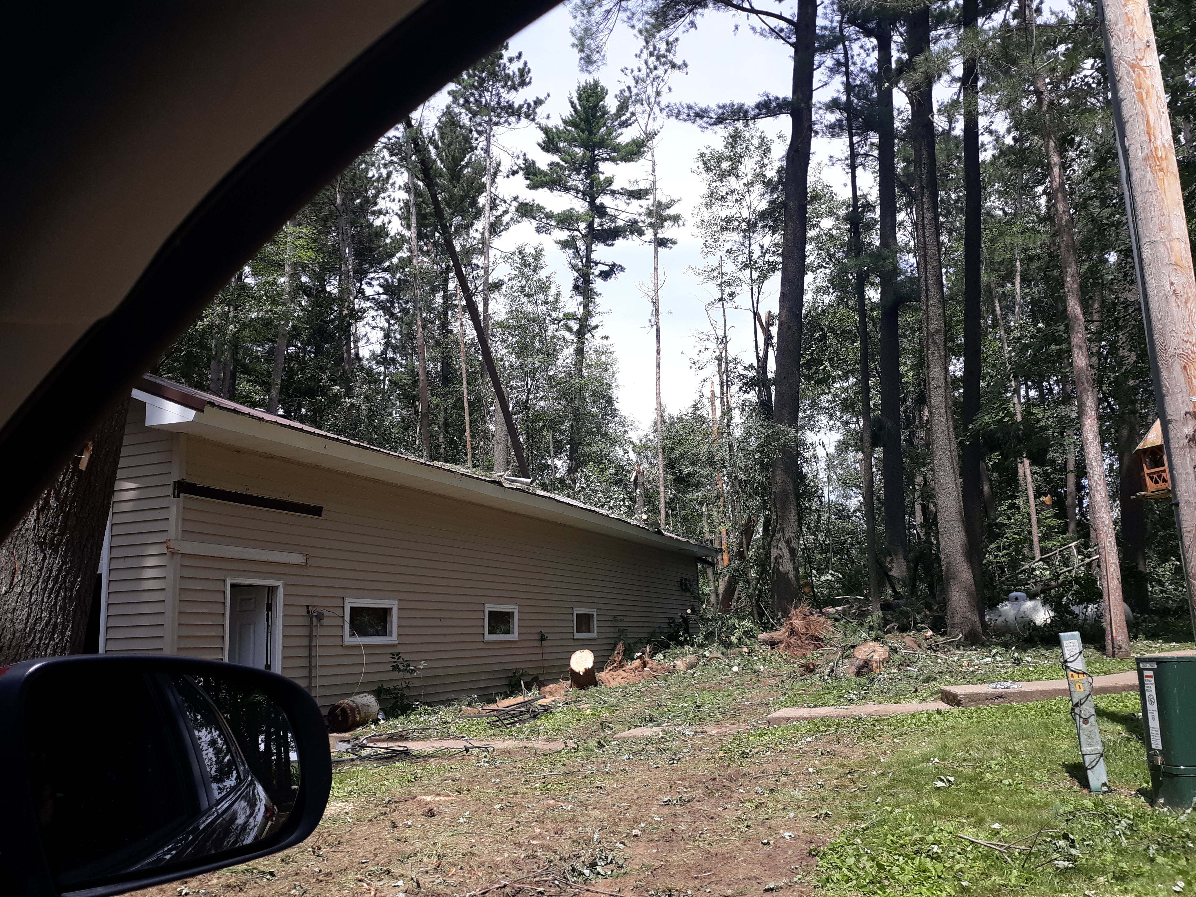
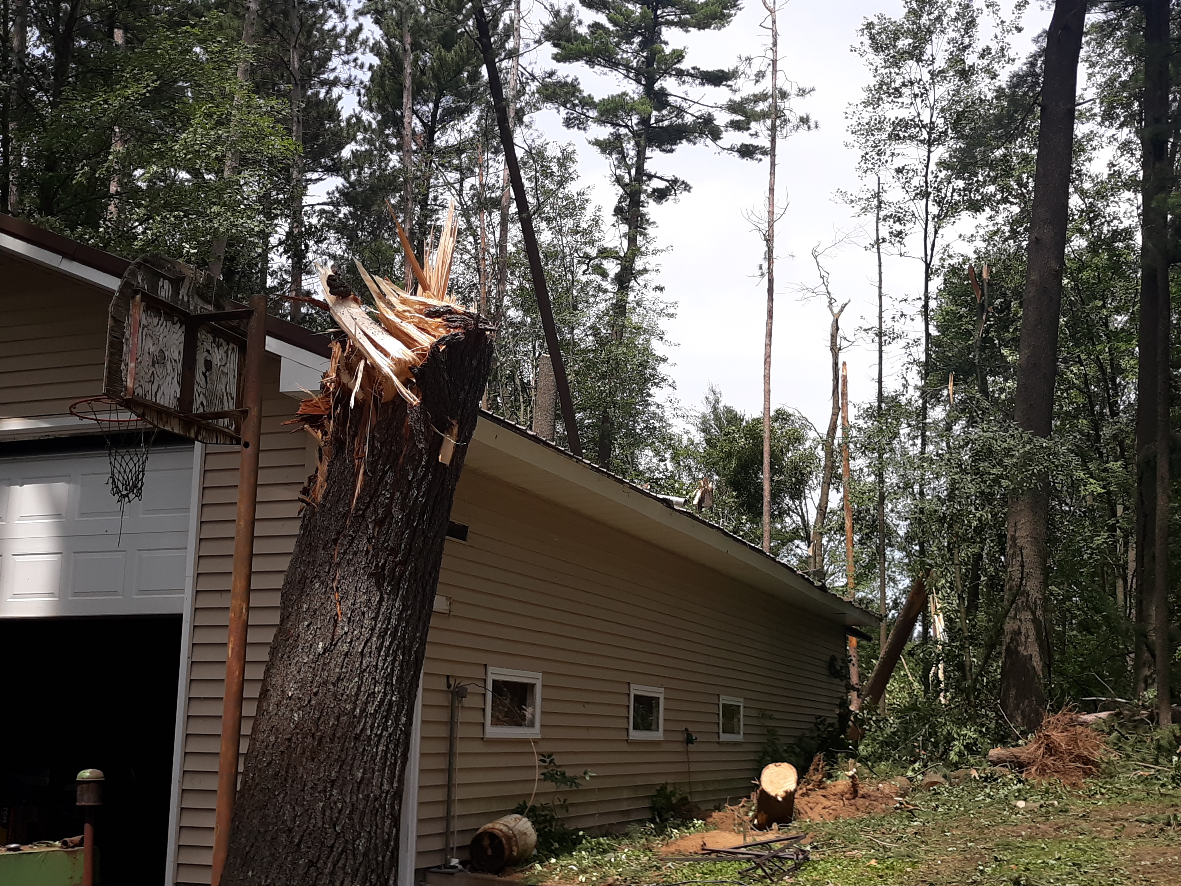
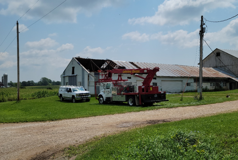
Marathon County, West and Southwest of Bevent (Refer to radar animation to the right) This is the same storm cluster that impacted the Merrill area. By this time, the storm cluster broke out on its own (i.e., became more discrete) and evolved into a rather large and long-lived high-precipitation (HP) supercell. Although we are only able to examine the mid-levels of the storm (~5700 ft) at this distance, we do observe a bit more of the classic (but broad) pendant structure (left panel) accompanied by an initially broad mid-level mesocyclone (right panel). Note the mid-level mesocyclone appeared to strengthen as it approached the area west of Bevent, along County J (Highway 153). It appears the mesocyclone (at this elevation) was positioned near the pendant area in the southwest portion of the storm. Significant damage to a farmstead was observed west of Bevent with more scattered straight-line wind damage further to the southeast. Data gathered from an NWS damage survey in this area is still being examined to determine whether the damage was caused by a macroburst (straight-line winds) or a brief tornado. |
Left panel is reflectivity and the right panel is velocity. |
Photos (below) show damage west of Bevent on Highway 153 (County Rd J), taken from NWS damage survey.
 |
 |
.jpg) |
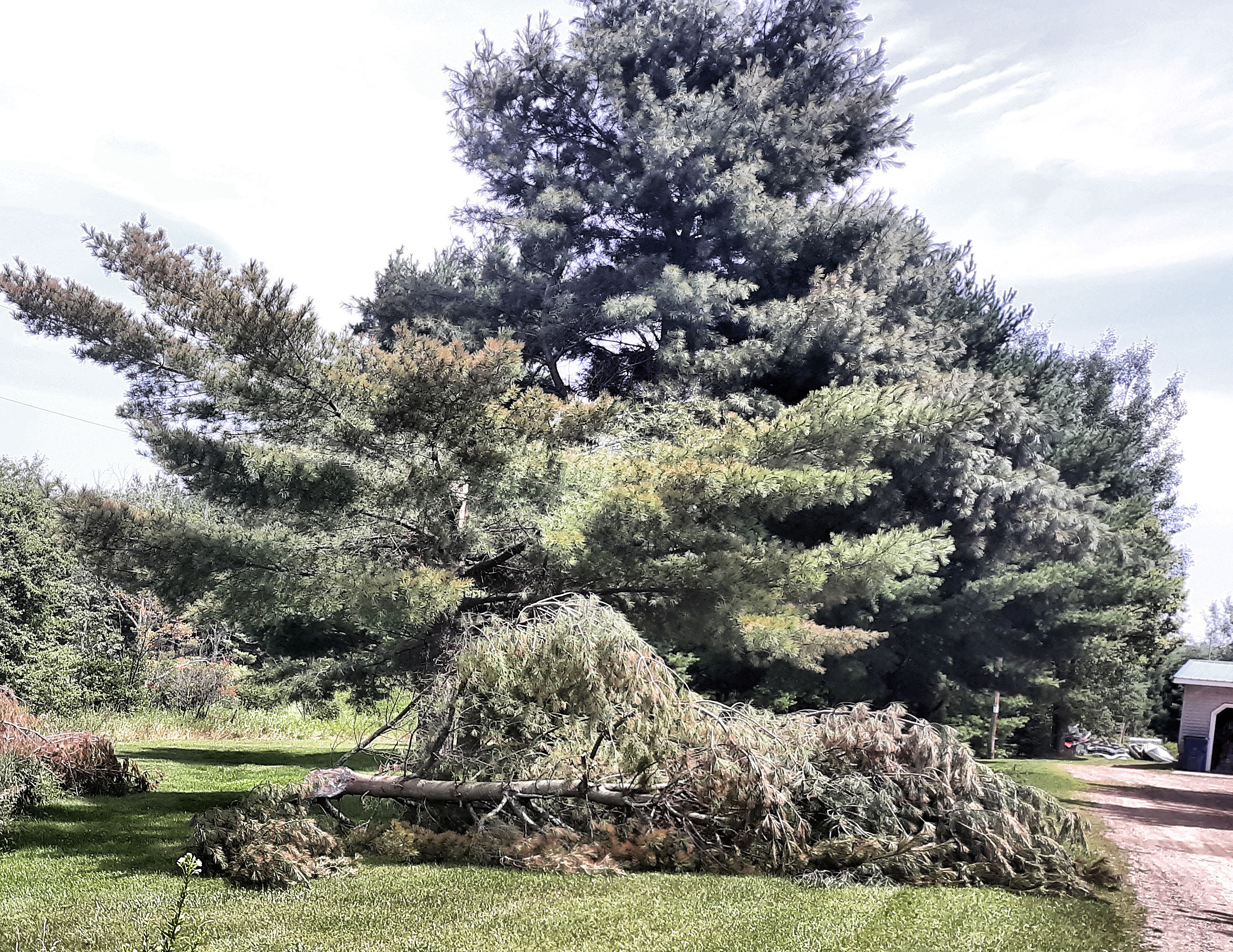
Photos (below) show damage further southeast off County Y (Marathon County), taken from NWS damage survey.
 |
 |
 |
Northeast of Nelsonville (Waupaca County)
| Date | July 28, 2021 |
| Time (Local) | 09:45 pm - 10:00 pm |
| Est. Peak Winds | 70 to 80 mph |
| Injuries/Deaths | None |
|
Summary: See the radar discussion below for more details. |
|
|
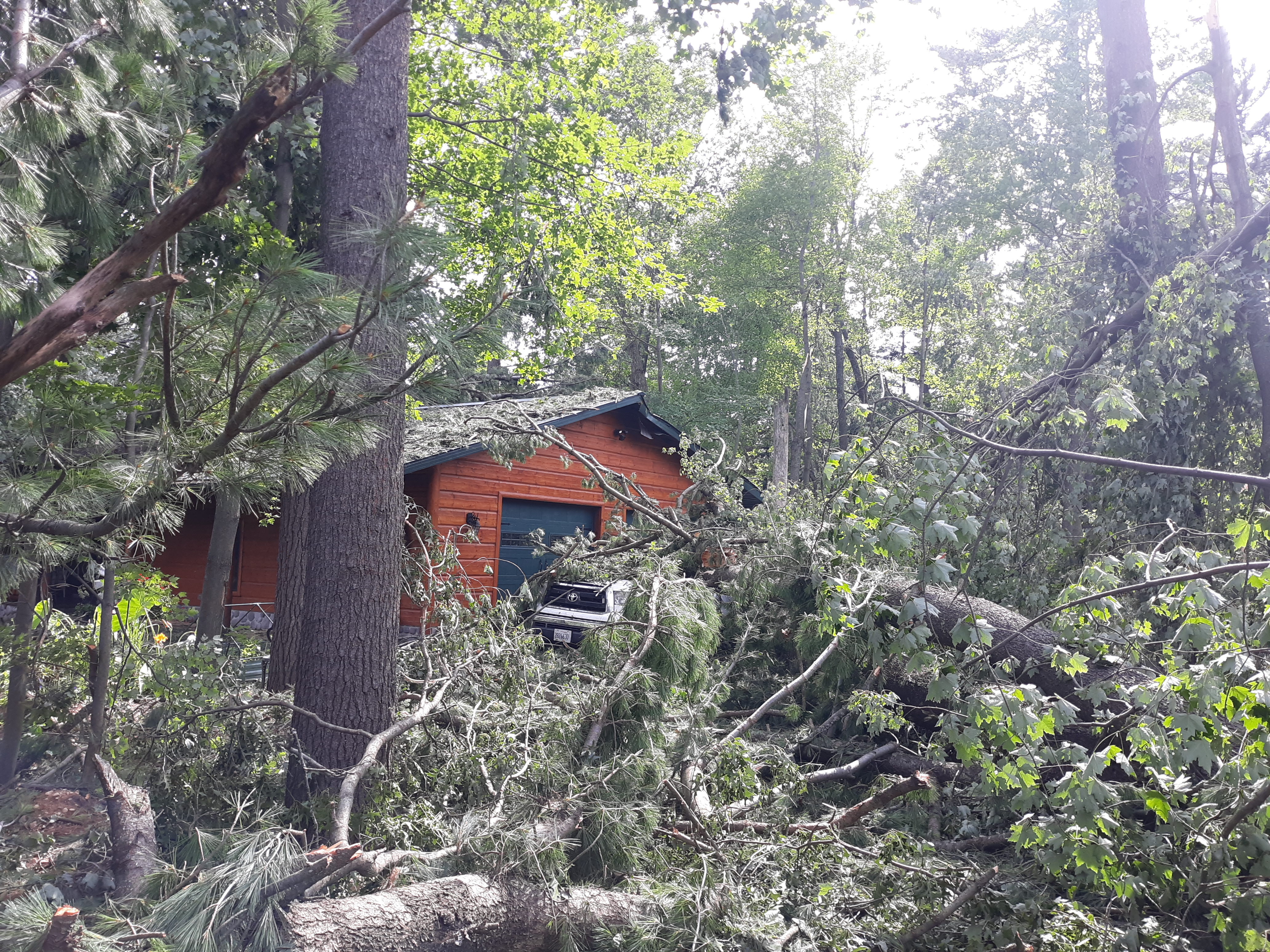
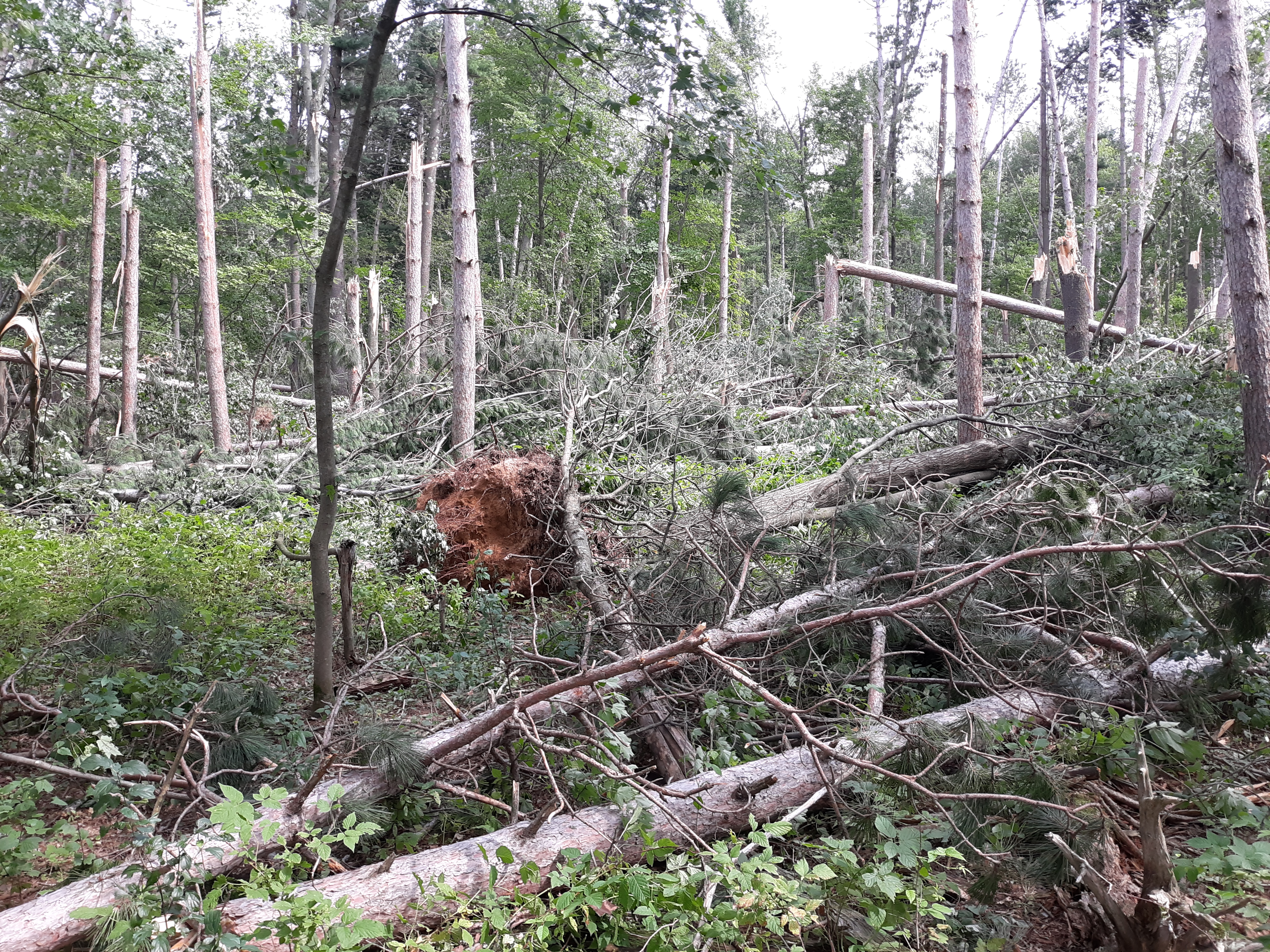
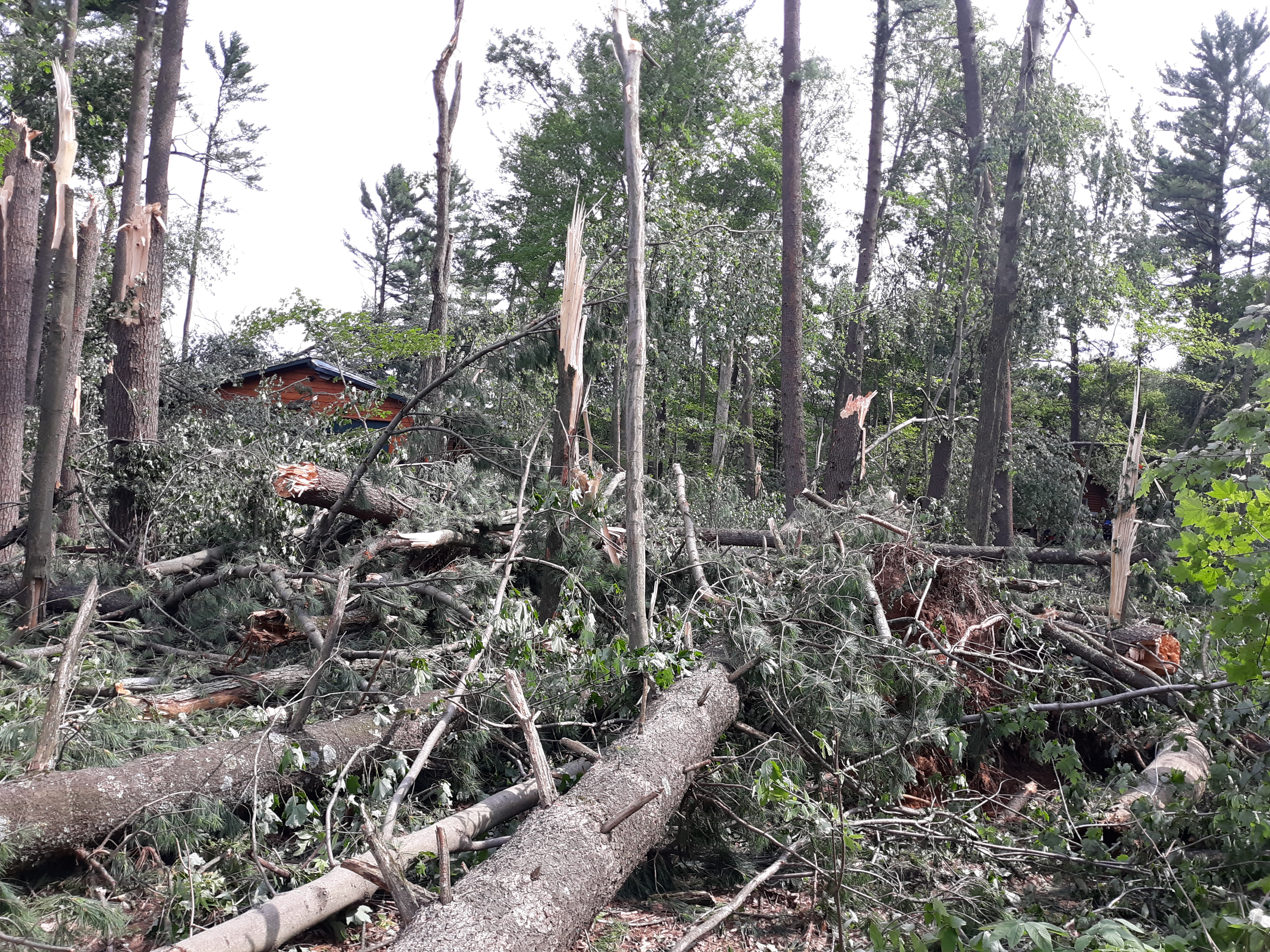
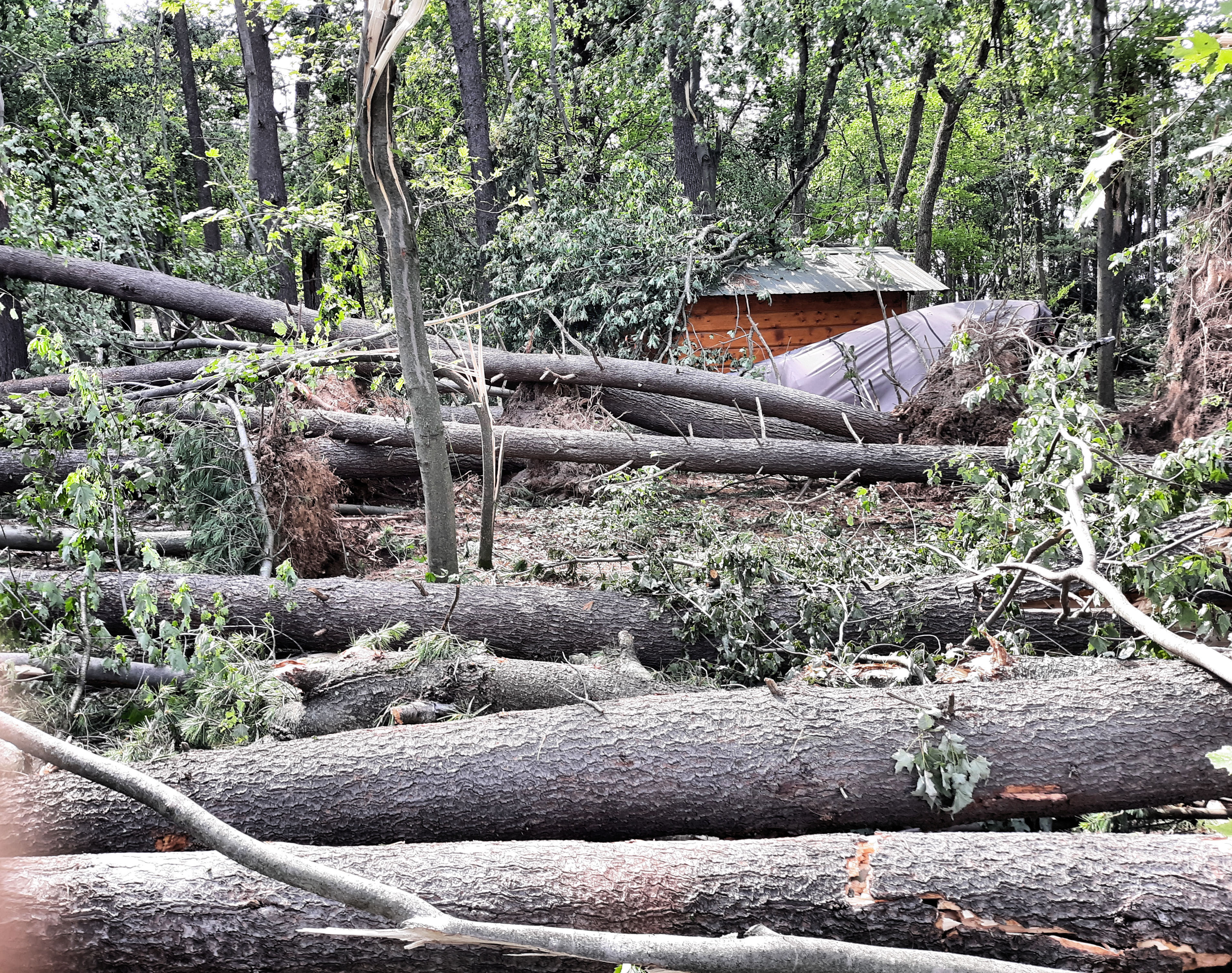
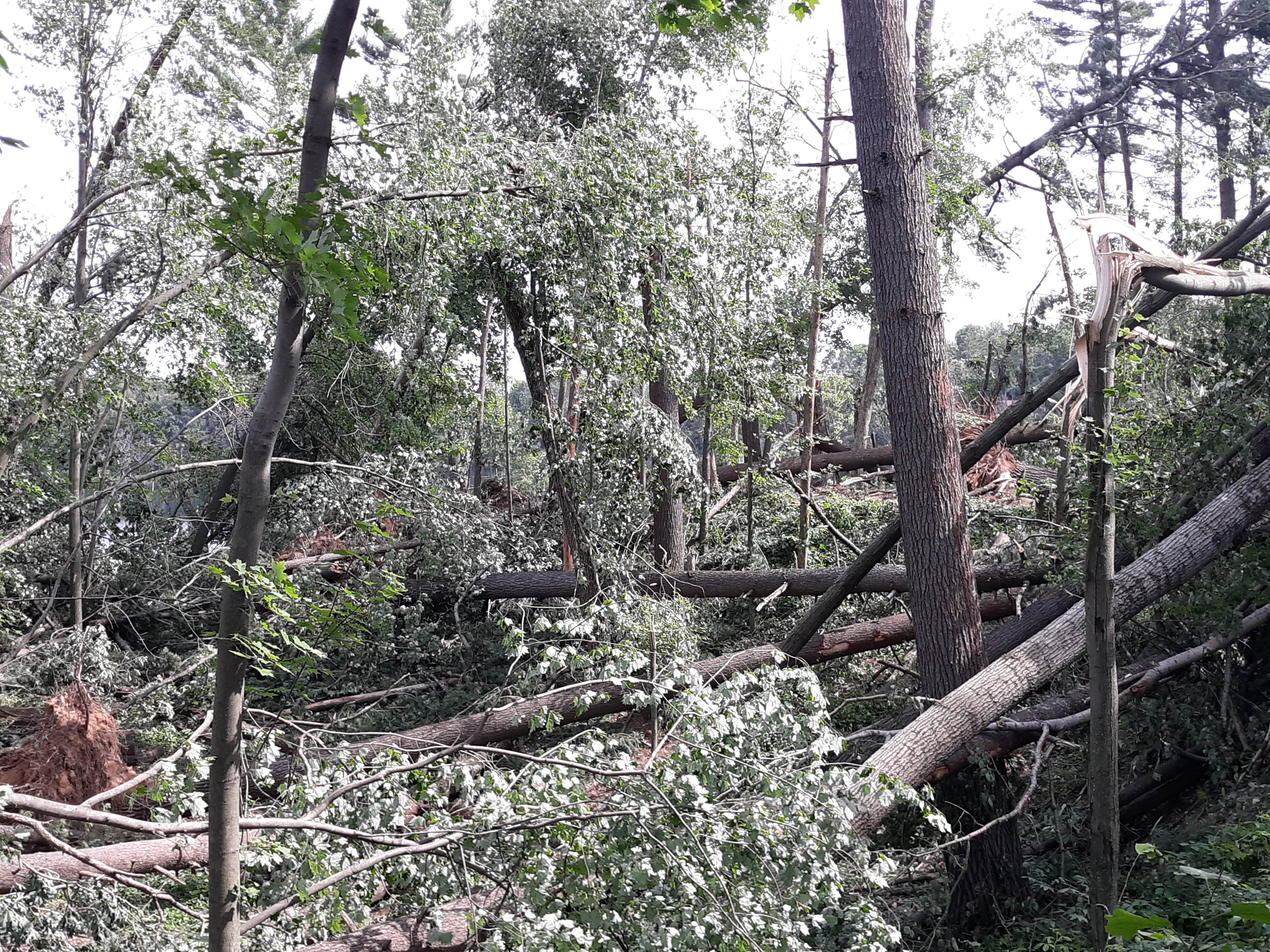
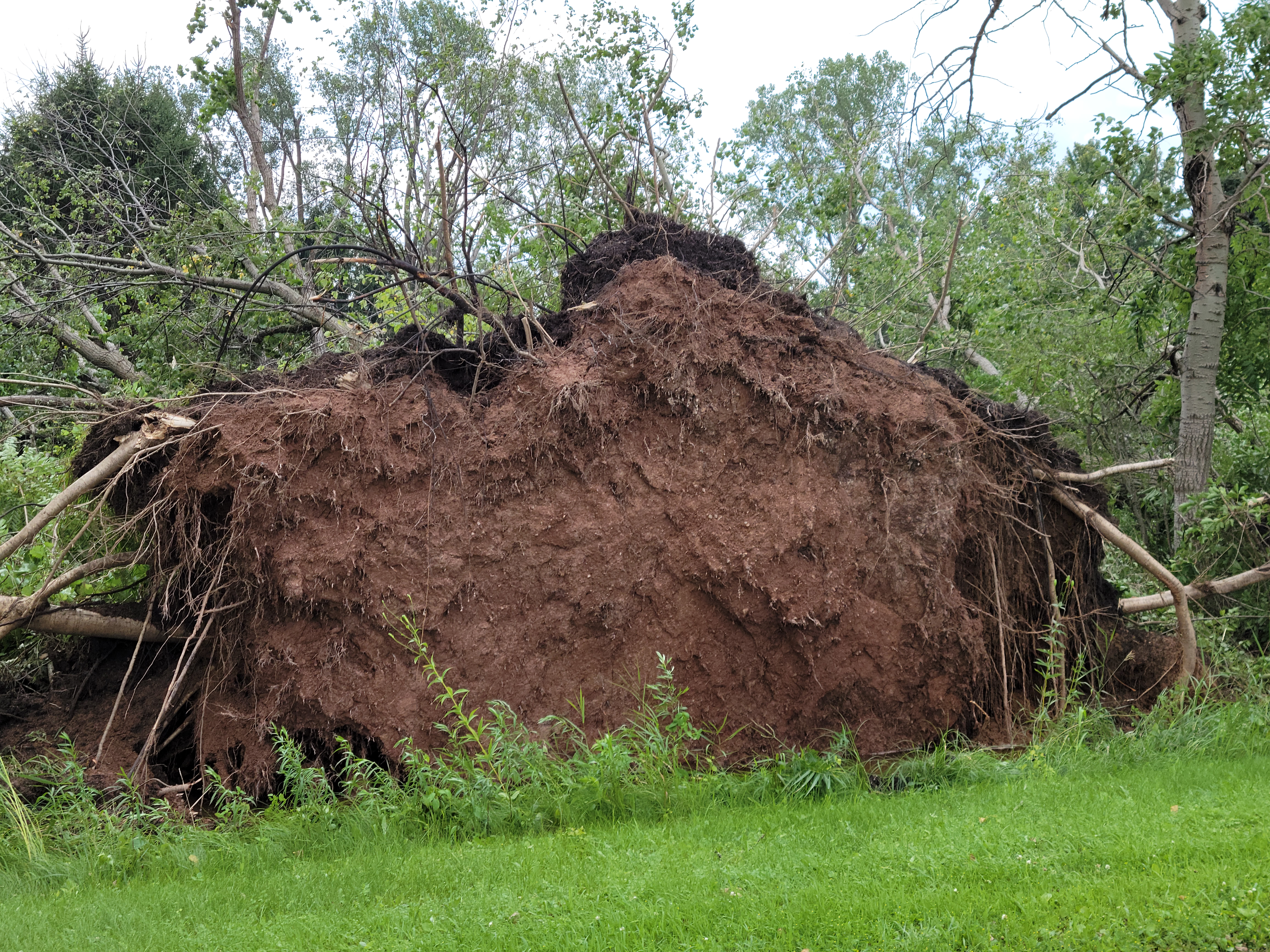
Waupaca County, Northeast of Nelsonville near Peru (Refer to radar animation to the right) Radar interpretation is a bit more challenging. This is the same HP supercell that impacted the area west of Bevent. Although we still observe a broad pendant structure in reflectivity (left panels), the mid-level mesocyclone seen on velocity (right panels) at this elevation and time period, appears to be broad and more disorganized. However, there is indication in the velocity data of strong mid-level convergence located closer to the forward-flank downdraft region of the supercell. (In reference to velocity, red colors indicate outbound winds and green colors indicate inbound winds.) This signature is referred to as the Mid-Altitude Radial Convergent (MARC) signature. MARC signatures are sometimes observed with supercells and may precede intense damaging downburst winds at the surface. A NWS damage survey conducted in this area observed some of the most extensive (tree) damage, especially near Sunset and Onland Lakes, and just south of County Road MM northeast of Nelsonville. |
Left panels are reflectivity and the right panels are velocity. |
(Below) Tree damage observed just west of Onland Lake and south of County MM northeast of Nelsonville (Waupaca County).
 |
 |
.jpg) |
 |
 |
 |
Eastern Waushara, Southwest Winnebago, Northeast Green Lake Counties,
and Surrounding Locations to the Southwest - "The Merge and Surge"
| Date | July 28, 2021 |
| Time (Local) | Approximately 11:00 pm - 12:00 am |
| Est. Peak Winds | 80 mph |
| Injuries/Deaths | None |
|
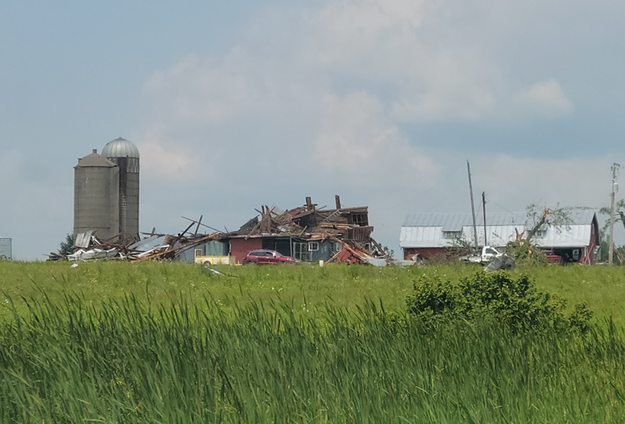
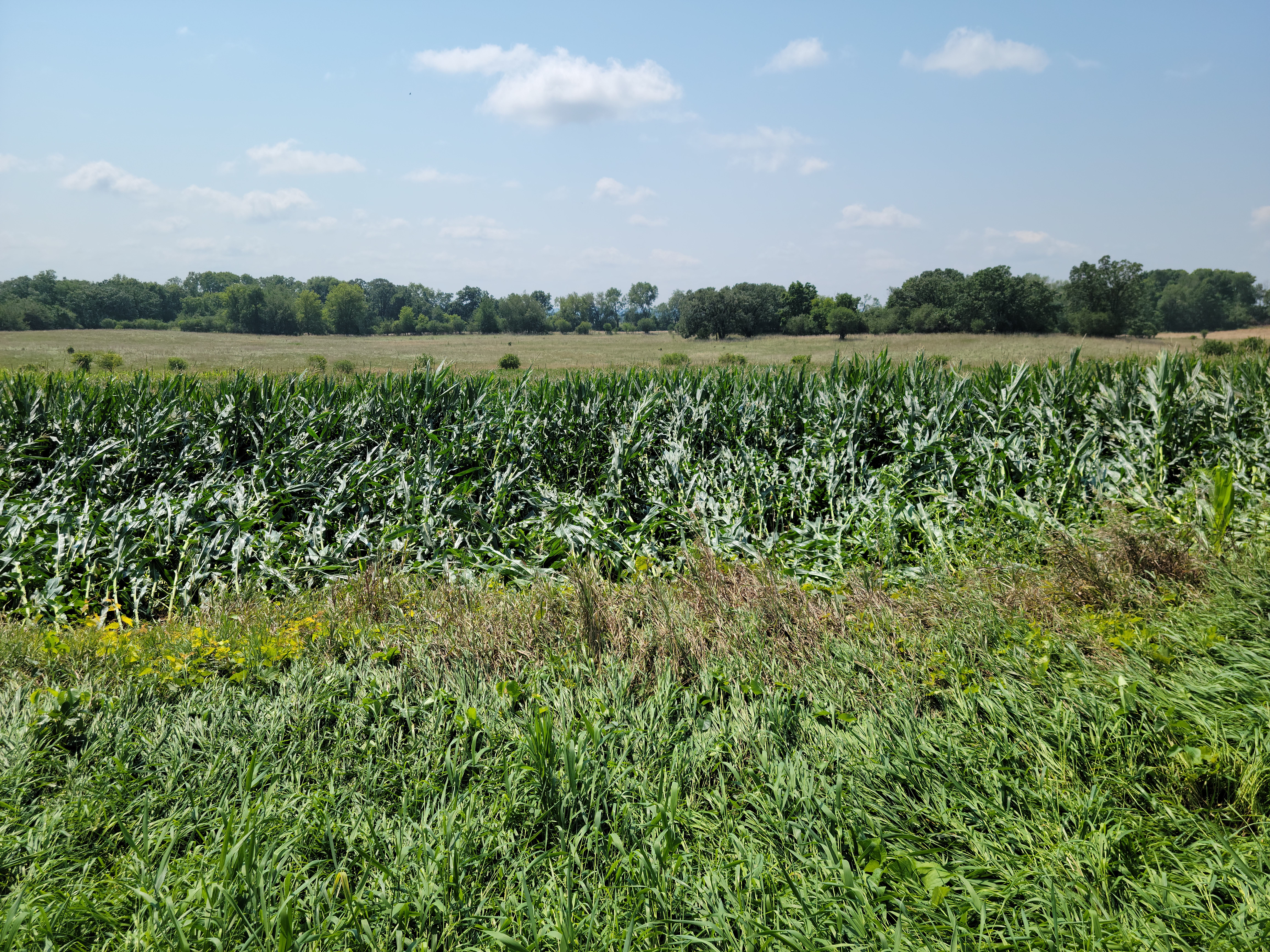
Summary: Localized wind speeds of 70 to 80 mph produced straight-line wind damage in Omro and surrounding locations to the southwest near Pickett and Rush Lake. Scattered damage was also observed in eastern Waushara County, west of the town of Borth, and along Highway 49. Hundreds of large trees were snapped or uprooted. Multiple power poles were snapped and sporadic shingles were ripped off of roofs. A roof was also torn off of a metal pole building. The damage surveyed near Omro is only about 10 miles southwest of the EAA Air Venture event center. See the radar discussion below for more details. |
|
|
Eastern Waushara, Southwest Winnebago, and Northeast Green Lake Counties (including Ripon area) (Refer to radar animations to the right) The radar evolution in this area is quite fascinating, and highlights the sequence of events leading to the intense damaging, straight-line winds that ripped through the Ripon area. Both the GRB and MKX radars are leveraged in this radar discussion. The (top) two-panel image denotes two storms. The lead storm (Storm 2) is the long-lived HP supercell previously discussed. Up to this point, it has generally exhibited broad mid-level rotation. The MKX radar (located to the south of these storms) detects this circulation with inbound velocities in green/blue colors and outbound velocities in red colors. The rotation associated with Storm 2 began to intensify as an upstream storm (Storm 1 - another HP supercell) approached its rear flank from the northwest. Note the strong inbound velocities associated with Storm 2 (arrow) in eastern Waushara County. In the standard ground-relative animation (middle) and storm-relative animation (bottom), note how Storm 1 overtakes Storm 2, ramming into its rear flank downdraft (RFD region). This initiated an intense forward surge directed to the southeast toward Ripon. Note the rapid strengthening of the inbound velocities (at ~ 4500 FT) with values (dark blue and purple colors) peaking at 80 to 85 knots! The merger and subsequent velocity surge also contributed to a strengthening of the circulation over eastern Waushara County. This circulation continued to track southeast from extreme eastern Waushara County, across southwest Winnebago County, and into Fond du Lac County. Note that the intense velocity surge occurred to the southwest of the circulation described above. Widespread straight-line wind damage was associated with this velocity surge in and around Ripon. Additional sporadic wind damage was noted to the northeast of the strengthening velocity couplet, as well as a couple of funnel cloud reports. There was evidence of a smaller, nearly gate-to-gate velocity couplet (within the broader circulation) that appeared from time to time as well, from extreme eastern Waushara County to southwest Winnebago County. Data gathered from a storm survey, conducted along the path of this circulation, is still being evaluated to determine if any of the scattered damage may have been associated with a brief, weak tornado touchdown. |
|
|
Just a quick side note: Intense damaging downbursts that result from colliding thunderstorms is not really that unusual. Remember the historic blowdown across northern Wisconsin during the evening of July 19, 2019? The animation on the right shows a similar storm merger. In this case a fast moving squall-line caught up to a supercell thunderstorm, resulting in the intense blowdown across Langlade County into western Oconto County! Severe thunderstorms with intense damaging wind gusts like those observed across northern Wisconsin on July 19, 2019, and near Ripon on July 28, 2021, are examples of why the new "Destructive" Severe Thunderstorm Warning category has been implemented. Remember that damaging straight-line winds, such as those associated with intense thunderstorm downbursts, can be equally as destructive as winds accompanying tornadoes! When thunder roars, get indoors! |
(Above) Storm-relative animation of colliding storms that resulted in the historic July 19, 2019, Northern Wisconsin Blowdown. |
(Below) Storm damage photos in and around the Omro area (southwest Winnebago County).
 |
 |
 |
 |
 |
 |
|
(Below) Storm damage photos west of the Borth area (eastern Waushara County). |
||
(Below) Damage photos taken in far southwest Winnebago County, near Pickett. (Lower Left) Photo of a funnel cloud looking north from about 3 miles north/northeast of Pickett, courtesy of James Daniel.
Environmental Overview:
|
Severe thunderstorms developed over northeast Minnesota and far northern Wisconsin during the late afternoon of July 28, 2021 and rapidly moved southeast across western and central Wisconsin (Figure 1). The storms initiated near a warm front that initially stretched from a low pressure center near Minneapolis, eastward across central Wisconsin (Figure 2). The storms organized into large quasi-linear structures and supercells within a region of strong large-scale upward motion ahead of an approaching upper-level disturbance, then quickly moved southeast across Wisconsin. Two atmospheric ingredients carefully monitored by forecasters were trends in vertical wind shear and buoyancy. Strong low to mid-level winds were steadily increasing over central Wisconsin. This led to impressive low-level Storm Relative Helicity (SRH) over the western half of Wisconsin by late afternoon (Figure 3). SRH is a rough approximation of the tendency of low-level storm relative inflow entering a developing storm to rotate in a helical fashion. In the wake of the approaching warm front, a very buoyant airmass was also approaching central Wisconsin from the west (Figure 4). Mixed-Layer Convective Available Potential Energy (MLCAPE), a measure of airmass buoyancy, exceeded 3000 J/kg near the Mississippi River Valley. Considerably less buoyant air resided over the eastern half of Wisconsin. Note the strong gradient in MLCAPE across central Wisconsin toward the end of the animation. Mid-level clouds and shower activity ahead of the approaching warm front (and perhaps exacerbated by smoke at higher levels of the atmosphere from the western U.S. fires), hindered atmospheric destabilization over central and east-central Wisconsin (Figure 5). One way forecasters can assess atmospheric tendencies that can hinder updraft strength in the low-levels, is via Mixed Layer Convective Inhibition (MLCIN). The more negative the values of MLCIN, the greater this tendency. Note the large negative values initially over western and central Wisconsin at 23 UTC (6 pm) (Figure 6). Despite very strong low-level SRH, a difficult forecast challenge was assessing how quickly the MLCIN could be reduced or eroded later that evening as the storms approached from the northwest. The presence of substantial MLCIN tends to reduce the probability of tornadogenesis, even when strong mesocyclones (supercells) are observed. Atmospheric soundings (observed or model estimated) are another tool forecasters can leverage to gain some insight with respect to general tendencies in vertical wind shear and buoyancy. The animation in Figure 7 shows trends in a RAP model estimated sounding near Wisconsin Rapids (ISW). Note how the wind barbs (far right) indicate both increasing wind speeds and veering with height, especially below 700 mb. However, also note the relatively persistent warm (stable) layer between 925 and 850 mb (aka inversion or cap). The presence of the cap, suggests a higher probability that surface-based air parcels would be hindered from rapid vertical accelerations (stretching) in a thunderstorm updraft, an important process for supercell tornadogenesis. However, given the deep dry layer, the sounding would also suggest a favorable environment for strong evaporative cooling and negative buoyancy that would favor intense downdrafts (microbursts/macrobursts) resulting in an enhanced threat for damaging straight-line winds. |
Figure 1 - GOES-16 IR Satellite Animation. Red Rectangle Depicts Approximate area of Observed Damage within the NWS Green Bay Forecast Area. Figure 2 - RAP analysis of surface pressure (black), temperature (red dashed) and winds. Radar data valid at approximately 03 UTC is overlaid. |
|
Figure 3 - RAP 0-1 km SRH (solid lines), near surface winds (yellow) and 1 KM winds (green) (22 UTC – 03 UTC) |
Figure 4 - RAP 0-1 MLCAPE (J/kg) (22 UTC – 03 UTC) |
|
Figure 5 - GOES-16 color-enhance visible imagery (18 UTC to 23 UTC). GOES GLM lightning flashes are overlaid. |
Figure 6 - RAP MLCIN (J/kg) Analysis valid at 23 UTC |
|
Figure 7 - RAP model sounding at Wisconsin Rapids (22 UTC to 03 UTC) |
Preliminary Storm Reports
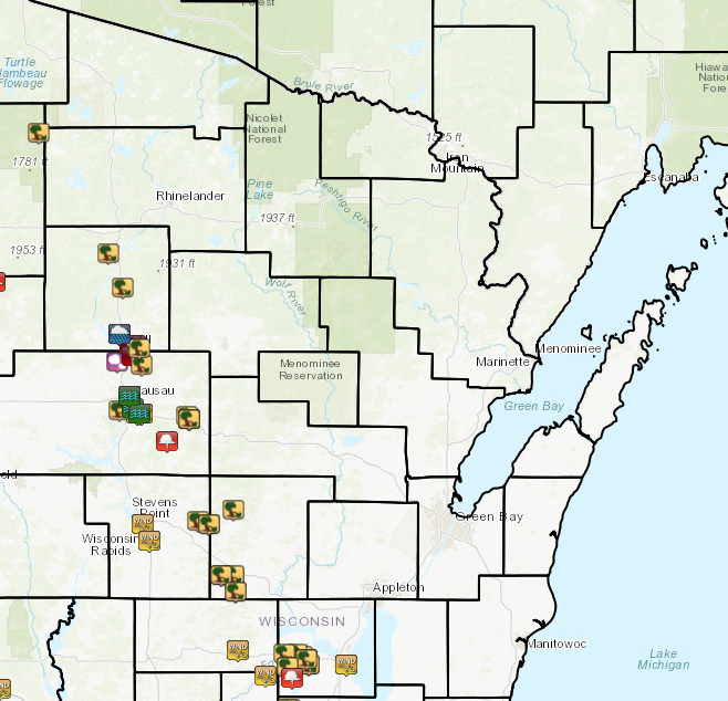 |
| Local Storm Reports from July 28, 2021 |
PRELIMINARY LOCAL STORM REPORT...SUMMARY
NATIONAL WEATHER SERVICE GREEN BAY WI
909 PM CDT THU JUL 29 2021

..TIME...   ...EVENT...      ...CITY LOCATION...     ...LAT.LON...
..DATE...   ....MAG....      ..COUNTY LOCATION..ST.. ...SOURCE....
            ..REMARKS..

0736 PM     HAIL             MERRILL                 45.18N 89.68W
07/28/2021  M0.50 INCH       LINCOLN            WI   PUBLIC

0807 PM     TSTM WND DMG     TOMAHAWK                45.46N 89.73W
07/28/2021                   LINCOLN            WI   BROADCAST MEDIA

            MULTIPLE TREES AND POWERLINES DOWN IN CITY

0820 PM     TSTM WND DMG     2 NE OTIS               45.29N 89.66W
07/28/2021                   LINCOLN            WI   PUBLIC

            MULTIPLE TREES DOWN AND UPROOTED ALONG COUNTY K.
            PARTIALLY DESTROYED BARN AS WELL. REPORT VIA SOCIAL
            MEDIA. TIME ESTIMATED BY RADAR.

0823 PM     TSTM WND DMG     IRMA                    45.34N 89.66W
07/28/2021                   LINCOLN            WI   PUBLIC

            MULTIPLE TREES AND POWERLINES DOWN IN CITY...VIA SOCIAL
            MEDIA.

0835 PM     TSTM WND GST     MERRILL                 45.18N 89.68W
07/28/2021  M48.00 MPH       LINCOLN            WI   MESONET

0839 PM     TSTM WND DMG     MERRILL                 45.18N 89.68W
07/28/2021                   LINCOLN            WI   LAW ENFORCEMENT

            NUMEROUS TREES AND POWER LINES DOWN IN THE CITY.

0840 PM     TORNADO          5 SE MERRILL            45.14N 89.60W
07/28/2021                   LINCOLN            WI   NWS STORM SURVEY

            NWS DAMAGE SURVEY HAS CONFIRMED A TORNADO STARTING NEAR
            PINE RIVER WITH WIDESPREAD TREE DAMAGE NEAR THE
            INTERSECTION OF COUNTY ROAD P AND VAN ROAD. THE PATH
            EXTENDS SOUTH INTO MARATHON COUNTY, ENDING NEAR THE
            INTERSECTION OF SHADY LANE ROAD AND HAZELWOOD LANE. PATH
            LENGTH IS ESTIMATED TO BE 2.68 MILES LONG, WITH A WIDTH
            OF 300 YARDS. PEAK WIND ESTIMATED TO BE 90 MPH WITH A
            PRELIMINARY DAMAGE RATING OF EF1.

0840 PM     TSTM WND GST     MERRILL                 45.18N 89.68W
07/28/2021  E70.00 MPH       LINCOLN            WI   PUBLIC

            THERE ARE REPORTS OF NUMEROUS TREES AND POWER LINES DOWN
            IN THE CITY.

0844 PM     TORNADO          3 SE PINE RIVER         45.10N 89.59W
07/28/2021                   MARATHON           WI   NWS STORM SURVEY

            THE TORNADO THAT TOUCHED DOWN IN LINCOLN COUNTY NEAR PINE
            RIVER CONTINUED INTO FAR NORTHERN MARATHON COUNTY. THE
            PATH CONTINUED SOUTH INTO MARATHON COUNTY, ENDING NEAR
            THE INTERSECTION OF SHADY LANE ROAD AND HAZELWOOD LANE.
            THE ENTIRE PATH LENGTH IS ESTIMATED TO BE 2.68 MILES
            LONG, WITH A WIDTH OF 300 YARDS. PEAK WIND ESTIMATED TO
            BE 90 MPH WITH A PRELIMINARY DAMAGE RATING OF EF1.

0850 PM     TSTM WND DMG     5 ENE BROKAW            45.07N 89.57W
07/28/2021                   MARATHON           WI   TRAINED SPOTTER

            NUMEROUS TREES DOWN, AT LEAST 7 PLUS ADDITIONAL TREES
            FURTHER DOWN THE ROAD

0852 PM     TSTM WND DMG     3 E PINE RIVER          45.13N 89.58W
07/28/2021                   LINCOLN            WI   PUBLIC

            MULTIPLE MATURE PINE TREES DOWN, ROOF BLOWN OFF BARN,
            CORN FIELDS SHREDDED. REPORT VIA SOCIAL MEDIA.

0858 PM     TSTM WND GST     SCHOFIELD               44.90N 89.59W
07/28/2021  E60.00 MPH       MARATHON           WI   TRAINED SPOTTER

0900 PM     TSTM WND GST     WAUSAU                  44.96N 89.63W
07/28/2021  M62.00 MPH       MARATHON           WI   ASOS

            AT THE AIRPORT.

0900 PM     TSTM WND DMG     RIB MOUNTAIN            44.91N 89.68W
07/28/2021                   MARATHON           WI   AMATEUR RADIO

            MULTIPLE PINE TREES SNAPPED OFF AT 15 FEET. HOUSE DAMAGE.


0902 PM     TSTM WND GST     WAUSAU                  44.96N 89.63W
07/28/2021  M63.00 MPH       MARATHON           WI   ASOS

            AT THE AIRPORT.

0904 PM     TSTM WND GST     WESTON                  44.90N 89.57W
07/28/2021  M78.00 MPH       MARATHON           WI   PUBLIC

            VIA SOCIAL MEDIA FROM WSAW TV-7.

0905 PM     TSTM WND DMG     WAUSAU                  44.96N 89.63W
07/28/2021                   MARATHON           WI   LAW ENFORCEMENT

            NUMEROUS TREES AND POWER LINES DOWN IN THE CITY OF
            WAUSAU.

0912 PM     HEAVY RAIN       SW MERRILL              45.18N 89.68W
07/28/2021  M1.38 INCH       LINCOLN            WI   MESONET

            IN THE LAST HOUR.

0912 PM     TSTM WND DMG     1 NW HATLEY             44.89N 89.34W
07/28/2021                   MARATHON           WI   PUBLIC

            BARN FLATTENED AND SPORADIC TREE DAMAGE. REPORT VIA
            SOCIAL MEDIA. TIME ESTIMATED BY RADAR.

0914 PM     TSTM WND GST     HATLEY                  44.88N 89.33W
07/28/2021  M54.00 MPH       MARATHON           WI   MESONET

0915 PM     TSTM WND DMG     3 ENE BOWLER            44.87N 88.90W
07/28/2021                   SHAWANO            WI   CO-OP OBSERVER

            SOME TREES DOWN THROUGHOUT THE STOCKBRIDGE-MUNSEE
            RESERVATION. TIME ESTIMATED BY RADAR.

0915 PM     TSTM WND DMG     HATLEY                  44.88N 89.33W
07/28/2021                   MARATHON           WI   LAW ENFORCEMENT

            TREES AND POWER LINES DOWN.

0920 PM     FUNNEL CLOUD     4 NW BEVENT             44.80N 89.44W
07/28/2021                   MARATHON           WI   LAW ENFORCEMENT

0925 PM     FLOOD            WAUSAU                  44.96N 89.63W
07/28/2021                   MARATHON           WI   LAW ENFORCEMENT

            SCHOFIELD AVENUE IS CLOSED BETWEEN DEPOT STREET AND EAU
            CLAIRE STREET DO TO FLOODING UNDER THE RAILROAD BRIDGE

0950 PM     TSTM WND DMG     5 N AMHERST             44.52N 89.29W
07/28/2021                   PORTAGE            WI   EMERGENCY MNGR

            NUMEROUS TREES SNAPPED NEAR THE TOWN OF NEW HOPE. TIME
            ESTIMATED BY RADAR.

0955 PM     TSTM WND DMG     5 NE AMHERST JUNCTION   44.51N 89.23W
07/28/2021                   PORTAGE            WI   PUBLIC

            REPORT VIA SOCIAL MEDIA, TIME ESTIMATED. MANY TREES DOWN
            AT THE WISCONSIN ENVIRONMENTAL STATION IN AMHERST
            JUNCTION.

0957 PM     TSTM WND DMG     4 N IOLA                44.56N 89.11W
07/28/2021                   WAUPACA            WI   TRAINED SPOTTER

            SEVERAL TREES DOWN. WINDS ESTIMATED AT 60 TO 65 MPH.

1014 PM     TSTM WND DMG     5 W WAUPACA             44.33N 89.17W
07/28/2021                   WAUPACA            WI   PUBLIC

            MULTIPLE SNAPPED PINE TREES. PICTURE VIA SOCIAL MEDIA.
            TIME ESTIMATED BY RADAR.

1016 PM     TSTM WND DMG     5 SSW WAUPACA           44.27N 89.10W
07/28/2021                   WAUPACA            WI   PUBLIC

            SHINGLES BLOWN OFF ROOF. REPORT VIA SOCIAL MEDIA. TIME
            ESTIMATED BY RADAR.

1017 PM     TSTM WND DMG     3 WSW WAUPACA           44.32N 89.11W
07/28/2021                   WAUPACA            WI   PUBLIC

            SOME DOWNED TREES, BROKEN TREE LIMBS, AND TREE DEBRIS.
            REPORT VIA SOCIAL MEDIA. TIME ESTIMATED BY RADAR.

1017 PM     TSTM WND DMG     2 WSW WAUPACA           44.33N 89.11W
07/28/2021                   WAUPACA            WI   PUBLIC

            MULTIPLE TREES DOWN, SOME UPROOTED. FENCE BLOWN DOWN.
            REPORT VIA SOCIAL MEDIA. TIME ESTIMATED BY RADAR.

1035 PM     TSTM WND GST     STEVENS POINT           44.51N 89.56W
07/28/2021  M43.00 MPH       PORTAGE            WI   AWOS

1040 PM     TSTM WND GST     PLOVER                  44.45N 89.53W
07/28/2021  M56.00 MPH       PORTAGE            WI   CO-OP OBSERVER

1059 PM     HEAVY RAIN       OSHKOSH                 44.01N 88.55W
07/28/2021  M1.03 INCH       WINNEBAGO          WI   AMATEUR RADIO

            MEASURED RAINFALL FROM 1041 PM TO 1059 PM BETWEEN 9TH
            STREET AND MICHIGAN STREET IN OSHKOSH.

1125 PM     TSTM WND DMG     1 WNW OMRO              44.04N 88.77W
07/28/2021                   WINNEBAGO          WI   PUBLIC

            STRONG WINDS DESTROYED BARN. REPORT VIA SOCIAL MEDIA.
            TIME ESTIMATED BY RADAR.

1125 PM     TSTM WND DMG     OMRO                    44.03N 88.75W
07/28/2021                   WINNEBAGO          WI   AMATEUR RADIO

            6 TO 12 INCH DIAMETER TREE LIMBS DOWN. LOCATED ON WEBSTER
            AND SCOTT STREETS IN OMRO. ESTIMATED GUSTS TO 80 MPH.
            TIME ESTIMATED BY RADAR.

1125 PM     TSTM WND GST     2 N REDGRANITE          44.06N 89.09W
07/28/2021  E65.00 MPH       WAUSHARA           WI   TRAINED SPOTTER

1125 PM     TSTM WND DMG     3 WNW OMRO              44.05N 88.80W
07/28/2021                   WINNEBAGO          WI   EMERGENCY MNGR

            SEMI FLIPPED ON HIGHWAY 21 AND EDGEWATER RIDGE IN OMRO.

1127 PM     TSTM WND DMG     1 NE WAUKAU             44.01N 88.74W
07/28/2021                   WINNEBAGO          WI   NWS STORM SURVEY

            NUMEROUS TREES SNAPPED AND UPROOTED BETWEEN OMRO AND
            WAUKAU. ESTIMATED WINDS AROUND 80 MPH

1127 PM     TSTM WND GST     OMRO                    44.03N 88.75W
07/28/2021  M72.00 MPH       WINNEBAGO          WI   MESONET

1130 PM     TSTM WND DMG     1 NE WAUKAU             44.01N 88.74W
07/28/2021                   WINNEBAGO          WI   PUBLIC

            MULTIPLE TREES AND BRANCHES DOWN. MINOR DAMAGE TO HOUSE
            FROM THE TREES AND BRANCHES. REPORT VIA SOCIAL MEDIA.
            TIME ESTIMATED BY RADAR.

1132 PM     TSTM WND DMG     3 NNW EUREKA            44.05N 88.86W
07/28/2021                   WINNEBAGO          WI   TRAINED SPOTTER

            TREE BRANCHES DOWN ON HIGHWAY 21. WINDS ESTIMATED AT 60
            TO 70 MPH.

1132 PM     TSTM WND GST     OSHKOSH                 44.01N 88.55W
07/28/2021  M37.00 MPH       WINNEBAGO          WI   ASOS

1133 PM     TSTM WND DMG     OMRO                    44.03N 88.75W
07/28/2021                   WINNEBAGO          WI   LAW ENFORCEMENT

            NUMEROUS TREES AND POWER LINES DOWN.

1135 PM     TSTM WND DMG     EUREKA                  44.00N 88.84W
07/28/2021                   WINNEBAGO          WI   TRAINED SPOTTER

            NUMEROUS TREES BLOCKING ROAD ON COUNTY K AND COUNTY E IN
            EUREKA.

1135 PM     TSTM WND DMG     EUREKA                  44.00N 88.84W
07/28/2021                   WINNEBAGO          WI   TRAINED SPOTTER

            NUMEROUS TREES BLOCKING ROAD ON COUNTY K AND COUNTY E
            NEAR EUREKA.

1140 PM     FUNNEL CLOUD     4 NNE RUSH LAKE         43.96N 88.82W
07/28/2021                   WINNEBAGO          WI   PUBLIC

            PUBLIC REPORTED A FUNNEL CLOUD BETWEEN HIGHWAY 91 AND
            RUSH LAKE ROAD. RELAYED VIA EMERGENCY MANAGEMENT
 |
Media use of NWS Web News Stories is encouraged! Please acknowledge the NWS as the source of any news information accessed from this site. |
 |