Overview
|
An area of low pressure slowly tracked east across east-central The city of Manawa measured around 5.7 inches of rain. This rain, coupled with the impacts from around 6 inches of recent rain from the two weeks prior, led to the failure of the Manawa Dam, as water overtopped the dam around 1230 pm. This led to evacuations of residences and businesses in Manawa and downstream of the dam into the town of Royalton. Additionally, several water rescues of people trapped in vehicles were made during the morning, especially in Manawa and Appleton. A Boil Water advisory was also issued for Manawa and surrounding areas. Please see the tabs below for more information. |
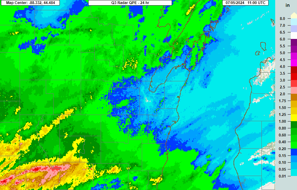
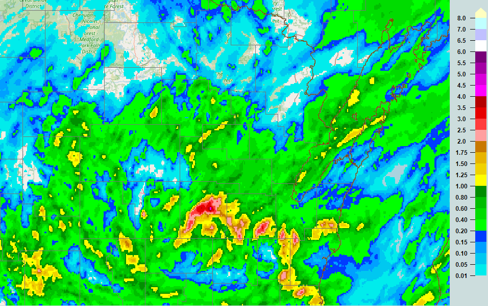 24- Hour Rainfall Estimate for July 5, 2024 |
|
|
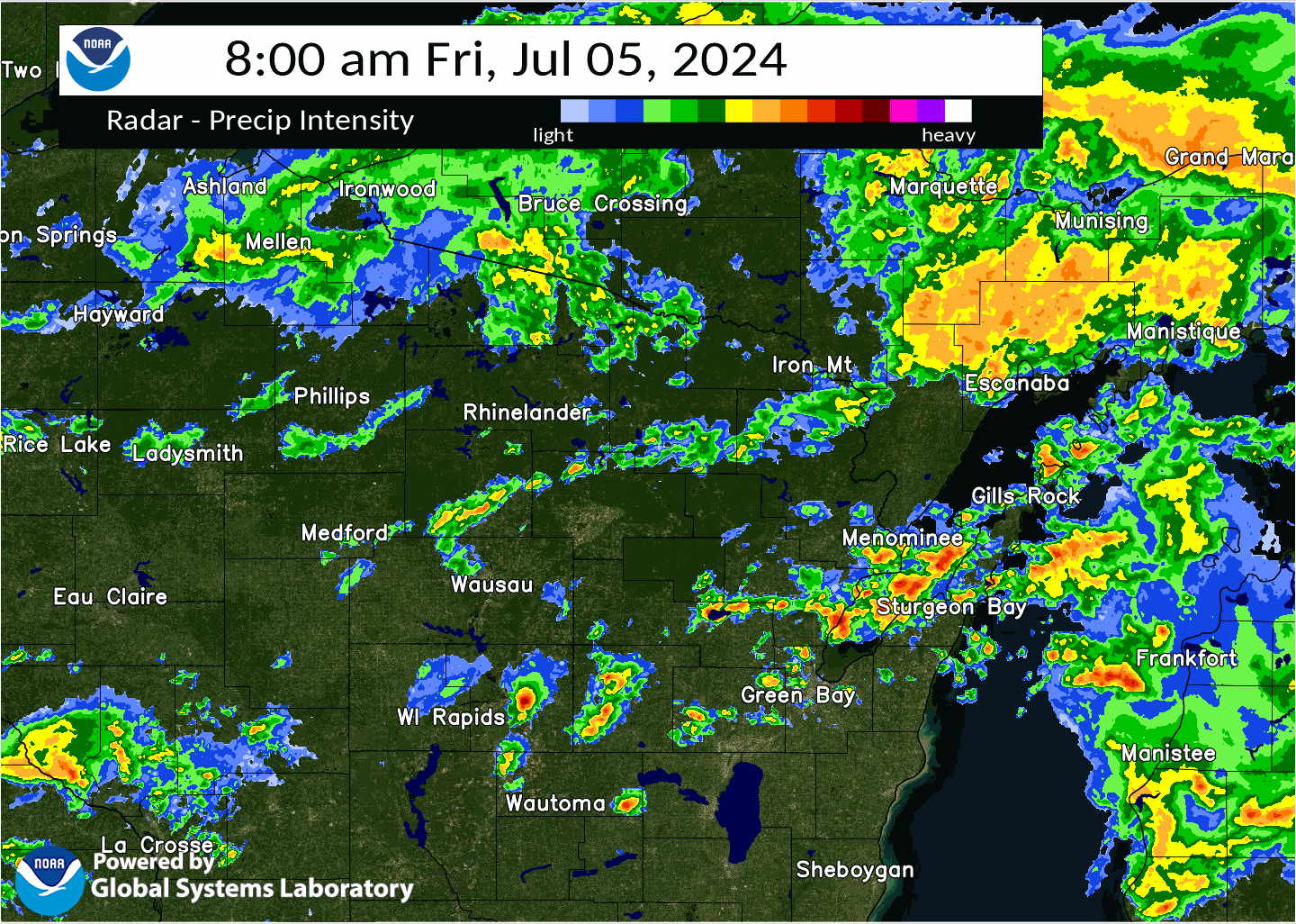
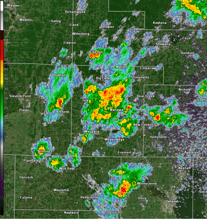 Radar Loop from 8:46 to 11:03am on July 5, 2024 |
Rain Maps / Reports
|
|
|
 ...24-HOUR PRECIPITATION REPORTS ON JULY 5, 2024...

Location                     Amount    Time/Date       Lat/Lon

...Wisconsin...

...Brown County...
Wrightstown                  0.83 in   0706 AM 07/06   44.33N/88.17W
De Pere                      0.68 in   0700 AM 07/06   44.37N/88.07W
Denmark WWTP                 0.55 in   0800 AM 07/06   44.35N/87.81W

...Calumet County...
New Holstein 1 W             2.11 in   0710 AM 07/06   43.95N/88.10W
Brillion 4.9 S               1.16 in   0700 AM 07/06   44.11N/88.05W
Chilton 0.5 E                0.60 in   0700 AM 07/06   44.03N/88.15W

...Door County...
Ephraim 0.2 WSW              0.68 in   0700 AM 07/06   45.16N/87.17W
Fish Creek 1 E WWTP          0.61 in   0625 AM 07/06   45.12N/87.23W
Ephraim Airport              0.60 in   0655 AM 07/06   45.13N/87.18W

...Langlade County...
White Lake 1.4 SE            1.24 in   0800 AM 07/06   45.15N/88.74W

...Manitowoc County...
Reedsville                   1.41 in   0700 AM 07/06   44.23N/87.96W
Millhome 2 E                 1.28 in   0709 AM 07/06   43.90N/87.91W
Valders 3.3 WSW              0.58 in   0700 AM 07/06   44.04N/87.94W

...Marathon County...
Stratford 4 W                0.78 in   0705 AM 07/06   44.81N/90.17W

...Marinette County...
Peshtigo 1 S                 1.09 in   0730 AM 07/06   45.03N/87.74W

...Outagamie County...
2 W Appleton                 2.50 in   0530 PM 07/05   44.26N/88.43W
New London 2 SE              2.50 in   0630 AM 07/06   44.36N/88.72W
Appleton 1.3 NW              2.30 in   0700 AM 07/06   44.28N/88.41W
Mackville 2 S                2.09 in   0600 AM 07/06   44.31N/88.41W
New London 3.3 NE            1.80 in   0740 AM 07/06   44.43N/88.70W
Appleton 2.3 NW              1.74 in   0600 AM 07/06   44.29N/88.43W
Grand Chute                  1.39 in   0710 AM 07/06   44.31N/88.42W
Shiocton 0.6 NW              1.27 in   0730 AM 07/06   44.44N/88.58W
Black Creek 3 NW             1.10 in   0700 AM 07/06   44.50N/88.47W
New London 4.1 N             0.99 in   0600 AM 07/06   44.45N/88.73W
Seymour                      0.72 in   0710 AM 07/06   44.54N/88.25W

...Portage County...
Stevens Point                0.64 in   0530 AM 07/06   44.51N/89.59W
Plover 1.8 W                 0.55 in   0700 AM 07/06   44.46N/89.58W

...Shawano County...
Shawano 2 SSW                0.54 in   0800 AM 07/06   44.76N/88.62W

...Waupaca County...
Ogdensburg 2 E               5.05 in   0700 AM 07/06   44.46N/88.98W
1 WNW Waupaca                3.65 in   1259 PM 07/05   44.34N/89.08W
Waupaca 1 E                  2.45 in   0600 AM 07/06   44.35N/89.06W
Waupaca                      2.21 in   0707 AM 07/06   44.34N/89.11W
New London - WWTP            1.70 in   0700 AM 07/06   44.39N/88.75W
Waupaca 7.6 SW               1.63 in   0600 AM 07/06   44.27N/89.17W
Clintonville 0.7 WNW         0.72 in   0600 AM 07/06   44.63N/88.76W
Clintonville 0.9 N           0.68 in   0700 AM 07/06   44.62N/88.75W
Fremont                      0.63 in   0705 AM 07/06   44.28N/88.82W
Clintonville Airport         0.58 in   0655 AM 07/06   44.62N/88.73W

...Waushara County...
Hancock 1.5 SW               0.51 in   0700 AM 07/06   44.12N/89.54W

...Winnebago County...
Menasha 1.5 W                1.32 in   0800 AM 07/06   44.20N/88.47W

Zittau                       0.52 in   0600 AM 07/06   44.22N/88.78W

...Wood County...
New Rome 3 WNW               1.26 in   0700 AM 07/06   44.26N/89.94W
New Rome 1 WNW               0.96 in   0700 AM 07/06   44.25N/89.91W
New Rome 4 ENE               0.54 in   0705 AM 07/06   44.26N/89.81W

Observations are collected from a variety of sources with varying
equipment and exposures. We thank all volunteer weather observers
for their dedication. Not all data listed are considered official.
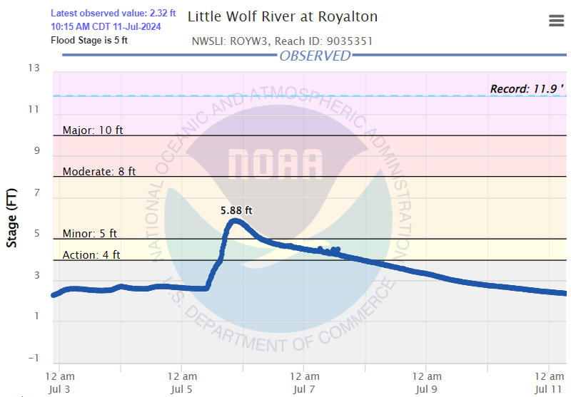
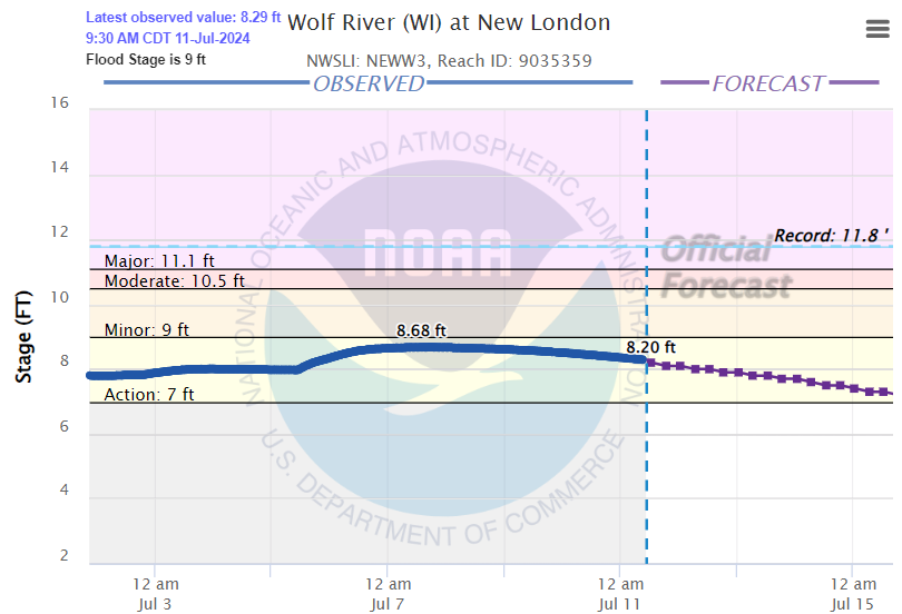
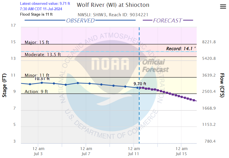
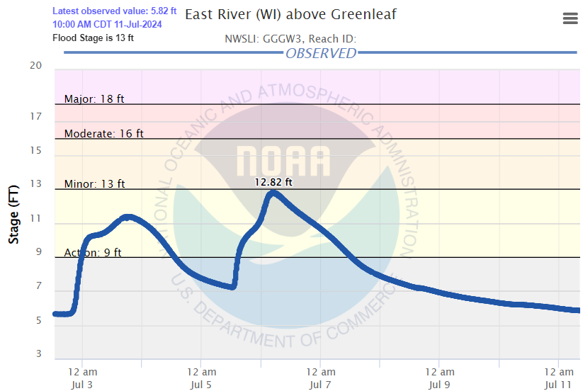
Rivers
The heaviest rain was rather localized, which helped reduce the river flooding across the area. However, a few locations near where the heaviest rainfall occurred did see a rise in river levels, with flooding observed on the Little Wolf River. The dam failure in Manawa also contributed to this flooding. Some water rises were also observed on the East River.
 |
 |
 |
 |
Photos
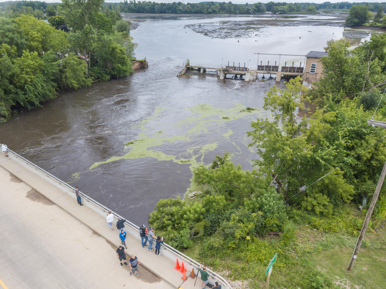
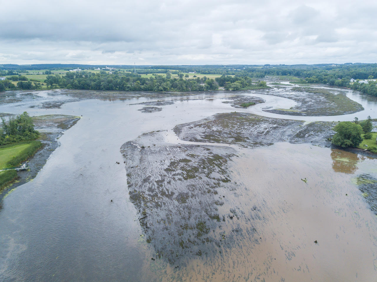
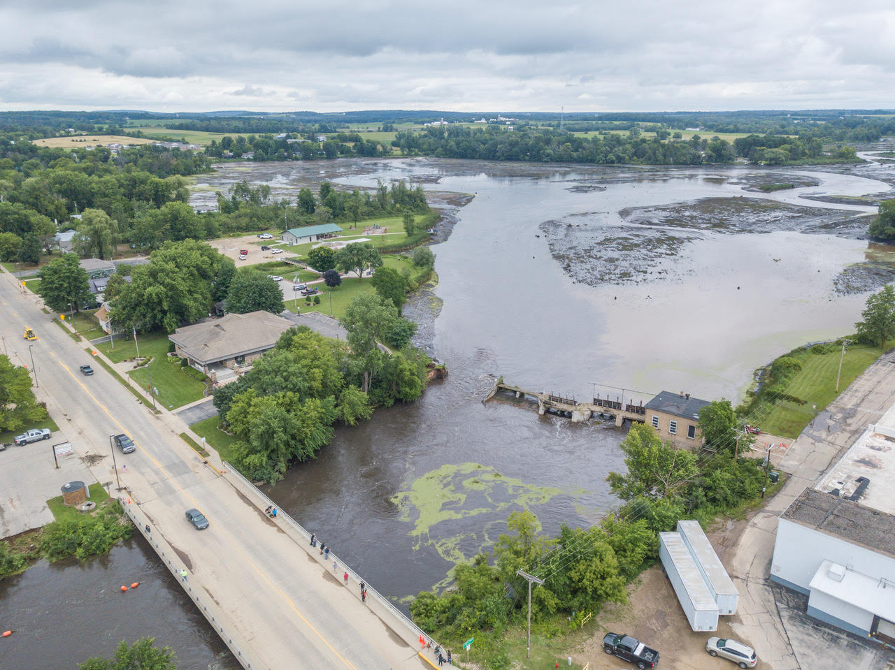
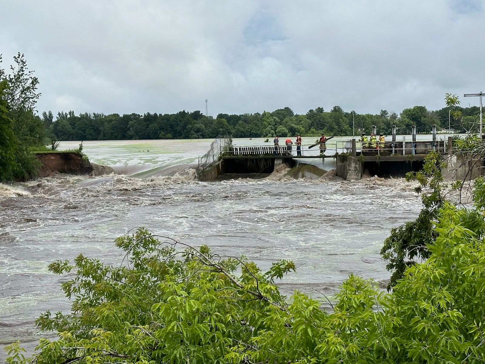 Manawa Dam Failure Credit: Waupaca Co. Emergency Management |
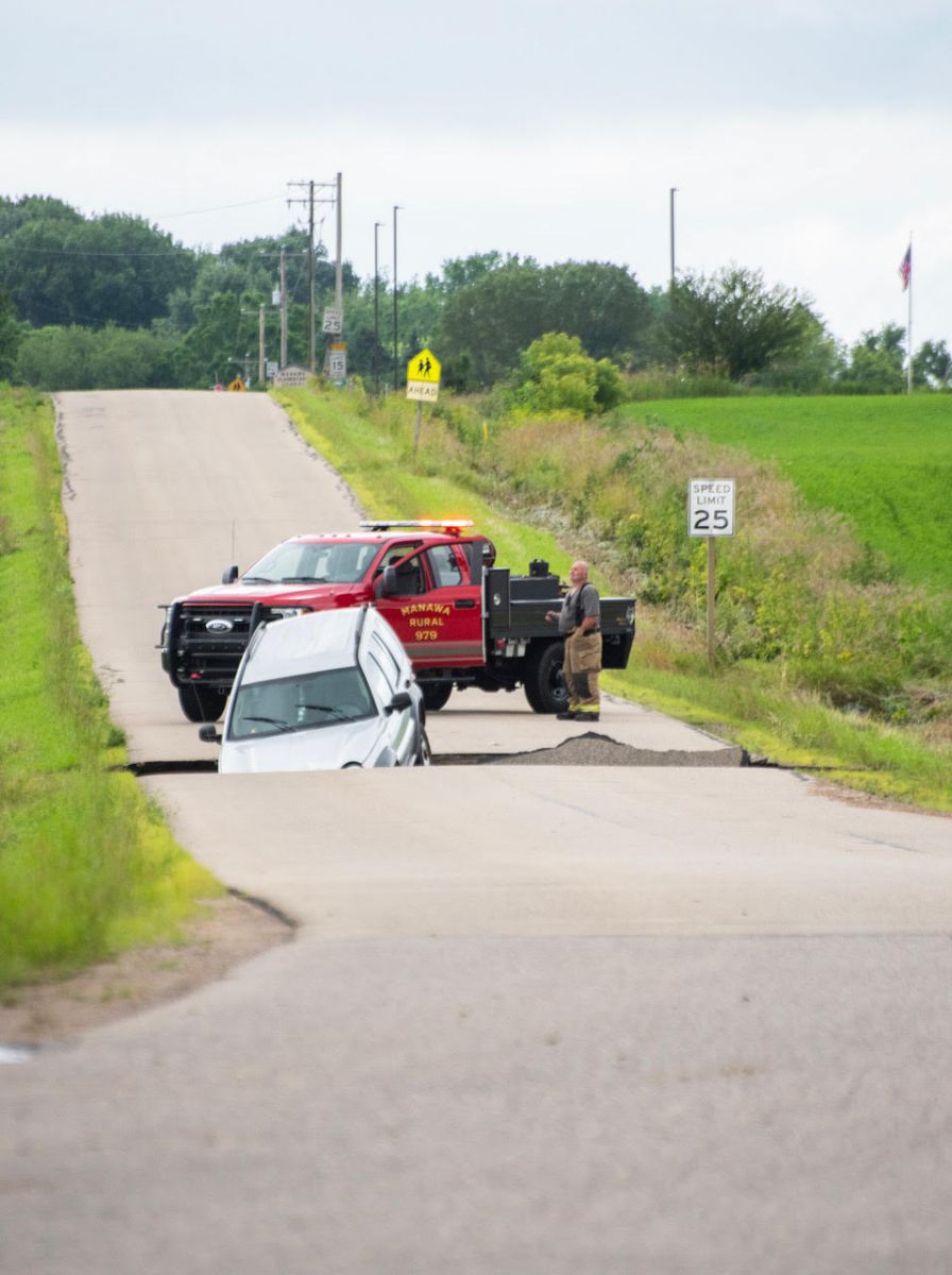
N. Bridge Street, Manawa |
|
|
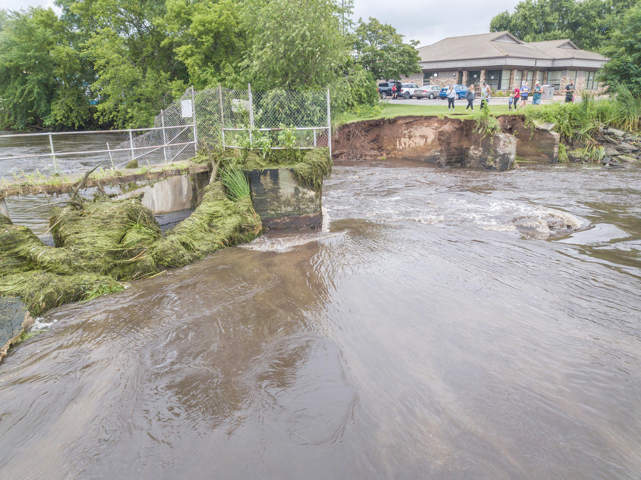
Beech Street, Manawa |
|
|
|
|
|
|
|
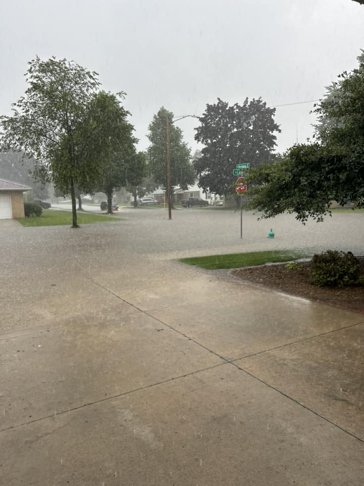
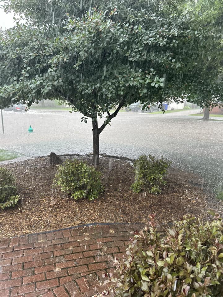
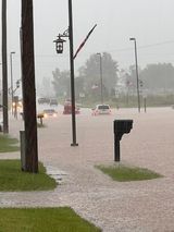
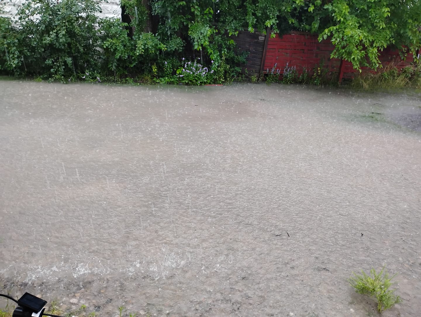
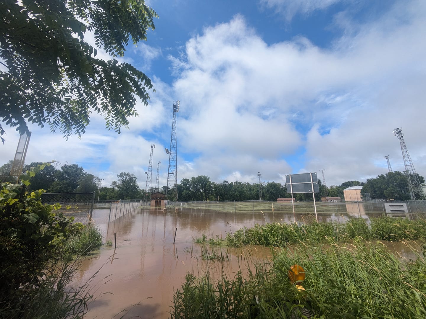
North Appleton |
North Appleton |
 |
Media use of NWS Web News Stories is encouraged! Please acknowledge the NWS as the source of any news information accessed from this site. |
|


 Linsey Park,