Scattered severe thunderstorms capable of damaging wind gusts and hail are forecast across the Northeast U.S. and North Dakota today. Heavy to excessive rainfall is possible over eastern New Mexico into western Texas and over the western Florida peninsula today. Critical fire weather conditions will persist today over parts of the interior Northwest and Great Basin. Read More >
Overview
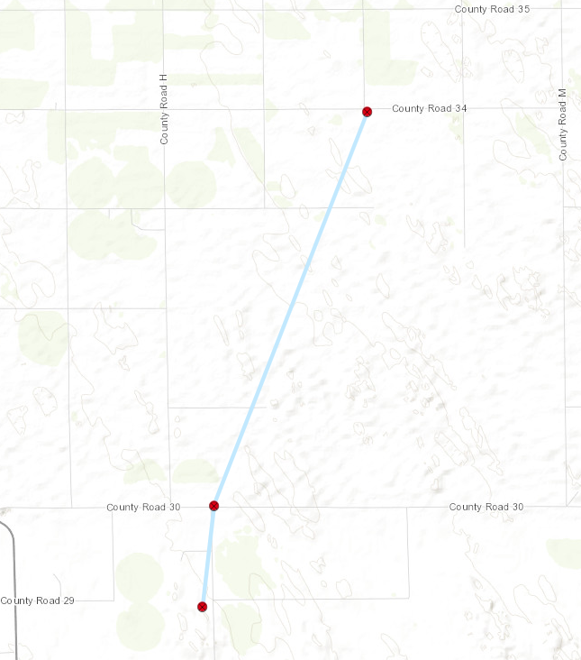
During the afternoon of August 8th, 2023, a strong thunderstorm had formed in northeastern Washington county in Colorado. By 4:57pm MDT the thunderstorm had become a supercell and was producing a tornado just a mile and a half south of Highway 34 and a mile west of the Washington/Yuma county lines. The tornado proceeded to move generally southeast while looping in on itself a few times. At the end of its lifecycle, the tornado would try to loop on itself one more time causing it to change its track to move north toward the town of Yuma and increase its wind speed. The tornado would proceed to veer southwest just before town and dissipate around 5:25 pm MDT. The supercell storm would then proceed to move south/southeast across the county producing a few more tornadoes and a Colorado state record hail stone of 5.25 inches on Highway 36 between Kirk and Idalia. A final brief tornado was produced a few miles south of Kanorado.
Tornadoes:
|
Tornado - SW of Yuma
|
||||||||||||||||
|
Tornado - Yuma Multivortex Tornado
|
||||||||||||||||
|
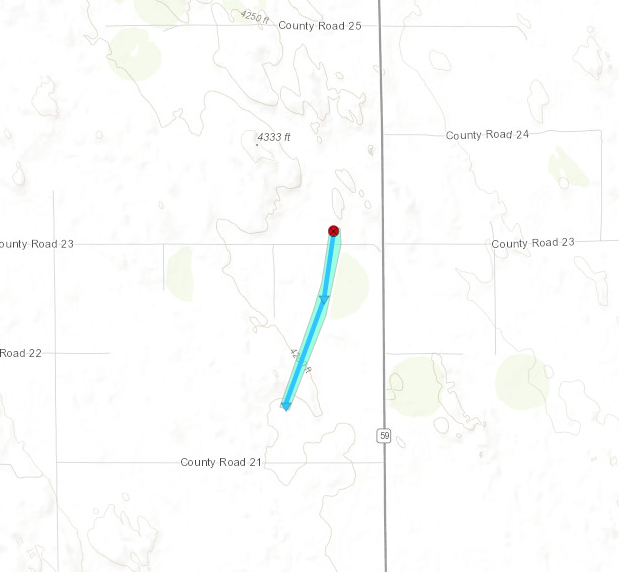
Tornado - CR 23 to 21 Tornado
|
||||||||||||||||
|
Tornado - East of Abarr Tornado
|
||||||||||||||||
|
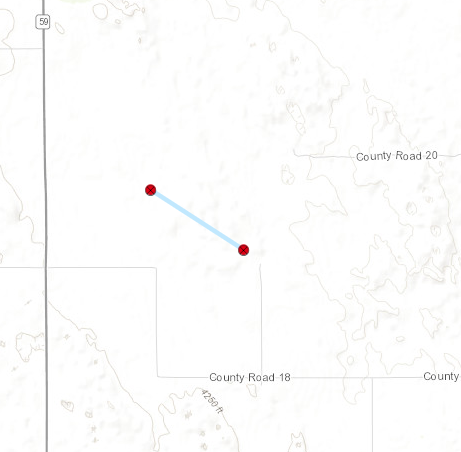
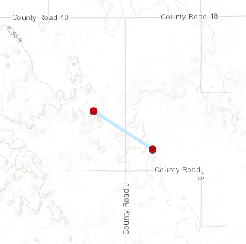
Tornado - County Road J Tornado
|
||||||||||||||||
|
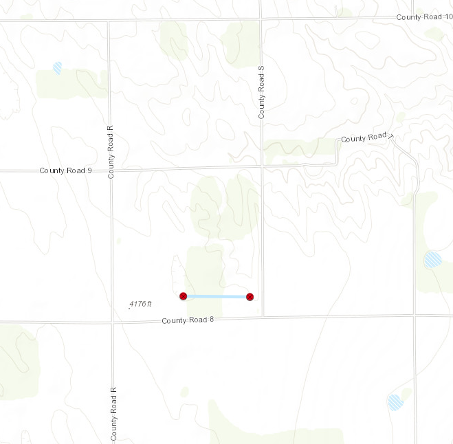
Tornado - County Road 8 Tornado
|
||||||||||||||||
|
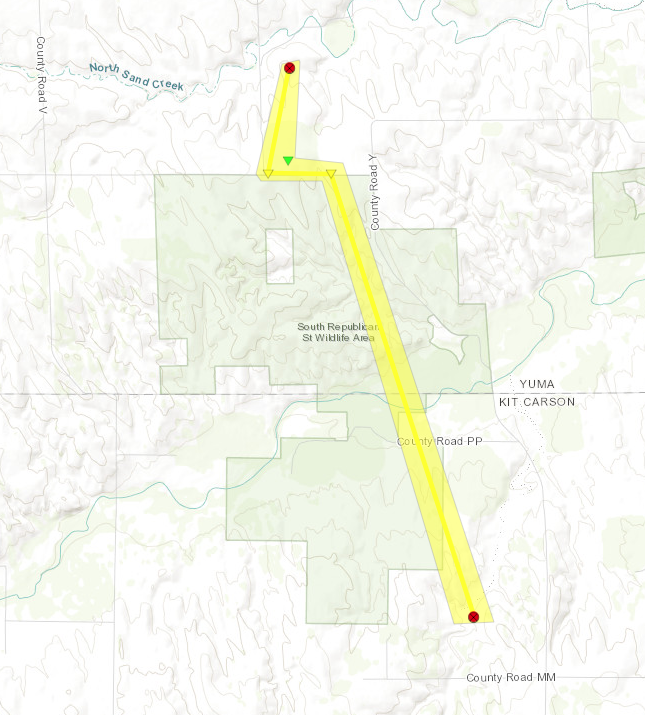
Tornado - Southern Yuma Wildlife Area Tornado
|
||||||||||||||||
|
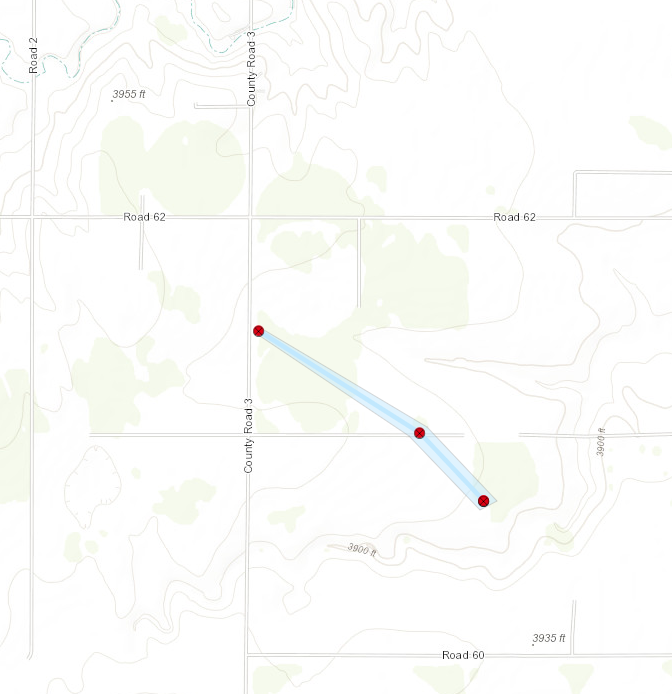
Tornado - South of Kanorado Tornado
|
||||||||||||||||
The Enhanced Fujita (EF) Scale classifies tornadoes into the following categories:
| EF0 Weak 65-85 mph |
EF1 Moderate 86-110 mph |
EF2 Significant 111-135 mph |
EF3 Severe 136-165 mph |
EF4 Extreme 166-200 mph |
EF5 Catastrophic 200+ mph |
 |
|||||
Hail
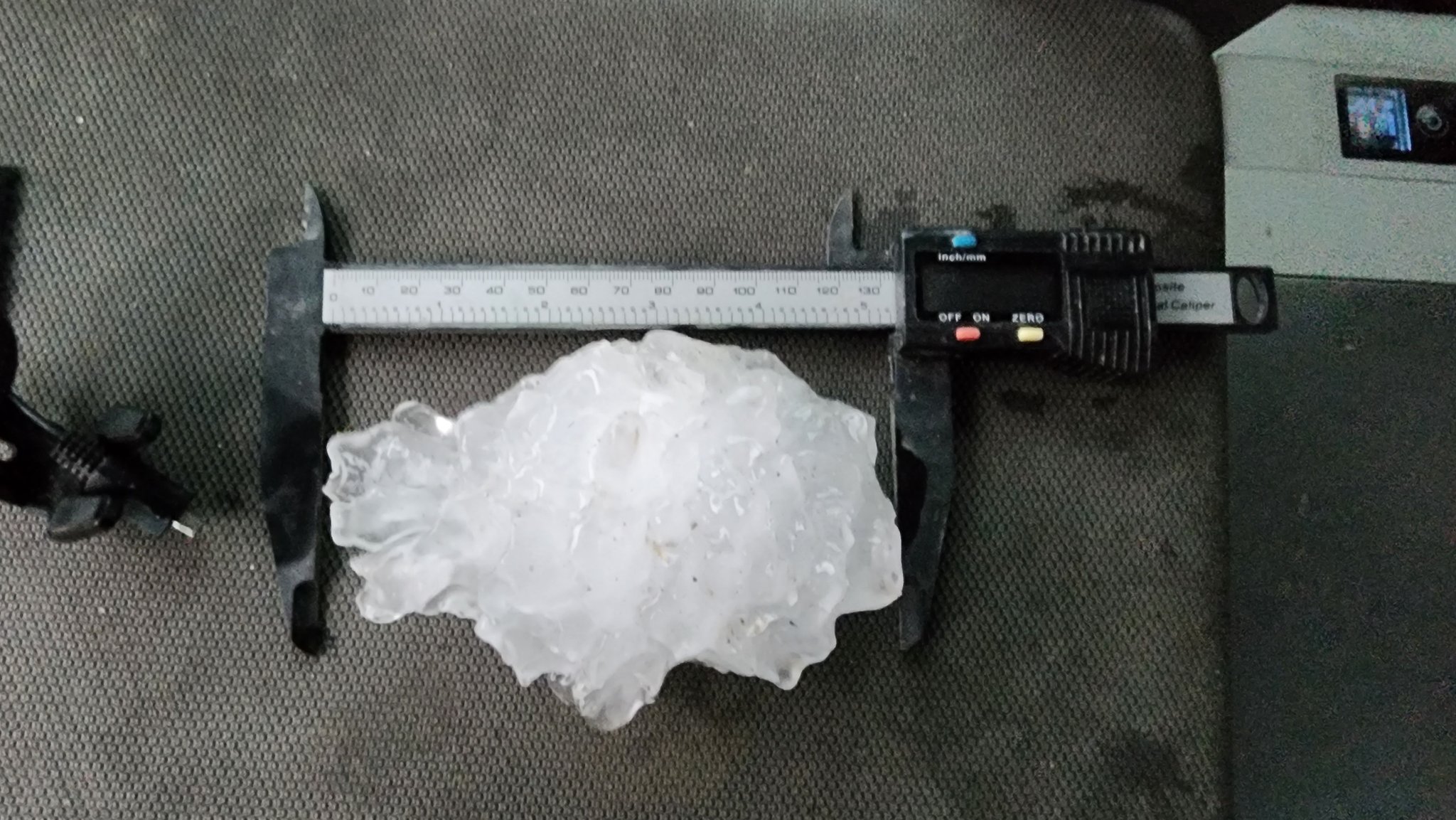
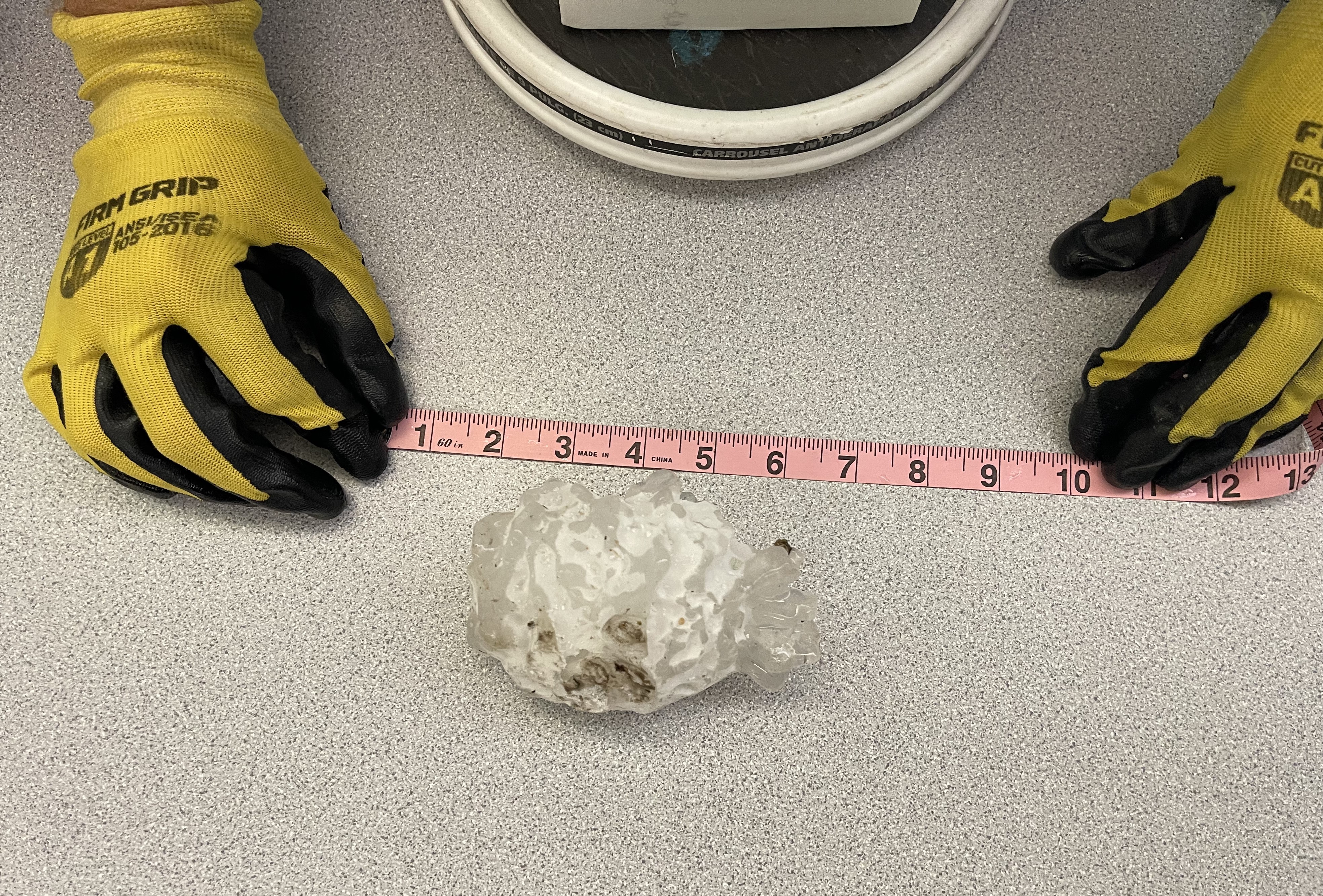
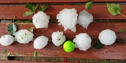
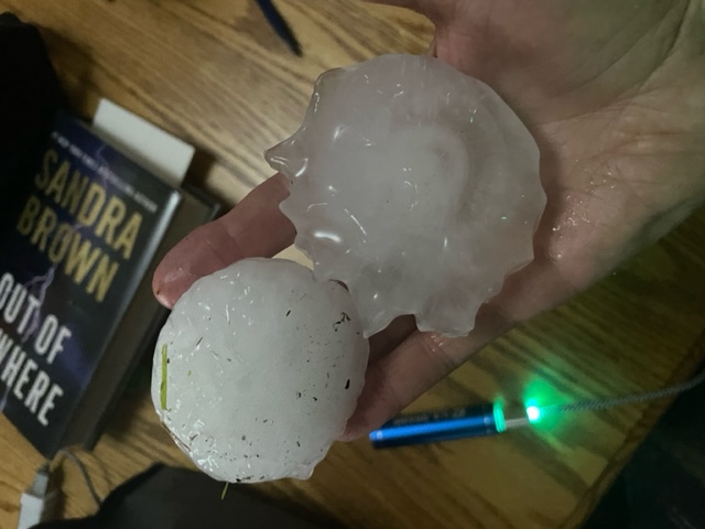
While the supercell was producing tornadoes, the supercell was also producing large to giant hail with numerous reports of 2+ inch hail stones. The supercell also produced a new Colorado state record hail stone with a diameter of 5.25 inches.
 |
 |
 |
 |
|
Picture of record hailstone between Kirk and Idalia. (Photo By: Dan Fitts) |
Record hail stone being measured (some melting had occurred). (Photo By: NWS Goodland) |
A variety of hailstones just east of Yuma, Colorado. (Photo By: Lynda Harper) |
Giant hail just southeast of Yuma. (Photo By: Lila Hahn) |
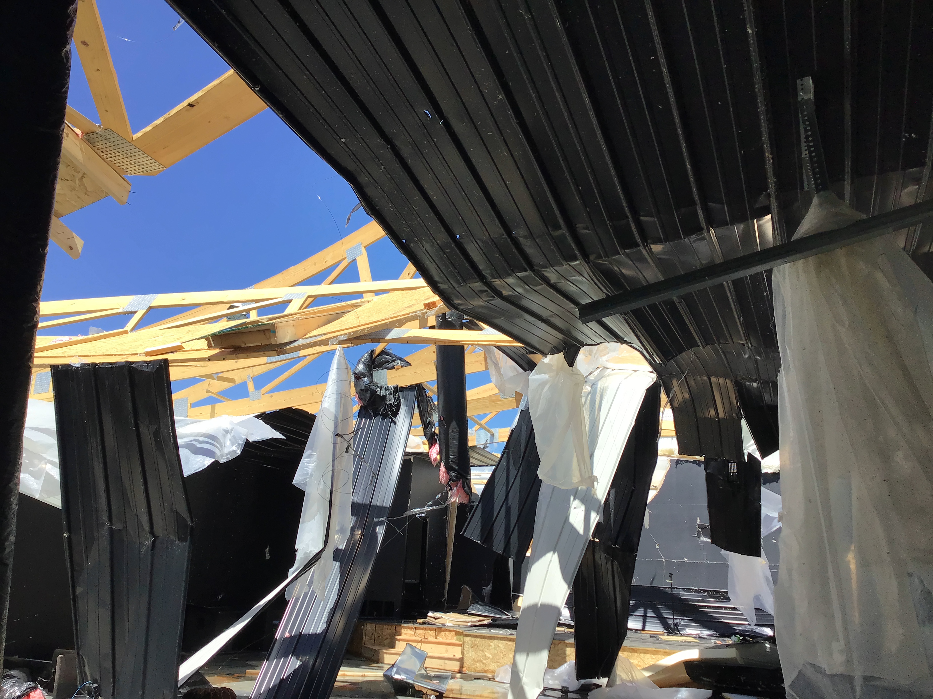
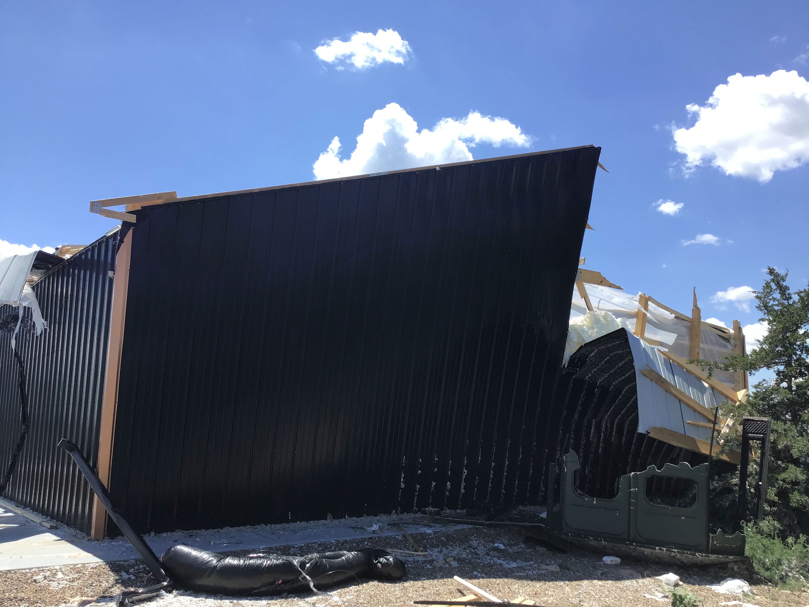
Photos & Video
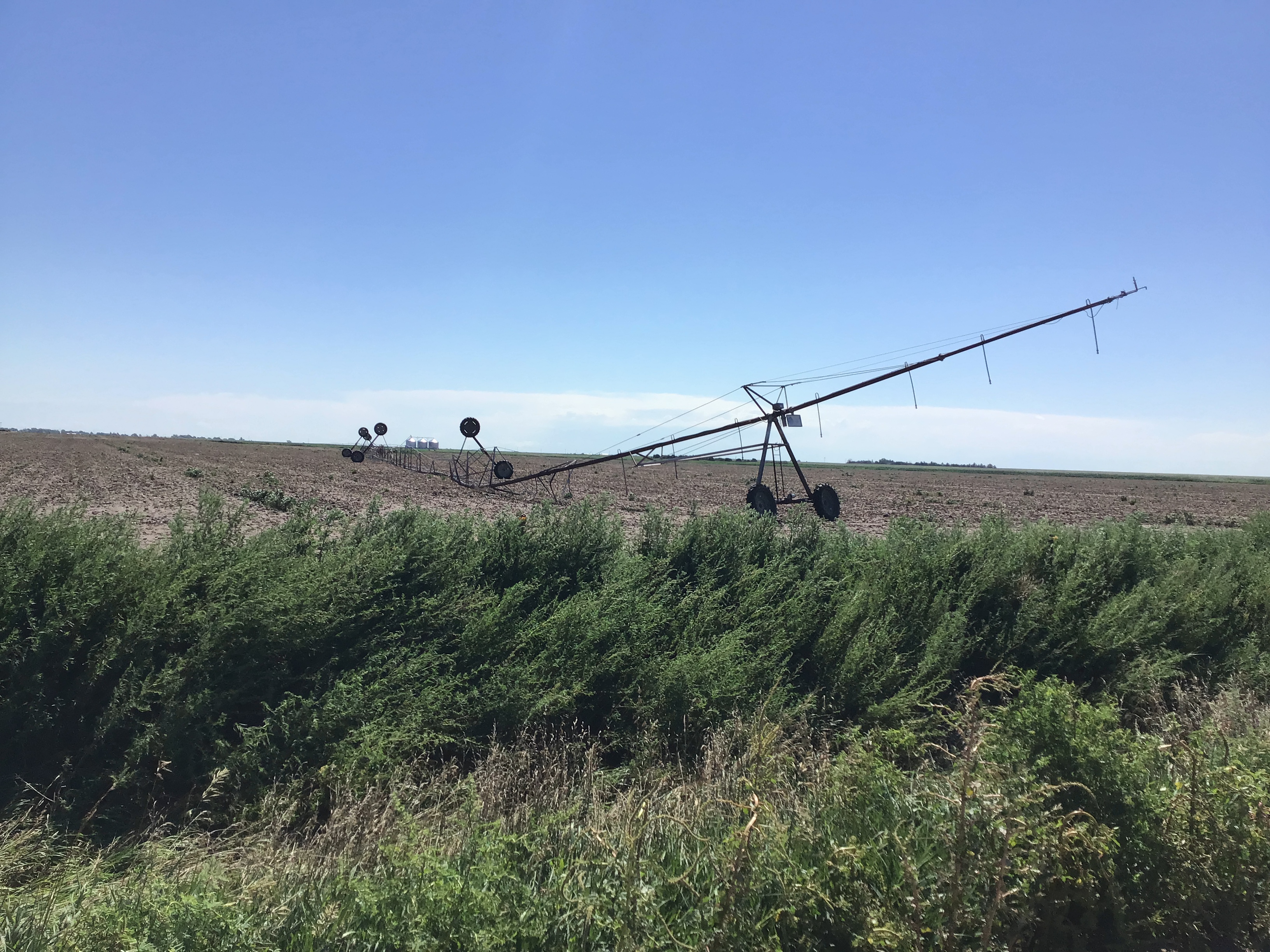
Pictures of the Yuma Tornado damage.
 |
 |
 |
 |
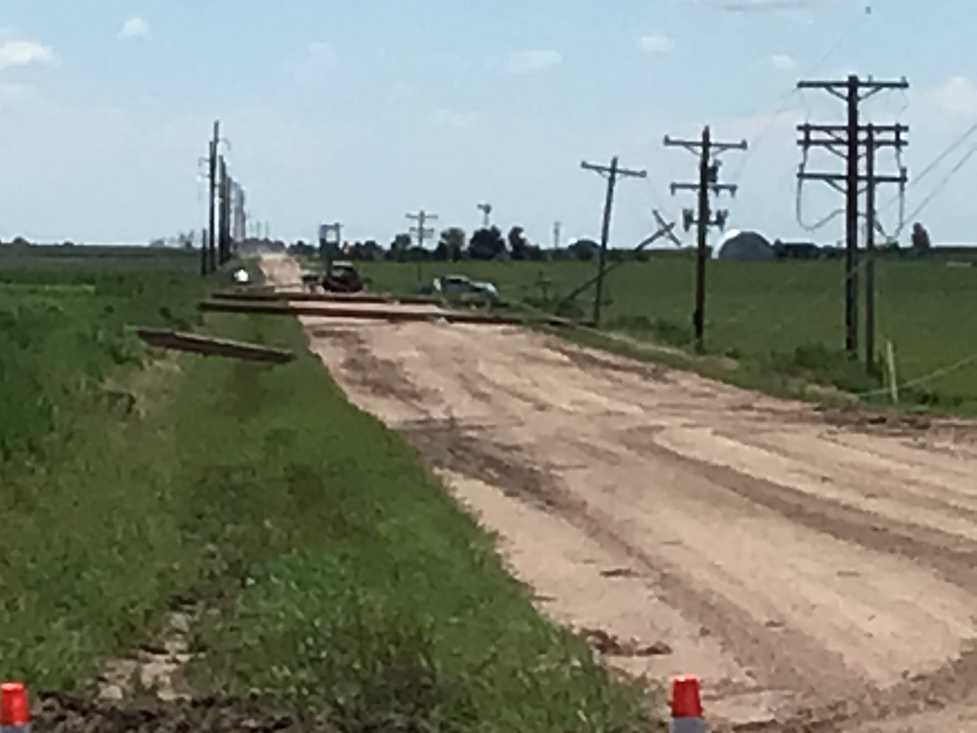
| Overturned irrigation sprinklers. (NWS Survey) |
Power poles being replaced. (NWS survey) |
Damaged building. (NWS Survey) |
Damage building. (NWS Survey) |
 |
 |
 |
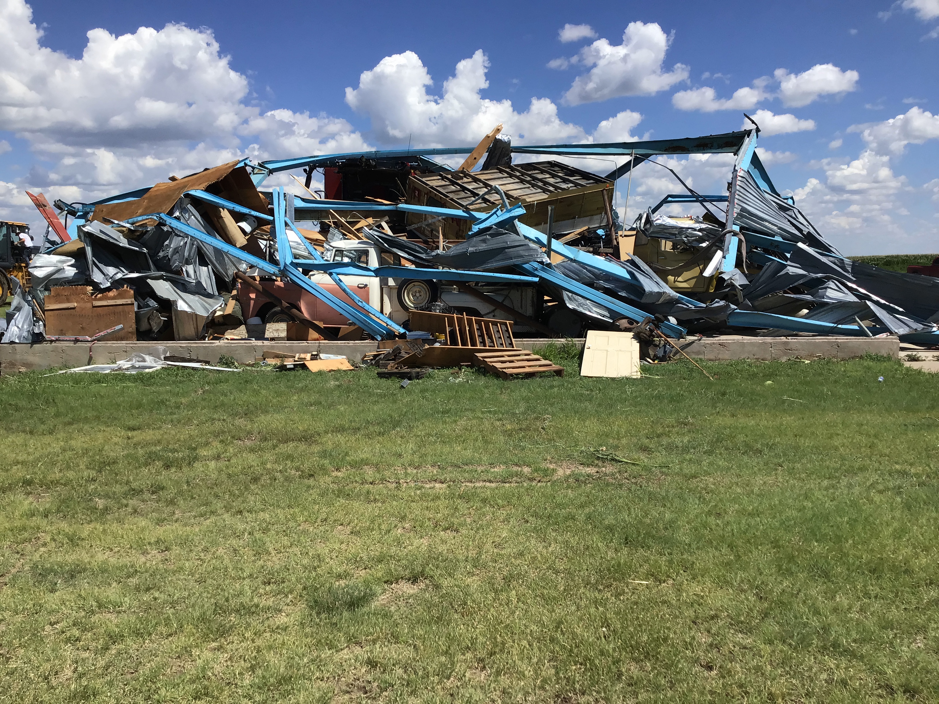 |
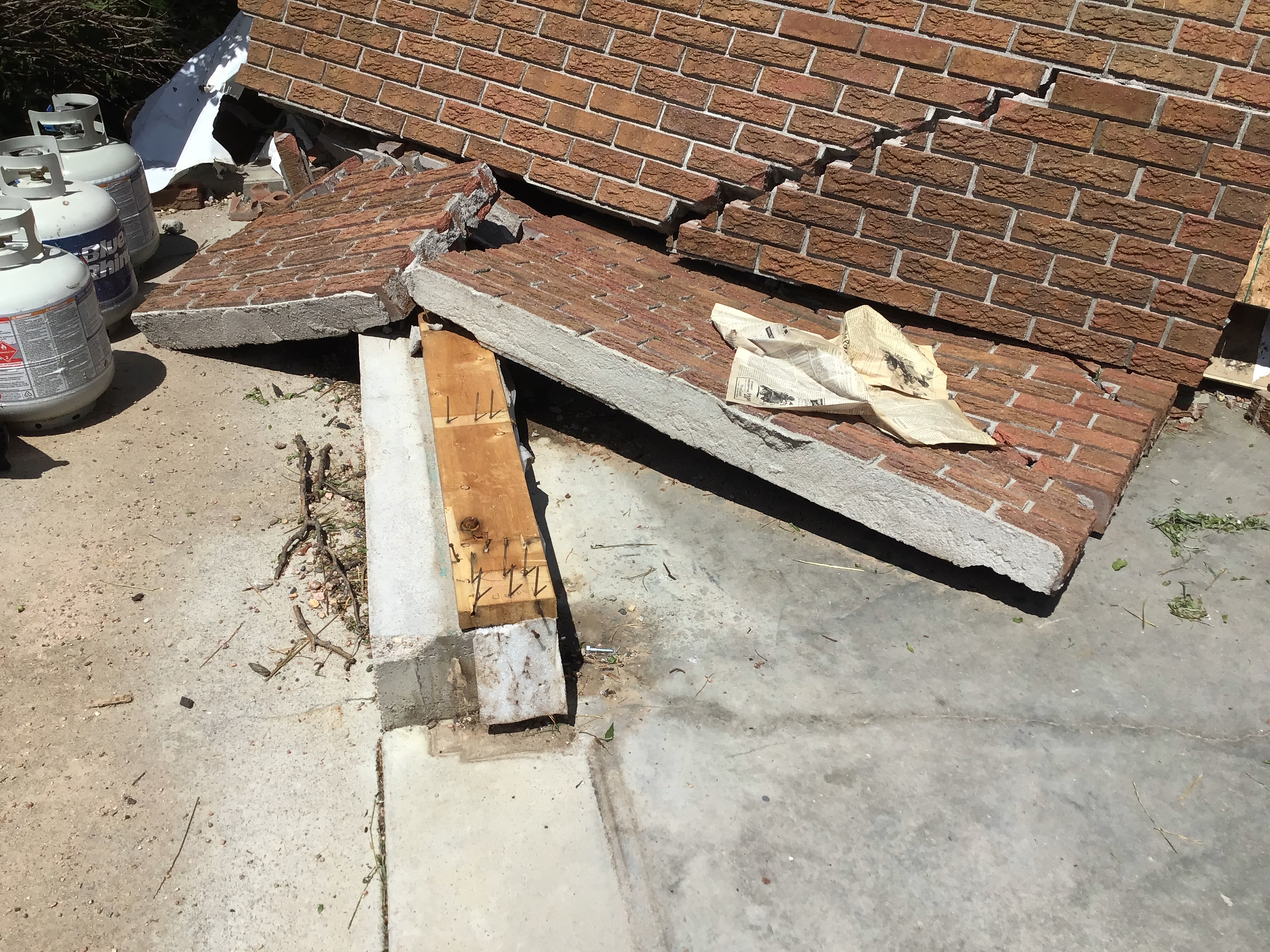
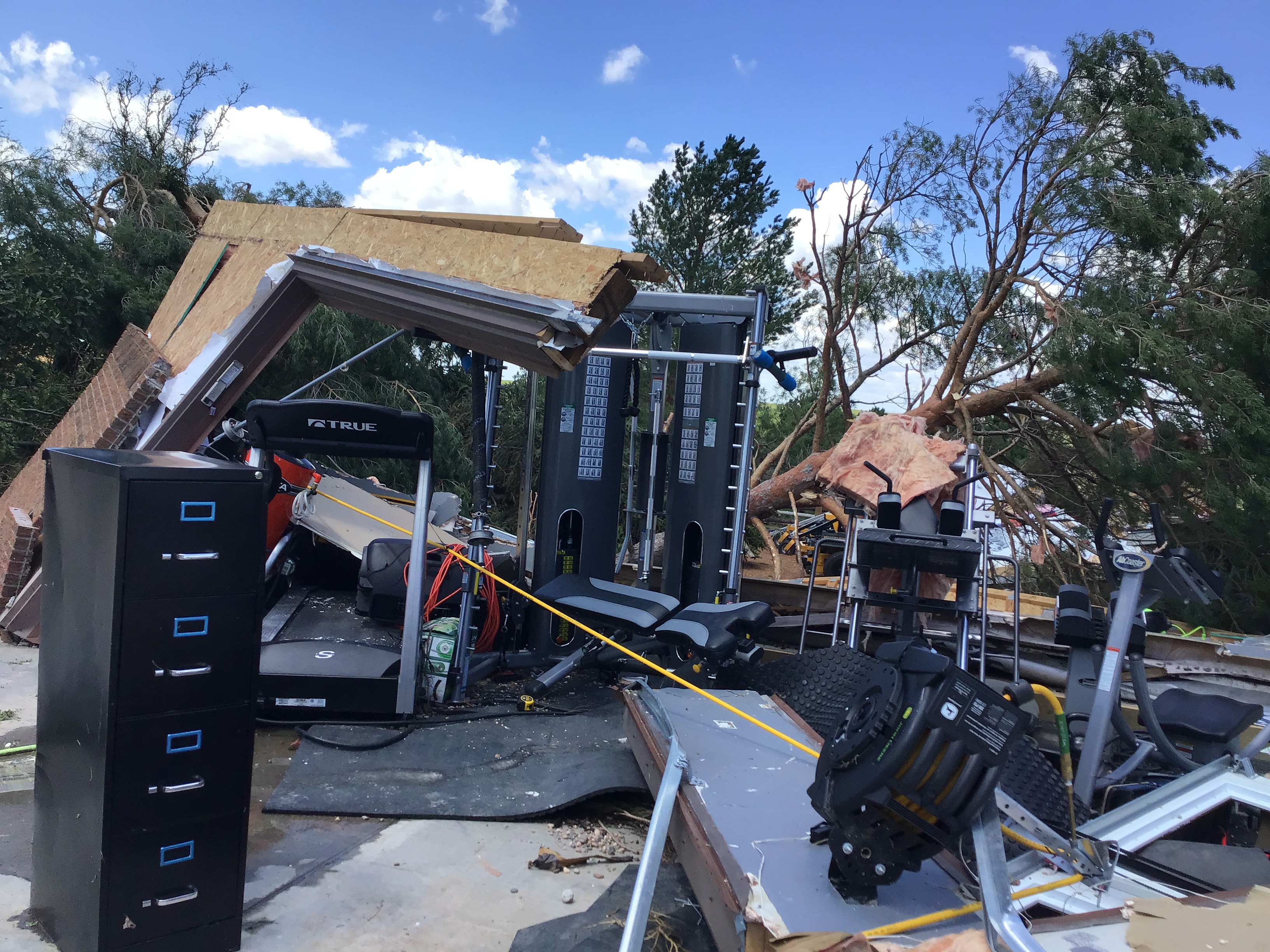
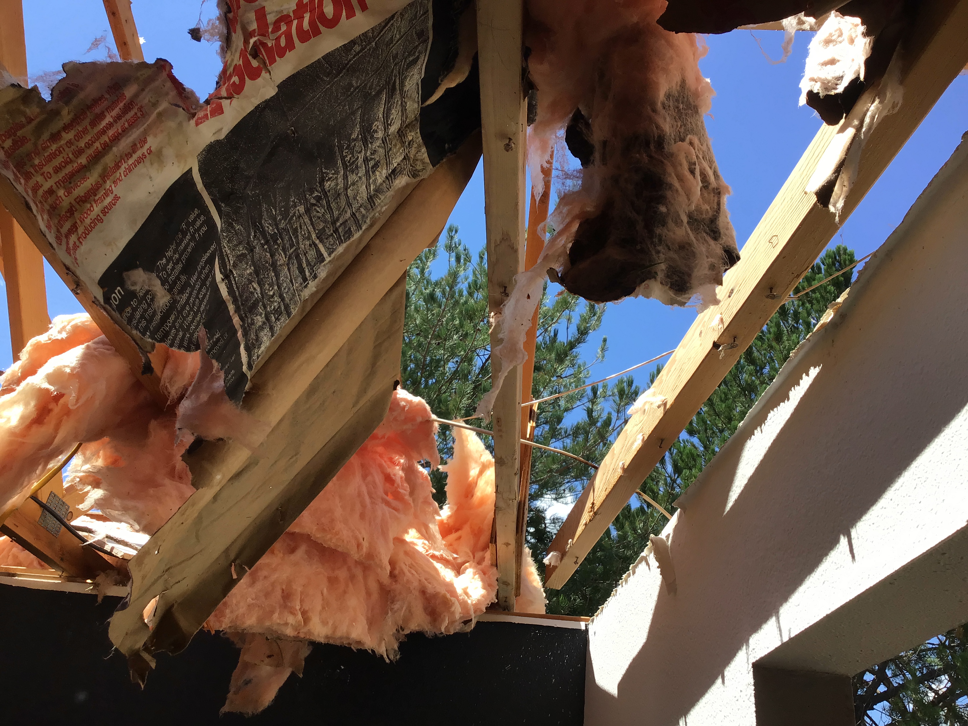
| Roof torn off building. (NWS Survey) |
Damaged shed. (NWS Survey) |
Outside of damaged shed. (NWS Survey) |
Machine shed collapsed. (NWS Survey) |
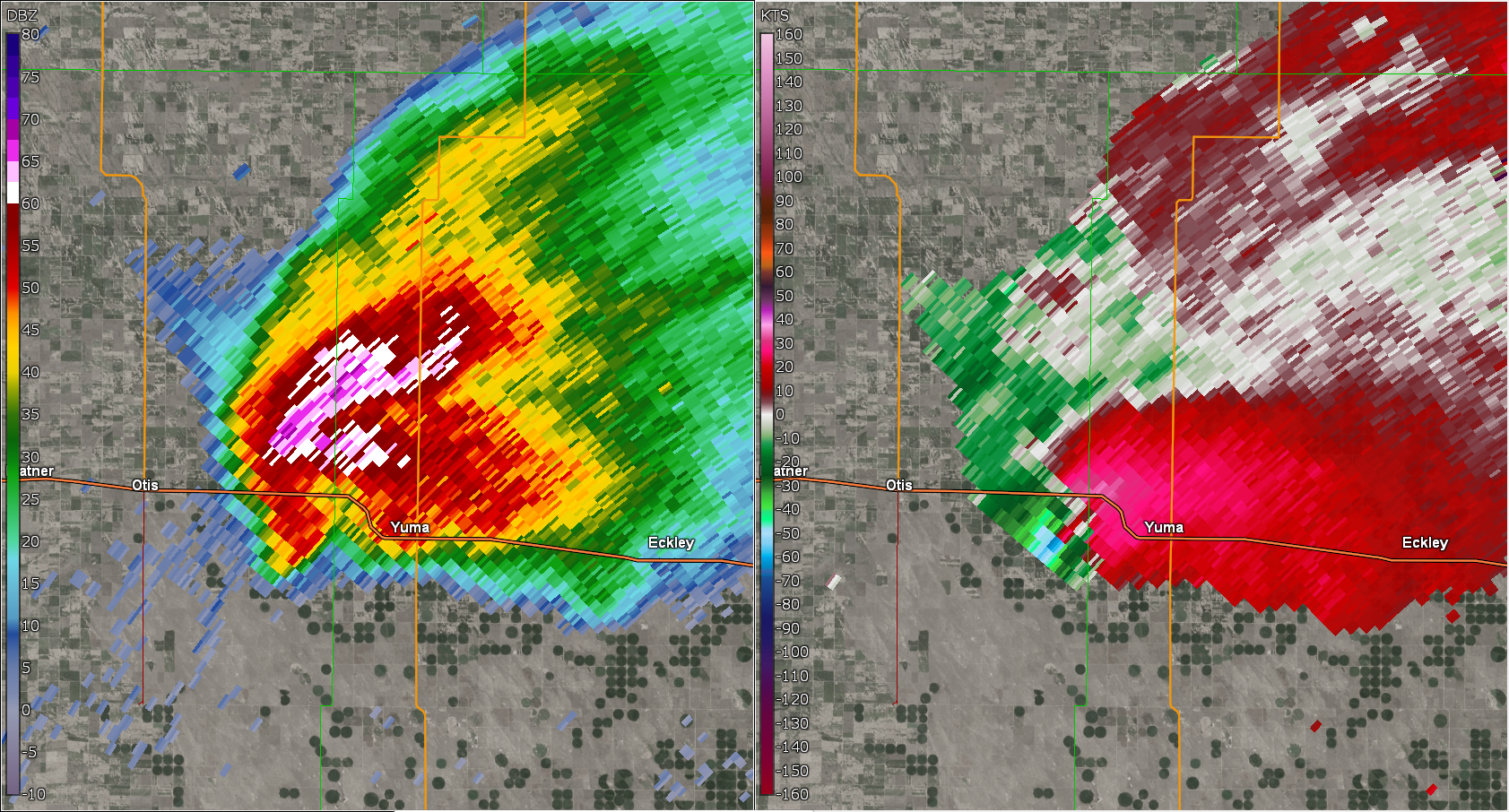
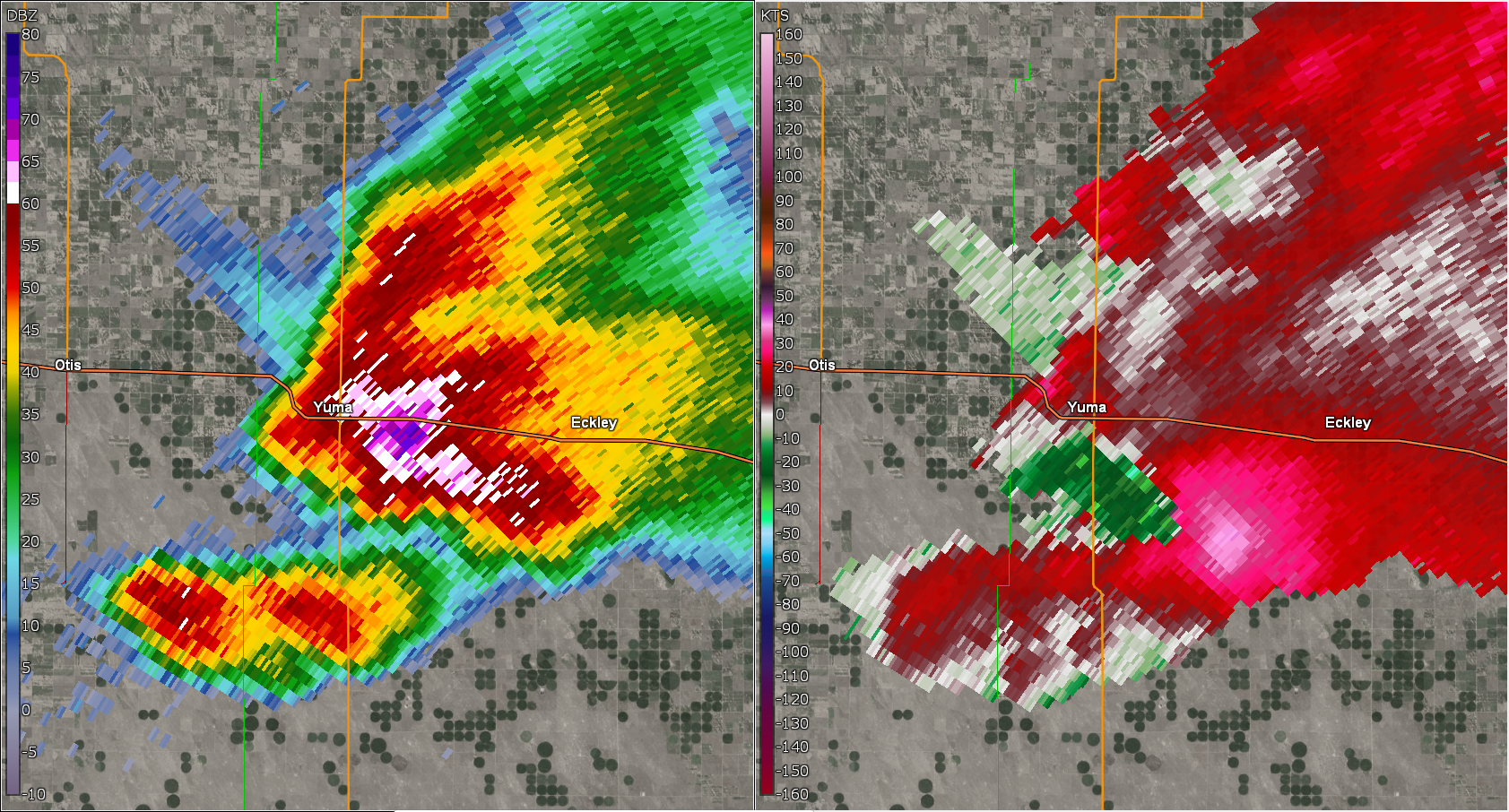
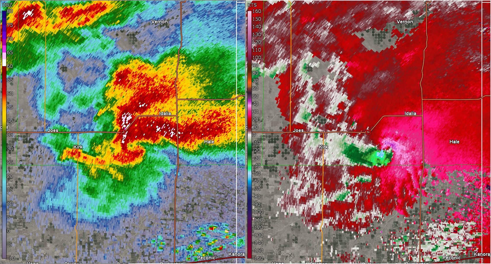
Radar
Header
 |
 |
 |
|
| Radar Loop (Coming Soon) | Reflectivity and Velocity at start of Yuma Tornado | Reflectivity and Velocity at end of Yuma Tornado | Reflectivity and Velocity when the record hail stone fell. |
Storm Reports
Preliminary Local Storm Report...Summary
National Weather Service Goodland KS
315 AM MDT Wed Aug 9 2023

..TIME...   ...EVENT...      ...CITY LOCATION...     ...LAT.LON...
..DATE...   ....MAG....      ..COUNTY LOCATION..ST.. ...SOURCE....
            ..REMARKS..

1025 PM     Hail             12 NNE Aroya            39.02N 103.08W
08/08/2023  E2.50 inch       Cheyenne           CO   Broadcast Media

            Baseball size hail broke numerous double
            paned windows in a home in extreme northwest
            Cheyenne County. A few miles away, quarter
            to golf ball size hail accumulated to a
            depth of 6 inches.

0921 PM     Tornado          3 SSE Kanorado          39.29N 102.01W
08/08/2023                   Sherman            KS   Official NWS Obs

            Tornado debris signature (TDS) observed via
            KGLD 0.5 and 0.9 degree tilts at 0321 UTC.
            Correlation Coefficient dropout to 0.60-0.75
            coincident with velocity couplet and
            reflectivity values ranging from 40-50 dBZ.
            Signature was only present for 1 volume
            scan.

0921 PM     Tornado          3 SSE Kanorado          39.29N 102.01W
08/08/2023                   Sherman            KS   Storm Chaser

            Possible tornado damage to an abandoned
            structure along with downed powerlines east
            of County Rd 3 on County Rd 61. Timing
            estimated via radar.

0920 PM     Hail             3 E Peconic             39.33N 102.10W
08/08/2023  M1.00 inch       Kit Carson         CO   Public

            Hail observed on I-70 at MM 447.

0920 PM     Hail             3 E Peconic             39.33N 102.10W
08/08/2023  M1.00 inch       Kit Carson         CO   Trained Spotter

            Hail observed at MM 447 on I-70.

0920 PM     Hail             3 E Peconic             39.33N 102.10W
08/08/2023  M1.00 inch       Kit Carson         CO   Public

            Hail observed at MM 447 on I-70.

0727 PM     Tornado          8 SSW Idalia            39.60N 102.37W
08/08/2023                   Yuma               CO   Public

            Chaser reported ongoing stovepipe tornado.
            Chaser was located 21 miles NW of
            Burlington. Location of report based on
            radar.

0725 PM     Tornado          8 SW Idalia             39.61N 102.40W
08/08/2023                   Yuma               CO   Storm Chaser

            Partially condensed cone tornado now rain
            wrapped. Location estimated via radar.
            Chaser was 11 miles SW of Idalia.

0722 PM     Hail             8 ENE Kirk              39.66N 102.45W
08/08/2023  M5.00 inch       Yuma               CO   Storm Chaser

            Corrects previous hail report from 8 WSW
            Idalia. Hail measured at 5.25 inches fell on
            Hwy 36. Time estimated. New LSR created with
            exact location stone was picked up.

0716 PM     Hail             Idalia                  39.70N 102.29W
08/08/2023  E1.50 inch       Yuma               CO   Public

            Report from mPING: Ping Pong Ball (1.50
            in.).

0713 PM     Hail             Idalia                  39.70N 102.29W
08/08/2023  E1.25 inch       Yuma               CO   Public

            Report from mPING: Half Dollar (1.25 in.).

0711 PM     Tornado          7 NE Kirk               39.69N 102.51W
08/08/2023                   Yuma               CO   Storm Chaser

            Delayed report via social media. Brief
            condensed and uncondensed circulations
            roughly 7 miles NE of Kirk from 7 to 7:15 PM
            MDT. Image taken at County Rd 3 and R.
            Location estimated for tornado.

0710 PM     Tornado          8 W Idalia              39.68N 102.45W
08/08/2023                   Yuma               CO   Storm Chaser

            Chaser sent video of ongoing tornado that
            was dissipated as of 7:13 PM. Video observed
            from Roads T and 8. Time and location
            estimated via radar.

0709 PM     Hail             Idalia                  39.70N 102.29W
08/08/2023  E1.00 inch       Yuma               CO   Public

            Report from mPING: Quarter (1.00 in.).

0707 PM     Hail             Idalia                  39.70N 102.29W
08/08/2023  E0.75 inch       Yuma               CO   Public

            Report from mPING: Dime (0.75 in.).

0630 PM     Tornado          5 SE Abarr              39.80N 102.65W
08/08/2023                   Yuma               CO   Public

            Ongoing tornado reported. Location roughly
            10 miles NW of Kirk. Location estimated via
            radar and report.

0630 PM     Hail             6 WSW Heartstrong       39.93N 102.68W
08/08/2023  E4.00 inch       Yuma               CO   Storm Chaser

            Storm chaser reported 3.5 inch to 4 inch
            hail near the intersection of Highway 59 and
            County Road 25 at approximately 6:30 pm MDT.

0625 PM     Tornado          3 E Abarr               39.85N 102.66W
08/08/2023                   Yuma               CO   Storm Chaser

            Storm chasers were 7 miles north of Joes
            looking to the northwest. They commented
            they saw rope tornado for about a minute and
            a half, emerging out of rain shaft. Position
            estimated by radar.

0620 PM     Hail             6 N Abarr               39.94N 102.71W
08/08/2023  E2.50 inch       Yuma               CO   Public

            Report from mPING: Tennis Ball (2.50 in.).

0619 PM     Tstm Wnd Gst     1 ESE Abarr             39.85N 102.70W
08/08/2023  E60 MPH          Yuma               CO   Trained Spotter


0619 PM     Tornado          5 SW Heartstrong        39.89N 102.63W
08/08/2023                   Yuma               CO   Storm Chaser

            Tornado just touched down via Chaser live
            feed. Location estimated via radar.

0617 PM     Hail             7 N Abarr               39.95N 102.71W
08/08/2023  E1.50 inch       Yuma               CO   Public

            Report from mPING: Ping Pong Ball (1.50
            in.).

0606 PM     Tornado          2 NNE Abarr             39.87N 102.71W
08/08/2023                   Yuma               CO   Storm Chaser

            Brief tornado lasted about 2 minutes
            (6:08PM) roughly 2-3 miles NW of County Rds
            L and and 18 intersection.

0559 PM     Hail             7 S Yuma                40.03N 102.72W
08/08/2023  E1.25 inch       Yuma               CO   Public

            Report from mPING: Half Dollar (1.25 in.).

0545 PM     Hail             6 SSW Yuma              40.05N 102.77W
08/08/2023  E1.75 inch       Yuma               CO   Trained Spotter

            Up to golf ball hail observed. Power was out
            at the residence.

0534 PM     Hail             6 NNW Heartstrong       40.04N 102.61W
08/08/2023  E3.00 inch       Yuma               CO   Public

            Delayed report via social media with photo
            of hailstones. Time estimated.

0530 PM     Tornado          7 NNW Heartstrong       40.05N 102.62W
08/08/2023                   Yuma               CO   Storm Chaser

            Delayed report via social media.
            Multi-vortex tornado reported roughly 7-8
            miles southeast of Yuma. Location
            approximate based on radar. Tornado has
            lifted prior to 5:51 PM MDT.

0518 PM     Hail             4 ESE Yuma              40.10N 102.66W
08/08/2023  E1.75 inch       Yuma               CO   Public

            Hail was ongoing at the location.

0516 PM     Hail             4 SE Yuma               40.08N 102.66W
08/08/2023  E1.00 inch       Yuma               CO   Public

            Report from mPING: Quarter (1.00 in.).

0515 PM     Hail             7 N Abarr               39.95N 102.72W
08/08/2023  E2.75 inch       Yuma               CO   Public

            Corrects previous hail report from 7 N
            Abarr. Delayed report via social media with
            picture. Time estimated.

0513 PM     Tornado          5 S Yuma                40.05N 102.72W
08/08/2023                   Yuma               CO   Storm Chaser

            5 power poles snapped along Hwy 59. Time
            estimated.

0508 PM     Hail             3 W Yuma                40.12N 102.78W
08/08/2023  E4.00 inch       Yuma               CO   Storm Chaser


0502 PM     Tornado          2 SW Yuma               40.10N 102.76W
08/08/2023                   Yuma               CO   Fire Dept/Rescue

            Tornado on the ground estimated 3 miles west
            of the airport. Location estimated.

0500 PM     Hail             4 NE Yuma               40.16N 102.67W
08/08/2023  E1.75 inch       Yuma               CO   Public

            Delayed report via social media.
 |
Media use of NWS Web News Stories is encouraged! Please acknowledge the NWS as the source of any news information accessed from this site. |
|


.PNG)