Scattered strong to severe storms capable of sporadic large hail and severe winds are expected this afternoon and evening across portions of western Texas. Widespread showers and thunderstorms may produce isolated flash flooding across the Ozarks today and the Southeast into next week. Read More >
Overview
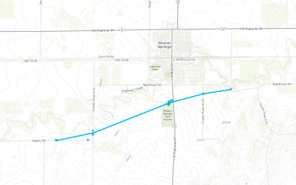
An intense low pressure system moved across the High Plains on October 12th, 2021. An "Enhanced" Risk of severe weather was forecast, as well as the potential for blowing dust and high winds before the storms formed later that evening. Initially, a few storms formed in extreme northwestern Kansas, but these storms were never able to fully mature into supercell thunderstorms. Eventually, a significant line of thunderstorms formed along the Kansas/Colorado border and moved east. It is this line of thunderstorms that produced the severe weather reports, with a tornado near Sharon Springs, wind damage near Oakley, and a few severe hailstones reported. In addition, beneficial rain fell as the majority of the area is experiencing drought conditions.Storm Survey Results:
|
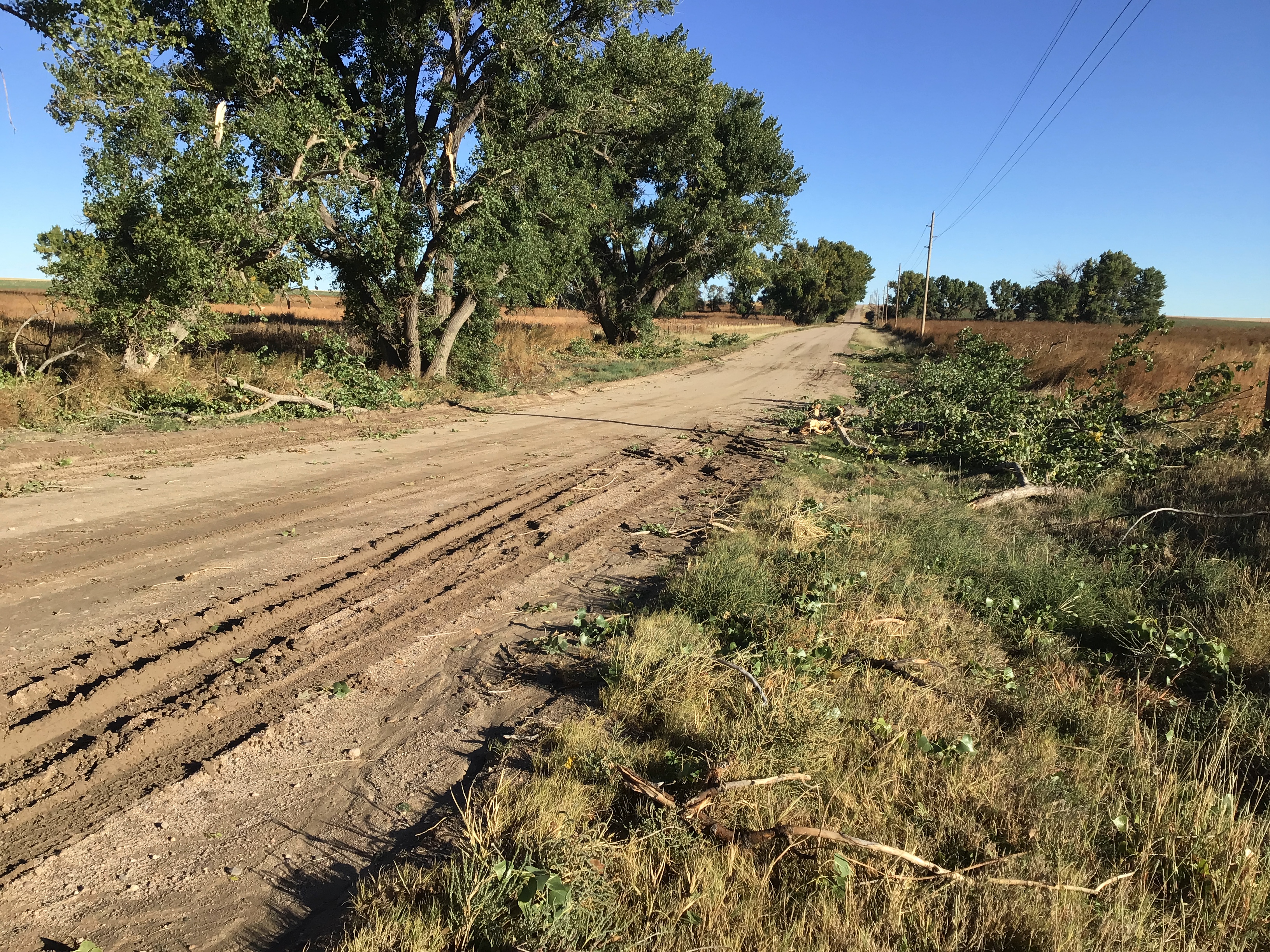
Tornado - Sharon Springs
|
||||||||||||||
The Enhanced Fujita (EF) Scale classifies tornadoes into the following categories:
| EF0 Weak 65-85 mph |
EF1 Moderate 86-110 mph |
EF2 Significant 111-135 mph |
EF3 Severe 136-165 mph |
EF4 Extreme 166-200 mph |
EF5 Catastrophic 200+ mph |
 |
|||||
Photos & Video
Header
 |
 |
 |
|
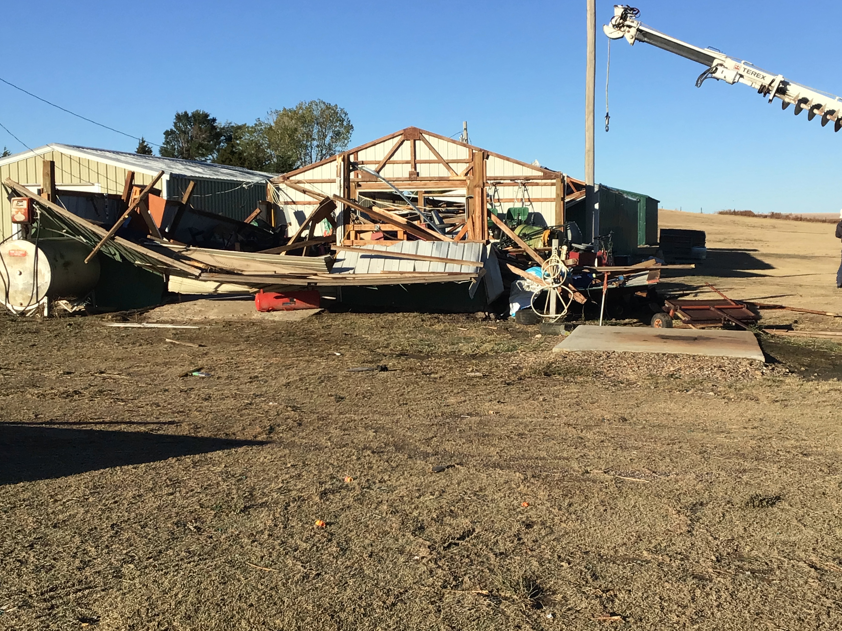
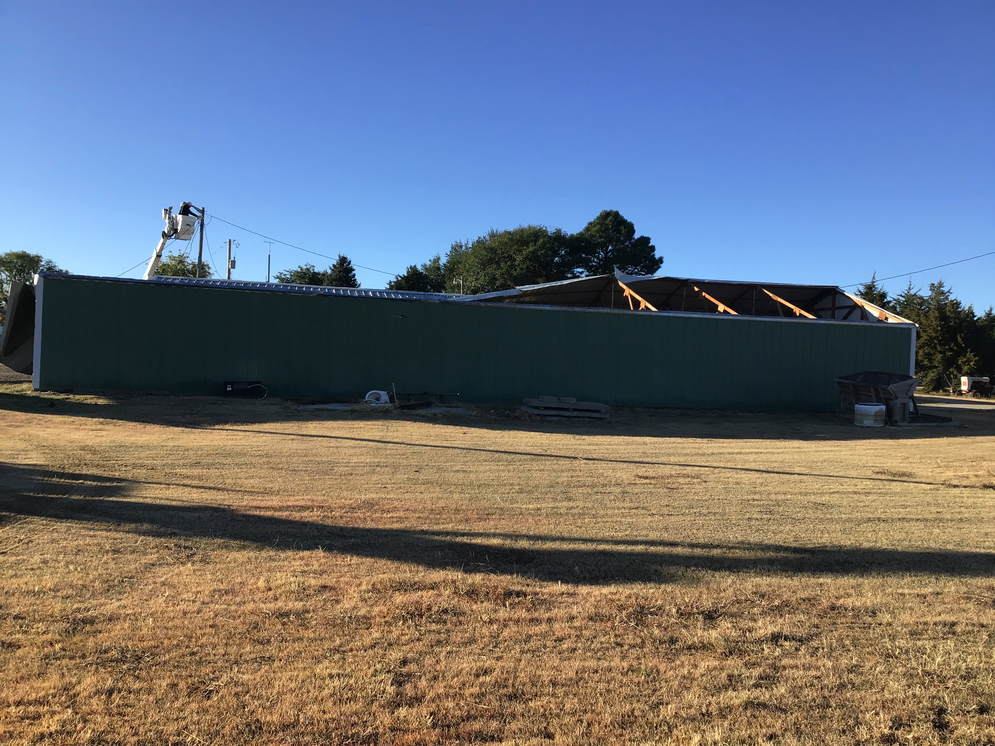
Damage to a golf course outbuilding. |
Damage to a golf course outbuilding. (NWS Storm Survey) |
Damage to a golf course outbuilding. (NWS Storm Survey) |
 |
 |
 |
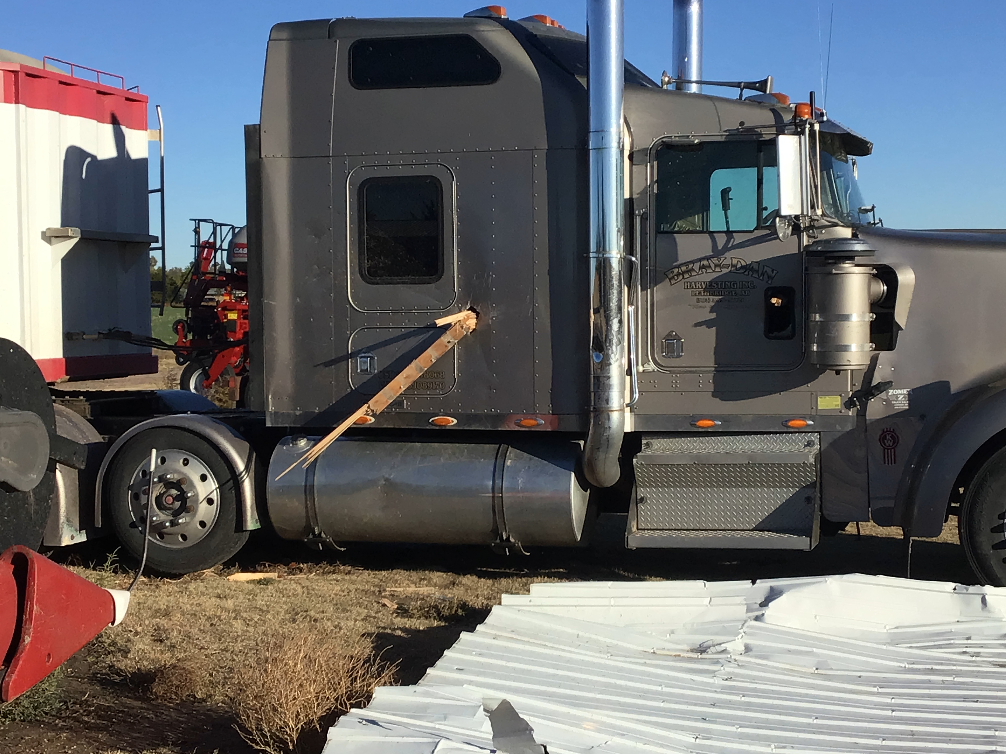
| Wood plank impaling a truck door. (NWS Storm Survey) |
Combine suffered broken windows. (NWS Storm Survey) |
Tree limbs down WSW of Sharon Springs (NWS Storm Survey) |
|
|
Radar
Header
 |
 |
 |
 |
|
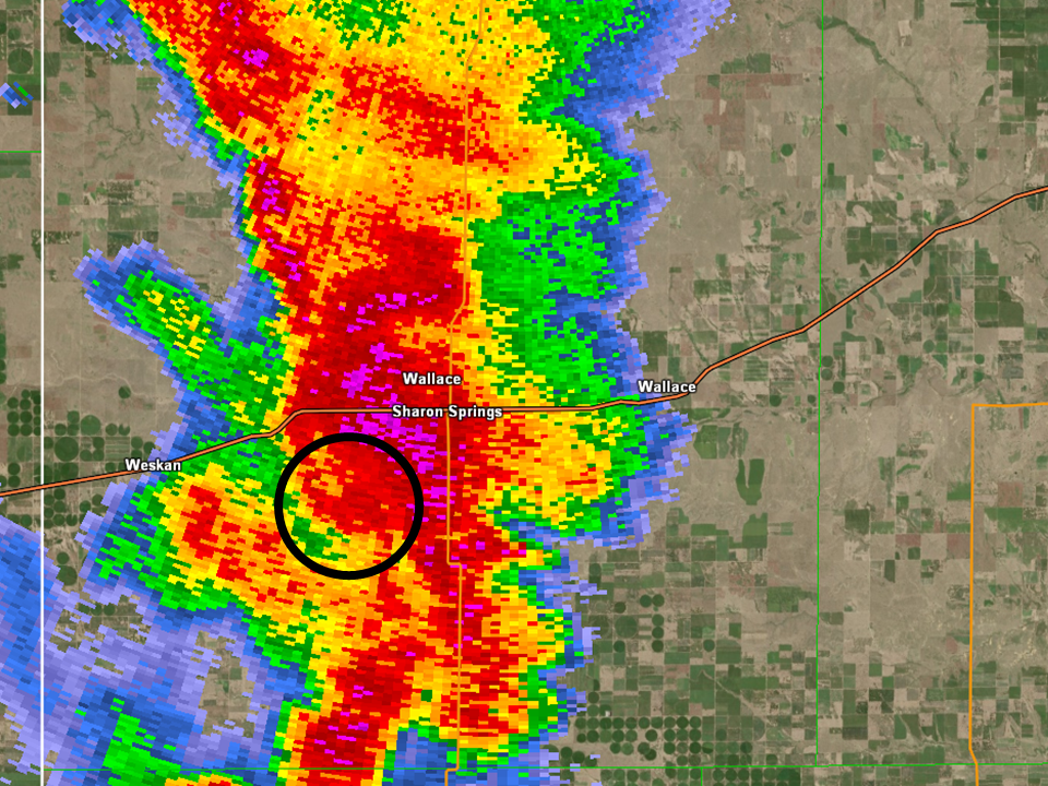
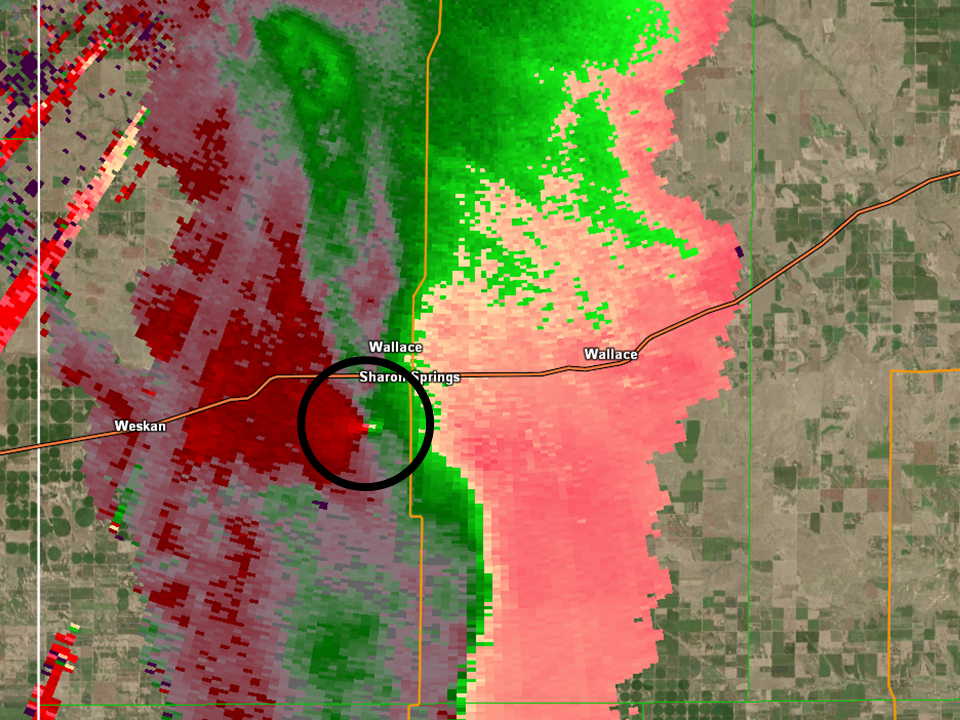
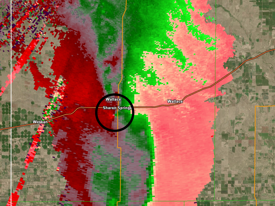
Radar Reflectivity Broad rotation beginning to tighten southwest of Sharon Springs, KS |
Storm Relative Velocity Broad rotation beginning to tighten southwest of Sharon Springs, KS |
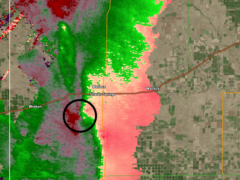
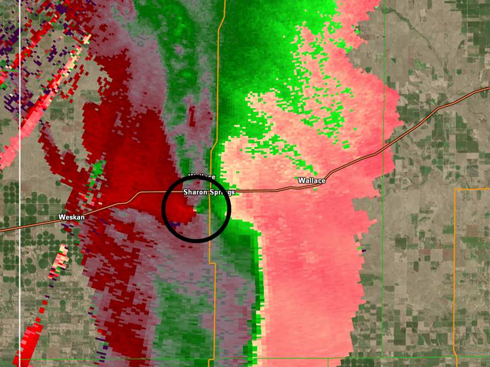
Radar Reflectivity Tornado begins southwest of Sharon Springs, KS |
Storm Relative Velocity Tornado begins southwest of Sharon Springs, KS |
 |
 |
 |
 |
|
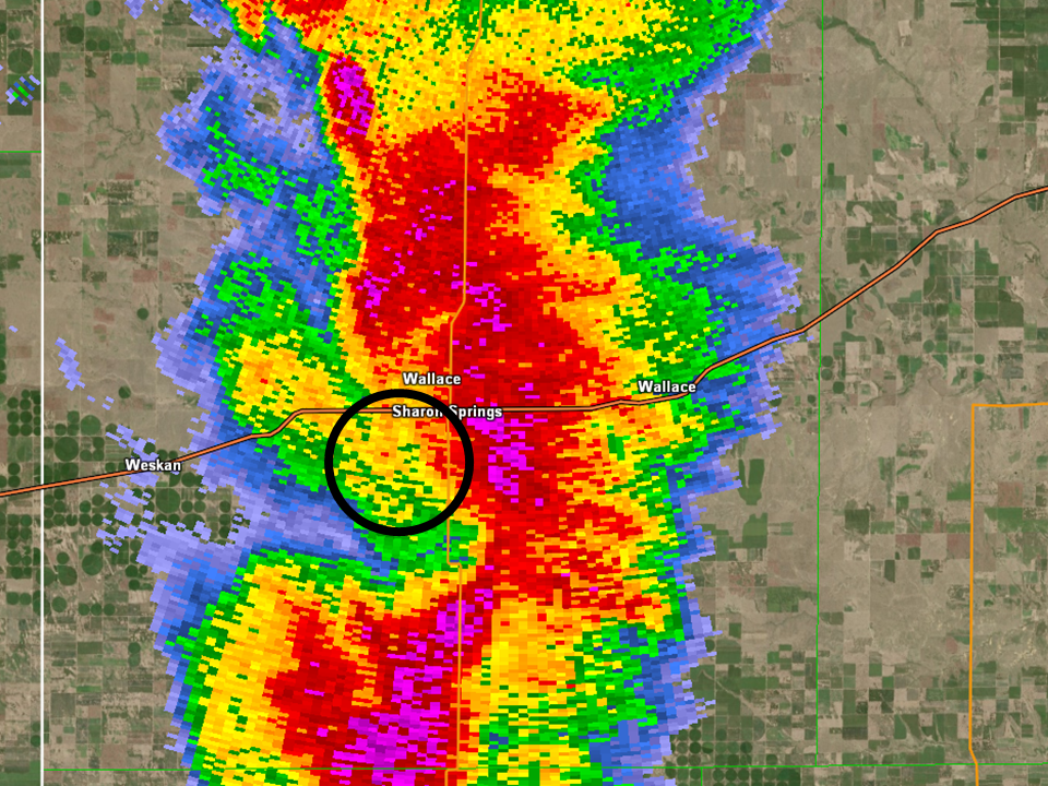
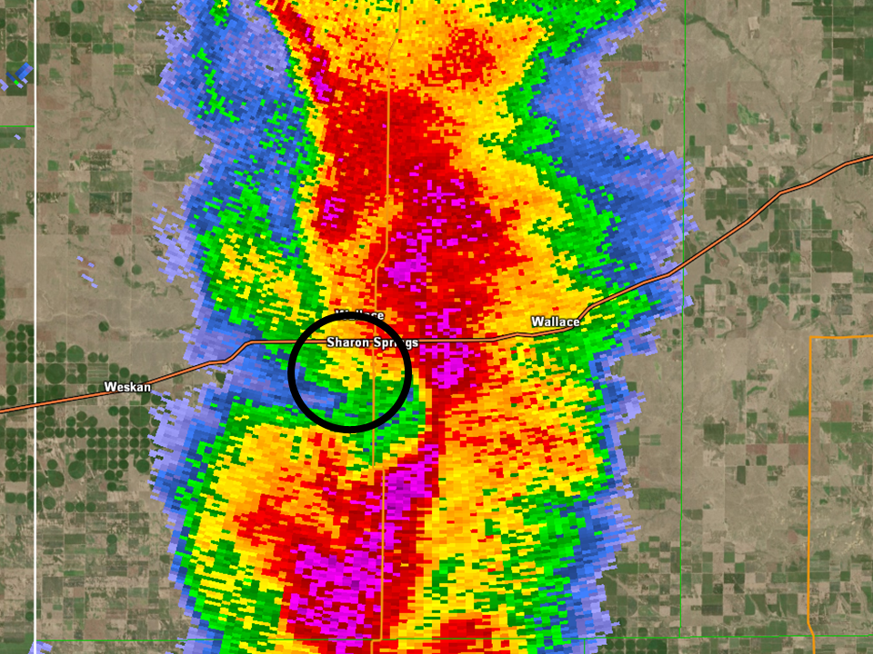
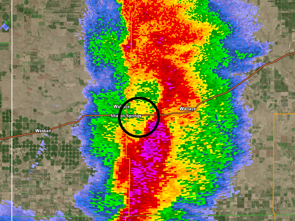
Radar Reflectivity Tornado continues southwest of Sharon Springs, KS |
Storm Relative Velocity Tornado continues southwest of Sharon Springs, KS |
Radar Reflectivity Tornado impacting the golf course south of Sharon Springs, KS |
Storm Relative Velocity Tornado impacting the golf course south of Sharon Springs, KS |
 |
 |
|
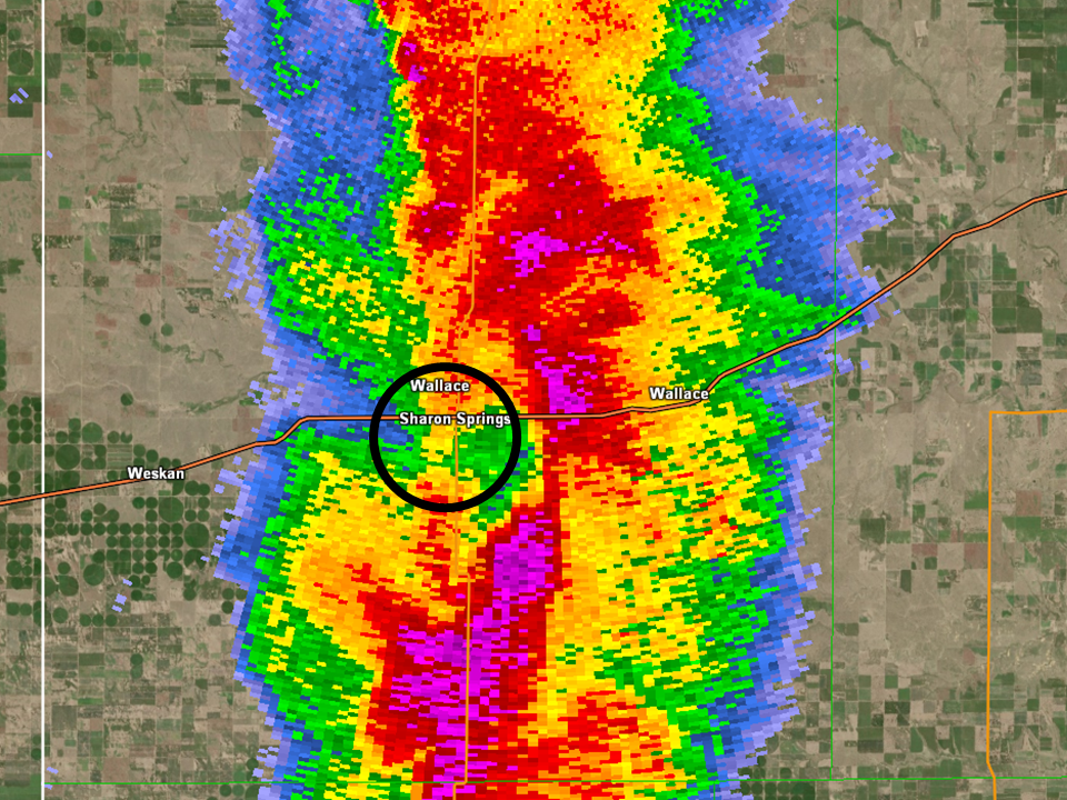
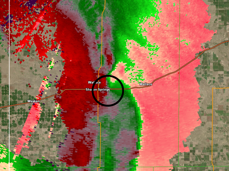
Radar Reflectivity Tornado dissipates southeast of Sharon Springs, KS |
Storm Relative Velocity Tornado dissipates southeast of Sharon Springs, KS |
Storm Reports
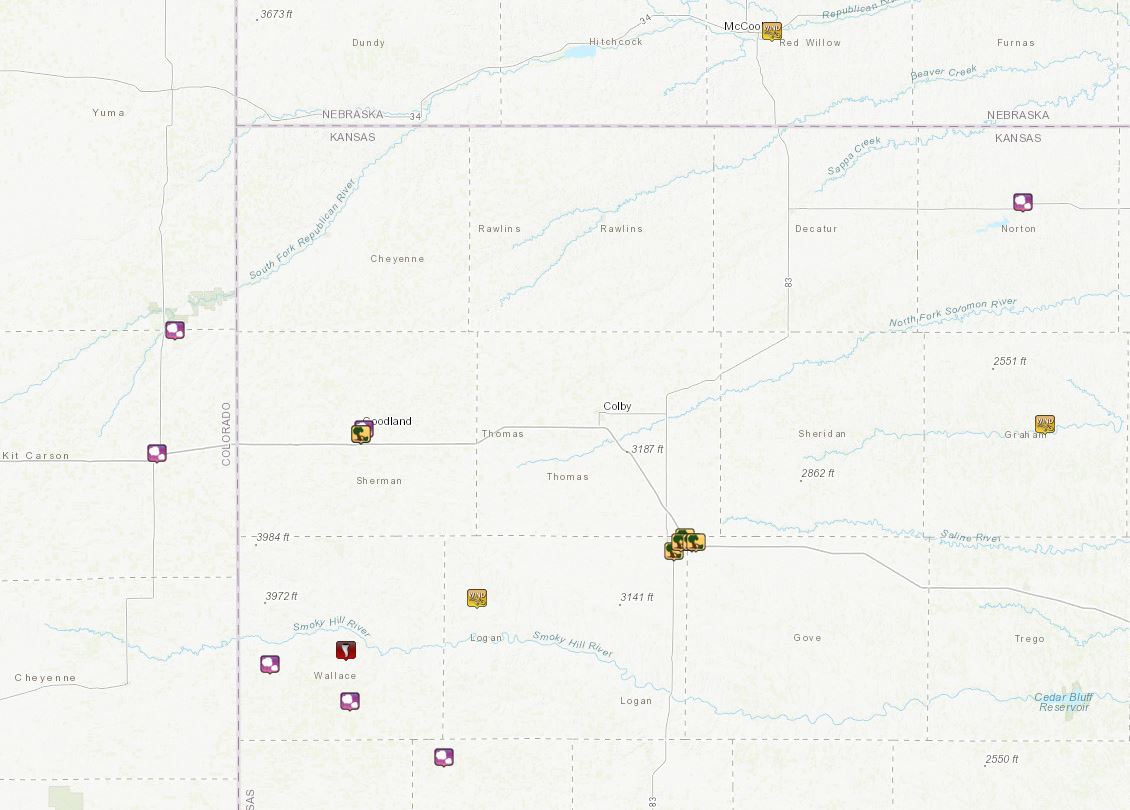
..TIME... ...EVENT... ...CITY LOCATION... ...LAT.LON...
..DATE... ....MAG.... ..COUNTY LOCATION..ST.. ...SOURCE....
..REMARKS..
0517 PM HAIL 1 NNE GOODLAND 39.36N 101.70W
10/12/2021 M0.25 INCH SHERMAN KS TRAINED SPOTTER
0532 PM TSTM WND DMG GOODLAND 39.35N 101.71W
10/12/2021 SHERMAN KS NWS STORM SURVEY
DISPATCH REPORT OF CAR WINDOW KNOCKED OUT OF
CUSTOMERS CAR AT WALMART AND A SMALL TREE
UPROOTED AND BLOWN INTO PARKING LOT. OTHER
SMALL BRANCHES WERE FOUND SNAPPED BEHIND
WALMART. DAMAGE SURVEY FOUND NO EVIDENCE OF
TORNADO AS ALL DAMAGE WAS BLOWN EAST. TIME
ESTIMATED VIA RADAR.
0600 PM HAIL WESKAN 38.86N 101.96W
10/12/2021 M1.00 INCH WALLACE KS 911 CALL CENTER
REPORT OF QUARTERS FROM DISPATCH TIME
ESTIMATED FROM RADAR.
0605 PM HAIL BURLINGTON 39.31N 102.27W
10/12/2021 E0.25 INCH KIT CARSON CO PUBLIC
0613 PM HAIL 4 SW BONNY RESERVOIR 39.57N 102.22W
10/12/2021 E0.25 INCH YUMA CO PUBLIC
0625 PM TORNADO 1 S SHARON SPRINGS 38.88N 101.75W
10/12/2021 WALLACE KS NWS STORM SURVEY
AN EF-0 IMPACTED LOCATIONS SOUTHWEST TO
SOUTHEAST OF SHARON SPRINGS, KS. THE MOST
SIGNIFICANT DAMAGE WAS OBSERVED AT THE
SHARON SPRINGS GOLF COURSE. PATH LENGTH WAS
3.34 MILES WITH A PATH WIDTH AS LARGE AS 100
YARDS.
0628 PM HAIL 8 S SHARON SPRINGS 38.78N 101.74W
10/12/2021 E1.00 INCH WALLACE KS TRAINED SPOTTER
QUARTER SIZED HAIL REPORTED.
0630 PM TORNADO SHARON SPRINGS 38.89N 101.75W
10/12/2021 WALLACE KS 911 CALL CENTER
CORRECTS PREVIOUS TORNADO REPORT FROM SHARON
SPRINGS. DISPATCH REPORT OF TORNADO HITTING
GOLF COURSE ON SOUTH SIDE OF SHARON SPRINGS.
POWERLINES WERE REPORTED DOWN.
0656 PM HAIL 14 NNE SELKIRK 38.66N 101.48W
10/12/2021 M0.25 INCH WICHITA KS TRAINED SPOTTER
PEA SIZE HAIL AND 51 MPH WIND GUST.
0758 PM TSTM WND DMG 2 S OAKLEY 39.10N 100.85W
10/12/2021 LOGAN KS EMERGENCY MNGR
CENTER PIVOT BLOWN OVER. FOUND IN THE
MORNING, TIME ESTIMATED BY RADAR.
0800 PM TSTM WND DMG 2 E OAKLEY 39.13N 100.82W
10/12/2021 LOGAN KS EMERGENCY MNGR
SEMI BLOWN OVER AT MM 75.5 ON I70.
0800 PM TSTM WND DMG 1 ESE OAKLEY 39.12N 100.83W
10/12/2021 LOGAN KS EMERGENCY MNGR
EM RELAYED THAT A 1/2 MILE OF POWER POLES
GOT TAKEN OUT DUE TO STRAIGHT LINE WINDS
RESULTING IN POWERLESS FOR THE CITY OF
OAKLEY.
0815 PM TSTM WND DMG 4 SSW GRINNELL 39.06N 100.66W
10/12/2021 GOVE KS TRAINED SPOTTER
DELAYED REPORT VIA SOCIAL MEDIA OF A LARGE,
DEAD TREE (TRUNK DIAMETER UNKNOWN) WITH
ROTTED ROOTS WAS BLOWN DOWN. TREE WAS
ESTIMATED TO BE APPROXIMATELY 30 TO 40 FEET
TALL. TIME ESTIMATED BASED ON RADAR AND
SPOTTER ESTIMATE.
0927 PM TSTM WND GST 1 E HILL CITY 39.37N 99.83W
10/12/2021 M53 MPH GRAHAM KS ASOS
ASOS STATION KHLC HILL CITY.
0938 PM HAIL NORTON 39.84N 99.89W
10/12/2021 E0.50 INCH NORTON KS COCORAHS
DELAYED REPORT. MOSTLY PEA SIZE HAIL, BUT
SOME UP TO HALF INCH SIZE.
 |
Media use of NWS Web News Stories is encouraged! Please acknowledge the NWS as the source of any news information accessed from this site. |
|