Grand Junction, CO
Weather Forecast Office
|
County Information:
|
Incident Information System (InciWeb) |
| Vis Satelite | IR Satellite | Radar | Observations | Air Quality Alert Text |
| Red Flag Warning Message | Area Forecast Discussion | Fire Weather Point Forecast Matrix | Fire Weather Zone Forecast | Hazardous Weather Outlook |
| Fire Weather Outlooks | ||
Day 1 |
Day 2 |
Day 3 |
| Lightning Potential Index (Generated by GJT NWS) | ||
Lightning Potential Index - Click Here |
||
| Drought | |||
Weekly Drought Monitor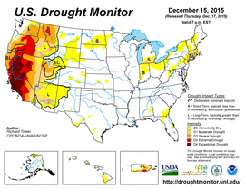 |
Seasonal Outlook |
||
| Wind and RH Forecast | |||
Maximum Wind Gust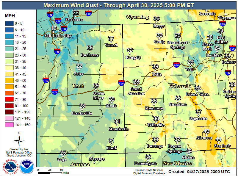 |
Day 1 Min RH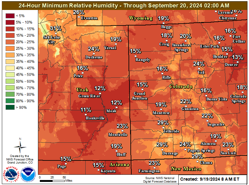 |
Day 2 Min RH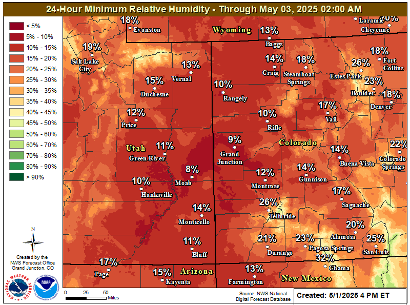 |
|
| Air Quality and Smoke |
Hazards
Detailed Hazards Viewer
Outlooks
Winter Storm Severity Index
Transportation Decision Support
National Briefing
Current Conditions
Observations
Radar
Satellite
Snow Cover
Snowfall Analysis
Precip Analysis
Social Dashboard
Forecasts
Forecast Discussion
Local Area
Activity Planner
Aviation Weather
Fire Weather
Severe Weather
Winter Weather
Hurricane Center
Hydrology
Recreational River Report
Rivers and Lakes
Weather Safety
Preparedness
NOAA Weather Radio
StormReady
SkyWarn
Spotter Training Calendar
US Dept of Commerce
National Oceanic and Atmospheric Administration
National Weather Service
Grand Junction, CO
2844 Aviators Way
Grand Junction, CO 81506-8644
970-243-7007
Comments? Questions? Please Contact Us.

