
Scattered strong to severe storms capable of sporadic large hail and severe winds are expected this afternoon and evening across portions of western Texas. Widespread showers and thunderstorms may produce isolated flash flooding across the Ozarks today and the Southeast into next week. Read More >
Overview
|
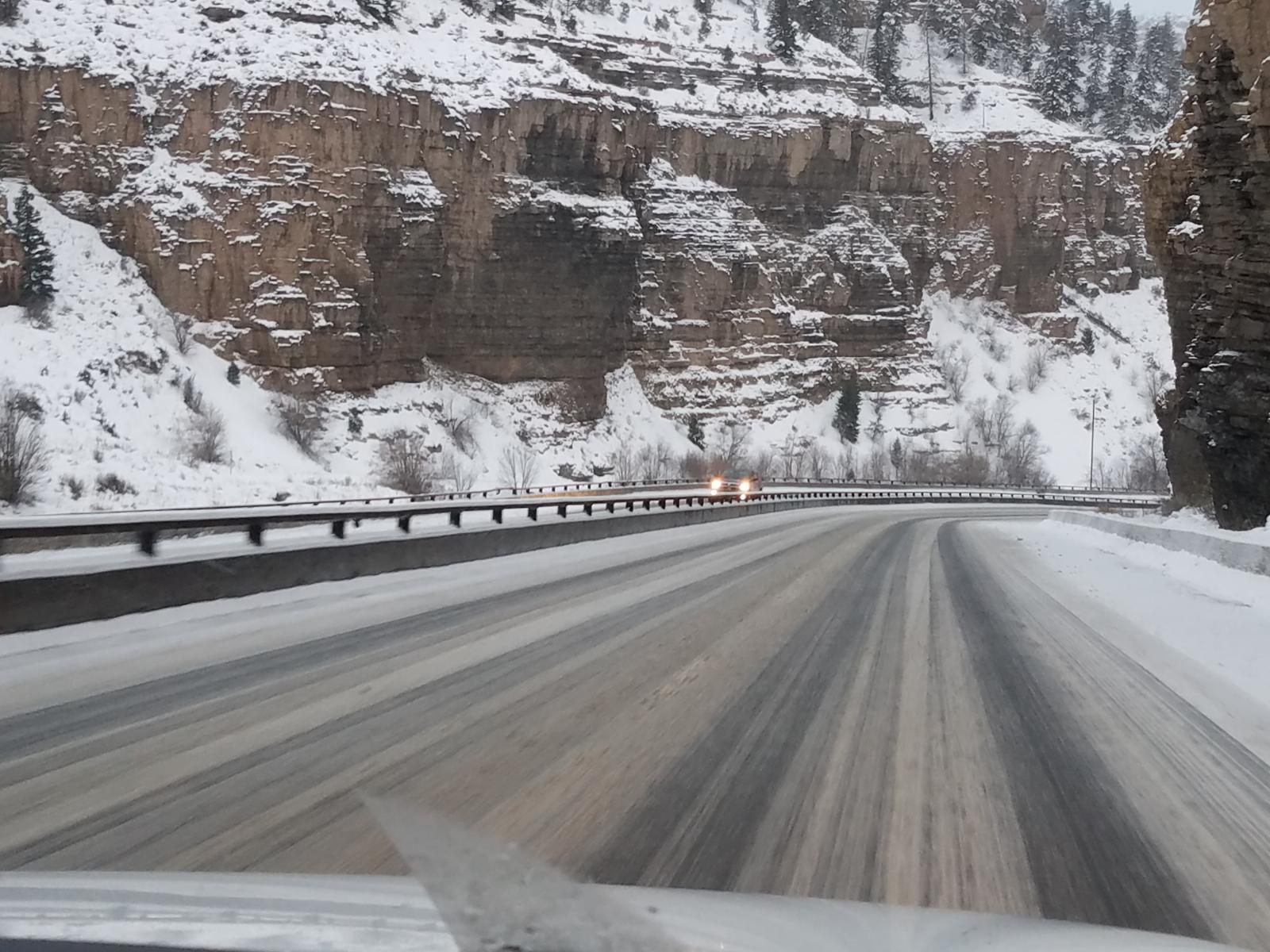
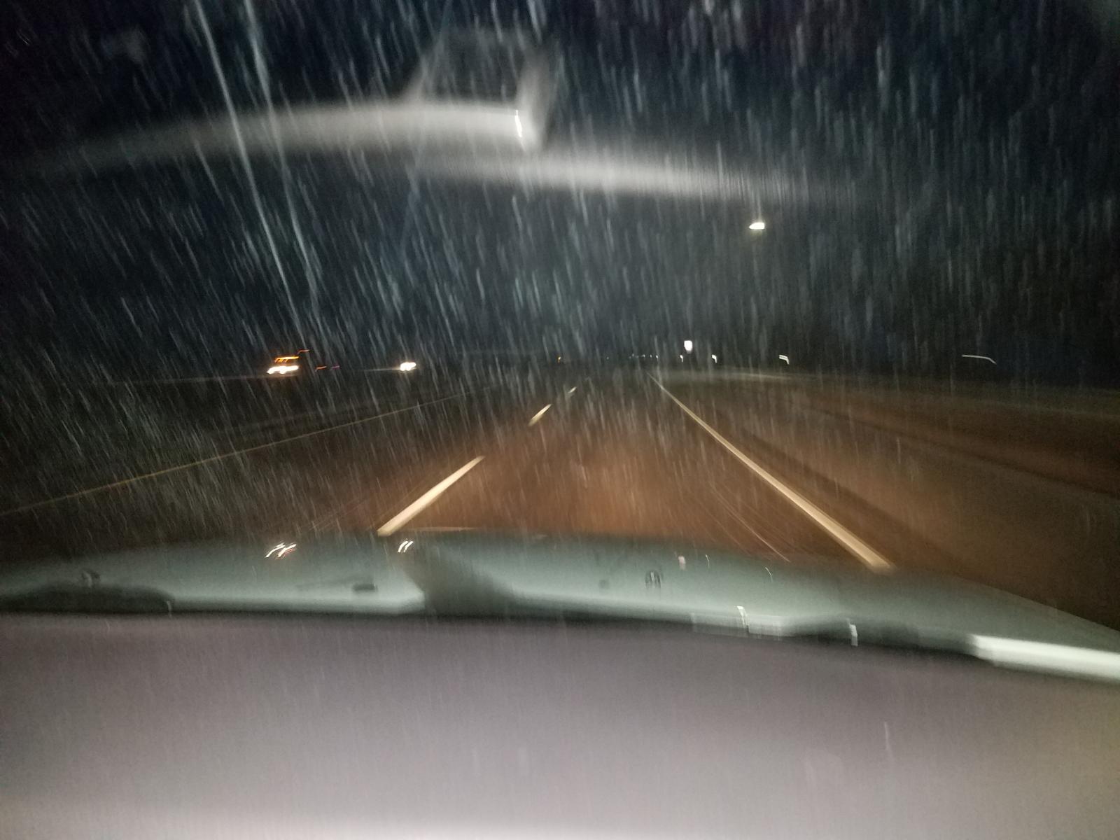
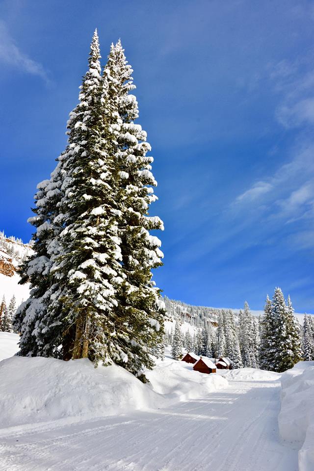
Christmas 2016 will be remembered for the storm that could have been great. Instead, it shifted slightly north, resulting in windy conditions and less snowfall than we were originally expecting across western Colorado and eastern Utah. The gusty winds created poor visibility over the higher mountains with widespread blowing and drifting snow. Combined with 6 to 12 inches of new snow, travel conditions were poor and a few of the higher passes were closed for periods of time while crews cleared up accidents. A second piece of energy rolled through late Christmas night. This brought very icy conditions to portions of Interstate 70, including in the Grand Valley where the highway was closed for a period of time early Monday Morning (December 26, 2016). The Grand Mesa and San Juan Mountains were the winners of this storm with over a foot of snow in a few places. The southwestern Colorado valleys and foothills in La Plata and Archuleta counties received a range of 2.5 inches near Ignacio to 3 inches in the town of Durango to 6 inches in Pagosa Springs. Locations below 6200 feet received little to no snow accumulation with this weather system. Northwest Colorado valleys did not see big snow amounts from this weather system, but the Steamboat Springs area did see about 4 to 7 inches from this storm. |
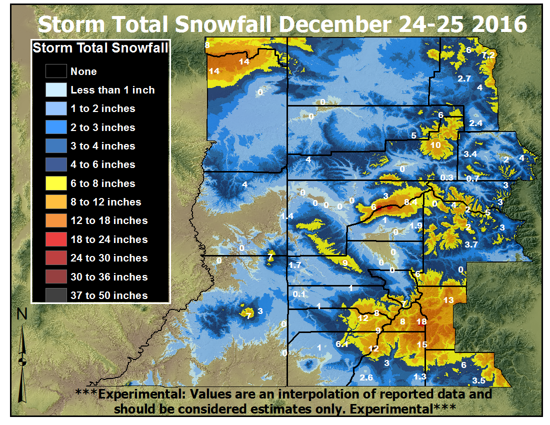 Total Snowfall from the December 24-25, 2016 Winter Storm |
 |
 |
 |
| Snow and blowing snow on Douglas Pass Credit: CDOT |
Snowy morning in Pagosa Springs Credit: Pagosa.com |
Weather Balloon launched on Christmas Day (it's there, look close!) Credit: Michael Charnick |
Photos & Video:
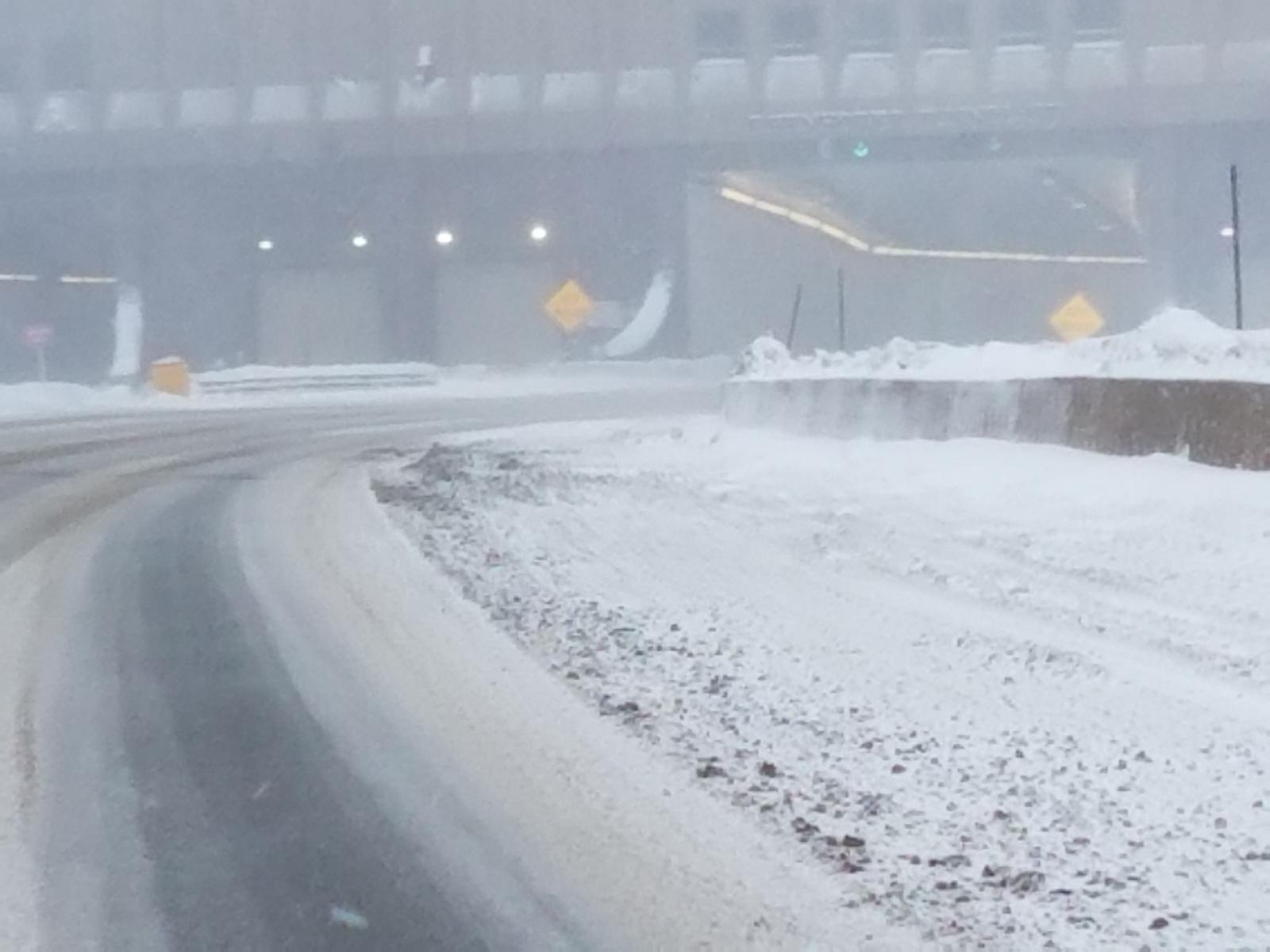
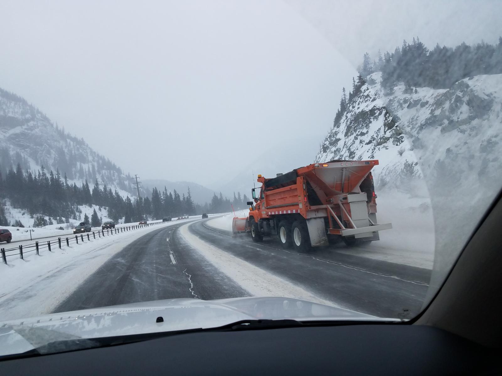
Tricky Travel
 |
 |
 |
 |
| Entering Eisenhower Tunnel Credit: Kim Colton (passenger) |
Snowplows working hard on Christmas Day Credit: Kim Colton |
Accident on west side of Vail Pass Credit: Kim Colton |
Snowy mountains headed toward Glenwood Canyon Credit: Kim Colton |
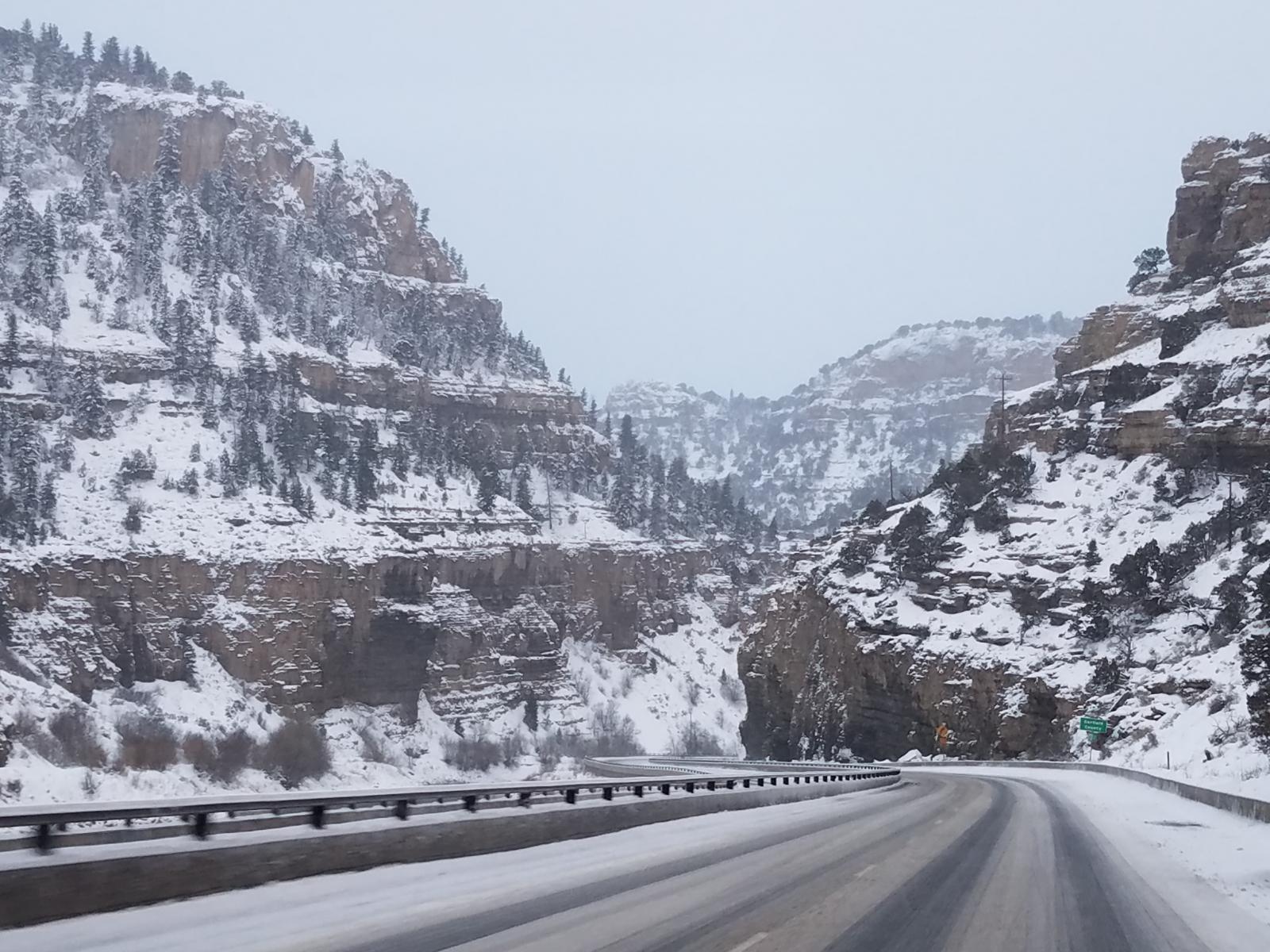 |
 |
 |
 |
| Entering Glenwood Canyon Credit: Kim Colton |
Icy roads in Glenwood Canyon Credit: Kim Colton |
Upper tunnel heading west in Glenwood Canyon Credit: Kim Colton |
Snow fall west of Rifle Credit: Kim Colton |
Grand Mesa
 |
 |
 |
 |
| Heavy snow on the Grand Mesa Credit: Grand Mesa Lodge |
Snow removal underway Credit: Grand Mesa Lodge |
Snow covered trees Credit: Grand Mesa Lodge |
Santa standing in snow Credit: Grand Mesa Lodge |
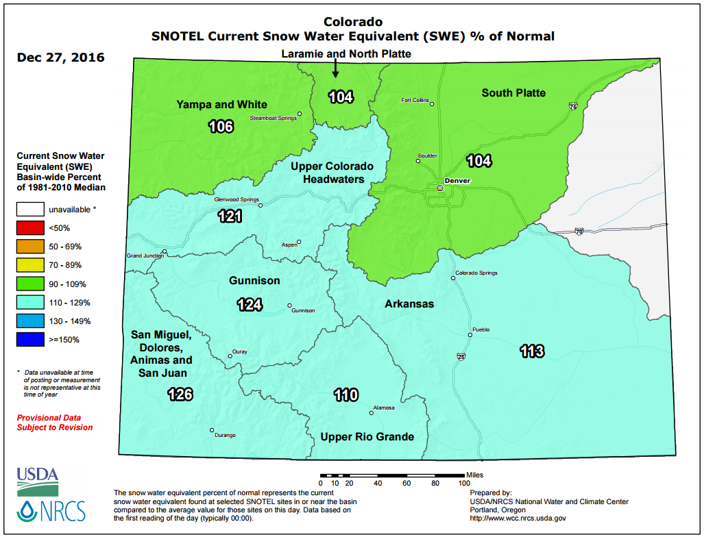
State of the Snowpack
 |
 |
 |
 |
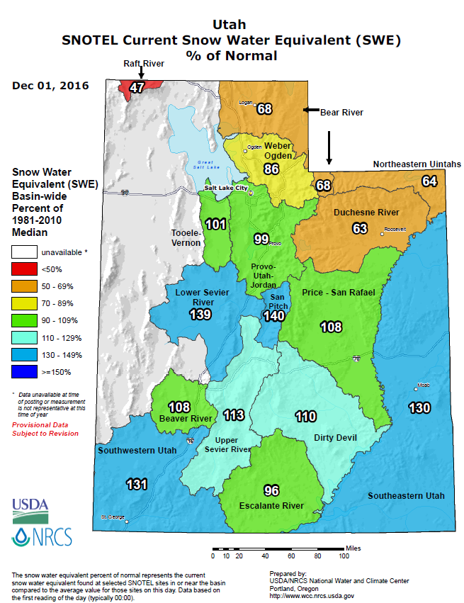
| Utah Snow-pack - Dec 1, 2016 Credit: USDA/NRCS |
Utah Snow-pack - Dec 27, 2016 Credit: USDA/NRCS | Colorado Snow-pack - Dec 1, 2016 Credit: USDA/NRCS |
Colorado Snow-pack - Dec 27, 2016 Credit: USDA/NRCS |
Storm Reports
Estimated storm total snowfall values for the mountains are shown,
followed by preliminary individual reports.

Elkheads & Park Range....  2 to  7 inches
Flat Tops................  5 to 10 inches
Grand Mesa...............  8 to 14 inches; 20 to 25 near Park Reservoir and Mesa Lake
Gore and Elk Range.......  2 to  4 inches
West Elks & Sawatch Range  3 to 10 inches
Uncompahgre Plateau......  6 to  9 inches
Northwest San Juans......  5 to 10 inches; 13 near Slumgullion
Southwest San Juans......  7 to 18 inches
Eastern Uintas...........  8 to 16 inches
Eastern Tavaputs.........  3 to  5 inches
La Sals and Abajos.......  3 to  7 inches

...Snowfall Reports...

Location                     Amount    Time/Date       Elevation (ft.)

...Colorado...

...Archuleta County...
Pagosa Springs 1.6 SSW       6.0 in    0800 AM 12/26   7401
5 WNW Chromo                 5.5 in    0900 AM 12/26   7408

...Delta County...
Cedaredge 10.5 NNW           25.0 in   0800 AM 12/26   10399
Paonia 2.1 SSE               1.9 in    0800 AM 12/26   6100
Cedaredge                    1.0 in    0800 AM 12/26   6354

...Eagle County...
Vail 0.9 WNW                 2.5 in    0700 AM 12/26   8172
Vail 2.6 E                   2.5 in    0700 AM 12/26   8389
Wolcott 2.3 N                1.5 in    0700 AM 12/26   7224
Wolcott 2n                   1.5 in    0700 AM 12/26   7215
Avon 2N                      0.8 in    0600 AM 12/26   8200

...Garfield County...
Glenwood Springs .64 S       2.6 in    0700 AM 12/26   5824
3 E Cattle Creek             2.4 in    0700 AM 12/26   6521
3 W Cattle Creek             2.3 in    0700 AM 12/26   6914
Alternbern Coop              1.6 in    0700 PM 12/26   5678
Glenwood Springs 1.7 NW      1.3 in    0700 AM 12/26   6050

...Gunnison County...
Cimarron 11.2 S              6.0 in    0700 AM 12/26   8356
Gunnison 6.6 N               3.7 in    0700 AM 12/26   7941
Gothic                       3.0 in    0700 AM 12/26   9469
Crested Butte 6.2 N          3.0 in    0700 AM 12/26   9606

...La Plata County...
Bayfield 7N                  6.0 in    0700 AM 12/26   7460
Durango 4.8 WSW              4.6 in    0700 AM 12/26   7430
Durango 0.8 SSW              3.3 in    0700 AM 12/26   6624
Hesperus 13.3 SSW            2.6 in    0715 AM 12/26   6686
Ignacio Spotter              2.5 in    0700 AM 12/26   6562
Arboles 5wnw                 2.5 in    0700 AM 12/26   6545
Redmesa 4.2 NW               2.3 in    0800 AM 12/26   6771
3 NW Kline                   2.0 in    0700 AM 12/26   N/A
3 S Vallecito                11.5 in   0700 AM 12/26   8200

...Mesa County...
Mesa 6S                      3.5 in    0600 AM 12/26   7720
3 E Plateau City             3.0 in    0700 AM 12/26   7044
17 W Glade Park              2.2 in    0800 AM 12/26   6385
Collbran 0.2 ESE             1.1 in    0700 AM 12/26   6043
1 W Fruitvale                0.4 in    0700 AM 12/26   4680
Grand Junction Regional Arpt 0.3 in    0553 PM 12/26   4850
Fruitvale                    0.3 in    0730 AM 12/26   4769
Grand Junction 8nnw          0.1 in    0700 AM 12/26   4751
Grand Junction 0.6 WSW       0.1 in    0800 AM 12/26   4627

...Montezuma County...
Dolores 4.8 ENE              6.1 in    0700 AM 12/26   7132
Cortez 11nw                  1.0 in    0700 AM 12/26   6598
Cortez 1.2 SW                0.4 in    0700 AM 12/26   6165

...Ouray County...
Ouray Spotter                0.6 in    0757 AM 12/26   7727
Ouray                        0.1 in    0757 AM 12/26   7728

...Routt County...
Steamboat Springs 1.9 E      6.9 in    0600 AM 12/26   7200
Steamboat Springs 0.7 ESE    5.4 in    0700 AM 12/26   7049
Steamboat Springs 1.2 SE     5.3 in    0545 AM 12/26   7075
Steamboat Springs 2.5 N      4.0 in    0700 AM 12/26   7005
Steamboat Springs 1.5 WNW    4.0 in    0700 AM 12/26   6778
Steamboat Springs 7.9 WNW    2.7 in    0800 AM 12/26   6653
4 W Toponas                  2.4 in    0700 AM 12/26   8496
Hayden Coop                  1.0 in    0600 PM 12/26   6440

...Utah...

...San Juan County...
Monticello No. 2             4.5 in    0745 AM 12/26   7083

Observations are collected from a variety of sources with varying
equipment and exposures. Not all data listed are considered official.

$$

NWS Grand Junction CO
IRIS System
 |
Media use of NWS Web News Stories is encouraged! Please acknowledge the NWS as the source of any news information accessed from this site. |
|

