Grand Junction, CO
Weather Forecast Office
Long Duration Flooding
Today's topic is flooding that develops in the time frame of longer than 6 hours to several days.
Floods in Colorado can result from rapid snow melt, ice jams, heavy rain, or a combination of snow melt and heavy rain.
National Weather Service forecast offices in Colorado closely collaborate with regional River Forecast Centers that monitor the Colorado River, South Platte River, Arkansas River, and Rio Grande to come to a consensus on the likelihood of flooding along rivers and large creeks.
The National Weather Service will discuss flood potential in hydrologic outlooks, daily hazardous weather outlooks, and in graphical weather stories on National Weather Service forecast office websites. The National Weather Office will also discuss this potential on Facebook and Twitter.
Hydrologic statements may be issued for high flows that are within the banks of a river or large creek.
When flooding is possible on a river or large creek, a Flood Watch will be issued, meaning flooding is possible within the designated watch area.
When flooding is likely or occurring on a river or large creek, a Flood Warning will be issued, meaning flooding is expected or has been reported at designated river forecast points.
Flood Advisories may be issued for minor flooding on rivers and creeks.
An Areal Flood Warning may also be issued for flooding on a river or large creek in areas away from the designated river forecast points.
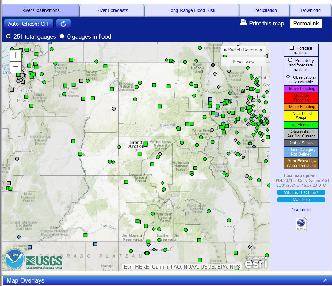
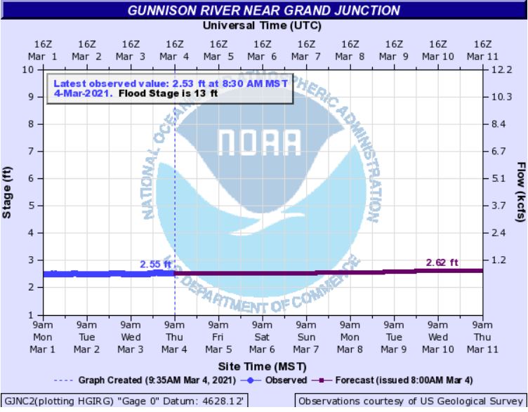
You can easily monitor potential flooding along rivers in Colorado and large creeks using the Advanced Hydrologic Prediction Service (AHPS) monitoring system. Information on the AHPS monitoring system can be obtained from this web site:
This monitoring system can be accessed on Colorado National Weather Service forecast office websites by clicking Rivers and Lakes.
At each river and large creek gauge you can easily look at current and forecast water levels, flood categories, historic crests, and flood impacts. Probabilities of exceedance of certain water levels by week or over the long term are also available.
In general, there will be some time to prepare for river and large creek flooding, and emergency management in your area has plans in place to address flooding issues. Know these plans and how you should act accordingly when Flood Watches and Flood Warnings are in effect.
For more information on flood safety, please go to:
Hazards
Detailed Hazards Viewer
Outlooks
Winter Storm Severity Index
Transportation Decision Support
National Briefing
Current Conditions
Observations
Radar
Satellite
Snow Cover
Snowfall Analysis
Precip Analysis
Social Dashboard
Forecasts
Forecast Discussion
Local Area
Activity Planner
Aviation Weather
Fire Weather
Severe Weather
Winter Weather
Hurricane Center
Hydrology
Rivers and Lakes
Recreational River Report
Weather Safety
Preparedness
NOAA Weather Radio
StormReady
SkyWarn
Spotter Training Calendar
US Dept of Commerce
National Oceanic and Atmospheric Administration
National Weather Service
Grand Junction, CO
2844 Aviators Way
Grand Junction, CO 81506-8644
970-243-7007
Comments? Questions? Please Contact Us.

