
Thunderstorms, some severe, may produce heavy to excessive rainfall and isolated flooding over portions of the Southern Plains through Saturday. Widespread showers and thunderstorms will spread east into the Great Lakes, Ohio Valley, Mid Atlantic and Northeast. Dry conditions, combined with gusty winds will continue to support an elevated fire weather threat in the Desert Southwest. Read More >
Grand Junction, CO
Weather Forecast Office
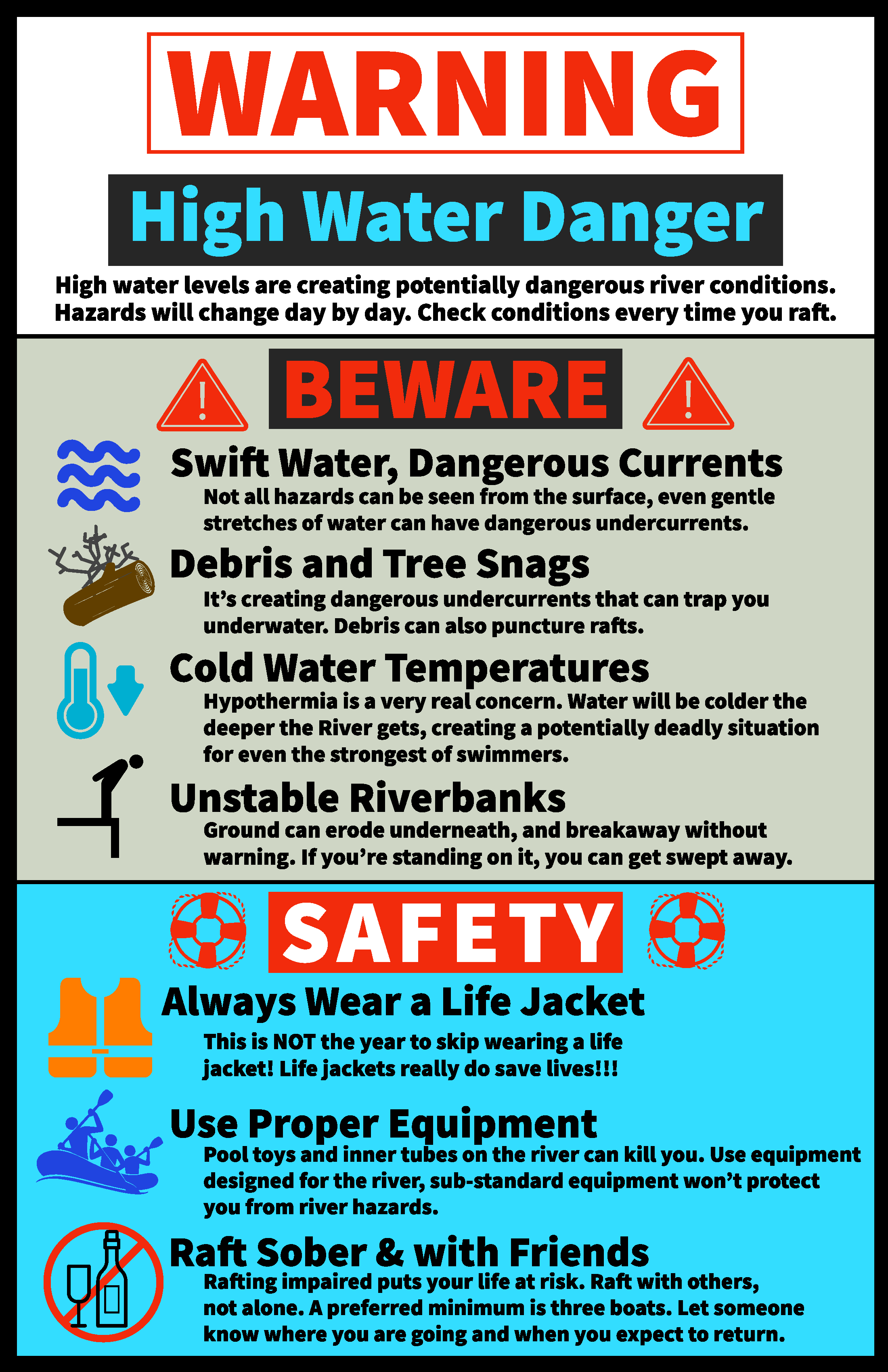
Runoff from snow melt will keep river flows strong and may present hazards near waterways across western Colorado and eastern Utah. Expect accelerated snow melt and strong high flows in streams and rivers across western Colorado and eastern Utah.
Some things to be aware of and safety tips are included in the attached graphic.
Remember, at increased flows, river banks can become saturated and unstable. Caution is urged as these banks can erode or collapse unexpectedly. Expect extra debris to be swept downstream. Do not let children play near high flowing rivers, creeks and canals.
River rafters and kayakers should use should use caution on rivers with increased flows, strong currents, cold water temperatures and increased debris. Novices should ride with experienced guides or commercial outfitters. Single chamber float devices are discouraged. Even experienced boaters should be aware of the hazards a river presents at different levels and rates of flow.
The National Weather Service in Grand Junction is urging everyone in western Colorado and eastern Utah to stay safe and use extra caution around rivers, streams and creeks during this runoff period.
Hazards
Detailed Hazards Viewer
Outlooks
Winter Storm Severity Index
Transportation Decision Support
National Briefing
Current Conditions
Observations
Radar
Satellite
Snow Cover
Snowfall Analysis
Precip Analysis
Social Dashboard
Forecasts
Forecast Discussion
Local Area
Activity Planner
Aviation Weather
Fire Weather
Severe Weather
Winter Weather
Hurricane Center
Hydrology
Recreational River Report
Rivers and Lakes
Weather Safety
Preparedness
NOAA Weather Radio
StormReady
SkyWarn
Spotter Training Calendar
US Dept of Commerce
National Oceanic and Atmospheric Administration
National Weather Service
Grand Junction, CO
2844 Aviators Way
Grand Junction, CO 81506-8644
970-243-7007
Comments? Questions? Please Contact Us.

