
Heavy to excessive rainfall is forecast over north Texas into Oklahoma Tuesday. Locally catastrophic flooding will be possible across portions of southwest Oklahoma. Flood Watches have been issued. Scattered severe thunderstorms are possible within a broad swath from the lower Great Lakes to the southern High Plains Tuesday afternoon into the evening. Read More >
Grand Junction, CO
Weather Forecast Office
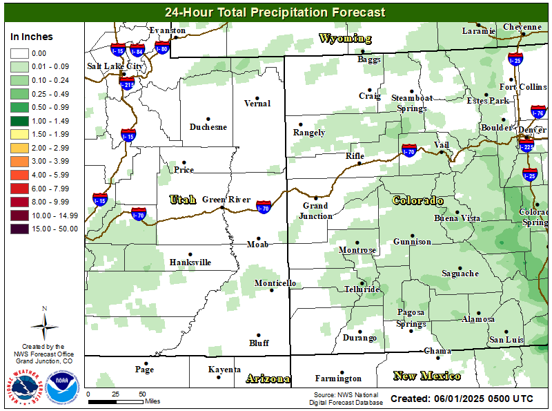
24 Hour Precipitation Outlook
5 Day Precipitation Outlook

Most Probable 48hr Snow Forecast

Forecast High Temperatures

Hazards
Detailed Hazards Viewer
Outlooks
Winter Storm Severity Index
Transportation Decision Support
National Briefing
Current Conditions
Observations
Radar
Satellite
Snow Cover
Snowfall Analysis
Precip Analysis
Social Dashboard
Forecasts
Forecast Discussion
Local Area
Activity Planner
Aviation Weather
Fire Weather
Severe Weather
Winter Weather
Hurricane Center
Hydrology
Rivers and Lakes
Recreational River Report
Weather Safety
Preparedness
NOAA Weather Radio
StormReady
SkyWarn
Spotter Training Calendar
US Dept of Commerce
National Oceanic and Atmospheric Administration
National Weather Service
Grand Junction, CO
2844 Aviators Way
Grand Junction, CO 81506-8644
970-243-7007
Comments? Questions? Please Contact Us.

