
Thunderstorms, some severe, may produce heavy to excessive rainfall and isolated flooding over portions of the Southern Plains through Saturday. Widespread showers and thunderstorms will spread east into the Great Lakes, Ohio Valley, Mid Atlantic and Northeast. Dry conditions, combined with gusty winds will continue to support an elevated fire weather threat in the Desert Southwest. Read More >
Grand Junction, CO
Weather Forecast Office
Cold Front Brings Snow to the Divide Mountains and Front Range through Monday
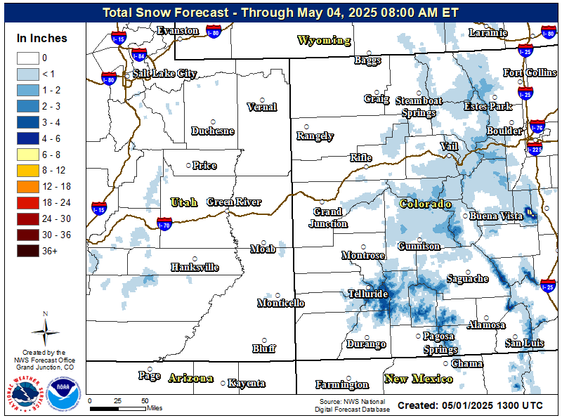
Snow has develop across portions of northern Colorado and northeast Utah and will continue to spread southward tonight. While most of the significant snow looks to stay on the eastern slopes and Front Range, the I-70 corridor from Vail to Vail Pass and northern and central Colorado mountains along the Divide will see impacts from this snow. The highest snowfall rates will occur this evening. The snow will impact the San Juans by early Monday morning with dry air behind it. For the northern Colorado mountains including the Elkhead and Park Ranges, expect 6 to 10 inches with locally higher amounts, while the central Colorado mountains including Vail Pass along I-70 can expect 4 to 8 inches. Dry air will filter in behind the front on Monday, however the next system will arrive quickly on its heels bringing more snow to the Divide Mountains on Tuesday.
Winter Weather Highlights in Effect
Winter Storm Warnings and Advisories
for the Colorado Mountains

Total Snowfall Accumulations
Today's Weather Map
High Temperatures:

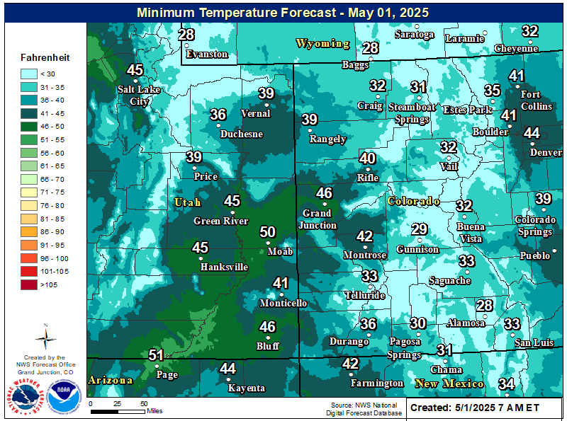
Low Temperatures:
For your latest forecast visit: https://www.weather.gov/gjt/
Hazards
Detailed Hazards Viewer
Outlooks
Winter Storm Severity Index
Transportation Decision Support
National Briefing
Current Conditions
Observations
Radar
Satellite
Snow Cover
Snowfall Analysis
Precip Analysis
Social Dashboard
Forecasts
Forecast Discussion
Local Area
Activity Planner
Aviation Weather
Fire Weather
Severe Weather
Winter Weather
Hurricane Center
Hydrology
Recreational River Report
Rivers and Lakes
Weather Safety
Preparedness
NOAA Weather Radio
StormReady
SkyWarn
Spotter Training Calendar
US Dept of Commerce
National Oceanic and Atmospheric Administration
National Weather Service
Grand Junction, CO
2844 Aviators Way
Grand Junction, CO 81506-8644
970-243-7007
Comments? Questions? Please Contact Us.

