Grand Junction, CO
Weather Forecast Office

High pressure will continue to build in from the west and persist through the end of the week. Dry weather is expected across the entire area through the end of the week with high temperatures warming a few degrees each day. The next chance for rain and snow moves in late this weekend and early next week as a strong Pacific storm moves across the region.
Latest Weather Map

Forecast High Temperatures Thursday

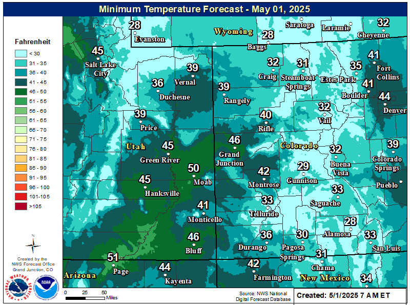
Forecast Low Temperatures Friday Morning
|
Changes to the NWS forecast pages are coming on March 7th! These improvements will help make our pages faster and more-reliable. Please take note: all bookmarked URLs from forecast.weather.gov will change on this date!
|
Hazards
Detailed Hazards Viewer
Outlooks
Winter Storm Severity Index
Transportation Decision Support
National Briefing
Current Conditions
Observations
Radar
Satellite
Snow Cover
Snowfall Analysis
Precip Analysis
Social Dashboard
Forecasts
Forecast Discussion
Local Area
Activity Planner
Aviation Weather
Fire Weather
Severe Weather
Winter Weather
Hurricane Center
Hydrology
Rivers and Lakes
Recreational River Report
Weather Safety
Preparedness
NOAA Weather Radio
StormReady
SkyWarn
Spotter Training Calendar
US Dept of Commerce
National Oceanic and Atmospheric Administration
National Weather Service
Grand Junction, CO
2844 Aviators Way
Grand Junction, CO 81506-8644
970-243-7007
Comments? Questions? Please Contact Us.


