Grand Junction, CO
Weather Forecast Office
Monsoon Moisture Continues Through Tuesday; Drier Weather to Follow
A persistent plume of monsoonal moisture stretching into the Four Corners region will continue to result in daily risks for scattered showers and thunderstorms through Tuesday, particularly across the central and southern mountains near the Continental Divide. With plenty of moisture to work with, these showers and storms will be capable of producing moderate to heavy rain, mainly during the afternoons and evenings. There will likely be enough flow in the atmosphere to keep storms moving, but if storms repeatedly move over the same locations, especially burn scars, localized flash flooding would be possible. In addition to the potential for heavy rain, frequent lightning and gusty winds of 40-50 mph will also be possible in the strongest storms. If you will be venturing outside over the next few days, make sure to know the forecast before you head out and have a way to receive the latest weather information.
The Monsoon Setup Through Tuesday
.png)
Expected 3-Day Rainfall Totals Courtesy of the Weather Prediction Center.

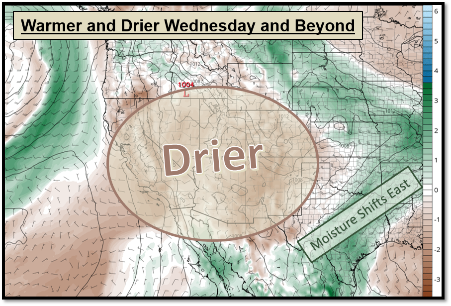
Turning Warmer and Drier Wednesday and Beyond
The plume of monsoonal moisture that has been anchored over the Four Corners region will shift to the east on Wednesday. In its wake, westerly winds will bring much drier air into the Great Basin, eastern Utah and western Colorado through the end of the week. As a result, the occasionally cloudy and showery weather will be replaced by a sunnier sky and temperatures rising back to near or even slightly above normal. The drier air will also drastically reduce the chances for showers and thunderstorms across the region, though a few isolated storms can still pop-up each day in the higher terrain closest to the Continental Divide.
Hazards
Detailed Hazards Viewer
Outlooks
Winter Storm Severity Index
Transportation Decision Support
National Briefing
Current Conditions
Observations
Radar
Satellite
Snow Cover
Snowfall Analysis
Precip Analysis
Social Dashboard
Forecasts
Forecast Discussion
Local Area
Activity Planner
Aviation Weather
Fire Weather
Severe Weather
Winter Weather
Hurricane Center
Hydrology
Recreational River Report
Rivers and Lakes
Weather Safety
Preparedness
NOAA Weather Radio
StormReady
SkyWarn
Spotter Training Calendar
US Dept of Commerce
National Oceanic and Atmospheric Administration
National Weather Service
Grand Junction, CO
2844 Aviators Way
Grand Junction, CO 81506-8644
970-243-7007
Comments? Questions? Please Contact Us.

