An abnormally mild Pacific storm system moved through western Colorado during the early morning hours of January 9th, producing rainfall due to the increase in warm air aloft. A few days before this event, some areas in western Colorado received several inches of snowfall which allowed surface based inversions to form in many western Colorado valleys. Due to the cold air trapped in some lower valleys, temperatures remained below freezing at the surface which resulted in the formation of freezing rain as these inversions never broke.
Freezing rain is fairly uncommon in western Colorado, so that alone was noteworthy, but the extent of the freezing rain occurrence makes this an event to remember. Even locals who have lived in western Colorado for over 50 years, especially the Grand Valley, do not recall an event of this magnitude in their lifetime.
Freezing rain was first detected in the Steamboat Springs area around 2 in the morning, where over 4600 customers went without power due to a downed feeder line west of Clark likely caused by a coating of ice on the power lines due to freezing rain. Then between 4 am and 6 am, freezing rain occurred in La Plata County in southwest Colorado as well as the Grand Valley through Glenwood Canyon in west-central Colorado. This resulted in icy roads, numerous slide offs and accidents and major highways to be closed for the majority of the day due to accidents and cleanup activities, including Interstate 70 from Grand Junction to Glenwood Springs and Highway 160 from Durango to Hesperus Hill. Impacts were felt not only with the morning commute, but also at dispatch centers and hospitals that were overwhelmed. Emergency rooms at various hospitals throughout the Grand Valley, including Grand Junction, exceeded their daily admittance records with over 200 people treated for broken bones and other blunt force injuries due to the icy surfaces. Schools were also closed throughout the Grand Valley and many businesses were negatively impacted by either not opening, opening late or the lack of customers. This was the first day back from winter break for Mesa County schools, which in addition to the icy road impacts, crippled transportation. The Grand Junction Regional Airport also closed for several hours due to the ice, resulting in a few diverted flights.
An after action review was conducted by forecasters at the National Weather Service in Grand Junction to discuss lessons learned and updated guidance and policies moving forward with regards to issuing Ice Storm Warnings for any occurrence of freezing rain. An additional summary of the winter weather events surrounding this timeframe can be found here: https://www.weather.gov/gjt/2017Jan08-10_WinterStorm.
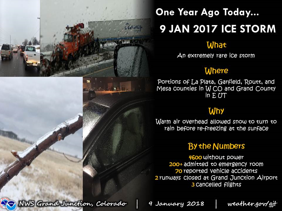
Social media post created on the one year anniversary of this rare ice storm event providing a summary of impacts
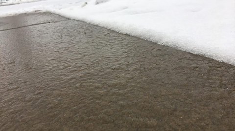
Photo taken of the icy pavement just outside the National Weather Service WFO in Grand Junction, CO (Credit: Mike Charnick)
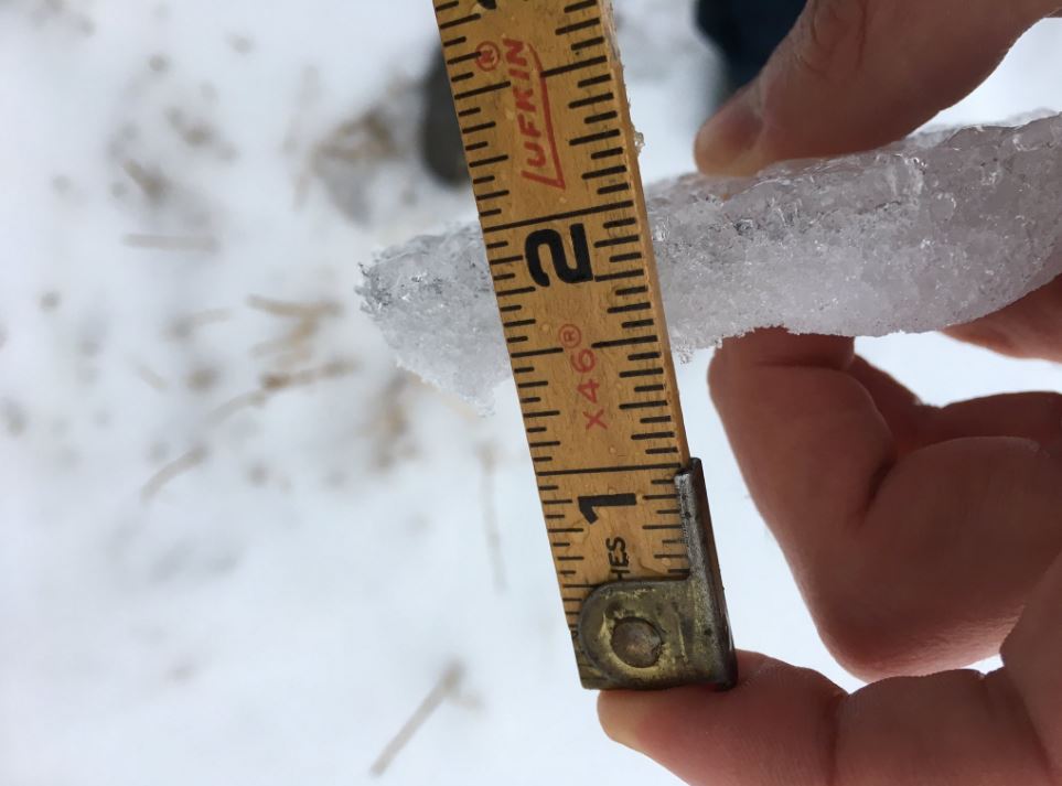
Photo taken of a measurement of ice thickness (half inch accumulation) in Grand Junction, CO (Credit: Mike Charnick)

