
More than 200 record or near record maximum temperatures are forecast across the southern half of the U.S. through the end of this week before additional record temperatures center back over the Southwest U.S. into the Rockies this weekend. Widespread record breaking warmth, low humidity, and gusty winds will produce critical fire weather today in the central Rockies to Plains. Read More >
Grand Junction, CO
Weather Forecast Office
Overview
.PNG)
| Click on any area for more detailed information on each Warning, Watch or Advisory. |
(Click on any Point on the Map for the latest Forecast)
Expected Precipitation

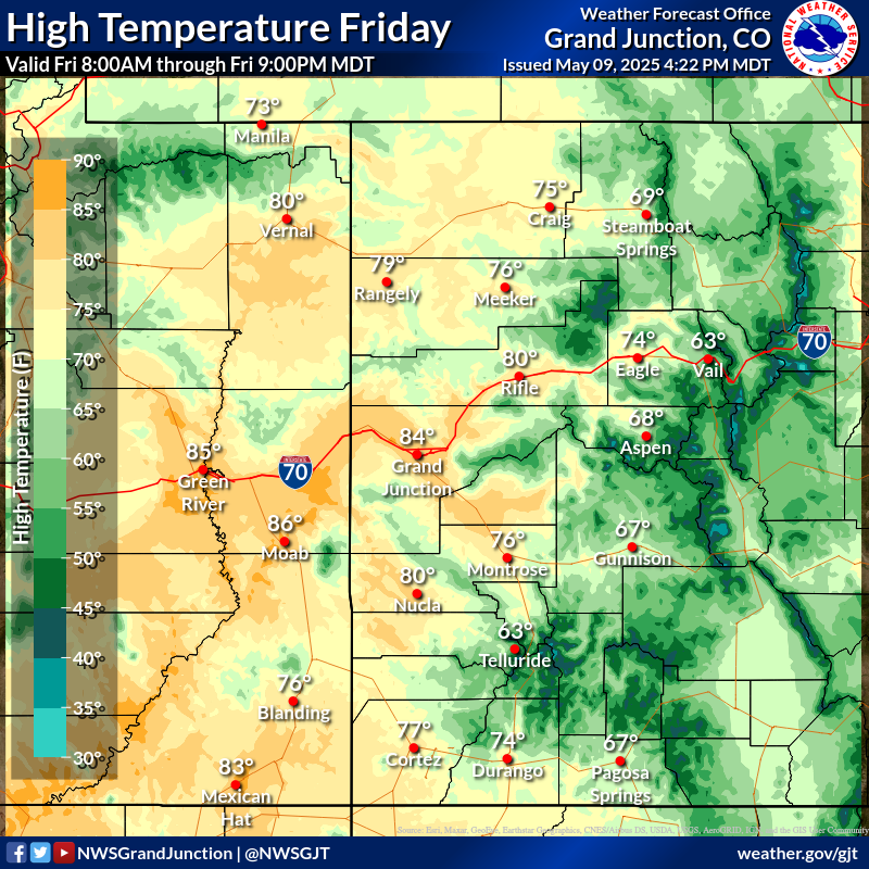
High Temperature Forecast
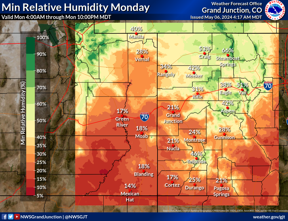
Minimum Relative Humidity Forecast
Click On Link Above For More Information about the HeatRisk Product

Current Large Wildfires
Current Drought Conditions

Wildfire Weather Safety
Hazards
Detailed Hazards Viewer
National Briefing
Outlooks
Transportation Decision Support
Winter Storm Severity Index
Forecasts
Aviation Weather
Fire Weather
Forecast Discussion
Forecast Points
Local Area
Severe Weather
Soaring Forecast
Winter Weather
Hydrology
Recreational River Report
River Forecast
Weather Safety
Preparedness
NOAA Weather Radio
StormReady
SkyWarn
US Dept of Commerce
National Oceanic and Atmospheric Administration
National Weather Service
Grand Junction, CO
2844 Aviators Way
Grand Junction, CO 81506-8644
970-243-7007
Comments? Questions? Please Contact Us.

