Overview
|
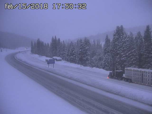
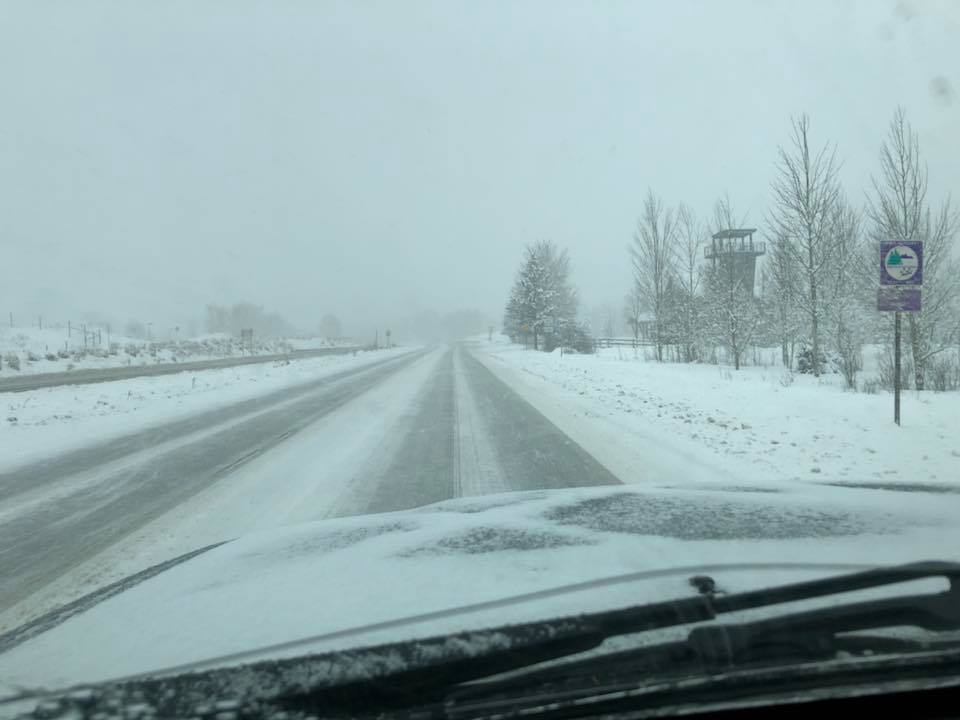
The progression and eventual merging of two weather disturbances across eastern Utah and western Colorado combined with a strong polar and sub-tropical jet to produce moderate to heavy snowfall across most Colorado mountains and some higher valley locations. Snowfall began over the higher terrain on the evening of Wednesday, February 14th before increasing in coverage and continuing through the night of Thursday, February 15th. The heaviest snowfall fell Thursday morning and early Thursday afternoon. The support of the two upper level jets overhead enhanced snowfall rates and allowed gusty winds to mix down to the surface which resulted in periods of reduced visibility in blowing snow. This made travel difficult during both the morning and evening commutes across the high passes of Colorado. The northern Colorado mountains received the most snowfall with this event with storm total snowfall amounts ranging from 12 to 24 inches in the Elkhead and Park Mountains. The central Colorado mountains generally received 5 to 15 inches with some locally higher amounts while the southern mountains of Colorado and Utah reported 4 to 10 inches. Some of the higher valleys, such as the Central Yampa and San Juan River Basins averaged 3 to 6 inches with locally higher amounts up to 10 inches. |
 West Aspen (Credit: Christian Dusold) |
 |
 |
 |
| Vail Pass on Feb 15 (Credit: CDOT) | HWY 160 near Hesperus (Credit: CDOT) | HWY 82 in Upper Roaring Fork (Credit: Christian Dusold) |
Storm Reports
Public Information Statement
National Weather Service Grand Junction CO
1152 PM MST Fri Feb 16 2018

An area of low pressure brought snow across the higher terrain of western
Colorado and eastern Utah Wednesday night, February 14th through the night
of Thursday, February 15th. The northern Colorado mountains received the
most accumulation throughout the event.

...Preliminary 48 hour Storm Total Snowfall Reports...

Northern Colorado Mountains.........12 to 20 inches and locally up to 24 inches
Central Colorado Mountains..........5 to 15 inches and locally up to 27 inches
San Juan Mountains..................5 to 10 inches and locally up to 15 inches
Southwestern Utah Mountains.........5 to 10 inches

Location                     Amount    Time/Date       Lat/Lon

...Colorado...

...Eagle County...
Basalt                       7.0 in    1159 PM 02/15   39.37N/107.03W
1 W Edwards                  1.5 in    0730 AM 02/16   39.65N/106.62W

...Garfield County...
4 N Cattle Creek             2.5 in    1159 PM 02/15   39.51N/107.24W

...Gunnison County...
Gothic                       5.0 in    0645 AM 02/16   38.96N/106.99W
Crested Butte                3.5 in    1159 PM 02/15   38.87N/106.98W

...Hinsdale County...
21 S Lake City               3.0 in    0800 AM 02/16   37.73N/107.27W

...Mesa County...
Powderhorn Ski Area          6.0 in    1127 AM 02/16   39.06N/108.15W
3 N Skyway                   4.0 in    1159 PM 02/15   39.09N/108.12W

...Moffat County...
1 SW Craig                   6.7 in    1159 PM 02/15   40.51N/107.56W
Craig                        5.3 in    1159 PM 02/15   40.52N/107.55W

...Montrose County...
14 SW Olathe                 2.0 in    1118 AM 02/16   38.46N/108.16W

...Ouray County...
Monument  (Highway 550)      5.0 in    1104 AM 02/16   37.97N/107.66W
Red Mountain Pass            3.0 in    1105 AM 02/16   37.90N/107.71W
10 WNW Colona                2.0 in    1159 PM 02/15   38.31N/107.93W
3 NNW Ridgway                1.2 in    0700 AM 02/16   38.20N/107.77W

...Pitkin County...
Snowmass Ski Resort          22.5 in   1159 PM 02/15   39.18N/106.95W
Aspen Mountain Resort        21.5 in   1159 PM 02/15   39.16N/106.82W
Aspen Highlands Resort       20.5 in   1159 PM 02/15   39.16N/106.87W
2 WNW Woody Creek            20.0 in   1159 PM 02/15   39.29N/106.92W
Snowmass Ski Resort          14.0 in   0600 AM 02/16   39.18N/106.95W
Buttermilk Ski Resort        13.0 in   1159 PM 02/15   39.19N/106.88W
Aspen                        9.0 in    1159 PM 02/15   39.19N/106.83W

...Routt County...
9 ENE Steamboat Springs      19.6 in   1247 PM 02/16   40.54N/106.68W

...San Juan County...
Molas Pass                   6.0 in    1113 AM 02/16   37.74N/107.70W
Coal Bank Pass               3.0 in    1115 AM 02/16   37.70N/107.78W

...San Miguel County...
Telluride Ski Resort         5.5 in    0751 AM 02/16   37.94N/107.81W
7 NE Sawpit                  4.0 in    0943 AM 02/16   38.06N/107.91W

Observations are collected from a variety of sources with varying
equipment and exposures. We thank all volunteer weather observers
for their dedication. Not all data listed are considered official.
 |
Media use of NWS Web News Stories is encouraged! Please acknowledge the NWS as the source of any news information accessed from this site. |
|

