
Dangerous and extreme heat will remain across portions of the southern U.S. through the weekend. A heat wave over the Southwest U.S. will intensify this week, peaking and expanding into the Intermountain West and northern High Plains this weekend. Multiple rounds of thunderstorms will produce heavy to excessive rainfall with significant flash flooding across portions of southern New England. Read More >
Grand Junction, CO
Weather Forecast Office

Are you curious about how high the Colorado River is running, or if any flooding is expected for your big rafting trip downstream? Then look no further than your one-stop shop for all hydrologic observations and forecasts: NOAA’s Advanced Hydrologic Prediction Service (AHPS).
On weather.gov/gjt, you can access AHPS by clicking on the “Rivers and Lakes” tab at the top of the page:
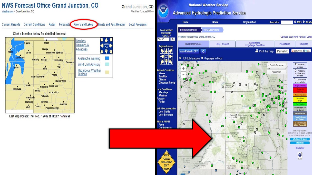
From here, you will be redirected to the AHPS page for our forecast area (eastern Utah and western Colorado). You can access a lot of information from this regional map view, as seen in the walkthrough below:
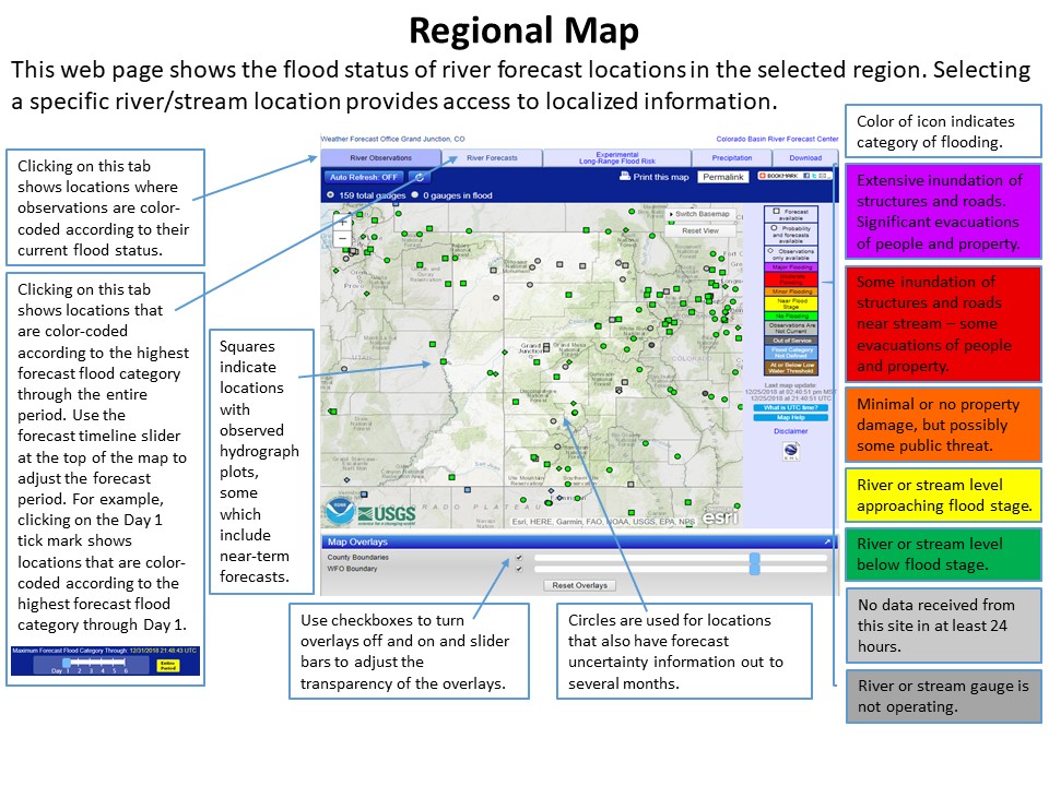
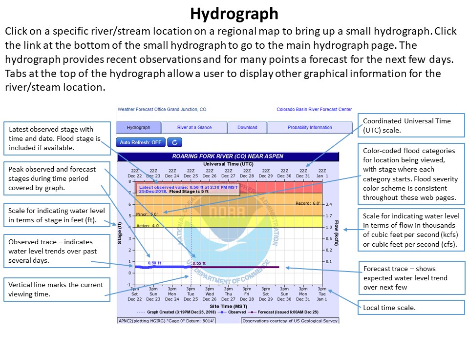
All available river gauges are plotted on the map with a color scale that shows if the gauge is in or out of service as well as the gauge stage (i.e. if it is near or approaching flood stage or if no flooding is occurring). Simply hover over your desired point and you will be redirected to the hydrograph for that specific river/stream location. More information on interpreting the hydrograph can be found below:
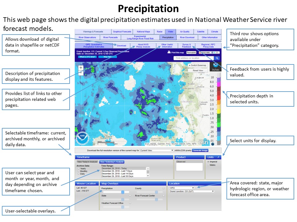
From the regional map, if you select the “Precipitation” tab you will be redirected to digital precipitation estimates page. From here, you can look at current or archived data for a certain region or somewhere else in the United States. More information on navigating the precipitation page can be found below:
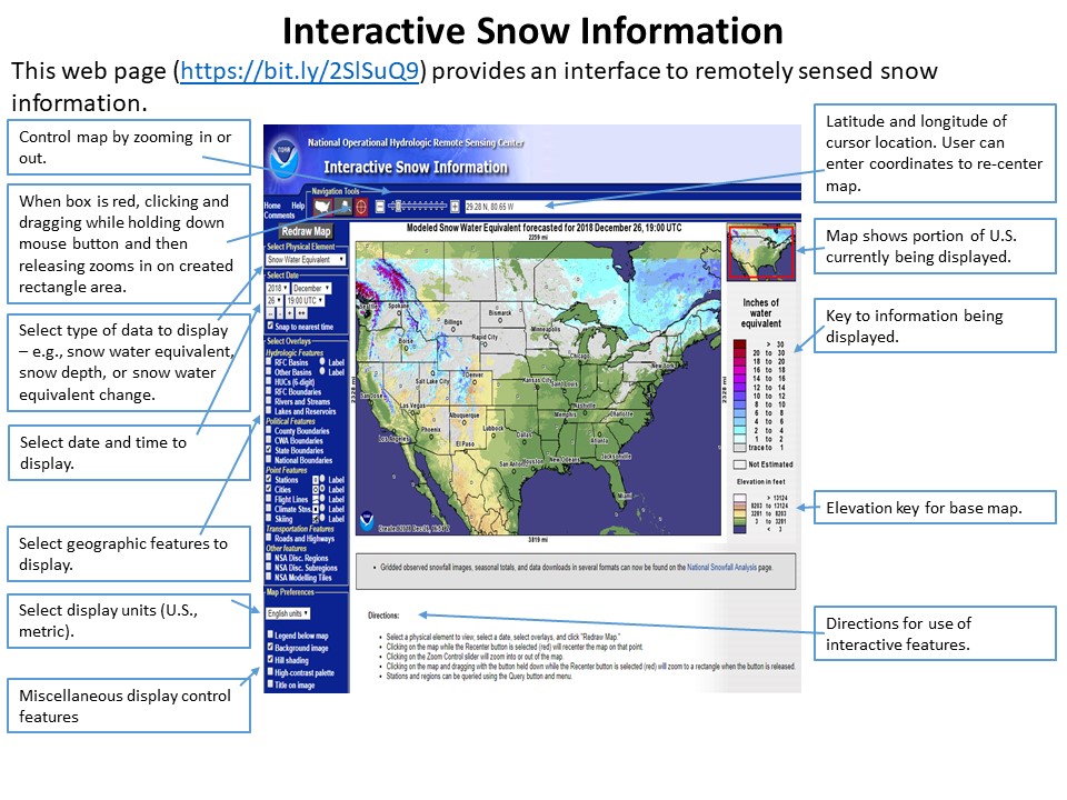
Finally, if you’re curious about snow estimates, you can visit the Interactive Snow Map which is courtesy of National Operational Hydrologic Remote Sensing Center (NOHRSC). Follow the below tutorial for navigating their interactive snow map:
If you have any other questions on accessing hydrologic information on our website, don’t hesitate to call us at 970-243-7007 or email us at wxgjt@noaa.gov.
Hazards
Detailed Hazards Viewer
National Briefing
Outlooks
Transportation Decision Support
Winter Storm Severity Index
Forecasts
Aviation Weather
Fire Weather
Forecast Discussion
Forecast Points
Local Area
Severe Weather
Soaring Forecast
Winter Weather
Hydrology
Recreational River Report
River Forecast
Weather Safety
Preparedness
NOAA Weather Radio
StormReady
SkyWarn
US Dept of Commerce
National Oceanic and Atmospheric Administration
National Weather Service
Grand Junction, CO
2844 Aviators Way
Grand Junction, CO 81506-8644
970-243-7007
Comments? Questions? Please Contact Us.

