
Thunderstorms and periods of heavy to excessive rainfall will continue over Florida through Thursday; and will begin to impact the central Plains today. Dry and gusty conditions will promote elevated to critical fire weather conditions in the Southeast. A Kona Low is expected to bring strong winds, widespread heavy rainfall, and flooding concerns to the island chain through the weekend. Read More >
Overview
|
An upper level disturbance moving southeast across the Central Rockies triggered widespread showers and thunderstorms on Saturday, May 29, 2021. Strong surface winds in the vicinity of the West Elk Mountains near Crested Butte, Colorado, combined with local terrain features, aided in the spin-up of a short-lived landspout tornado that was captured by a storm chaser along Kebler Pass. The tornado was estimated to be near 12,600 feet near the summit of Purple Mountain. It briefly touched down around 1:30 PM LST and traveled a short distance along the ridge before dissipating. Snow could be seen blowing around the base of the rotation as it moved across the ridge.
This is the first confirmed tornado in western Colorado west of the Continental Divide in 2021, and is also the first confirmed tornado in the area since the June 24, 2018 Routt County tornado. Unfortunately, due to its remote location NWS meteorologists were unable to perform a storm survey so the estimated EF rating and subsequent peak wind speeds of the landspout tornado remain unknown.
Colorado Storm Chasers captured the landspout on video which you can view on YouTube. |
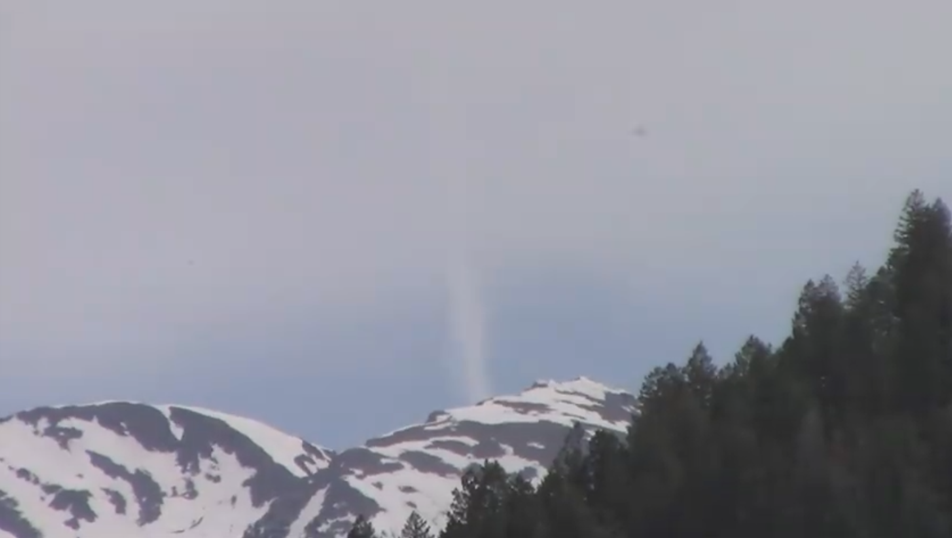 Landspout Tornado near Purple Mountain summit (Credit: CO Storm Chasers) |
 |
 |
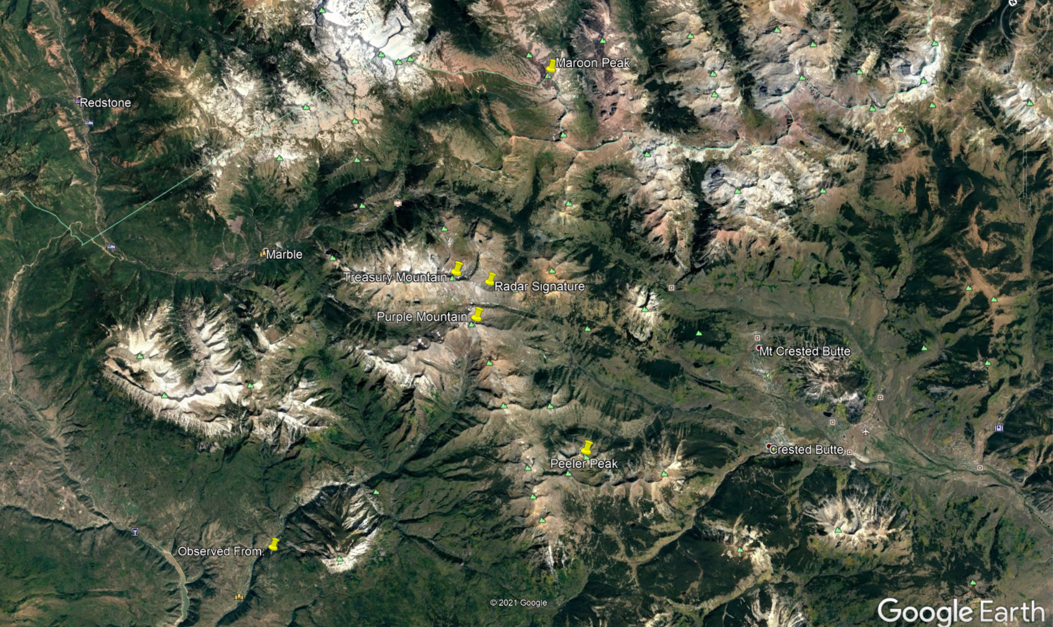 |
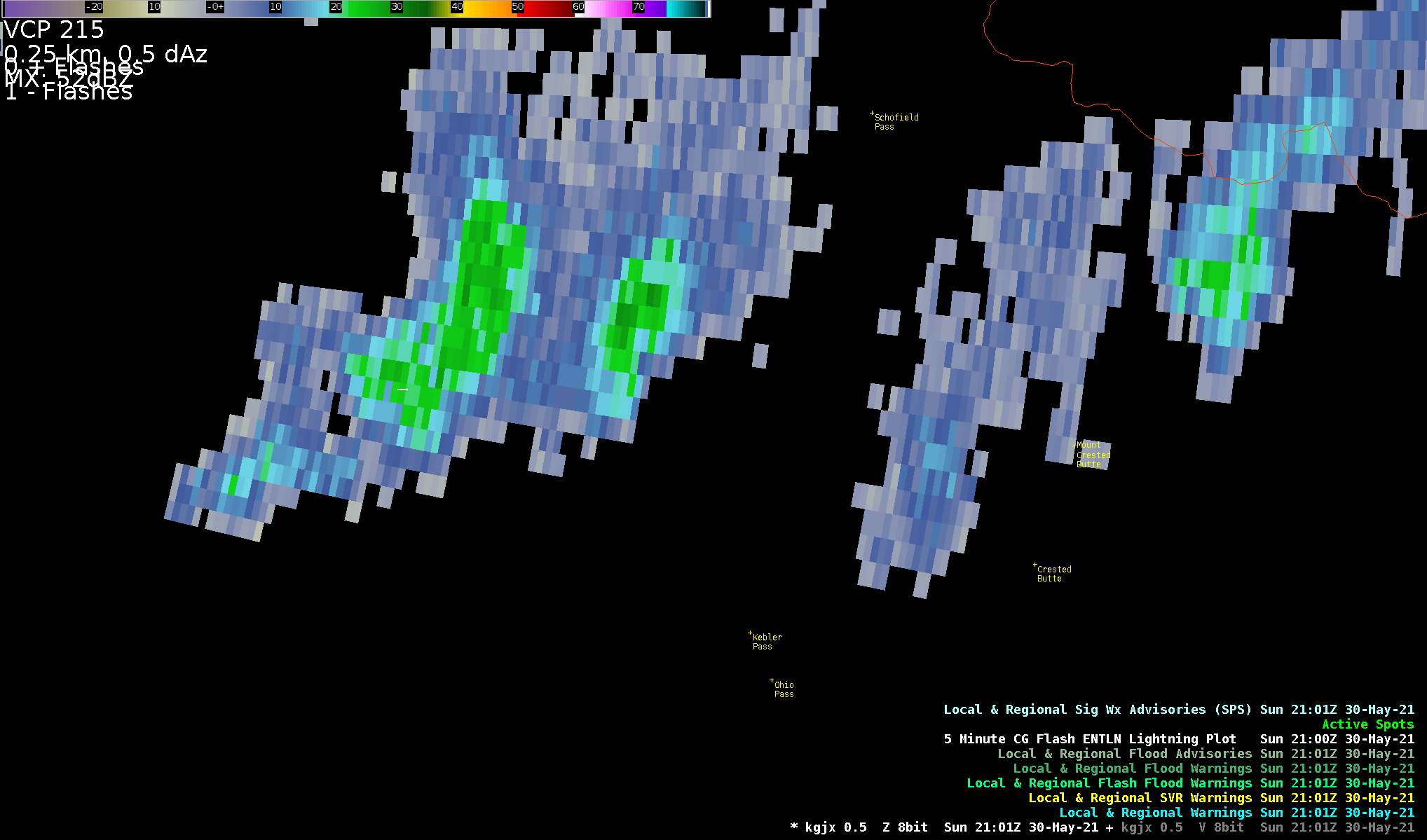
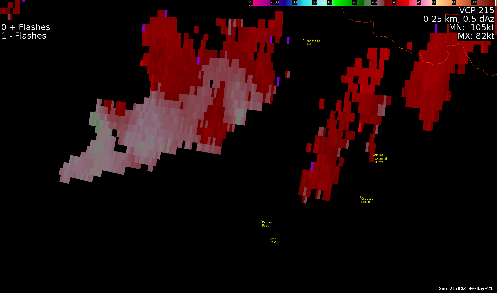
| Radar reflectivity loop from KGJX WSR-88D radar during the event | Radar storm-relative velocity loop from KGJX WSR-88D radar during the event | Google Earth image showing estimated landspout touchdown compared to terrain features and where it was observed from |
|
Landspout Tornado - Summit of Purple Mountain/West Elk Mountains
|
||||||||||||||||
The Enhanced Fujita (EF) Scale classifies tornadoes into the following categories:
| EF0 Weak 65-85 mph |
EF1 Moderate 86-110 mph |
EF2 Significant 111-135 mph |
EF3 Severe 136-165 mph |
EF4 Extreme 166-200 mph |
EF5 Catastrophic 200+ mph |
 |
|||||
 |
Media use of NWS Web News Stories is encouraged! Please acknowledge the NWS as the source of any news information accessed from this site. |
|

