
Severe thunderstorms capable of damaging winds will be possible from the Ozark Plateau east into portions of the Southeast today. Rounds of heavy thunderstorms ahead of a slow moving front will continue locally heavy rainfall and scattered flash flooding potential from the Ozarks to the Ohio and Tennessee Valleys today. Read More >
Overview
|
An abnormally strong and cold low pressure system and associated cold front dropped south across the Northern Rockies and into the Four Corners region beginning September 8, 2020. The low remained quasi-stationary for about a day before lifting northeast into the Plains by the evening of the 10th. This system produced widespread showers of rain in the lower elevations and snow in the mountains, though the cold front dropped snow levels to approximately 7000 feet. Grand Junction set a new record daily maximum rainfall on September 8th with 0.88 inches measured. This broke the old record of 0.49 inches, set in 1929. In addition to the abundance of moisture, gusty winds were observed ahead of and with the passage of the cold front. Wind gusts averaged from 35 to 45 MPH across the region with gusts exceeding 60 to 70 MPH at times. This was especially true across the north as downsloped winds from the surrounding terrain enhanced wind gusts at Storm Peak Laboratory near the Steamboat Springs Ski Resort, which had sustained speeds of 50 MPH with gusts of 70 to 75 MPH. These high winds led to not only reduced visibility in blowing snow, but also numerous downed trees and power outages in some areas. Leading up to this storm, record heat occurred across the area with critical fire weather concerns across the northern and central portions of eastern Utah and western Colorado. Triple digit heat was recorded in Moab, Utah and the Grand Junction Regional Airport topped out at 99°F two days in a row on September 5th and 6th. Temperatures cooled significantly in the wake of the cold front with record low temperatures set at Grand Junction each day on September 8-10. Additionally, numerous sites saw their coldest high temperature with values sitting 20 to 30 degrees below the seasonal normal for early September. |
 Storm Total Snowfall: September 8-10, 2020 |
Photos
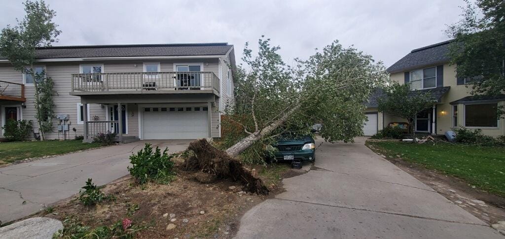
Wind Damage Across the Region
 |
 |
 |
 |
| Steamboat Springs, Colorado (Credit: Natalie Jo) |
Steamboat Springs, Colorado (Credit: Natalie Jo) |
Steamboat Springs, Colorado (Credit: Natalie Jo) |
Naples, Utah (Credit: Lynda Flynn) |
Snowfall Across the Region
 |
 |
 |
 |
| Crested Butte, Colorado (Credit: Kay Peterson Cook) |
Glade Park, Colorado (Credit: Dennis Barbee) |
Douglas Pass, Colorado (Credit: Cathy Redmon) |
West of Rifle, Colorado (Credit: CDOT) |
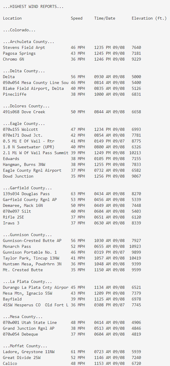
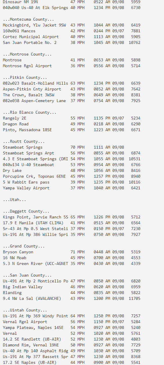
Wind Reports
Wind gusts averaged 35 to 45 MPH across the region ahead of and with the passage of the strong cold front. The highest gusts were recorded near Steamboat Springs, Colorado with gusts of 55 to 75 MPH and in Bryson Canyon, Utah with a peak gust of 71 MPH. Below is a summary of the highest wind gusts recorded from a variety of sites across eastern Utah and western Colorado. All data is considered preliminary.
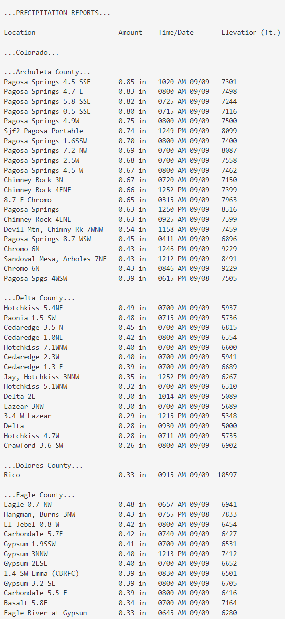
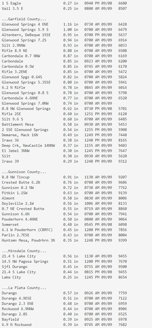
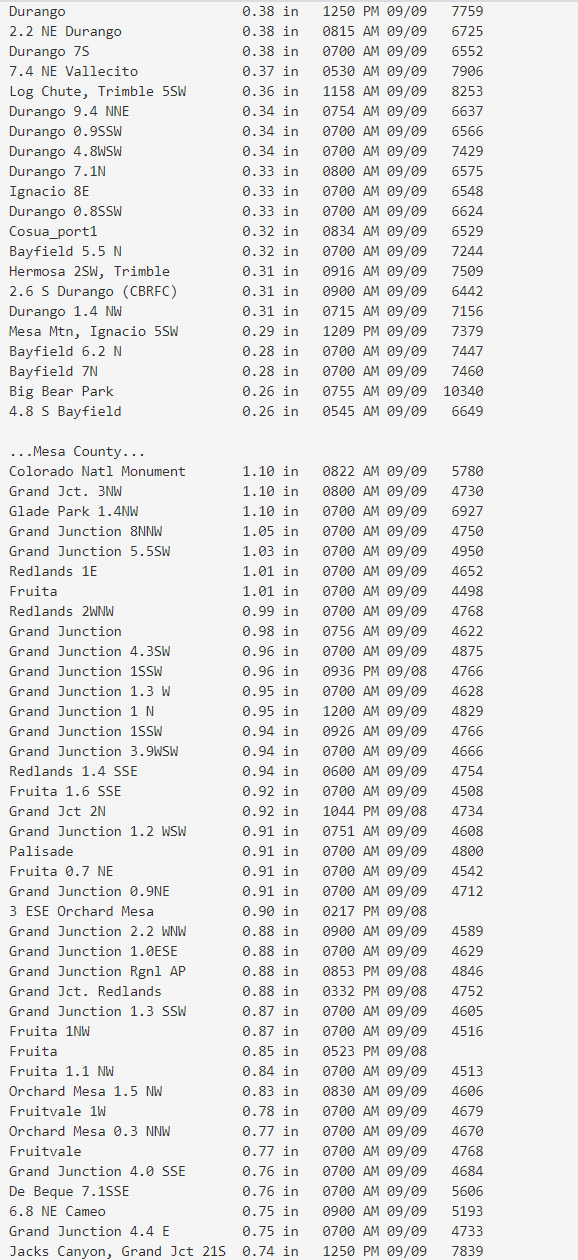
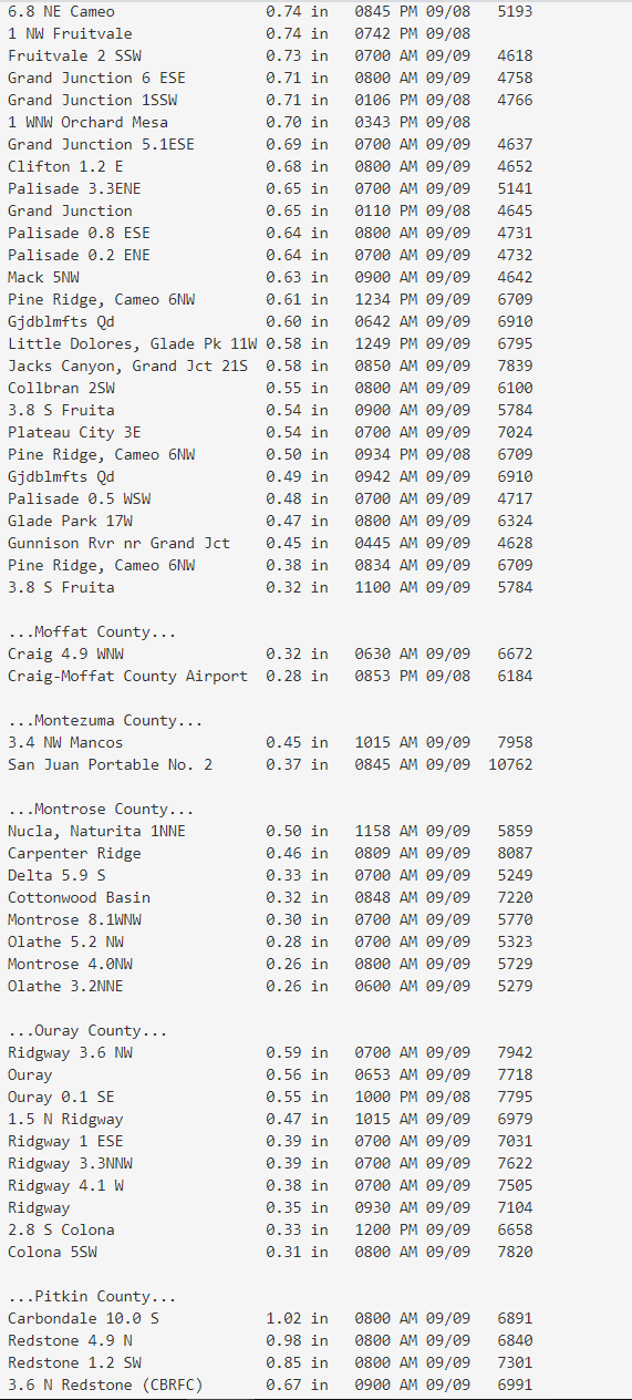
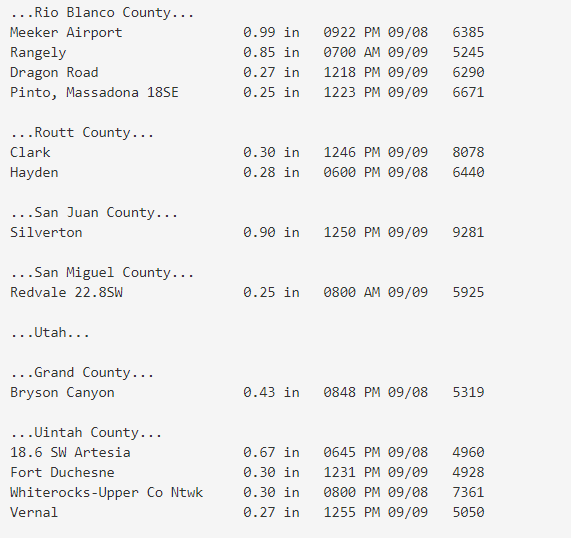
Precipitation Reports
Widespread rain and snow showers occurred across eastern Utah and western Colorado. Several locations saw their highest precipitation totals since late spring 2020. Below is a summary of the precipitation totals from a variety of sites across the region. All data is considered preliminary.
 |
Media use of NWS Web News Stories is encouraged! Please acknowledge the NWS as the source of any news information accessed from this site. |
|

