If you have any photos you would like to share, please feel free to post them to our Facebook or Twitter pages, or send them to our webmaster e-mail account at: w-gid.webmaster@noaa.gov. Please let us know where the photo was taken, and at least an approximate time. Thanks!
September 10, 2015: Another Round Of Large Hail And Damaging Winds
Strikes South Central Nebraska, This Time Also Affects North Central Kansas
Event Summary |
Storm Reports |
Photos |
Radar
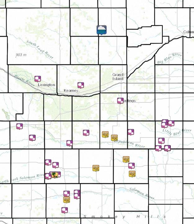
This is a NWS radar loop running from 3:40 p.m. to 8:30 p.m. CDT September 10th. The NWS Hastings coverage area is located within the orange outlined area labeled "GID".
 |
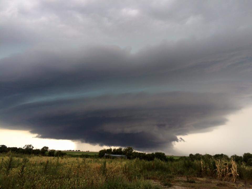
A good portion of the NWS Hastings coverage area (Click HERE for a map) saw another round of severe thunderstorms, resulting in very large hail and damaging winds. Unlike the severe weather on September 9th, this round primarily affected locations south of Interstate 80 in Nebraska and into north central Kansas. An upper level disturbance sliding southeast out of the Northern Rockies pushed a surface cold front south to near the Nebraska-Kansas state line during the day on Thursday, and it was this front that helped provide a focus for thunderstorm development.
There were scattered thunderstorms that moved through the coverage area around the midday hours, but it was the additional development during the mid to late afternoon hours that brought the severe weather. Oriented generally in a east-west line, these thunderstorms resulted in reports that started near 4:30 p.m. anywhere from Dawson to Nuckolls Counties in south central Nebraska, and ended near 7 p.m. in the Thayer County, Nebraska and Jewell County, KS areas.
Reports ranged from nickel size hail and 50 MPH winds to just over baseball ball size hail and 80 MPH winds. A few reports of house and vehicle damage were received, and there likely was a large amount of crop damage, but specifics are not currently known.
This story will be updated with any additional information that becomes available.
 |
 |
 |
 |
 |
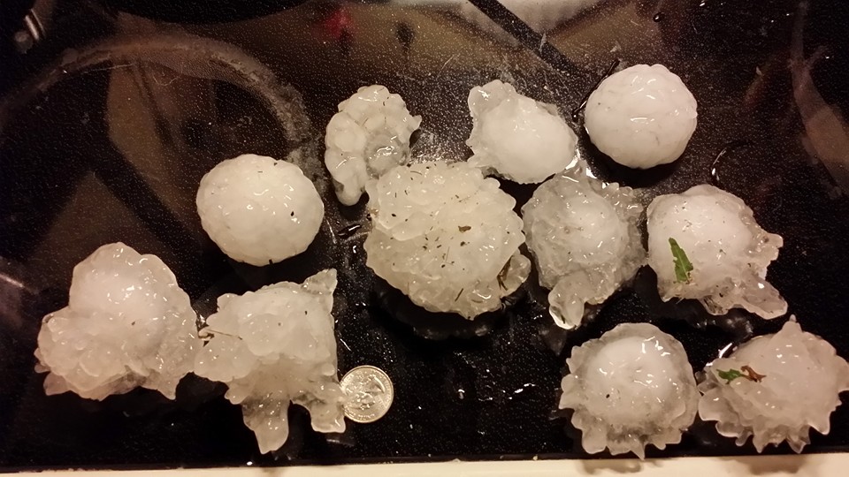
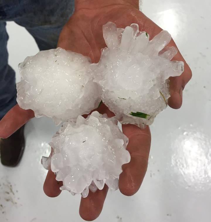
| Large hail and damage near Chester, NE. Photos courtesy of Donna Jones. | |||
 |
 |
 |
 |
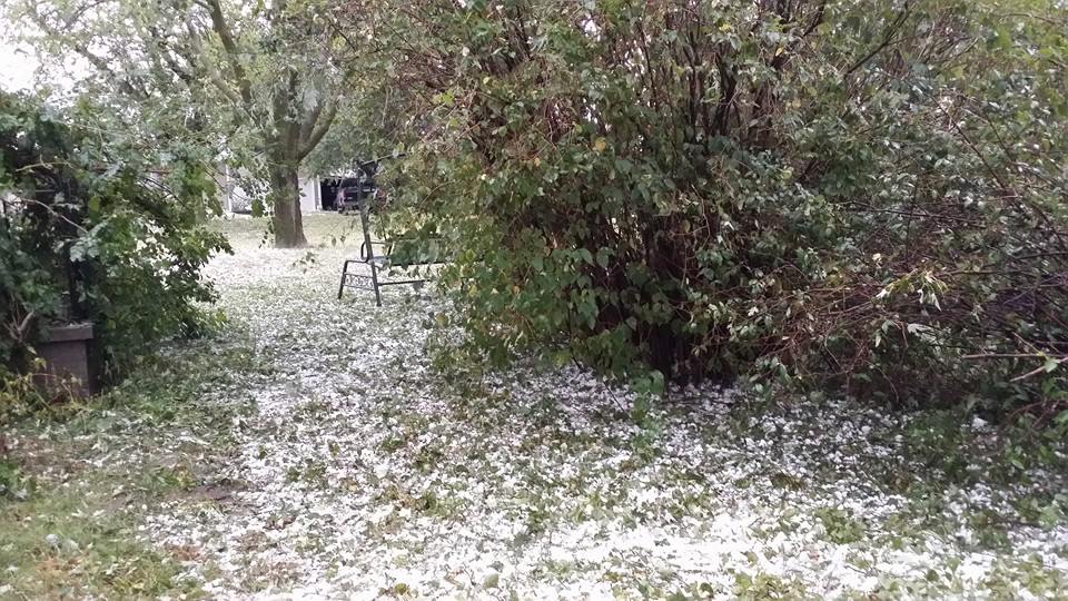
| Large hail and damage near Chester, NE. Photos courtesy of Sarah Dake. | |||
 |
 |
 |
 |
| Hail near Holbrook, NE. Photo courtesy of Keith Andrews. |
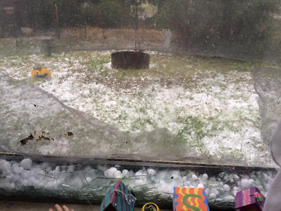
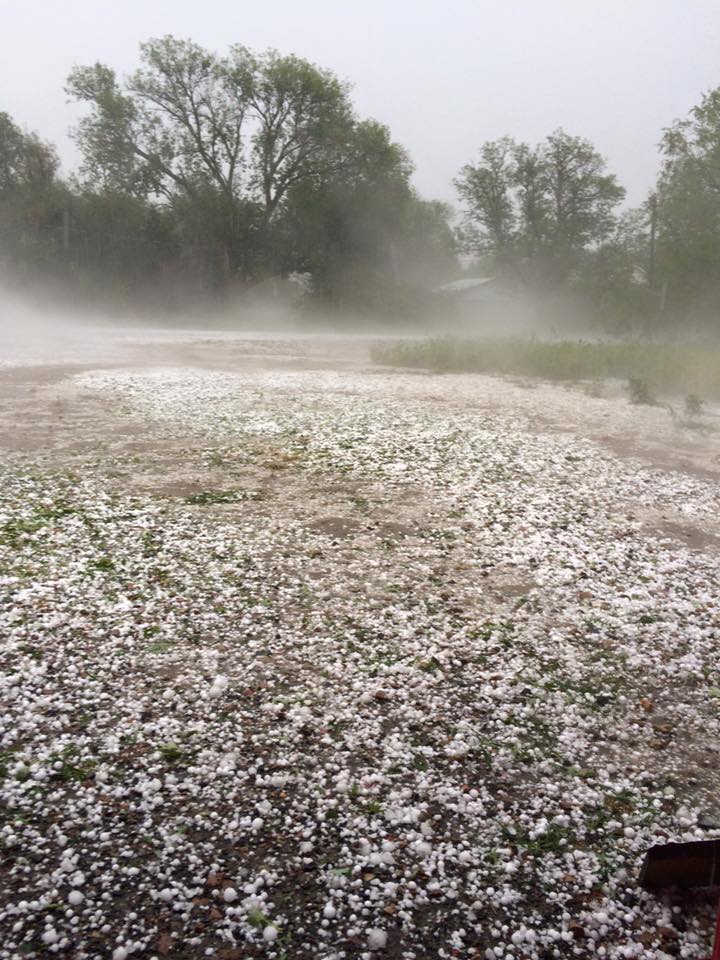
Fog caused from recent hail near Deshler, NE. Photo courtesy of Kevin Houtwed. |
Hard to tell if it's hail or snow in this yard near Deshler, NE. Photo courtesy of Judith Fintel. |
|
 |
 |
 |
 |
| Hail near Chester, NE. Photo courtesy of Doug Watkins. |
Hail near Byron, NE. Photo courtesy of Corey Heitmann. |
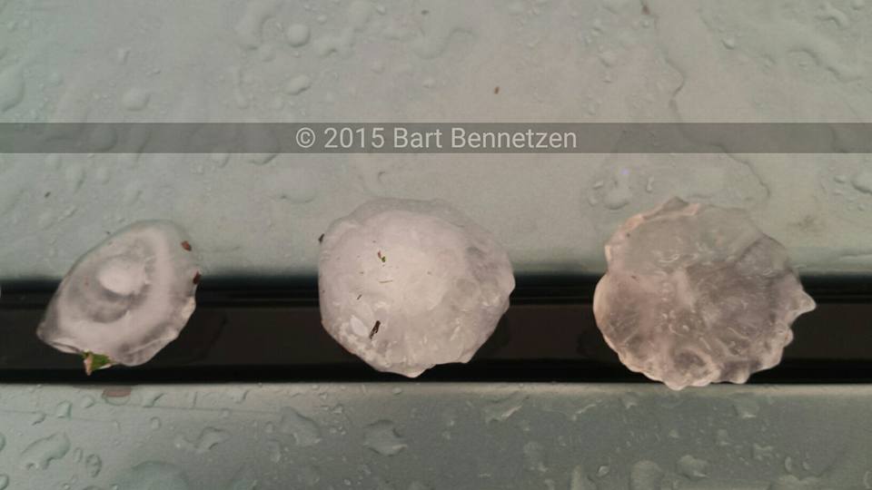
Hail near Burr Oak, KS. Photo courtesy of Bart Bennetzen. |
Hail near Woodston, KS. Photo courtesy of Karl Boland. |
 |
This page was composed by the staff at the National Weather Service in Hastings, Nebraska. |
 |

