Overview
Minor flooding is possible long the Platte River due to heavy rainfall and snow melt in the mountains. The reservoirs upstream from the Platte River have increased releases to manage the amount of incoming water. |
 |
|
| Rivers and Streams - Click HERE to interact |
Observed 24 hr Precipitation - Click HERE to interact |
Flood Safety - Click HERE for National Tips Click Image to Enlarge |
Flooding:
People living along the Platte River will want to watch for rising water and move livestock and other necessities to higher ground.
Platte River Hydrographs
Click on Hydrograph to expand image, click on text below each image to see stage impacts and historic crests.
| Brady | Cozad |
|
|
|
| Kearney | Grand Island |
|
|
|
| Duncan |
|
|
Precipitation & Temperature:
Click Images to Enlarge
| Expected Rainfall Accumulation next 24 hours | Expected Rainfall Accumulation Through ~72 hours |
| 6 to 10 Days | 8 to 14 Days |
 |
 |
| Temperature Outlook 6 to 10 Days | Temperature Outlook 8 to 14 Days |
 |
 |
Snow Pack
Wyoming and Colorado (North and South Platte)
Snow Pack as a Percent of Median
| Wyoming Basin Outlook Report - Click Here | Colorado Snowpack Basin Report - Click Here |
|
Upper North Platte River Basin Water Content
Red Line = Current Snow Water Content (inches)
Click Here to read the full user's guide
Click here to go to the |
South Platte River Basin Water Content
Thin Red Line = Median
|
Colorado Snow Pack
|
|
| Please Click Here for the Latest Information Image above does not update automatically |
Reservoir Data
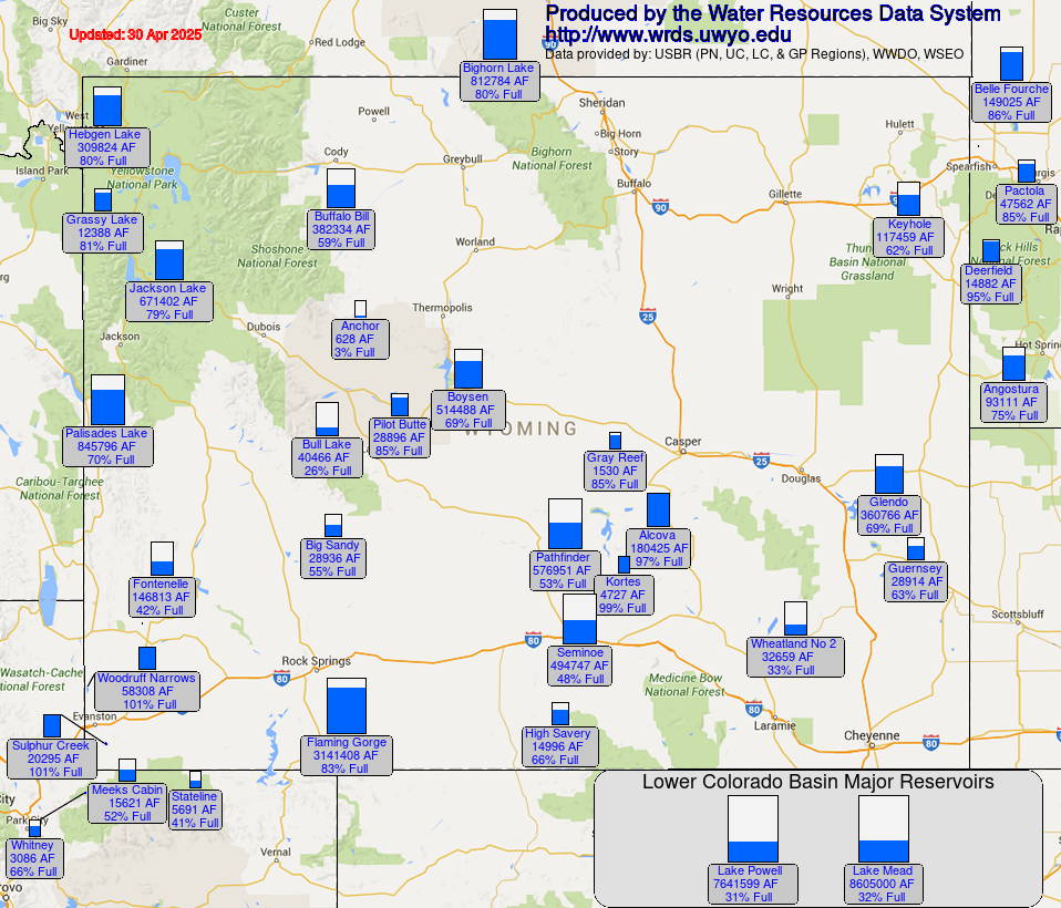
Wyoming Reservoir Teacup Diagrams
Click on the Image to Enlarge - Updates Dynamically
 |
 |
| Teacup Diagrams Click Here for Interactive Map Click Image to Enlarge |
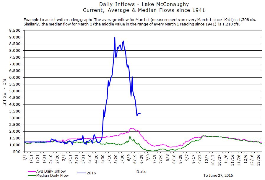
Latest Lake McConaughy Data - Click Here for Reservoir Information Click Image to Enlarge |
|
North Platte and South Platte River Basins
|
|
 |
Media use of NWS Web News Stories is encouraged! Please acknowledge the NWS as the source of any news information accessed from this site. |
 |