 |
So far this late-fall season, MOST of our coverage area has yet to see truly measurable snow (including the Tri Cities). In fact, this means that MOST of our area is now "overdue" for its first true snow of the season. So...What are the "typical" FIRST DATES that our NWS Hastings coverage area of central/south central NE and north central KS can expect accumulating snow?
Listed in the table below are average "first snowfall" dates for various locations across our coverage area, generally arranged from north-to-south. This information is based on the most recent 30 snowfall seasons from official NWS Cooperative Observers (the 1992-1993 through 2021-2022 seasons).
AVERAGE "First Snowfall" Dates Over The Last 30 Seasons (1992-2021)
| Location | 0.1" Or More (in 24 hours) |
1" Or More (in 24 hours) |
2" Or More (in 24 hours) |
| Ord | Nov. 12 | Nov. 15 | Nov. 18 |
| Osceola | Nov. 16 | Nov. 22 | Dec. 11 |
| Grand Island | Nov. 11 | Nov. 26 | Dec. 10 |
| Hastings | Nov. 12 | Nov. 24 | Dec. 13 |
| Kearney | Nov. 15 | Nov. 20 | Dec. 3 |
| Holdrege | Nov. 22 | Nov. 30 | Dec. 13 |
| Cambridge | Nov. 17 | Nov. 24 | Dec. 12 |
| Hebron | Nov. 20 | Dec. 2 | Dec. 11 |
| Smith Center, KS | Nov. 23 | Dec. 15 | Dec. 22 |
| Beloit, KS | Dec. 7 | Dec. 11 | Dec. 23 |
| Plainville, KS | Nov. 20 | Dec. 6 | Dec. 20 |
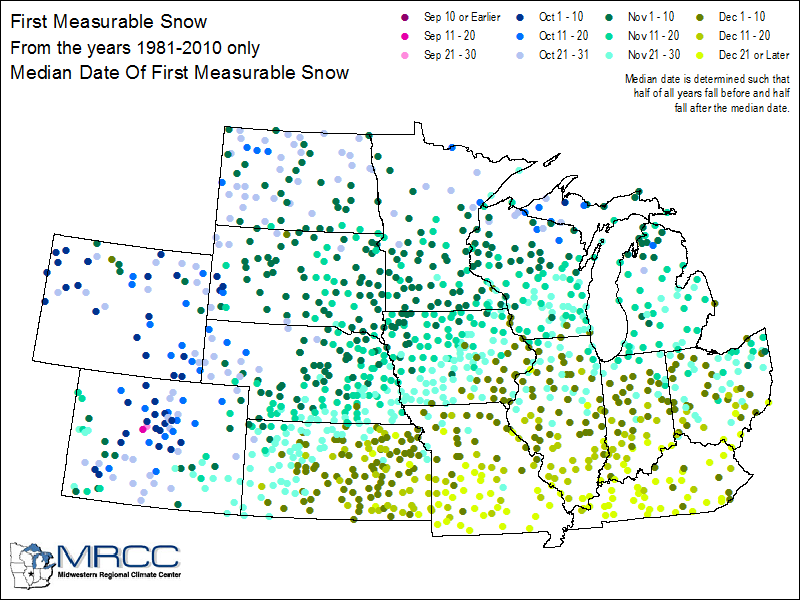
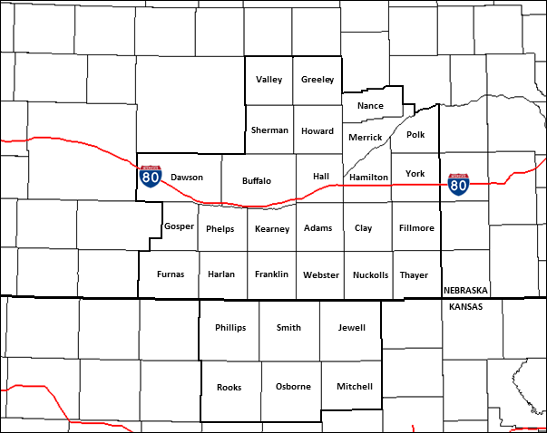
The graphics below also help to "set the stage" for the upcoming snowfall season within our Central Plains Region (click images to enlarge):
 |
 |
For more local climate information, check out the following website:
 |
Media use of NWS Web News Stories is encouraged! Please acknowledge the NWS as the source of any news information accessed from this site. |
|
Last updated: 11-25-22

