Overview:
|
(Please note: Any official rainfall totals cited below are from either NWS cooperative observers or NeRAIN/CoCoRaHS observers) |
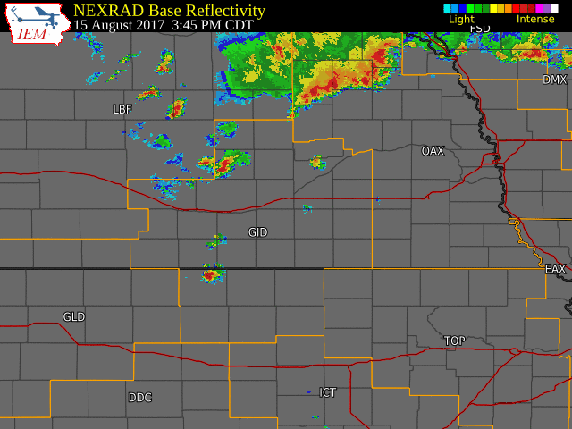 NWS Hastings radar loop from 3:45 p.m. on Aug 15th -9 a.m. CDT on Aug 16th. The NWS Hastings coverage area is outlined in orange and interstates are in red. |
Rain Totals:
Below is an image and table reflecting the heavy rainfall that affected mainly the northern half of the NWS Hastings coverage area, and are 24 hours totals ending at 7 AM CDT on August 16th. These amounts come from a number of sources, including NWS Cooperative Observers, CoCoRaHS and NeRAIN Observers. NOTE: Unfortunately, this section does not include lingering rain that fell after 7 AM on the morning of the 16th, but these amounts were rather minimal, mainly one-quarter inch or less.
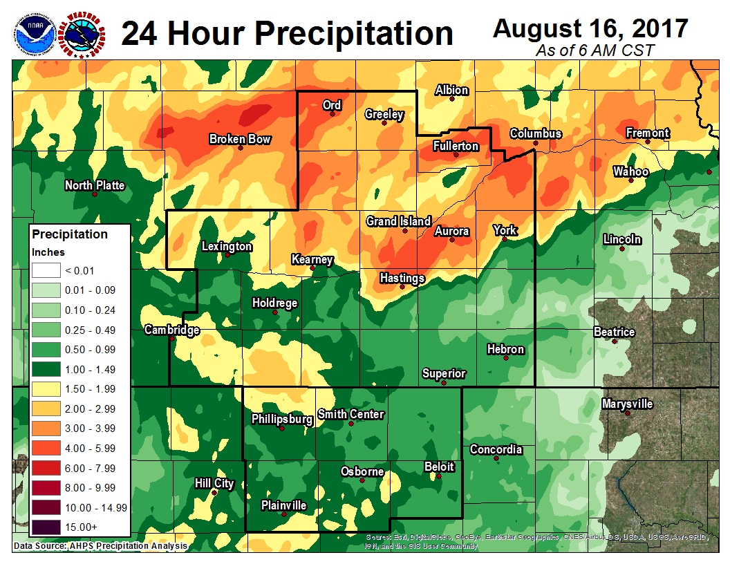 |
| 24 Hour totals ending at 7 AM CDT Aug. 16th Click to enlarge the image. |
| Location | Total Rainfall (inches) |
| 8.37 | 5 NE Osceola |
| 6.95 | Osceola |
| 6.70 | 5 ESE Phillips |
| 6.00 | 5 N Aurora |
| 5.50 | 8 W Fort Hartsuff State Park |
| 5.36 | 1 NW Giltner |
| 5.20 | 3 SSW Genoa |
| 5.20 | Shelby |
| 5.05 | 4 S Marquette |
| 4.94 | 4 ENE Doniphan |
| 4.77 | 4 N Litchfield |
| 4.70 | Hansen |
| 4.57 | NWS Hastings Office |
| 4.48 | 4 WNW Osceola |
| 4.40 | 13 N Shelby |
| 4.37 | 1 E Stromsburg |
| 4.30 | 2 NE Hordville |
| 4.18 | 4 E Alda |
| 4.06 | Aurora |
| 3.98 | 2 N Palmer |
| 3.95 | 3 W Gresham |
| 3.94 | 4 W Benedict |
| 3.76 | 4 NW Bradshaw |
| 3.75 | 4 S Shelby |
| 3.74 | 4 SW Polk |
| 3.52 | 3 SE Ravenna |
| 3.46 | 3 WNW Elyria |
| 3.36 | 1 NNE Grand Island |
| 3.35 | 3 W Elba |
| 3.30 | 3 ESE Hampton |
| 3.25 | 2 W Loup City |
| 3.17 | 1 ENE Hampton |
| 3.08 | 3 W Arcadia |
| 3.03 | 2 NE Central City |
Flooding:
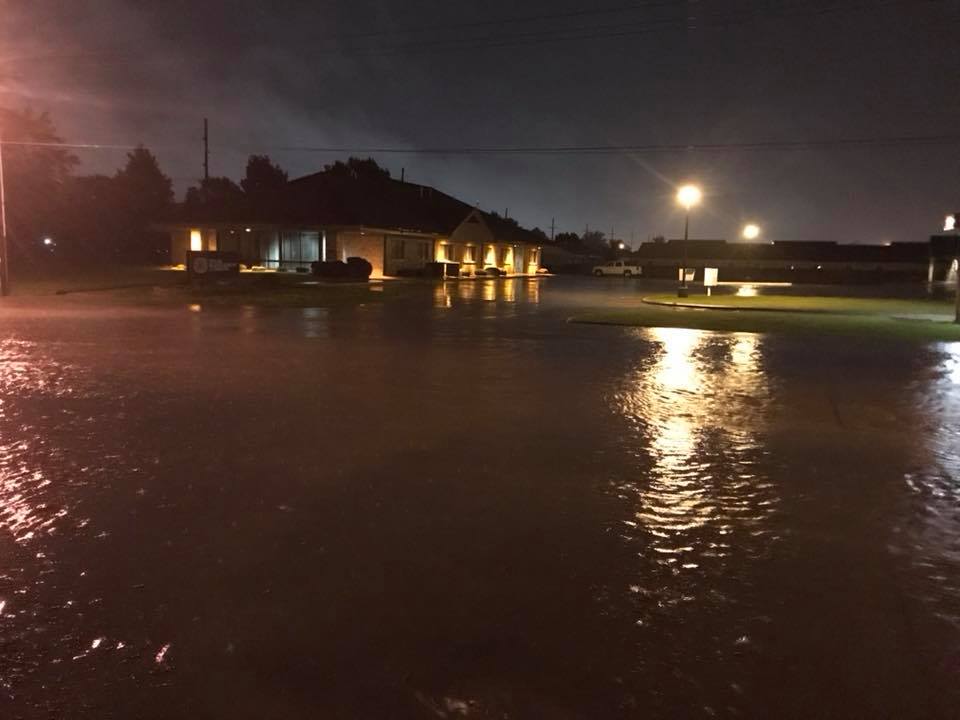
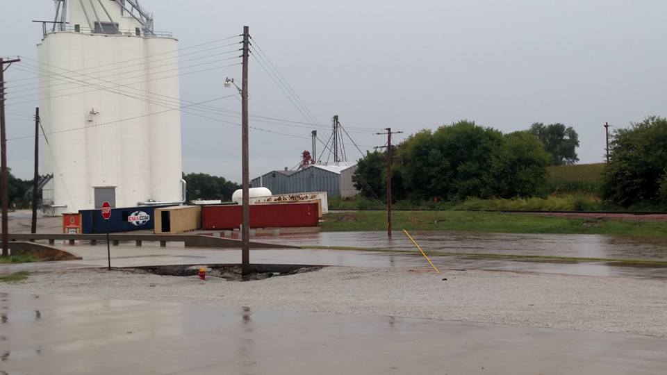
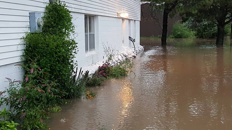
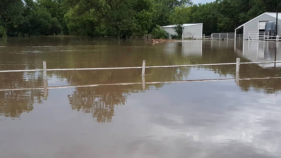
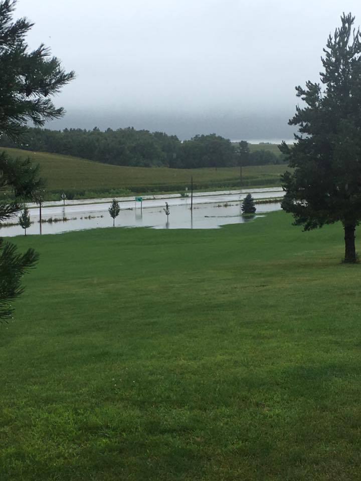
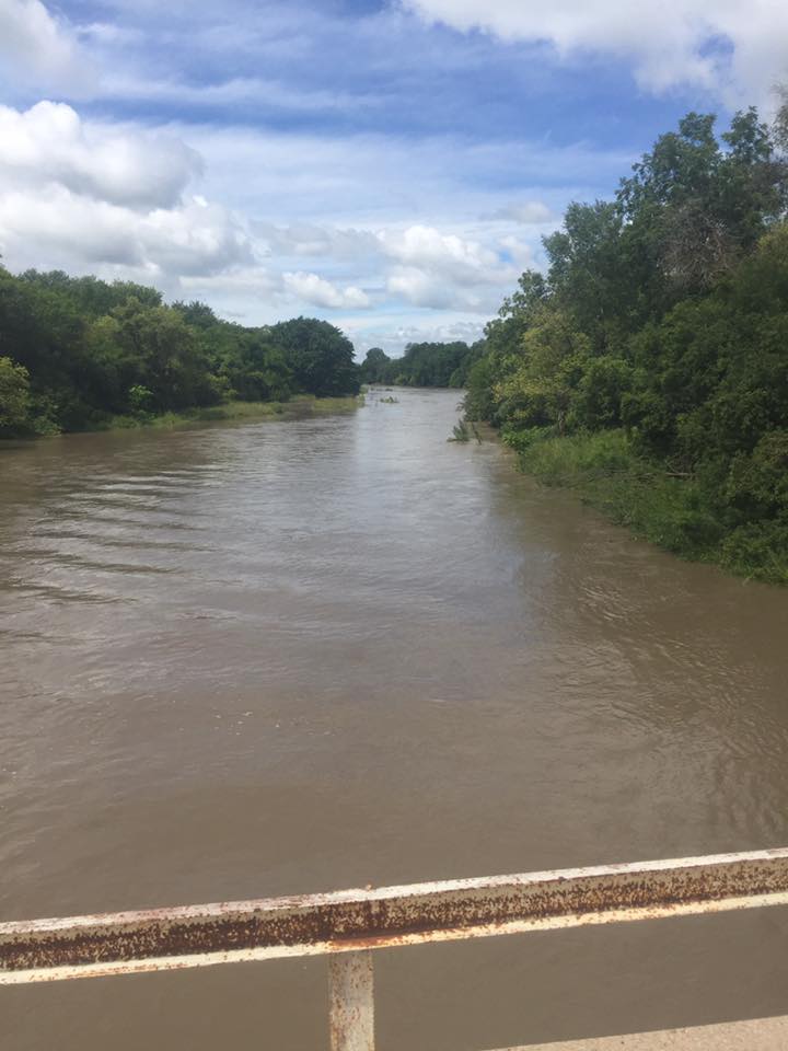
The heavy rainfall resulted in flooding for a number of locations across the northern half of the NWS Hastings coverage area. Hardest hit was Polk County, with numerous road closures and flooding along Clear Creek, Davis Creek and the Big Blue River. Below are a few photos from the area.
 |
 |
 |
| Grand Island - August 15th Photo from Joshua Janulewicz |
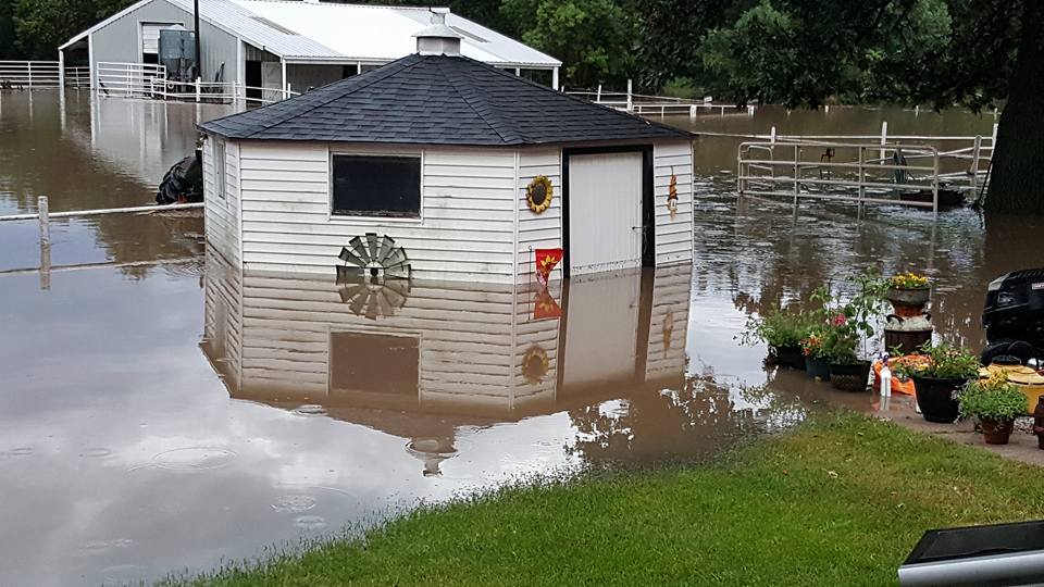
West side of Osceola Photos from Osceola Fire Department |
|
 |
 |
 |
 |
| East side of Osceola Photos from Patricia Mentink |
|||
 |
 |
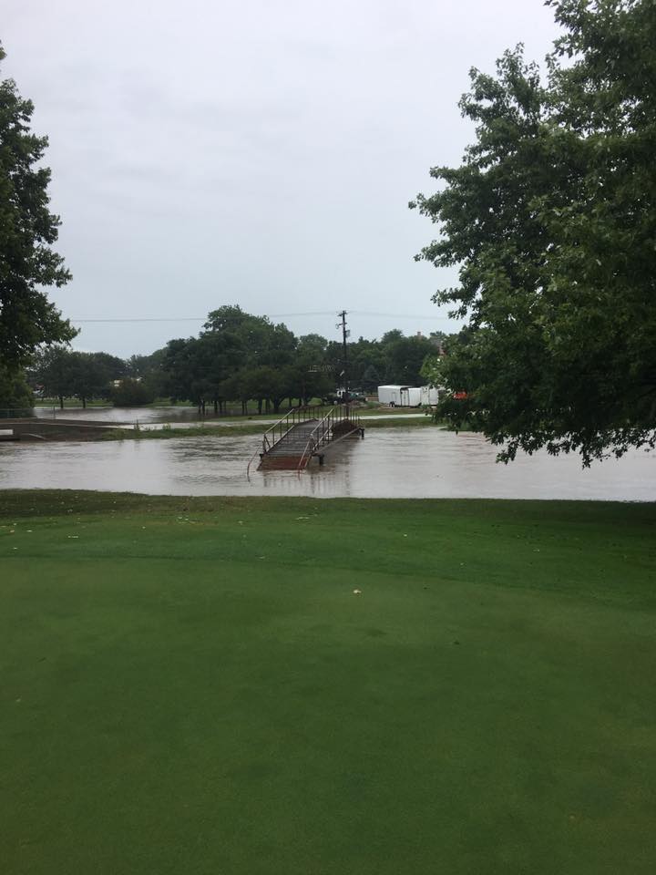 |
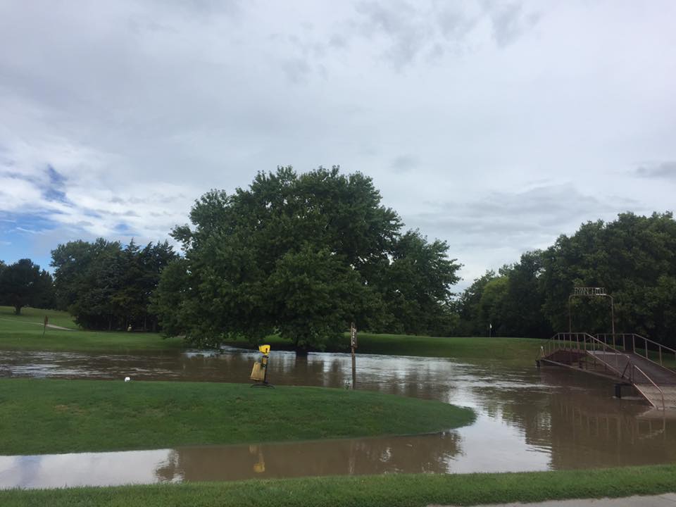
| West side of Osceola. Middle photo is looking down on Highway 81/92 just outside Osceola. Photos from Ryan Hill Country Club. |
||
 |
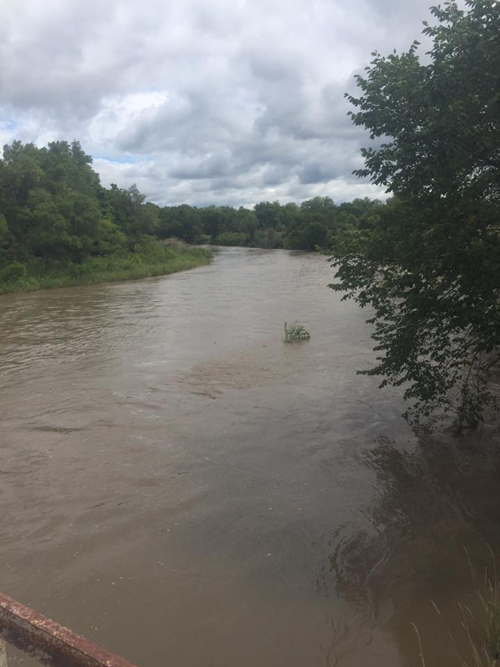 |
| South Loup River in Buffalo County Photos from Buffalo County Emergency Management. |
|
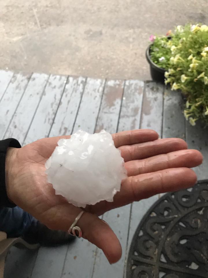
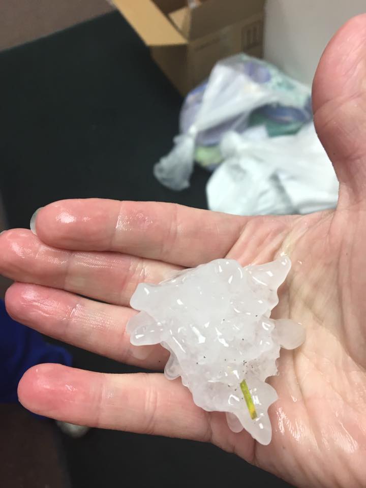
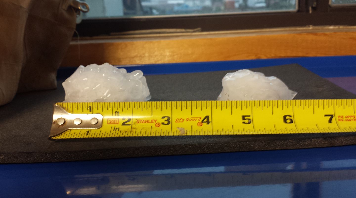
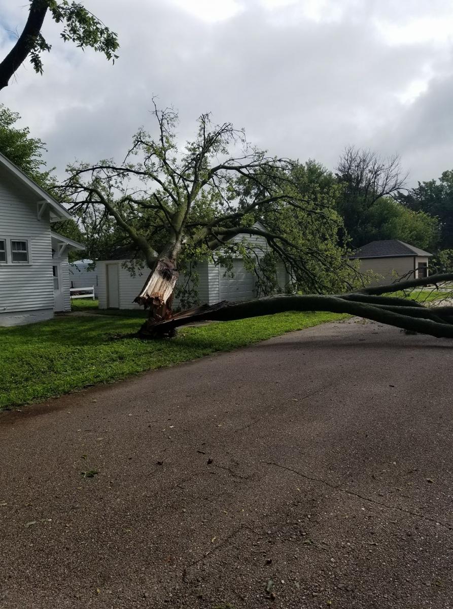
Hail & Wind:
There weren't a lot of hail reports from the area, but the most significant hail fell in the Fullerton area. Hail ranging in size from quarters to baseballs was reported in Fullerton and just to the south of town. Other reports included half dollar size (1.5") hail in the Palmer area and quarter size (1") hail near Arcadia, Loup City and Litchfield.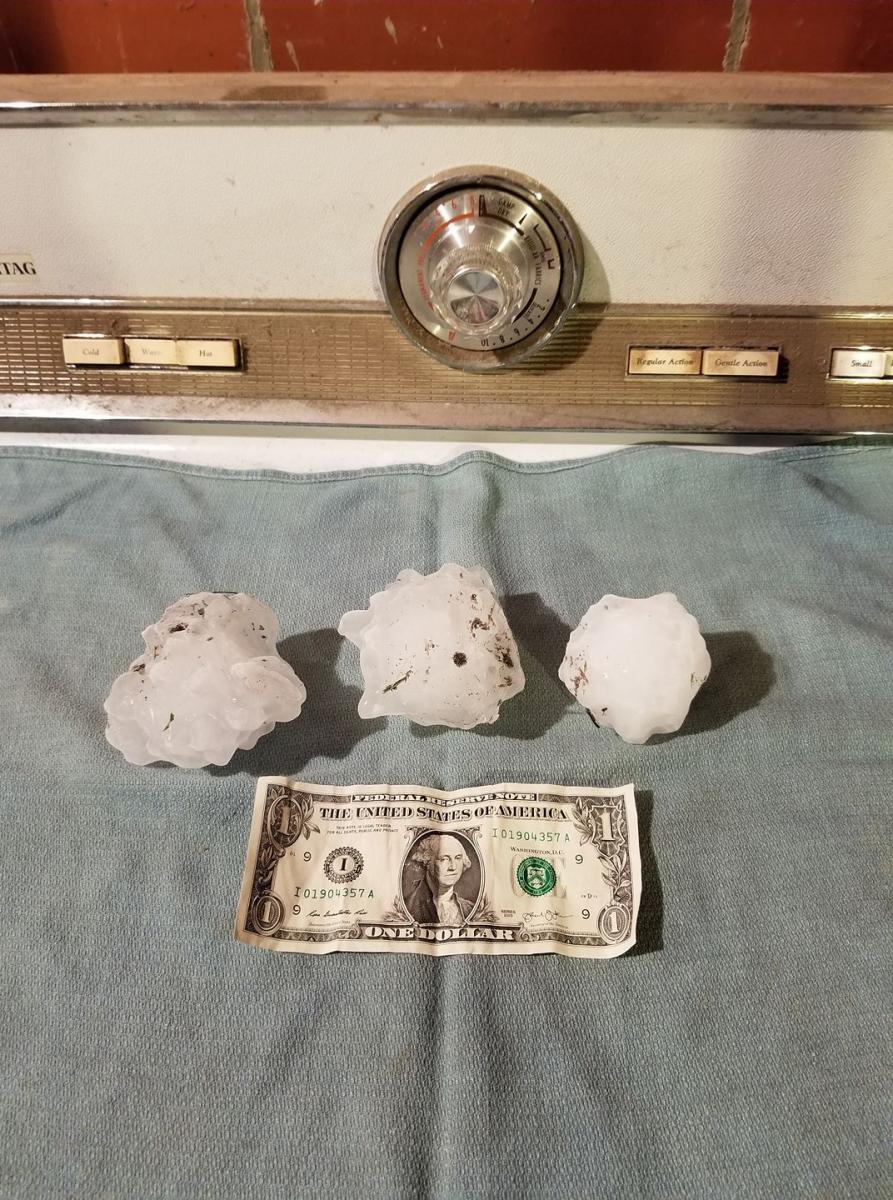 |
 |
 |
 |
| 2 S of Fullerton Photo from Gerald Shotkoski |
Fullerton Photo from Michelle Beed |
Fullerton Photo from Brenda Knopik |
Fullerton Photo from Tessa Nelson |
 |
 |
 |
| Fullerton Photo from Nance County Emergency Manager |
Fullerton Photo from Rose Borgheiinck |
Heartwell Photo from Brynn Gustafson. |
 |
Media use of NWS Web News Stories is encouraged! Please acknowledge the NWS as the source of any news information accessed from this site. |
|

