Overview
|
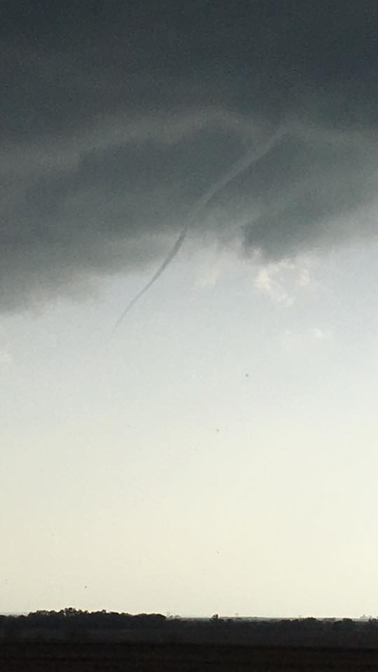
The first significant and widespread severe weather event of the 2016 season struck the NWS Hastings coverage area (click HERE for a map) on Tuesday, April 26th. After a break in the thunderstorm activity, things starting ramping back up mid/late afternoon, with high amounts of instability nosing into east-southeastern portions of the area and large scale lift increasing with the arrival of the main upper level low pressure system. At the surface, an area of low pressure established itself over portions of north central Kansas, with a warm front extending east roughly along Interstate 70 and a dry line draped to the south. Initially, the activity was confined to locations generally along and east of Highway 281. This produced an outflow boundary, which pushed west of the main activity, and as the early/mid evening hours progressed, aided in the development of additional severe weather and heavy rain. While the severe weather threat waned later in the evening, rainfall continued overnight and through the day on Wednesday, as that upper level low slowly passed right through the heart of Nebraska. All modes of severe weather occurred, including an EF-0 tornado north of Kensington, KS. Hail up to the size of tennis balls and wind gusts of 60 MPH were reported, as well as torrential rainfall. Additional details can be found below. |
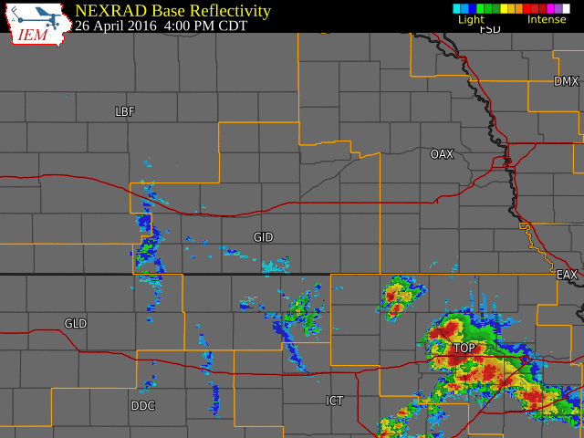 NWS radar loop from 4:00 p.m. April 26th through 9 a.m. April 27th. The NWS Hastings coverage area is outlined in orange and labeled "GID". Interstates are marked in red. |
Tornadoes:
|
Track Map 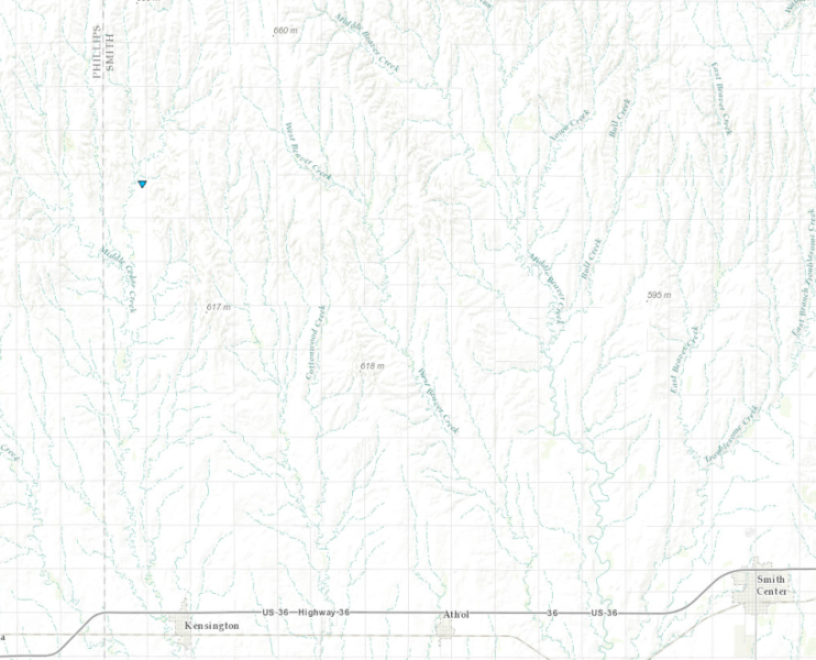  |
||||||||||||||||
The Enhanced Fujita (EF) Scale classifies tornadoes into the following categories:
| EF0 Weak 65-85 mph |
EF1 Moderate 86-110 mph |
EF2 Significant 111-135 mph |
EF3 Severe 136-165 mph |
EF4 Extreme 166-200 mph |
EF5 Catastrophic 200+ mph |
 |
|||||
 |
 |
 |
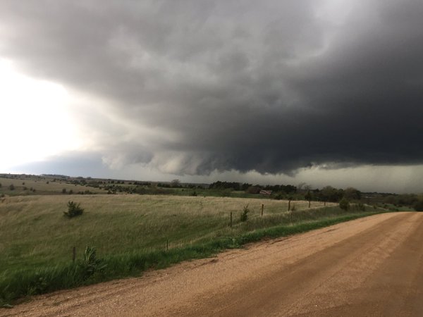 |
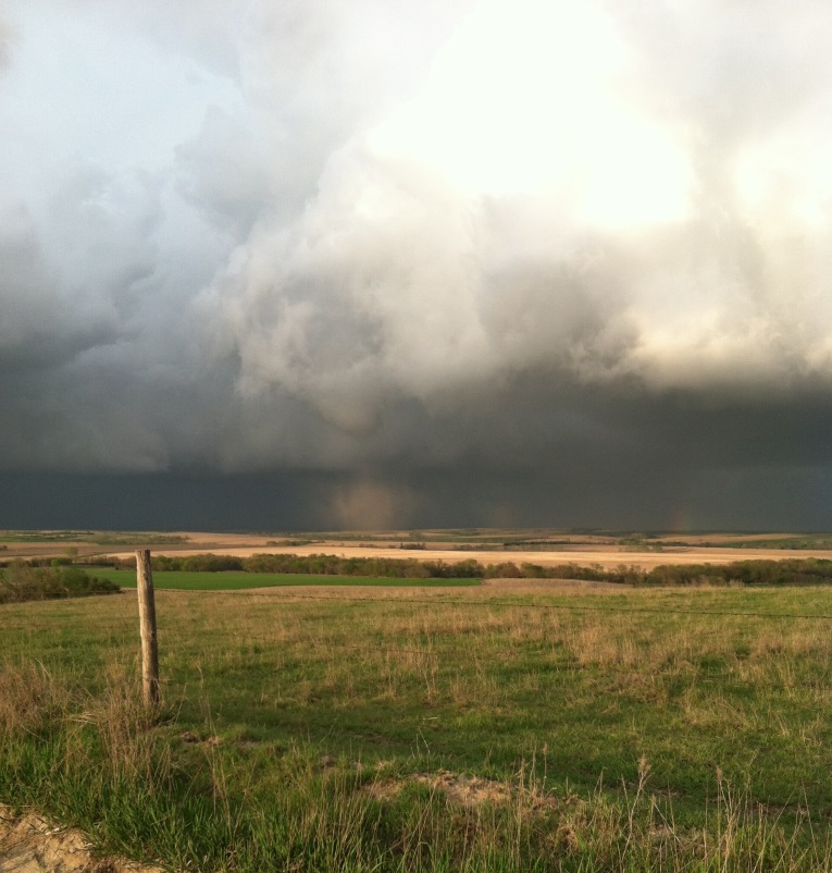
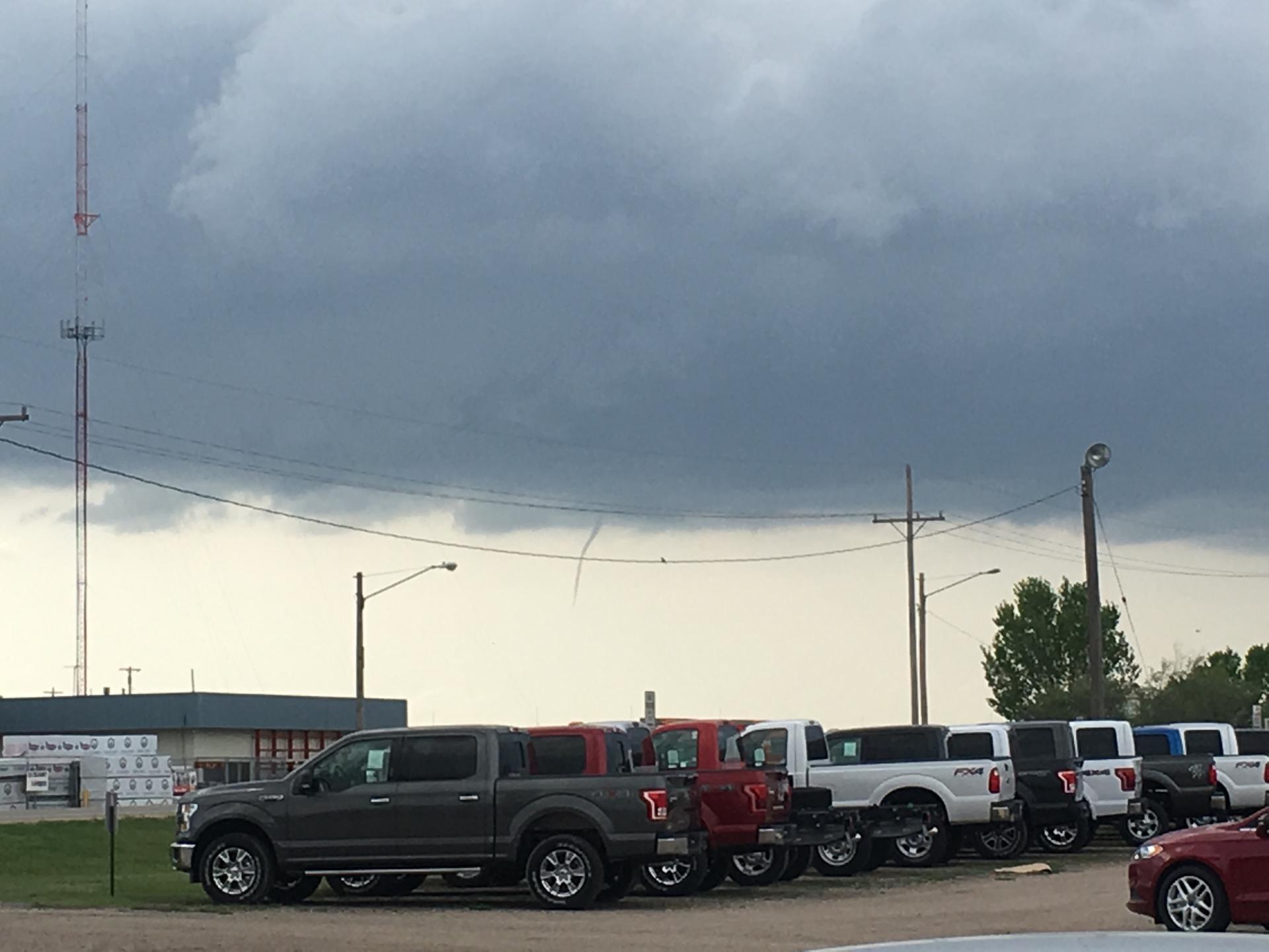
| Tornado 10 miles north of Kensington, KS. Photo courtesy of James Molzahn. | Funnel Cloud NW of Beloit, KS. | Funnel cloud NW of Beliot, KS. Photo courtsy of Skyler Campbell. | Wall cloud south of Deshler. Photo courtesy of Tim Jones. |
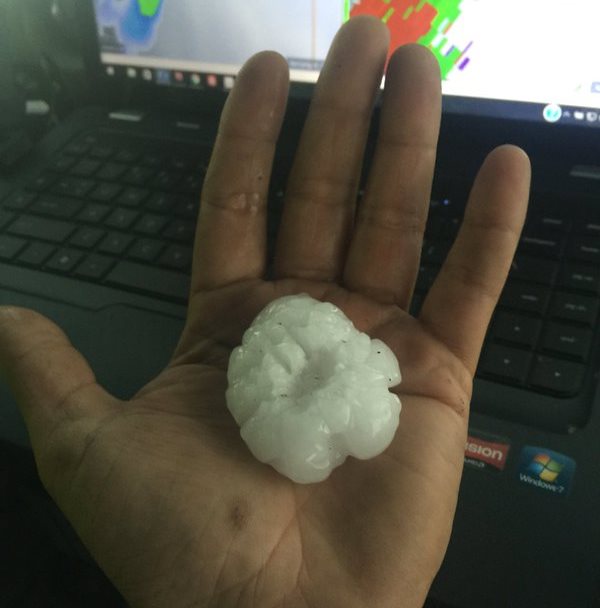
Wind & Hail:
Large hail and damaging winds were reported across the NWS Hastings coverage area, with the majority of the reports coming from locations east of Highway 281. The largest hail report received was the size of tennis balls, with many locations seeing hail between quarter and golf ball size. 50-60 MPH wind gusts were also reported. Below is a list of the more notable wind and hail reports from the event:
 |
 |
| Hail near Hebron that fell during the very early morning hours on the 26th. Photo courtesy of Tyler Watson. | Tree damage in Lawrence later in the day. Photo courtesy Maria Guadelupe Gamez Contreras. |
 |
 |
| Hail 1 W of Deshler later in the day. Photo courtesy of Ted Nesslein. | Hail 3 SW of Deshler later in the day. Photo courtesy of WOWT 6 News. |
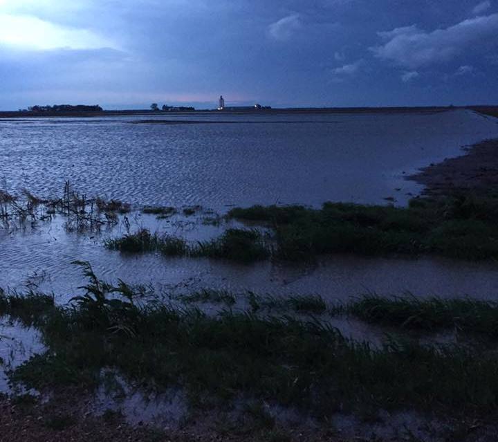
Flooding
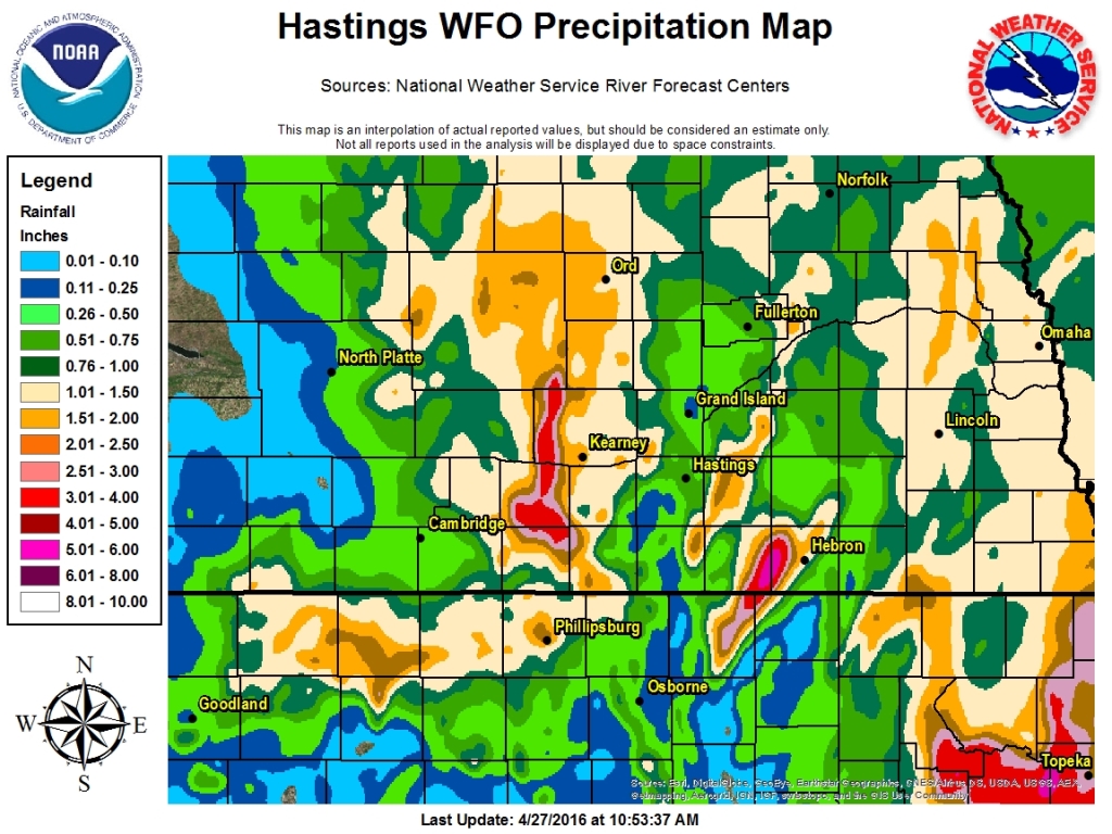
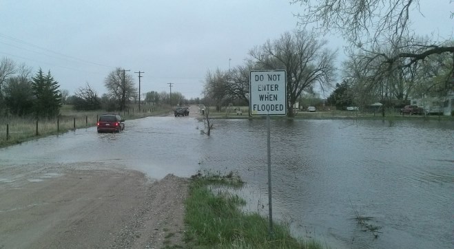
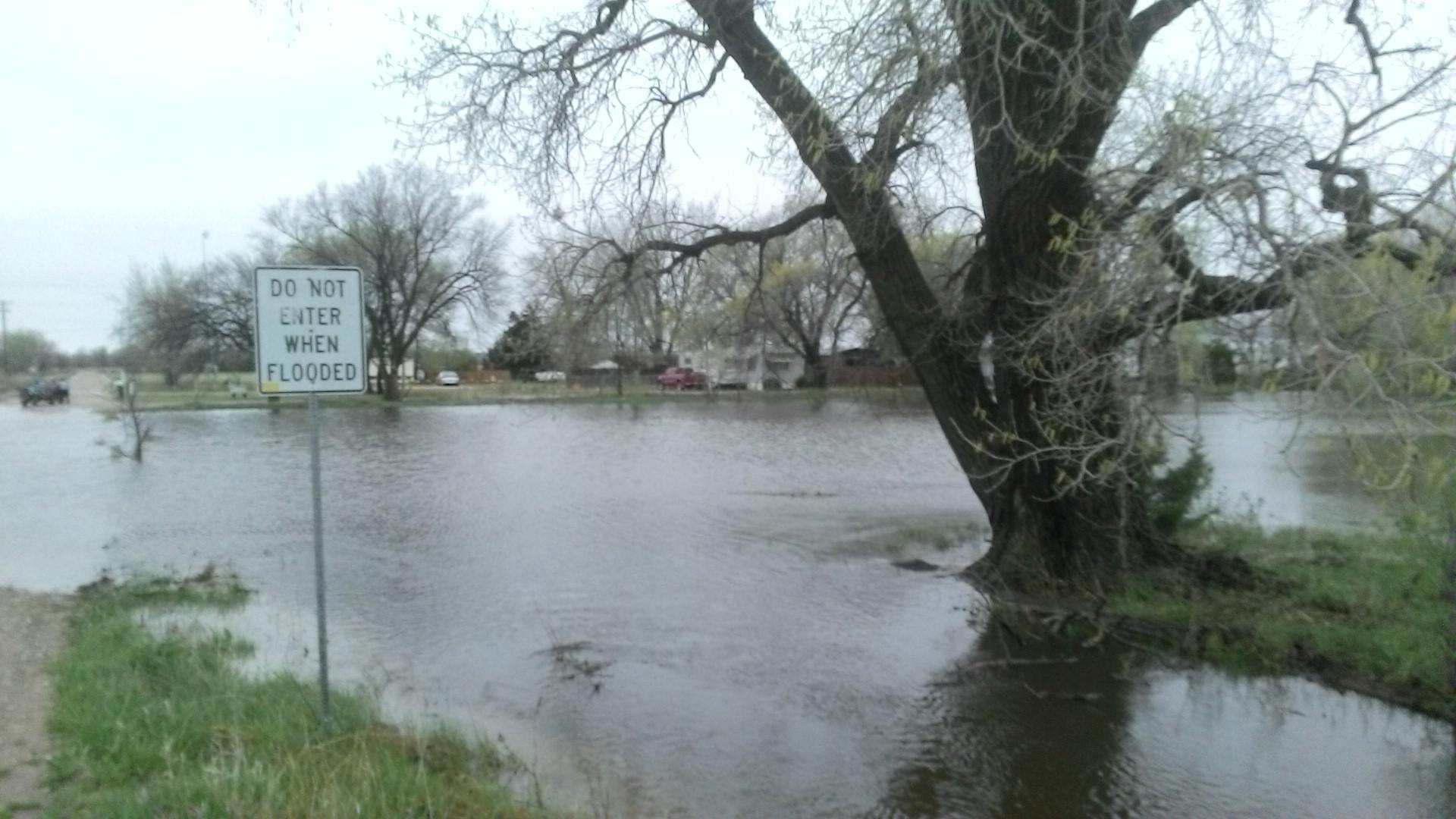
Thunderstorms with heavy rainfall, training over the same areas for long periods of time, resulted in significant rainfall totals across portions of the area. There were two localized areas with the heaviest rain. The main axis of heavy rainfall was over northeastern Jewell County, Kansas into Nuckolls and Thayer Counties in Nebraska, while further west, a secondary axis developed over western Buffalo into Phelps Counties. While radar estimated rainfall totals of anywhere from 3 to 8 inches, ground truth reports in those heavier bands were hard to come by, with the highest reported total being 5.10 inches from an NeRAIN observer in Ruskin (far eastern Nuckolls County).
The most significant flash flooding occurred over far eastern Nuckolls County into western Thayer County, when a portion of Highway 136 between Ruskin and and Deshler had to be closed due to a large amount of water flowing over the road. In Deshler itself, roads were covered in water and due to the high levels of Spring and Snake Creeks, residents of an assisted living facility on the south side of town had to be evacuated. One resuce was conducted when a person went out to board up their home and became surrounded by the water.
A portion of Highway 30 was also closed near Elm Creek in Buffalo County due to water running over the road. Flooding was also reported in low lying areas in the Amherst and Odessa areas, causing water to run over several county roads. In Phelps County, lowland flooding wast reported and the underpass on the east side of Holdrege was still blocked on the morning of the 27th.
 |
 |
 |
| Storm Total Precipitaiton. This map is an interpolation of actual reported values and should only be used as an estimate. | Significant flooding over Highway 136 and Road 5100 near Deshler. Photo courtesy of the Omaha World Herald. | Video showing the flooding over Highway 136 near Deshler. Courtesy of Trevor Tetley. |
 |
 |
 |
| Flooded pasture northeast of Fairfield. Photo courtesy of Jeana Marie. | Turkey Creek flooding near Kearney. Photo courtesy of Buffallo County EM. | Turkey Creek flooding near Kearney. Photo courtesy of Buffallo County EM. |
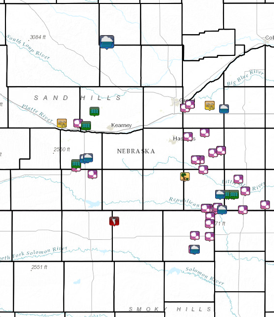
Storm Reports
More detailed information about individual storm reports can be found by clicking on the image below.
 |
|---|
 |
Media use of NWS Web News Stories is encouraged! Please acknowledge the NWS as the source of any news information accessed from this site. |
|

