|
Event Summary:
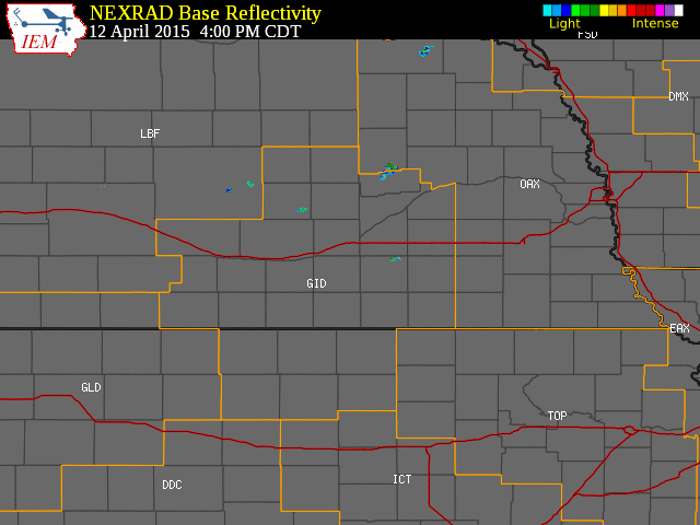
A surface cold front working southeast through the region heped to spark isolated to scattered thunderstorms during the late afternoon and evening hours of Sunday, April 12, 2015. A few of these storms became severe mainly within counties along/east of the Highway 281 corridor within the NWS Hastings coverage area, primarily between 5 PM-830 PM. The greatest concentration of severe weather reports were received from Polk County Nebraska and Smith/Jewell counties in Kansas.
Although the majority of severe storms resulted in reports of large hail up to golf ball size (see below for a graphic and listing of storm reports), an isolated supercell storm that tracked eastward through mainly the northern halves of Smith and Jewell counties in Kansas also produced one or more funnel clouds and even a brief EF0 tornado a few miles north-northeast of Smith Center.
Storm Reports:
(click to get to more detail information)
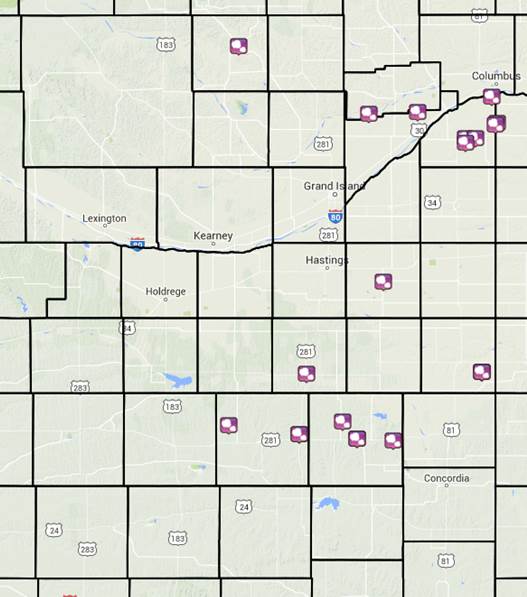 |
| Storm Reports from April 12th. |
Here are a few of the most significant storm reports from this event:
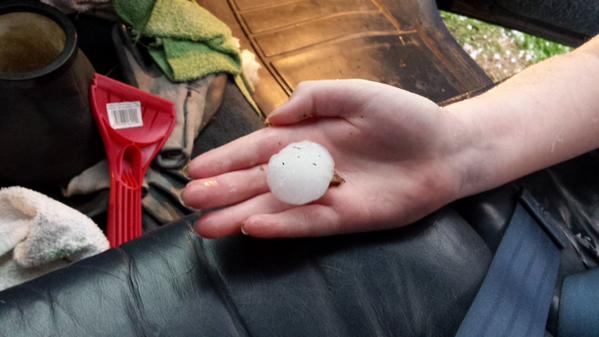
- 1.75" diameter hail (golf ball) reported 5 SSW of Columbus (in far northeast Polk County), 5 E of Clarks in Polk County and also in Mankato, KS
- 1" diameter hail reported in several locations, including: 4 NE of Shelby, Clay Center, Lebanon, KS, Burr Oak, KS and Formoso, KS.
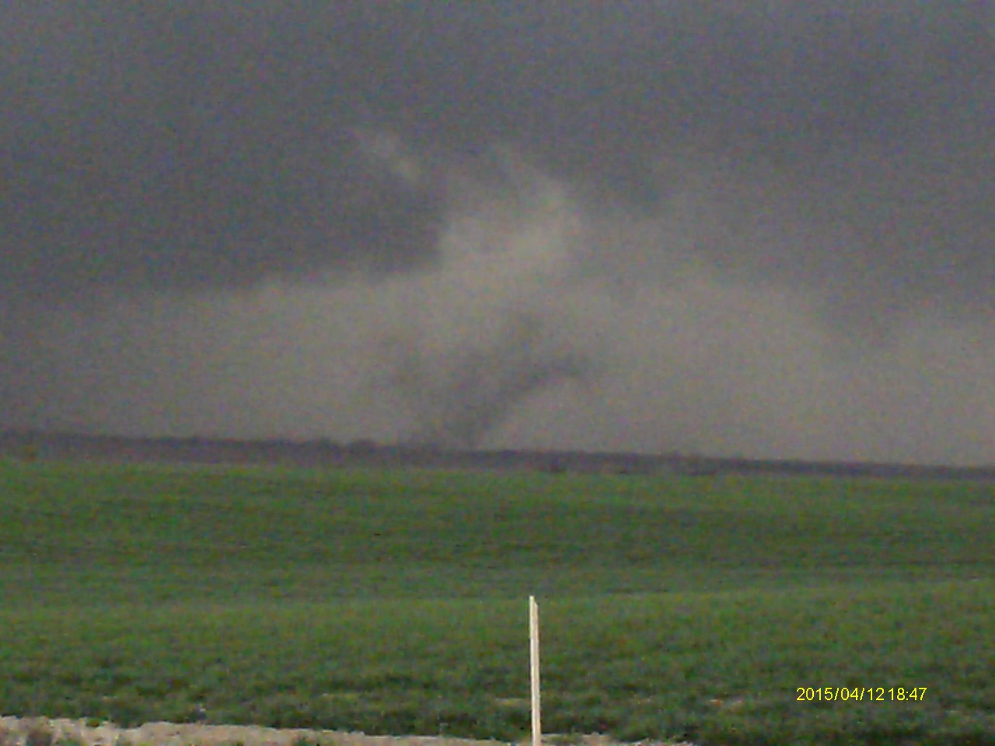
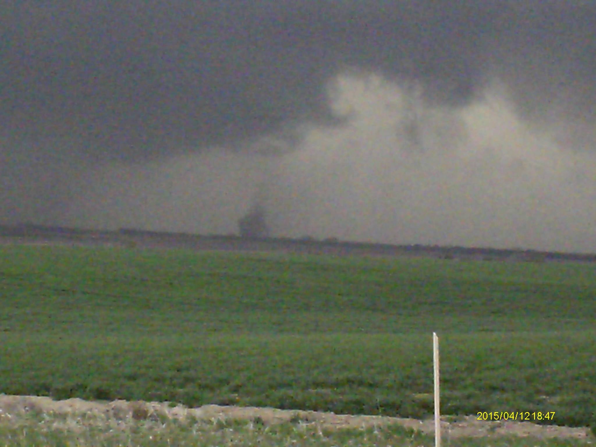
Tornado: 3 miles north to 3 miles north-northeast of Smith Center, KS (Smith County)
Rating: EF-0
Estimated Peak Wind Speed: 75 mph
Time: 6:46 - 6:48 p.m. CDT
Path Length: Intermittent for about 1 mile
Max Path Width: 20 yards
Fatalities/Injuries: 0 / 0
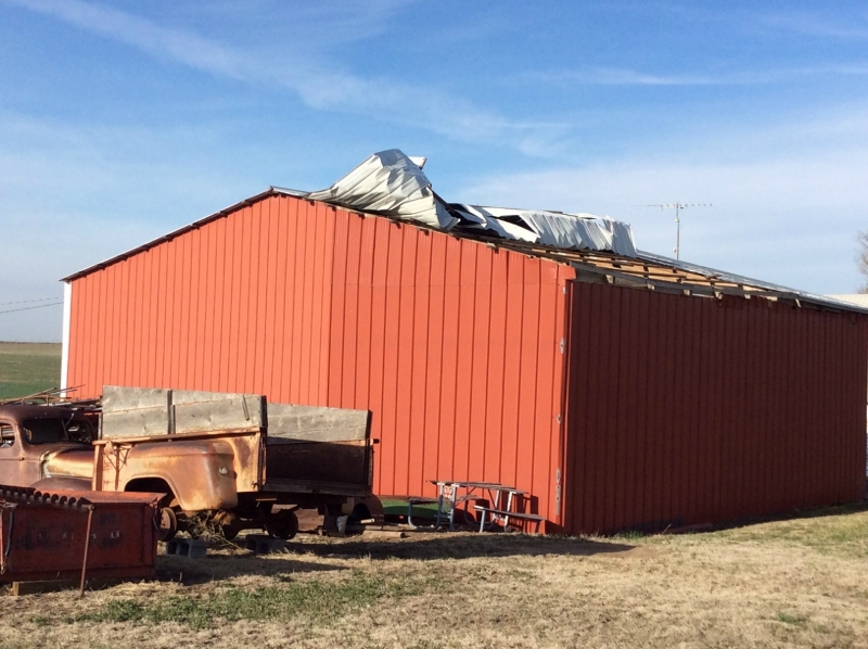
This tornado was brief and likely had an intermittent path as it traversed rural areas from about 3 miles north of Smith Center to 3 miles north-northeast of Smith Center. Prior to the tornado itself, the parent severe thunderstorm produced a funnel or multiple funnels along and north of Highway 36, mainly west of Smith Center. Many people in the county were able to see the storm characteristics as it moved east across the central part of the county. An outbuilding in the path suffered roof damage.
 |
 |
 |
| Photo of tornado near Smith Center, KS. Courtesy of Greg Wagner. |
Damage near Smith Center, KS. |
A few photos from this event:
 |
 |
 |
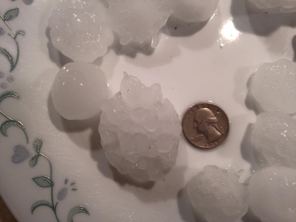
| Large Hail in Mankato, KS. Photo courtesy of Wendy Showers Ost. |
Large hail in Mankato, KS. Photo courtesy of Toriana Jacobs. |
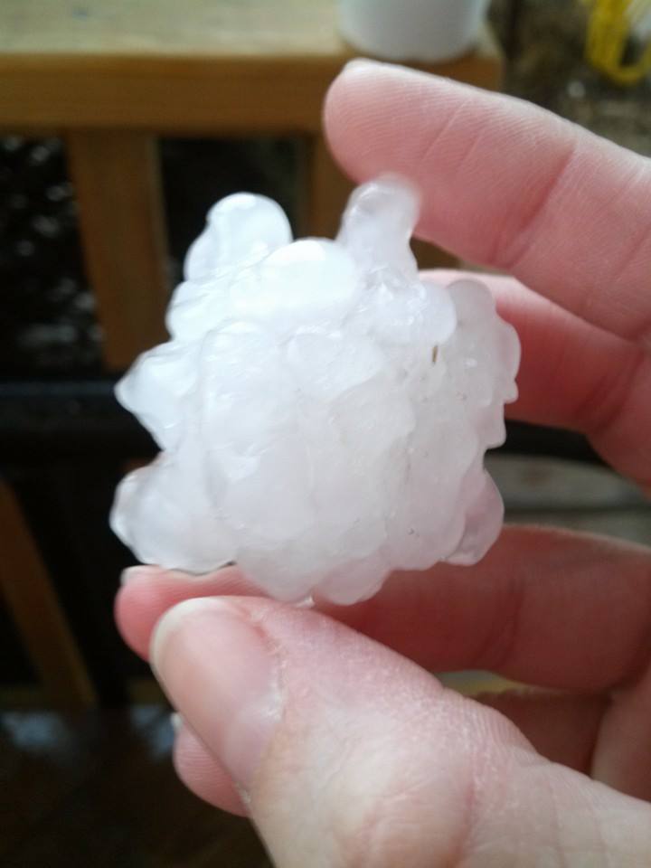
Large hail near Lebanon, KS. Photo courtesy of Nikki Jackson Stephenson. |
 |
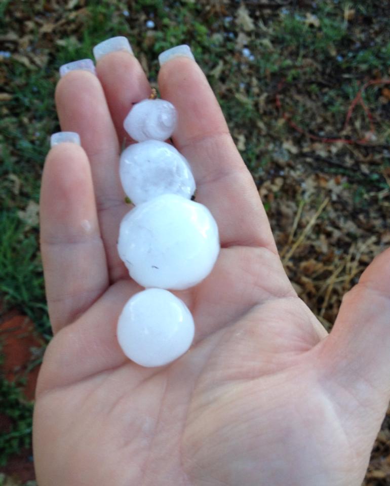
| Large hail 5 S of Columbus along the Polk/Butler County line. Photo courtesy of Freddy McKinney. |
|