Winter Weather Information
|
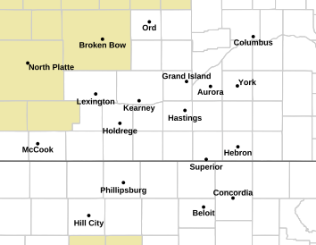
Current Watches, Warnings and Advisories |
|
Forecast Snow Accumulation |
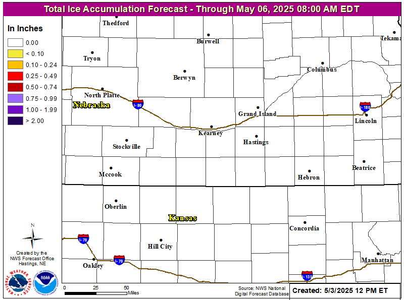
Forecast Ice Accumulation |
Report Snowfall or Other Weather Events
OR
Share your reports and images with us on Facebook and Twitter
Radar & Satellite
 |
 |
 |
 |
| Local Radar | Regional Radar | U.S. Radar | Satellite |
Forecasts
Click to Enlarge
 |
 |
 |
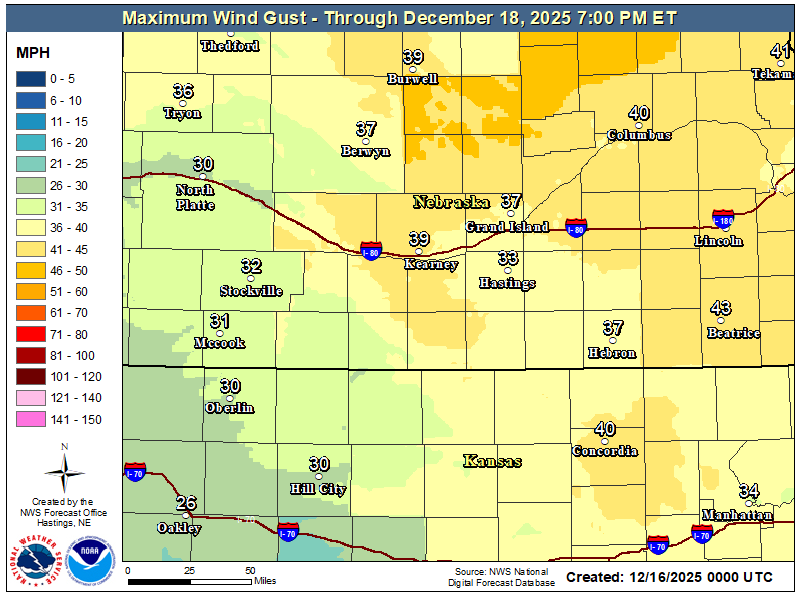 |
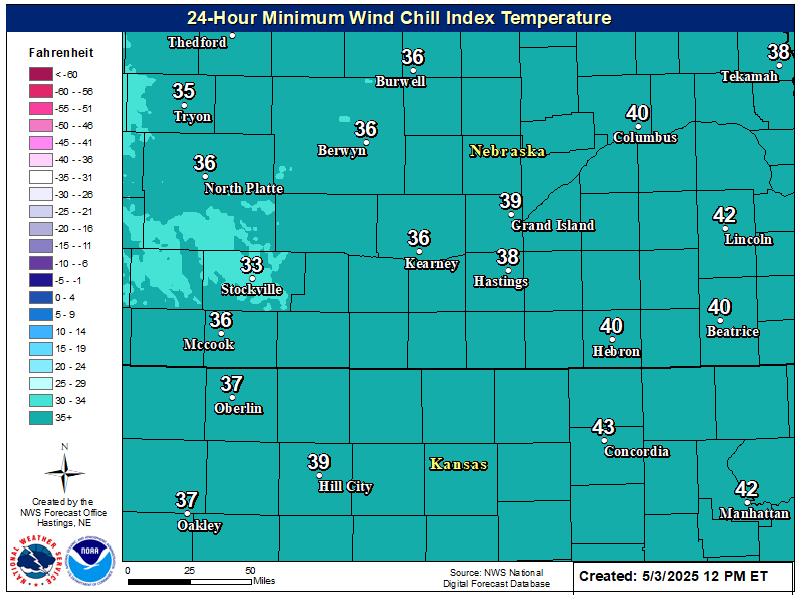
| Total Snowfall Forecast | Total Ice Accumulation | 24 Hour Minimum Wind Chill | 24 Hour Maximum Wind Gust |
 |
|
 |
 |
| Day 1 High Temperature | Day 1 Low Temperature | Day 2 High Temperature | Day 2 Low Temperature |
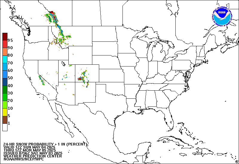
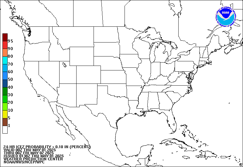
Snow and Ice Accumulation Probabilities
Click to view Interactive Plots
 |
 |
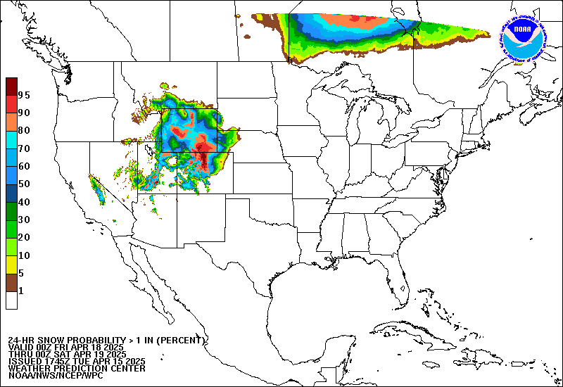 |
| Day 1 Snow | Day 2 Snow | Day 3 Snow |
 |
 |
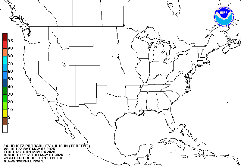 |
| Day 1 Ice | Day 2 Ice | Day 3 Ice |
Webcams & Road Conditions
Click images to enlarge
511 (in-state) or (800)-906-9069
 |
 |
 |
| I-80 at Kearney, NE | I-80 at Aurora, NE | I-80 at York, NE |
 |
 |
 |
| I-80 at Cozad, NE | I-80 at Lexington, NE | South of Clay Center, NE |
511 (in-state) or (866)-511-5368
 |
 |
 |
| US-183 at Stockton, KS | US-36 at Lebanon, KS | US-81 at Belleville, KS |
 |
Travel Information for the Rest of the U.S.
Temperature & Wind Chill
Observed Snow Estimates
Click to Enlarge
 |
 |
 |
| 24-Hour Snowfall | 48-Hour Snowfall | 72-Hour Snowfall |
 |
 |
|
| 24-Hour Liquid Equivalent | Current Snow Depth | Season Total Snow |
More Precipitation and Snow Observations
Interactive 24, 48 & 72-Hour Snow Maps
Safety & Preparedness Information
Click to Enlarge
 |
 |
 |
|
| Are you prepared at home? | Is your vehicle prepared? | Are you prepared to travel? | |
 |
 |
 |
|
| Dangers of wind chill | What is frostbite? | What is hypothermia? | |
 |
 |
 |
|
| Avoid winter weather dangers! | Dress properly to go outdoors! | What if I am trapped outside? | |
 |
 |
||
| What if I am trapped in my car? | What if I am trapped indoors? | ||
 |
Media use of NWS Web News Stories is encouraged! Please acknowledge the NWS as the source of any news information accessed from this site. |
|