Two Days of Intense Winds - January 14th and 15th, 2021
|
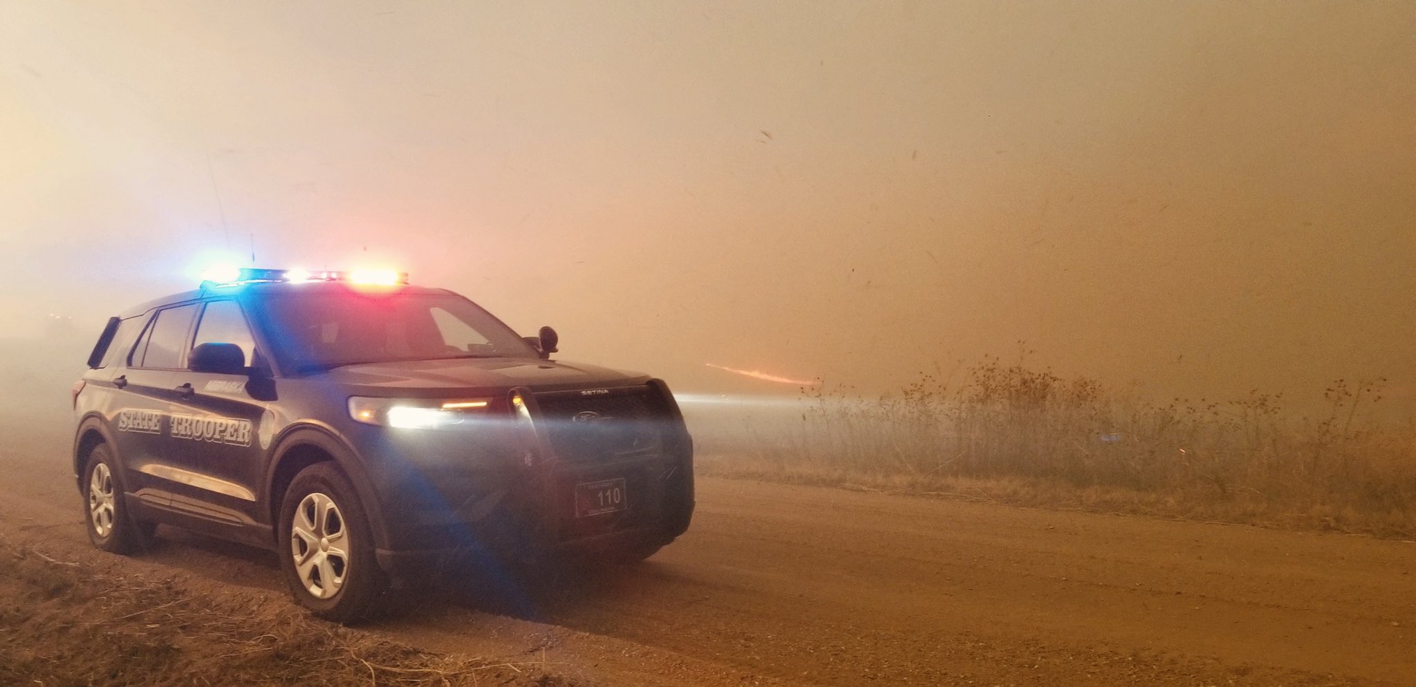
Intense northwest winds pummeled the Central Plains for two consecutive days on January 14th and 15th, with severe wind gusts of 58 to 70 mph common across much of south central Nebraska and north central Kansas. An upper low pressure system moving inland from the Pacific Northwest deepened across the Plains states and sent a strong cold front southward across our region. The combination of dry weather with low relative humidity and the intense winds provided favorable conditions for the spread of wildfires, and a grass fire developed five miles north of Guide Rock, NE and quickly spread for eight miles before it was extinguished two miles west of Bostwick. The fire and smoke plume were visible on weather satellite, radar and was also seen on the NDOT web camera. Two days of fierce northwest winds also produced areas of damage including downed tree limbs, damage to buildings and also toppled high profile vehicles. |
 January 14, 2021 - Grass fire near Guide Rock, NE photo by Nebraska State Patrol |
Winds
Here is a summary of the strongest wind gusts on both January 14th and January 15th. Numerous locations saw severe wind gusts of 58 mph or greater with wind gusts reaching as high as 70 mph. High Wind Warnings were in effect both days due to the extreme winds.
 |
 |
 |
| Peak Wind Gusts January 14, 2021 | Peak Wind Gusts January 15, 2021 | January 14th and 15th, 2021 Top Windiest Days at Grand Island |
Grass Fire
On January 14, 20201, a grass fire started in a corn field around the intersection of Highway 78 and Road L, which is approximately five miles north of Guide Rock. Due to the strong winds and dry conditions, the fire quickly traveled spread and crossed Highway 78 and moved southeast and into southwest Nuckolls County, crossing Highway 136 near the Webster and Nuckolls County line. Highway 136 was closed from Highway 14 to Highway 78 for a period of time. Several farmsteads and structures had to be protected from the fire, which got within a few feet of houses, but no structures were actually burned. Residents were evacuated from the fire and there were no personal injuries, however some cattle were casualties from the fire.
 |
 |
 |
 |
| January 14, 2021 Grass fire near Guide Rock photo by Nebraska State Patrol |
January 14, 2021 Fire near Guide Rock photo by Nuckolls County Sheriff Dept. |
January 14, 2021 Smoke from grass fire near Guide Rock photo by Nuckolls County Sheriff Dept. |
January 14, 2021 Smoke from grass fire near Guide Rock photo from NDOT web camera |
 |
 |
 |
 |
| January 14, 2021 Smoke from grass fire near Guide Rock photo by Nuckolls County Sheriff Dept. |
January 14, 2021 Fire near Guide Rock photo by Nuckolls County Sheriff's Office |
January 14, 2021 Fire near Guide Rock photo by Webster County Sheriff |
January 14, 2021 KUEX radar shows the smoke plume from the fire |
Damage Photos
Here is a look at some of the damage from the strong winds on January 14th and 15th. The strong winds toppled high profile vehicles and damaged trees and buildings.
 |
 |
 |
| January 14, 2021 East of Minden on Hwy 6 photo by Nebraska State Patrol |
January 15, 2021 Hampton Interchange photo by Aurora News Register |
January 15, 2021 Lexington, NE photo by Brain Neben |
 |
 |
| January 15, 2021 Tree limbs down in Clay Center photo by Clay County Emergency Manager |
January 15, 2021 2E Pauline, NE Photo by Jesse Wirtes |
Environment
The weather pattern aloft on January 14th and 15th shows a trough in Saskatchewan/Montana deepening over the northern and central plains and closing off over Iowa. Intense winds developed on the back side of the system. While south central Nebraska and north central Kansas saw very little snowfall (mainly flurries), blizzard conditions developed across eastern Nebraska/Kansas (and points east). To the west, the strong winds caused a dust storm across portions of western Kansas.
 |
 |
 |
 |
| 500 mb chart 00 UTC January 14, 2021 |
500 mb chart 12 UTC January 14, 2021 |
500 mb chart 00 UTC January 15, 2021 |
500 mb chart 12 UTC January 15, 2021 |
Here is a look at the surface maps and the progression of a cold frontal boundary across the Plains states.
 |
 |
 |
 |
| Surface Analysis 00 UTC January 14, 2021 |
Surface Analysis 06 UTC January 14, 2021 |
Surface Analysis 12 UTC January 14, 2021 |
Surface Analysis 18 UTC January 14, 2021 |
 |
Media use of NWS Web News Stories is encouraged! Please acknowledge the NWS as the source of any news information accessed from this site. |
 |