
A few severe thunderstorms with large hail and damaging winds are possible this evening into tonight from eastern Kansas into western and central Missouri. Thunderstorms with heavy to excessive rainfall may produce flooding through tonight over parts of the northern High Plains, central Missouri, and along the Florida/Georgia line. Read More >
Overview:
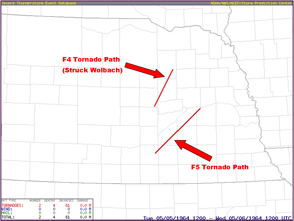
Tuesday, May 5, 1964, a historic, damaging and deadly tornado event affected several counties within central and eastern Nebraska. Within the present-day NWS Hastings coverage area, two particularly damaging/violent tornadoes occurred, one rated F5 and the other rated F4. |
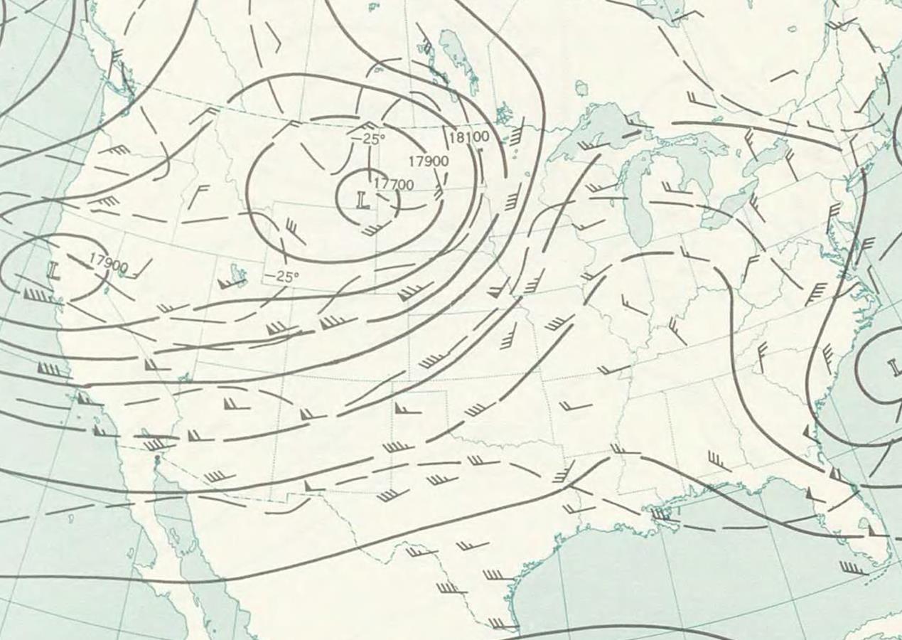
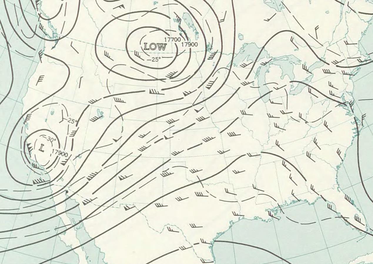
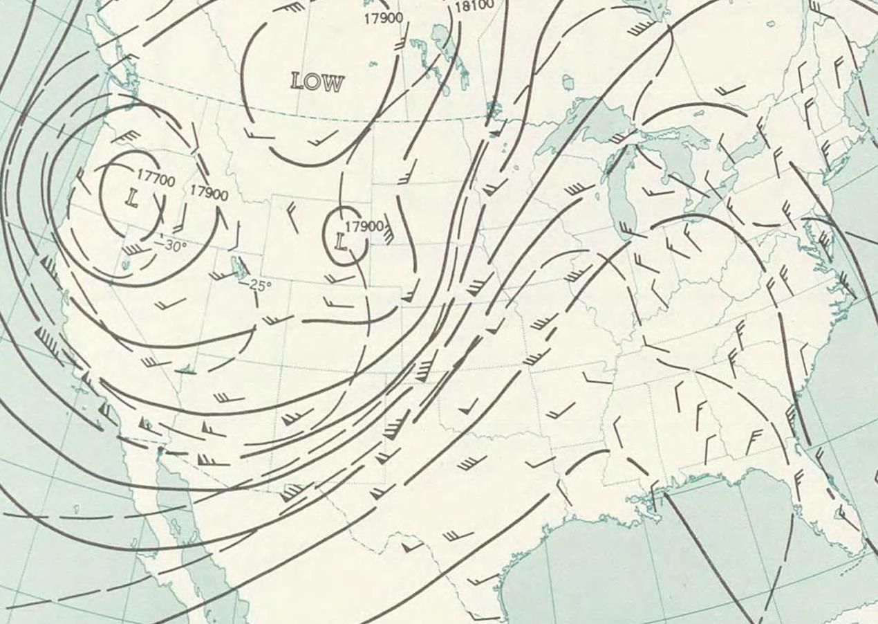
500mb Upper Air Maps:
 |
 |
 |
|
| 7 PM CDT - May 3rd | 7 PM CDT - May 4th | 7 PM CDT - May 5th | |
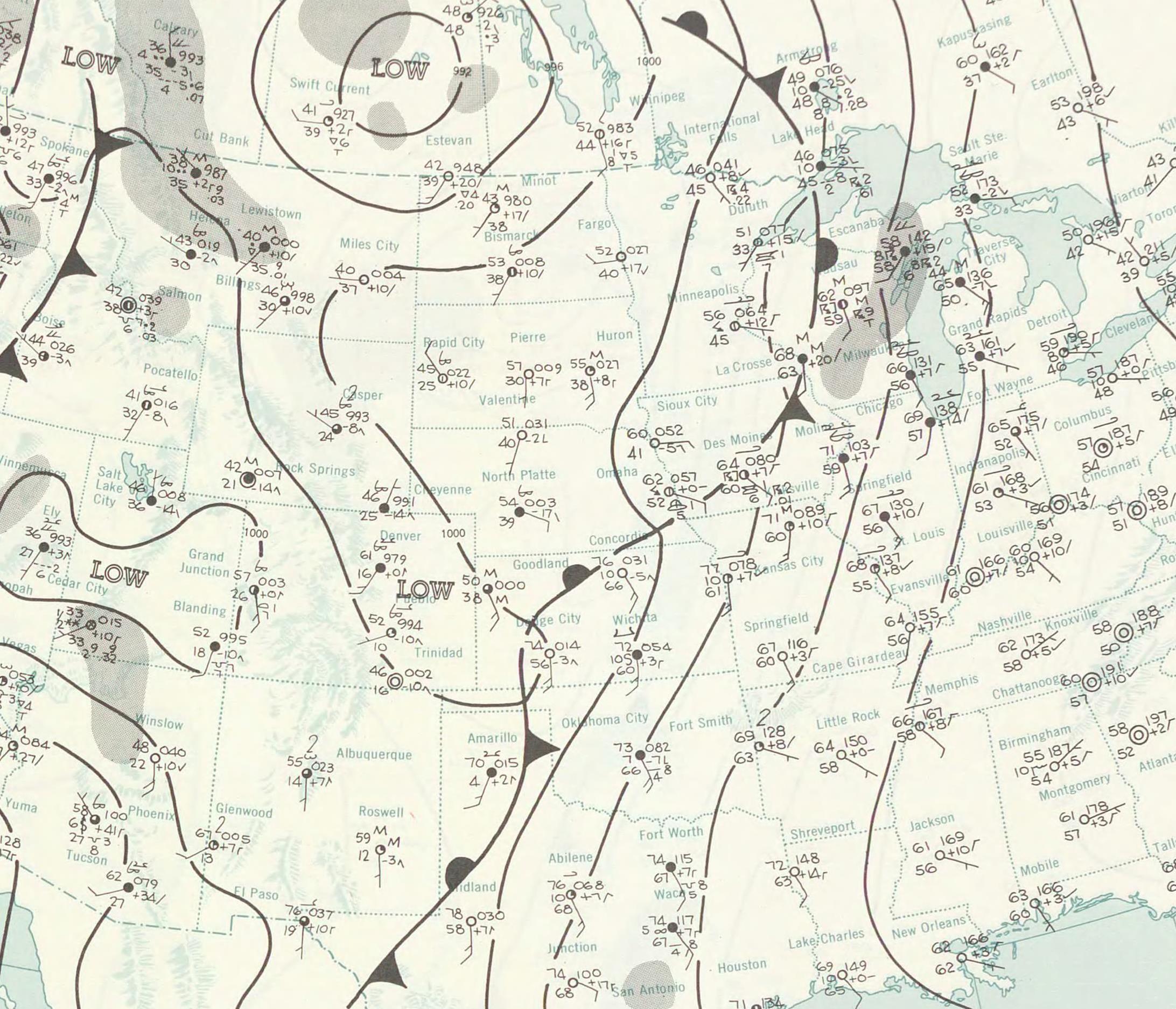
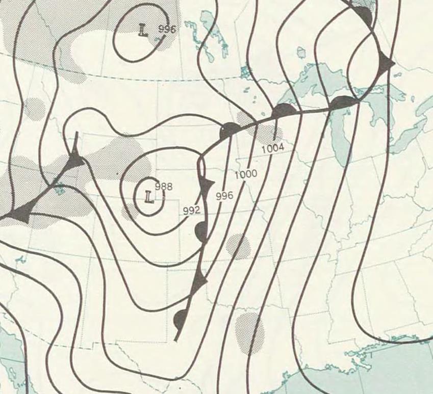
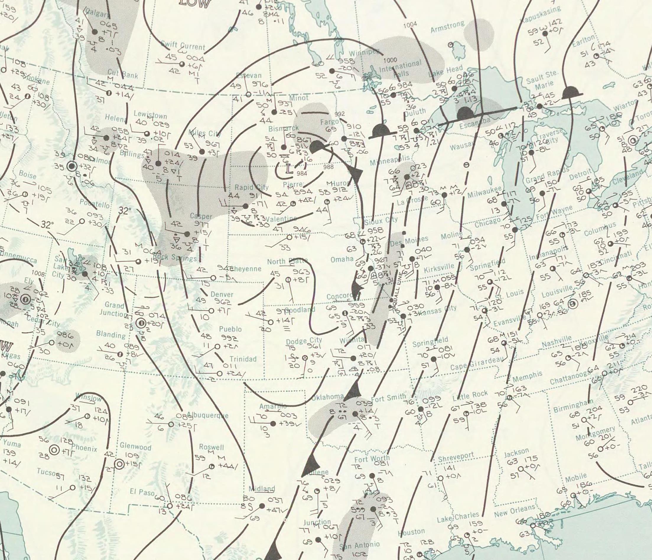
Surface Maps:
 |
 |
 |
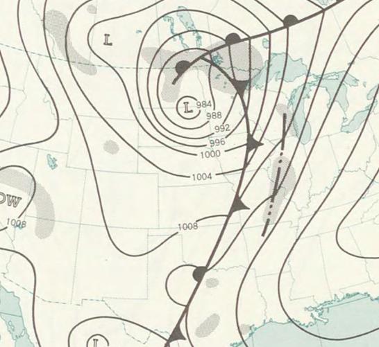 |
| 1 AM CDT - May 5th | 1 PM CDT - May 5th | 1 AM CDT - May 6th | 1 PM CDT - May 6th |
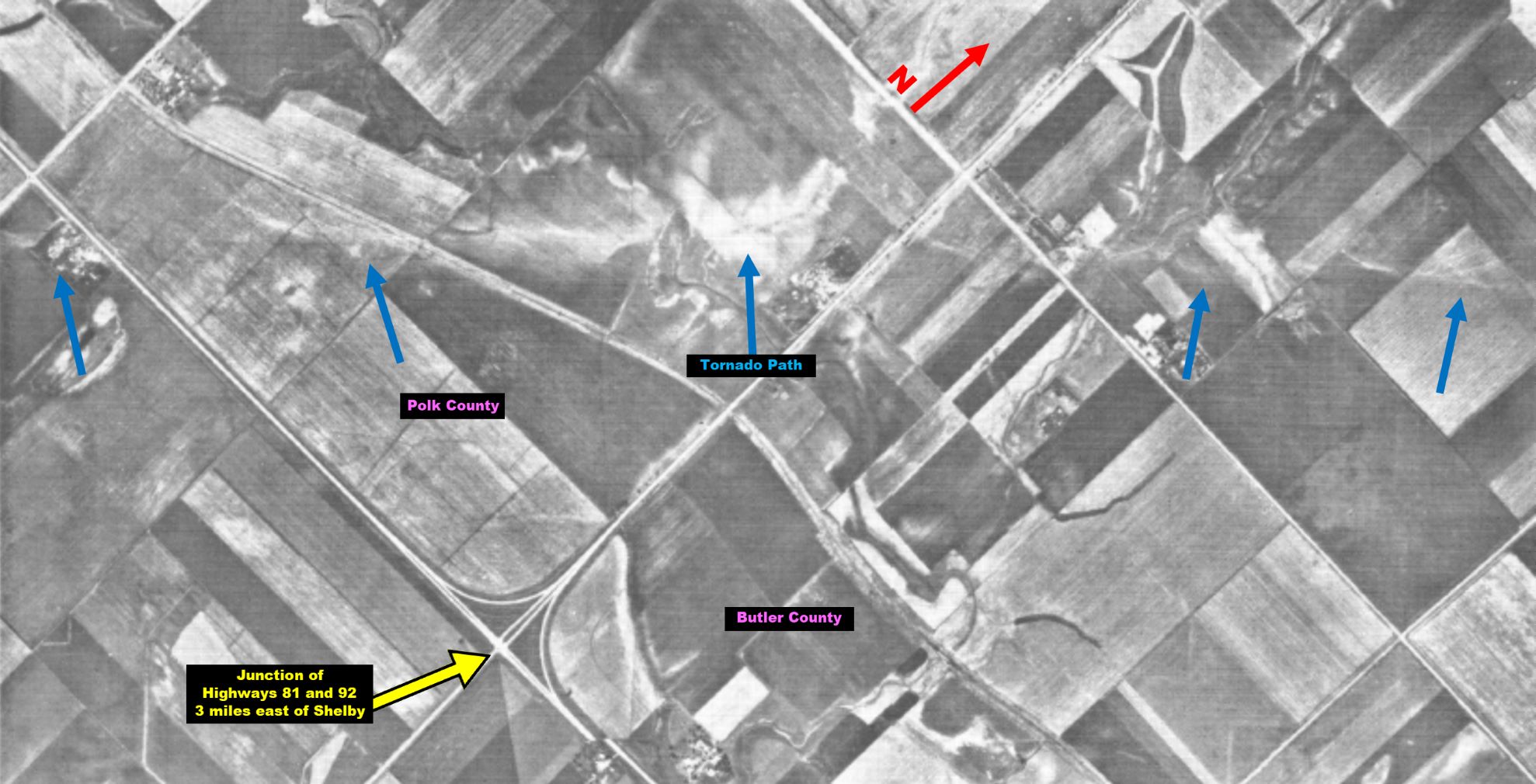
Tornado Track Information:
 |
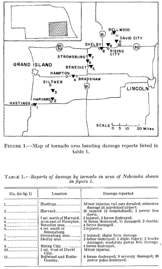 |
| Tornado track map courtesy of the Storm Prediction Center. | Damage points along the path. Courtesy of Monthly Weather Review. |
 |
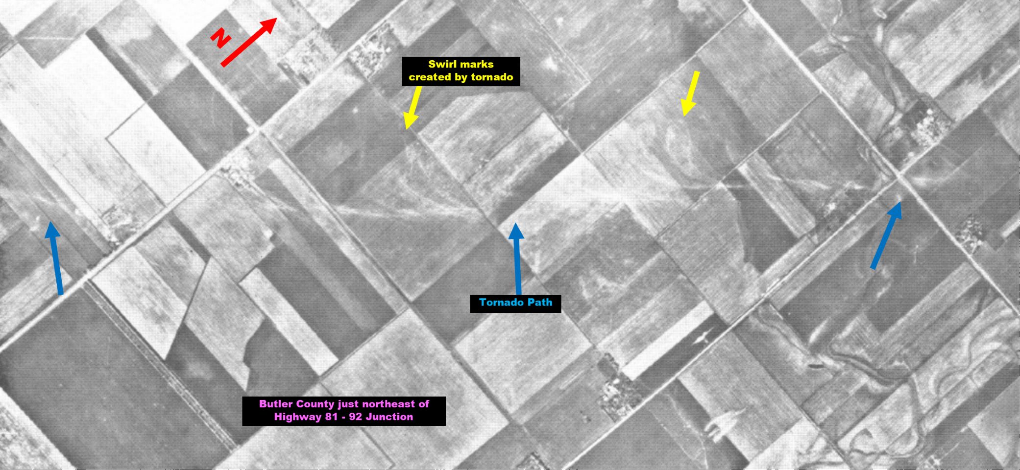 |
| Aerial tornado track images, taken near the Polk/Butler County line. Courtesy of Monthly Weather Review. | |
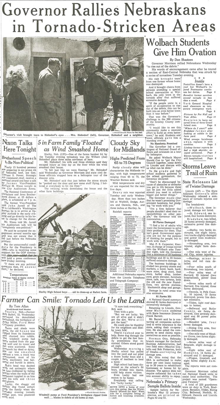
Newspaper Articles & Images:
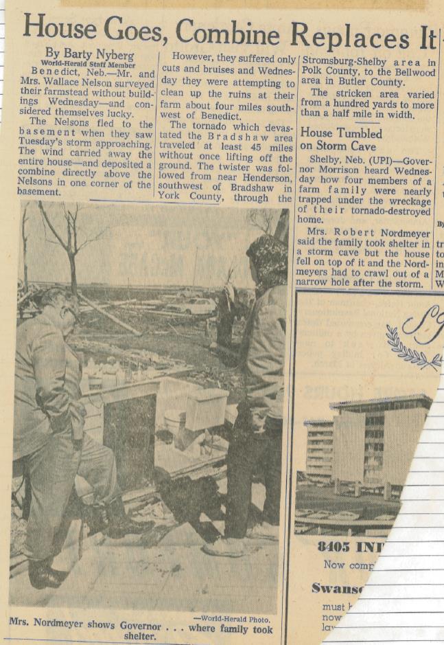
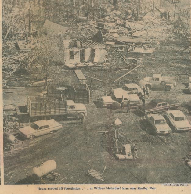
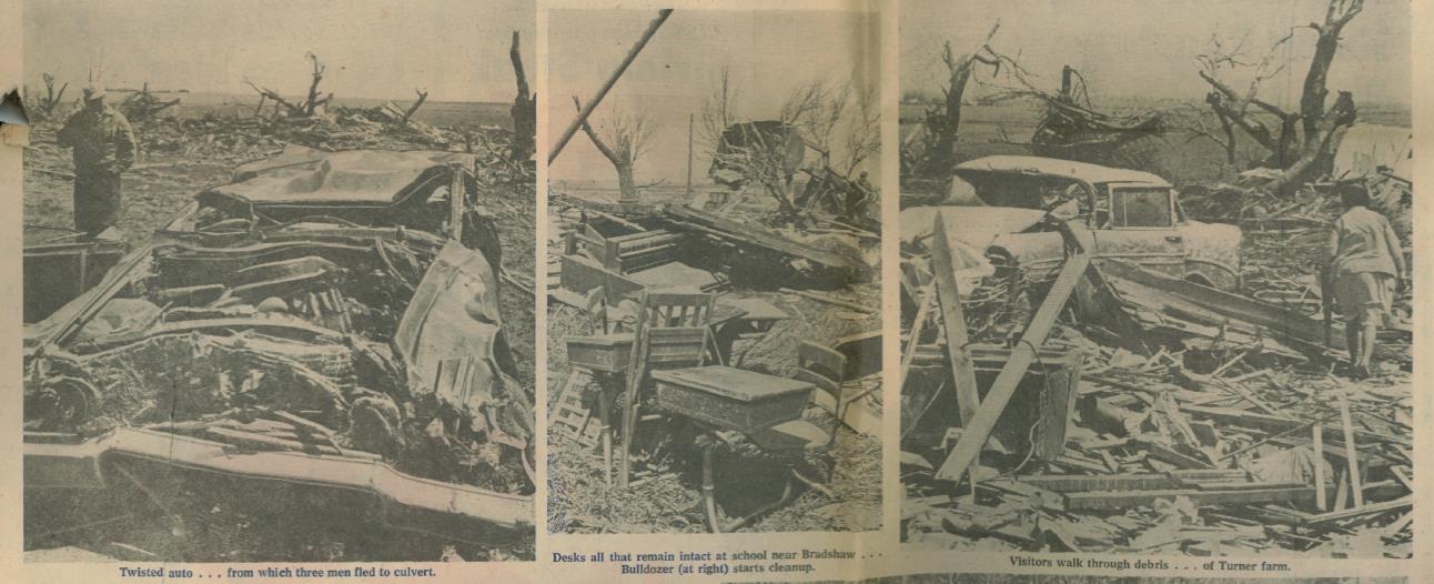
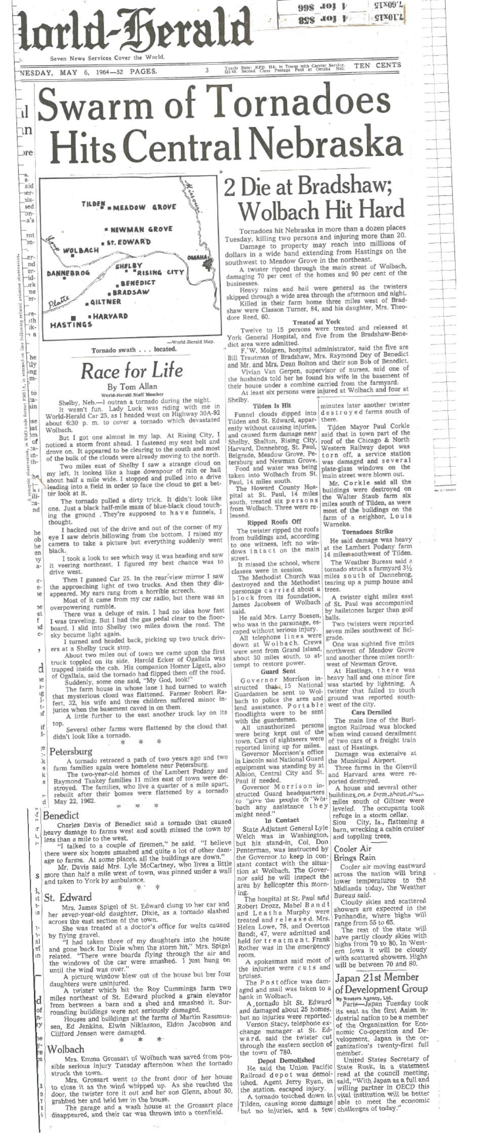
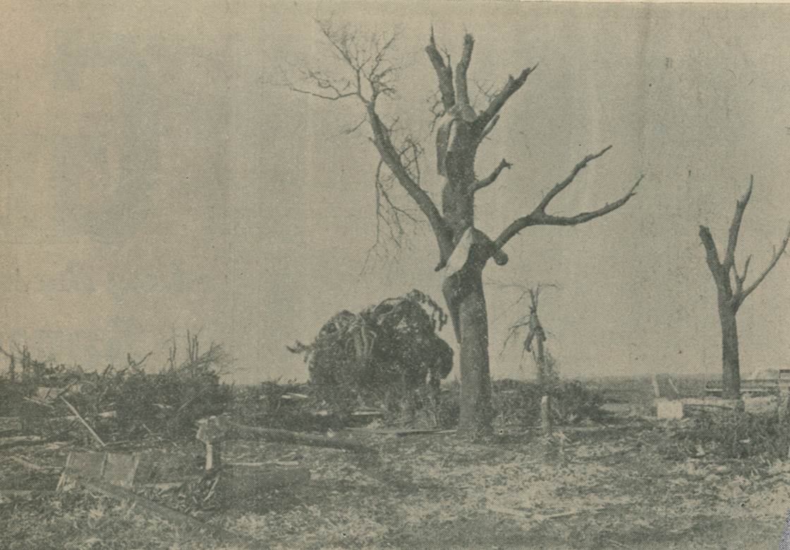
The following images are from the Omaha World Herald, dated May 6-7, 1964.
 |
 |
 |
 |
 |
 |
 |
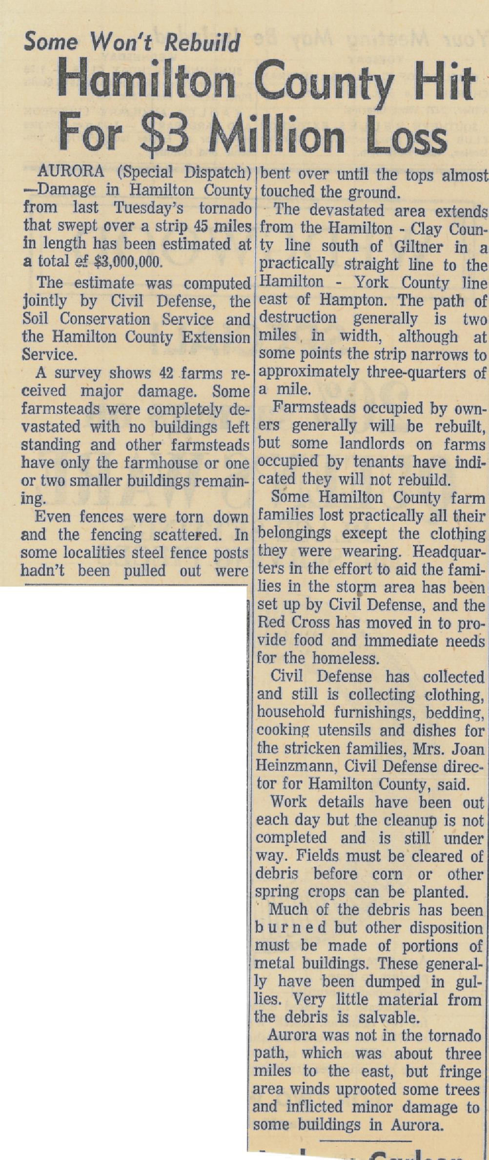
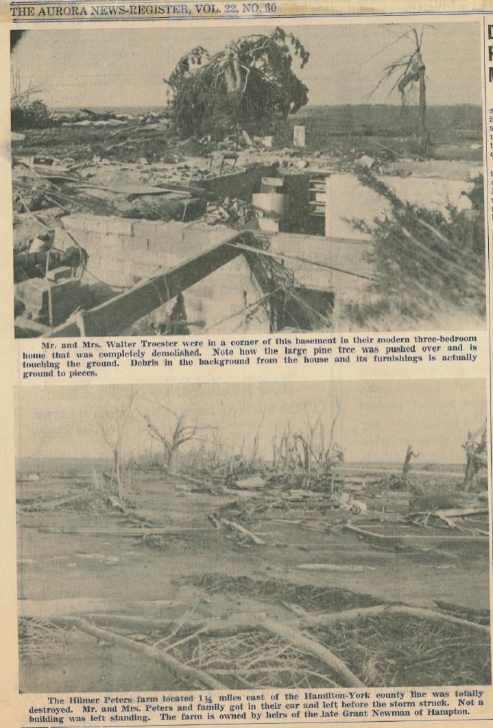
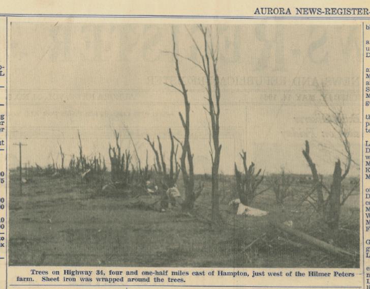
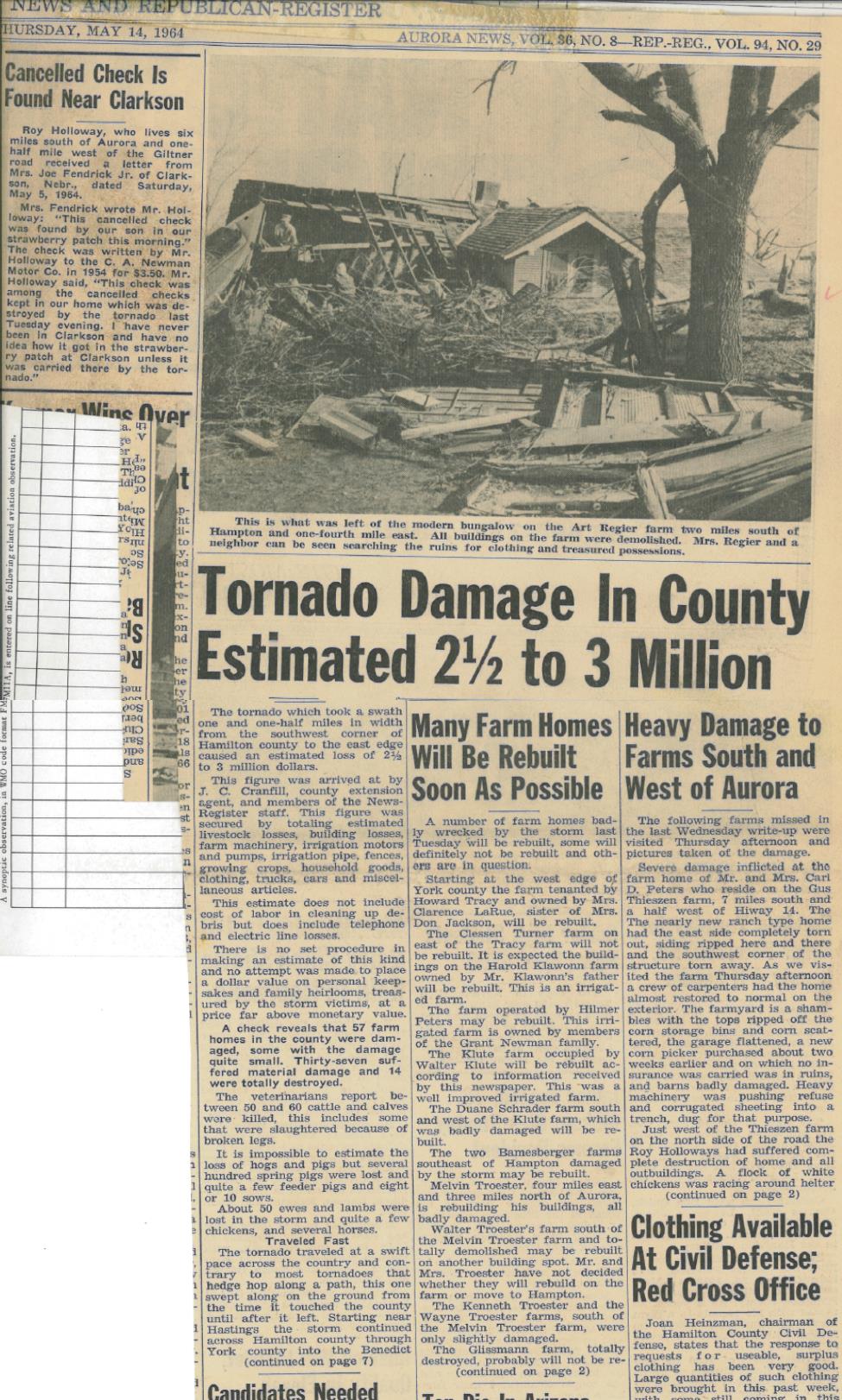
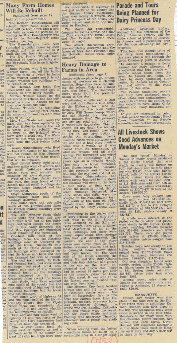
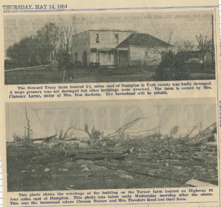
The following images are from the Aurora News-Register, dated May 14, 1964.
 |
 |
 |
 |
 |
 |
 |
 |
Media use of NWS Web News Stories is encouraged! Please acknowledge the NWS as the source of any news information accessed from this site. |
|


