Severe thunderstorms producing damaging winds are most likely over parts of the Dakotas into Minnesota from this afternoon into the overnight, with other isolated storms producing hail or wind over the northern High Plains. In the Northern Plains into the Upper Great Lakes and Mid-Atlantic, heavy to excessive rain may bring flash and urban flooding through Wednesday. Read More >
Overview:
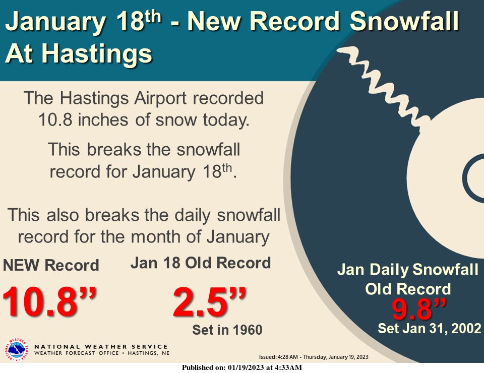
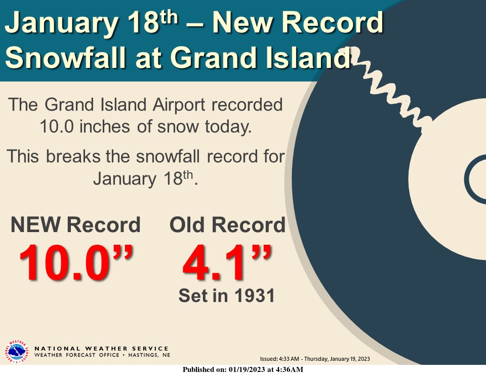
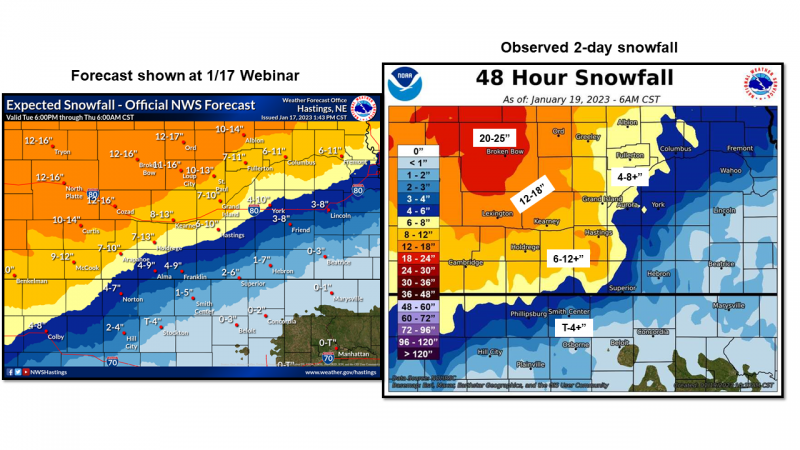
On Wednesday, Jan. 18, 2023, a significant winter storm impacted the NWS Hastings coverage area, bringing heavy snow accumulations to many places along with some freezing rain. Much of the area saw snowfall accumulations of at least 6-10 inches with the highest totals of 15-17” occurring along a line from Lexington to Ord. A secondary maximum was found between Hastings and Kearney with accumulations of 12-14”. To the southeast of the Tri-Cities, mixed precipitation and dry air led to a sharp dropoff in snowfall. Snowfall accumulations of 3-4 " occurred along a line from Clay Center to Superior NE, and Hebron received only 1.8 inches of snow.
Snow began early in the morning on the 18th, with locations west of Highway 281 seeing the first snow accumulations. Heavy snowfall closed Interstate 80 from Kearney to the Wyoming border by 6:30am. Precipitation began in Hastings and Grand Island as freezing rain, with overall light icing/limited impacts. Around noon, mixed precipitation over the Tri-Cities abruptly transitioned to intense heavy snow with 2-3”/hour snow rates! These intense snowfall rates allowed Hastings to receive 10.6" of snow just between 12-6 pm! Snow began to let up across the Tri-Cities after 6 pm, and accumulations came to an end for most locations by sunrise on Thursday the 19th.
While lingering falling snow ended early on the 19th, the heavy snowfall accumulations across the area kept many roads impassable throughout most of the day, with Interstate 80 finally re-opening at 7pm.. Portions of Highway 30 (along with several other rural highways) remained closed all day Thursday and even into Friday the 20th. Additional impacts included numerous school, civic, business, and church closings on both Wednesday (the 18th) and Thursday (the 19th). Some school closures and late starts even lingered into Friday, particularly within rural areas and areas that received the heaviest snow.
The heavy snow in the Tri Cities broke multiple official records:
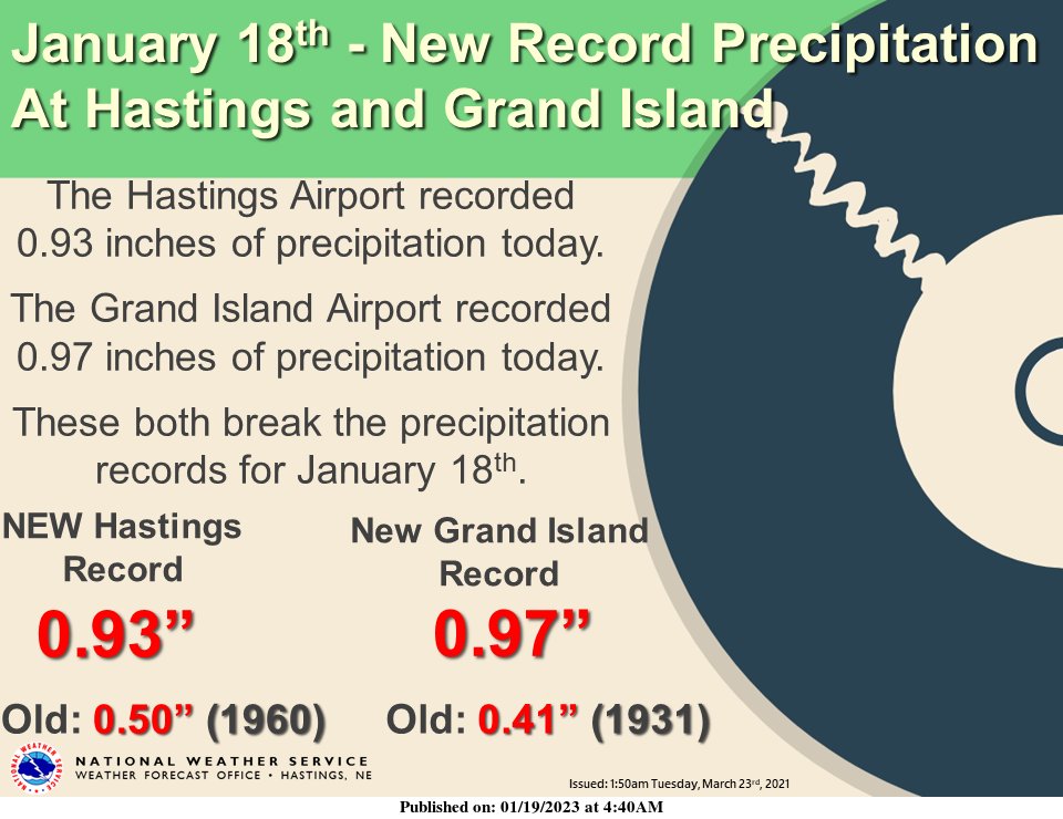
- Hastings broke a record for total precipitation for January 18th, with 0.93” easily beating the previous record of 0.50 in 1912”. Hastings also set a new record snowfall for January 18th with 10.8" (previous record 2.5”). More notably, this was also is the highest single-day snowfall for ANY JANUARY DAY in Hastings (previous record 9.8” on Jan. 31, 2002).
- Grand Island broke its record for January 18th total precipitation with 0.97” (previous record 0.41" in 1931). Grand Island’s 10" of snow also broke the daily record for the 18th, but fell just shy of the highest single-day snowfall record for the month of January (10.5” on Jan. 31, 2002).
Adding to the impressive nature of these new snowfall records was the fact that the vast majority of snow fell within only a 6-8 hour period!
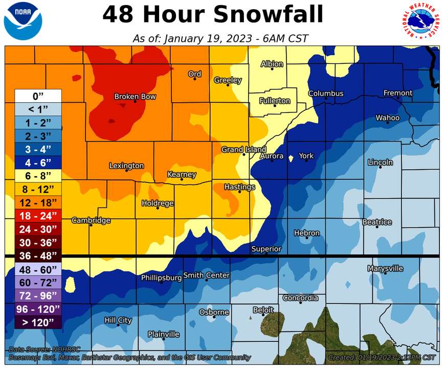
Map of Storm Total Snow Amounts:
Snow amounts of 10" (or more) were most common from around the Tri-Cities and especially off to the west and north. The heaviest snowfall of 14-17" occurred along and northwest of a line from Elwood, to Pleasanton, to North Loup in central Nebraska. A sharp gradient in snow amounts and decrease was noted along and southeast of a line from Phillipsburg, Kansas to York, Nebraska. Some places in Rooks, Osborne, Jewell, and Mitchell Counties in north central Kansas received around 1" (or less) snow.
 |
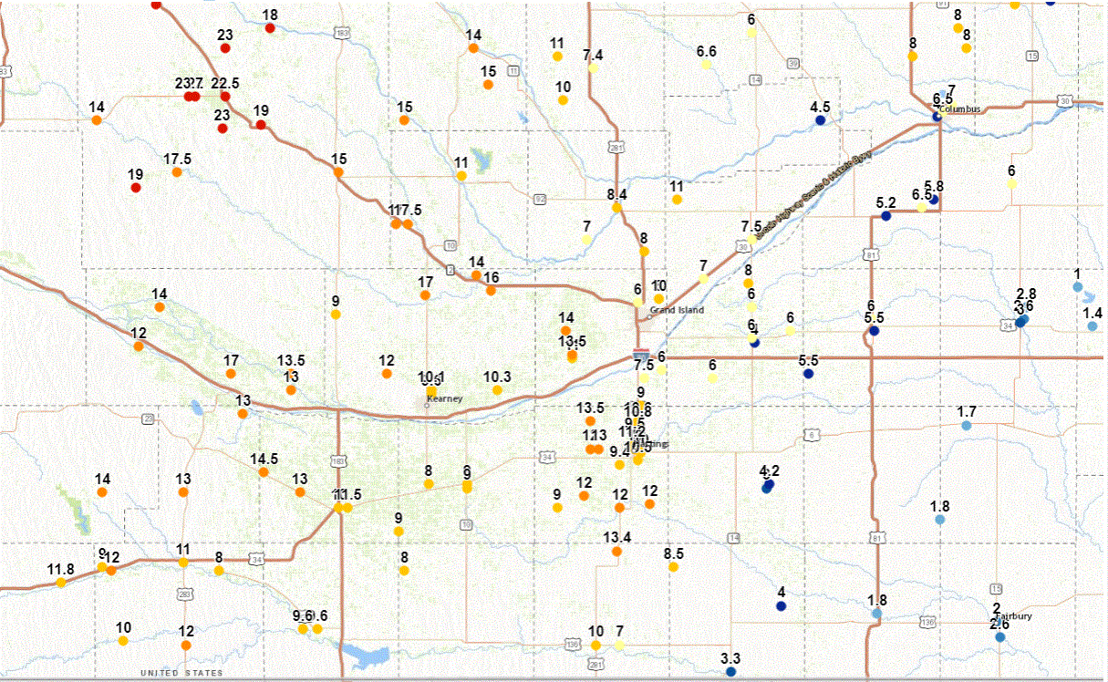 |
List of Snowfall Reports:
Complete list of reports as of 2:30PM CST on Thursday, January 19, 2023
|
|
Records
 |
 |
 |
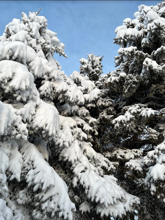
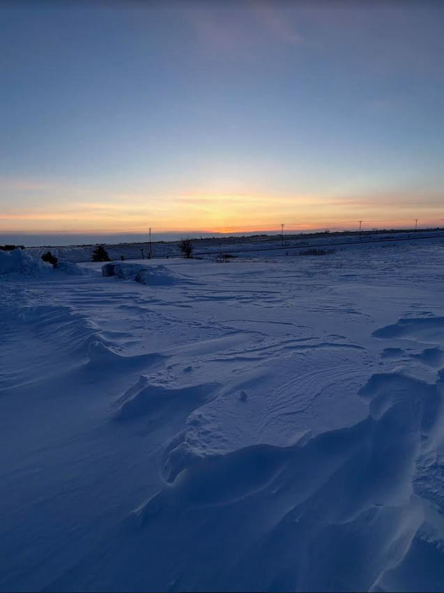
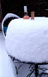
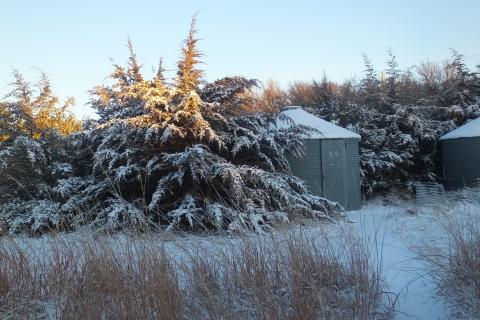
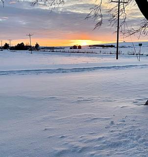
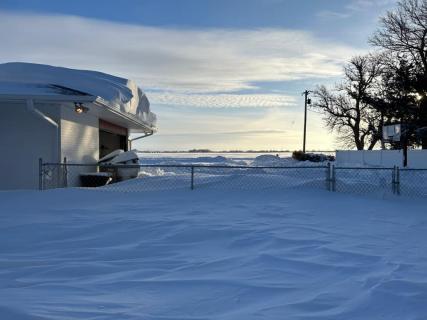
Photos
 |
 |
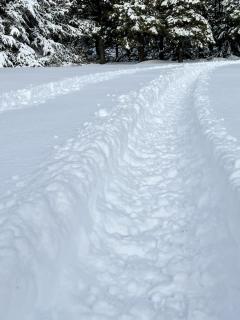 |
 |
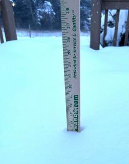
| Hastings Credit: Deb Boesen |
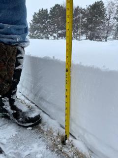
Pleasanton Credit: Bonnie Busch |
5.5N Heartwell Credit: Sarah Armbruster |
Bertrand Credit: Juli Morris |
 |
 |
 |
 |
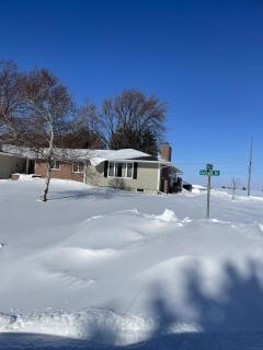
| Holdrege Credit: Todd Veal |
6E Phillipsburg Credit: David Roberts |
Sumner Credit: Kyle Davis |
1.5S Wood River Credit: Brittany Skeen |
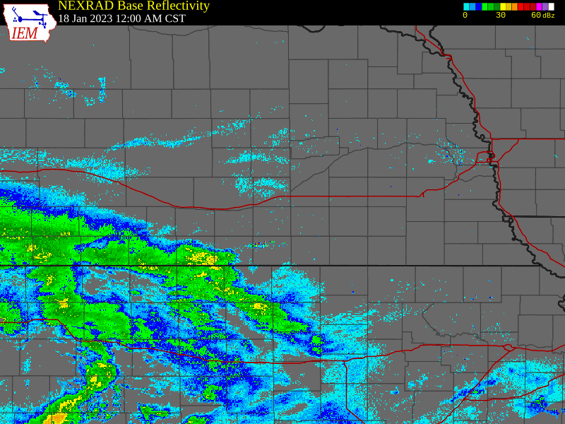
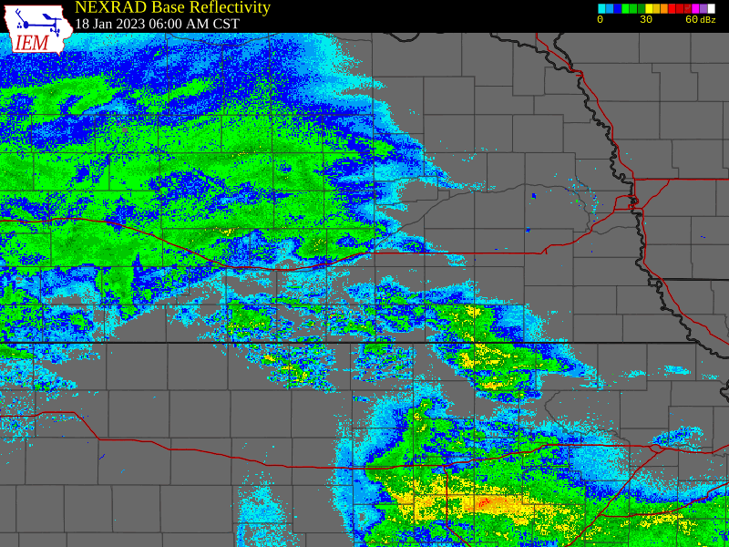
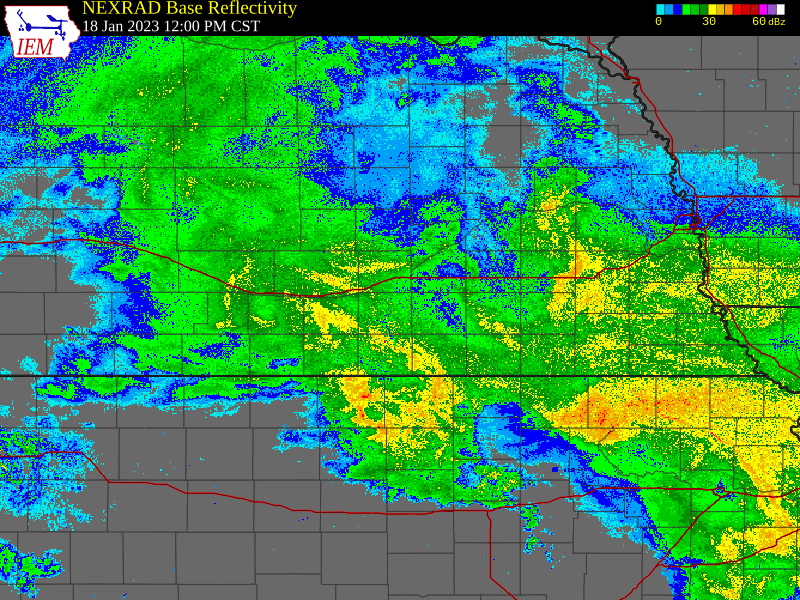
Radar Summary:
Below are 6-hour radar loops, covering the entire calendar day of Jan. 18, 2023. Data courtesy of IEM.
Precipitation expanded SW to NE across the area late Tuesday night into early Wednesday morning. Peak snowfall rates were during the daytime hours Wednesday, particularly from around midday through the afternoon. Snow coverage and intensity tapered off Wednesday evening.
 |
 |
 |
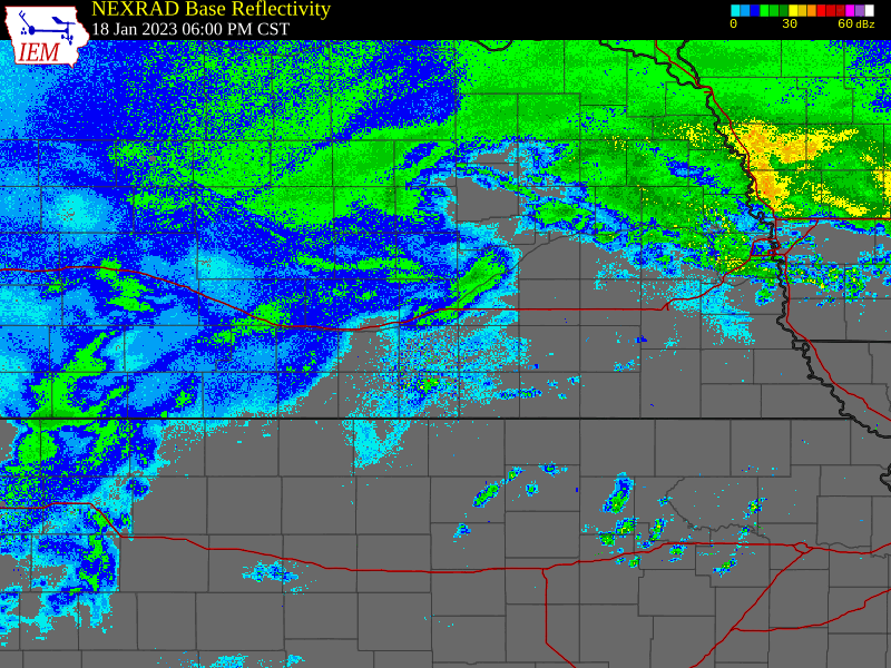 |
| Midnight to 6AM Wed., Jan. 18, 2023 | 6AM to Noon Wed., Jan. 18, 2023 | Noon to 6PM Wed., Jan. 18, 2023 | 6PM Wed. Jan. 18 to Midnight |
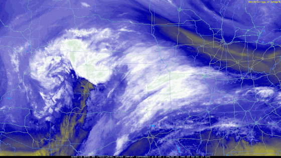
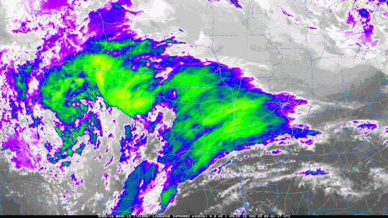
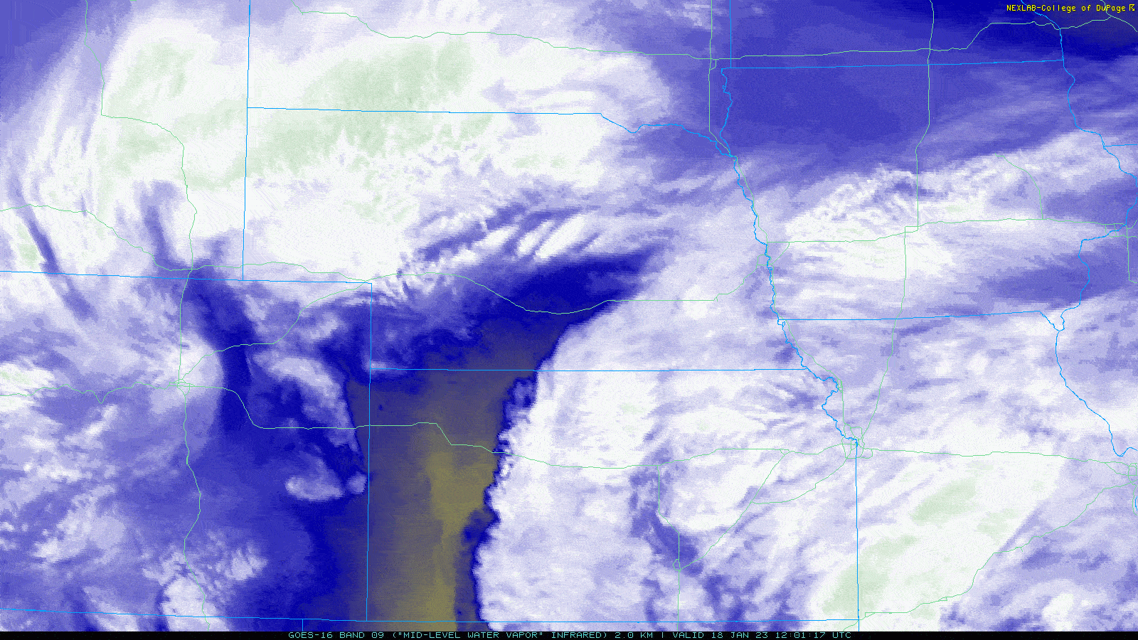
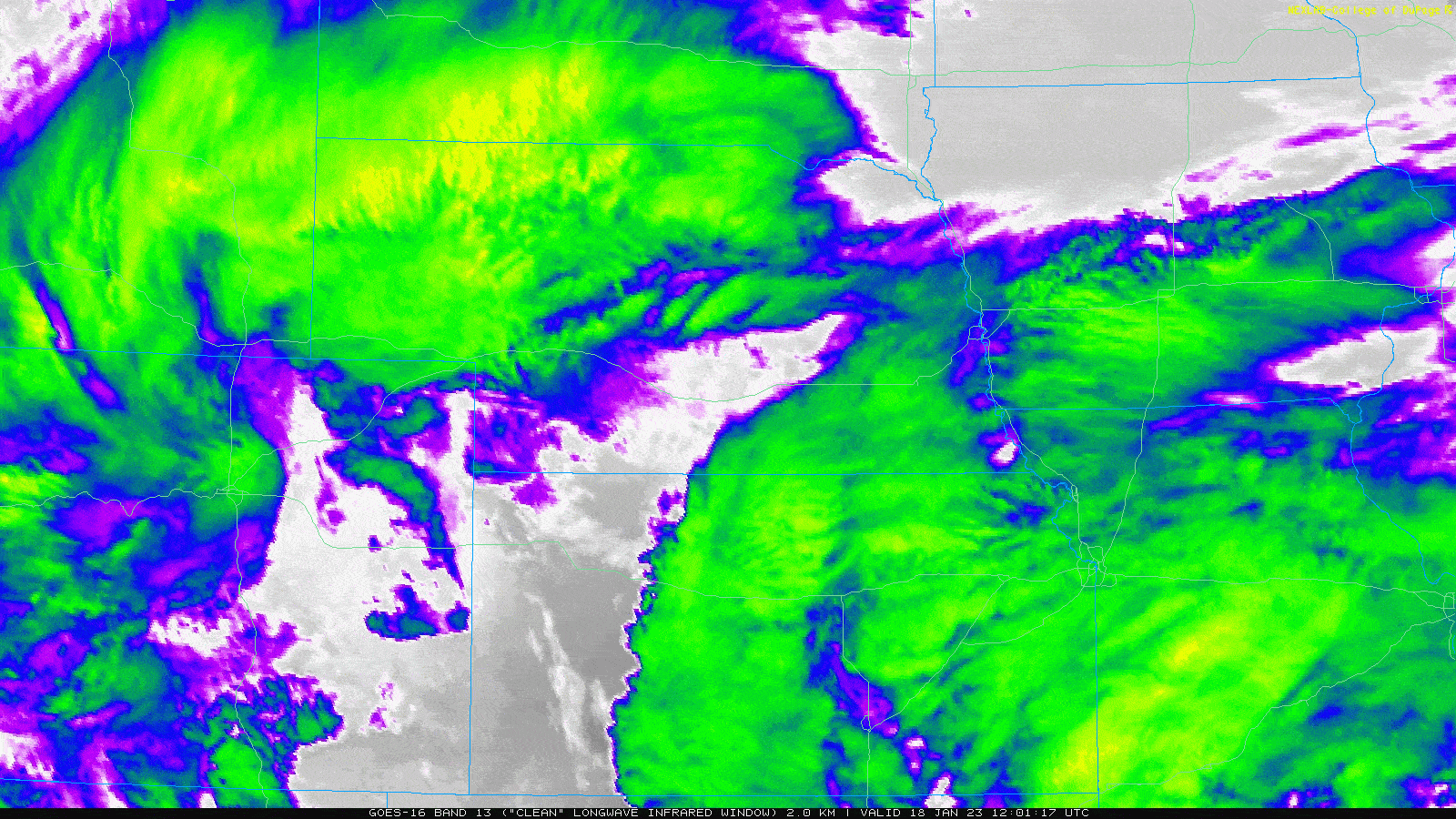
Satellite:
Data courtesy of College of DuPage NEXLAB
|
Water Vapor Loop from 10PM Tues (Jan. 17) to 5AM Thurs (Jan. 19) |
Infrared Loop from 10PM Tues (Jan. 17) to 5AM Thurs (Jan. 19) |
|
Water Vapor Loop from 6 AM to 6 PM Wed. (Jan. 18) |
Infrared Loop from 6 AM to 6 PM Wed. (Jan. 18) |
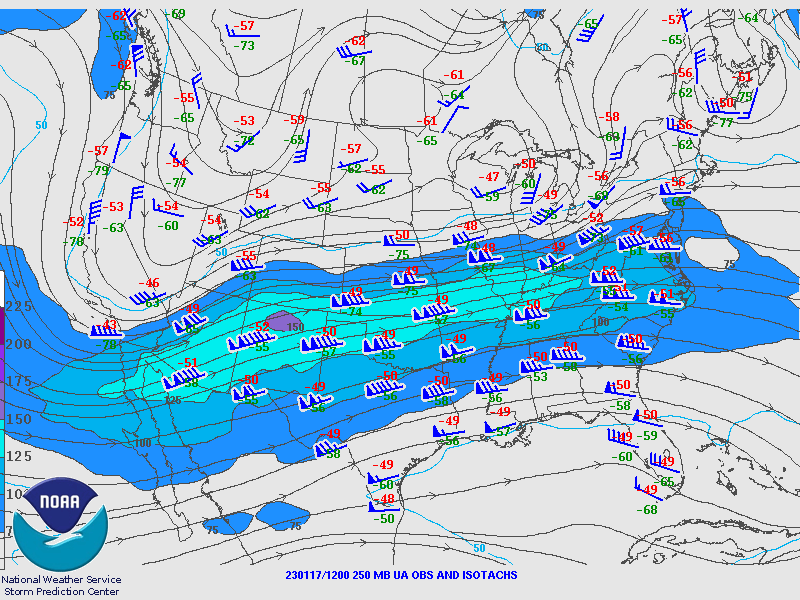
Environment:
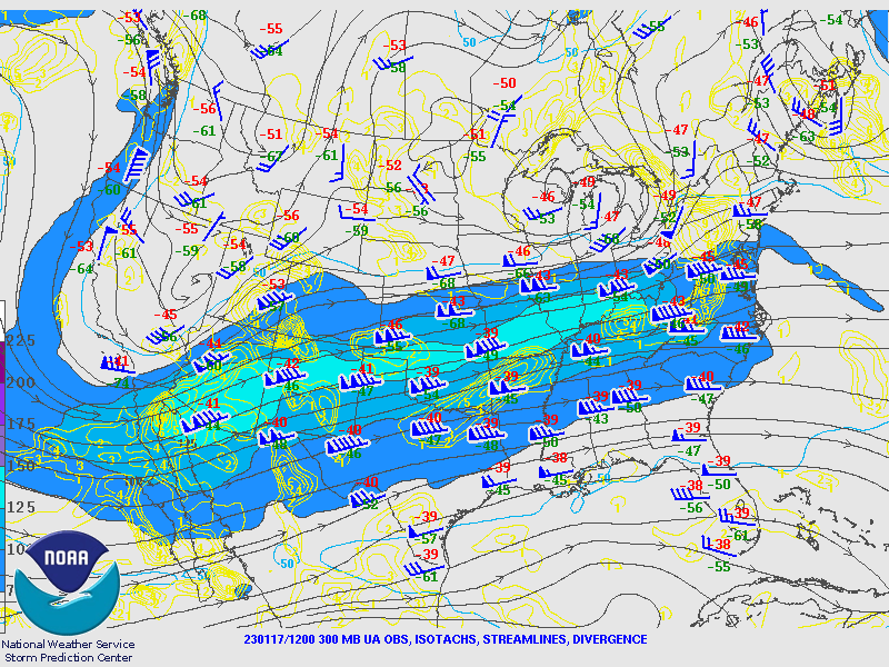
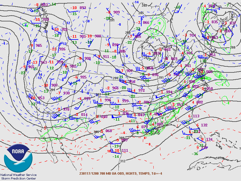
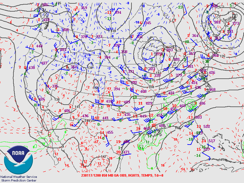
Upper Level Charts
 |
 |
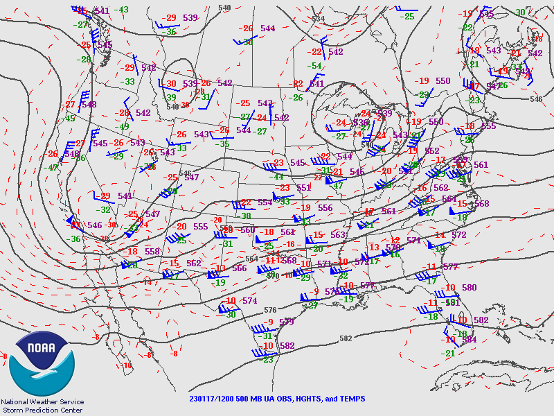 |
| 250mb (Highest Altitude) | 300mb | 500mb |
 |
 |
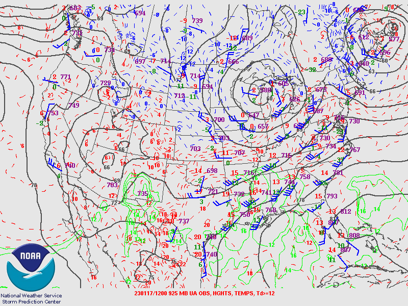 |
| 700mb | 850mb | 925mb (Lowest Altitude) |
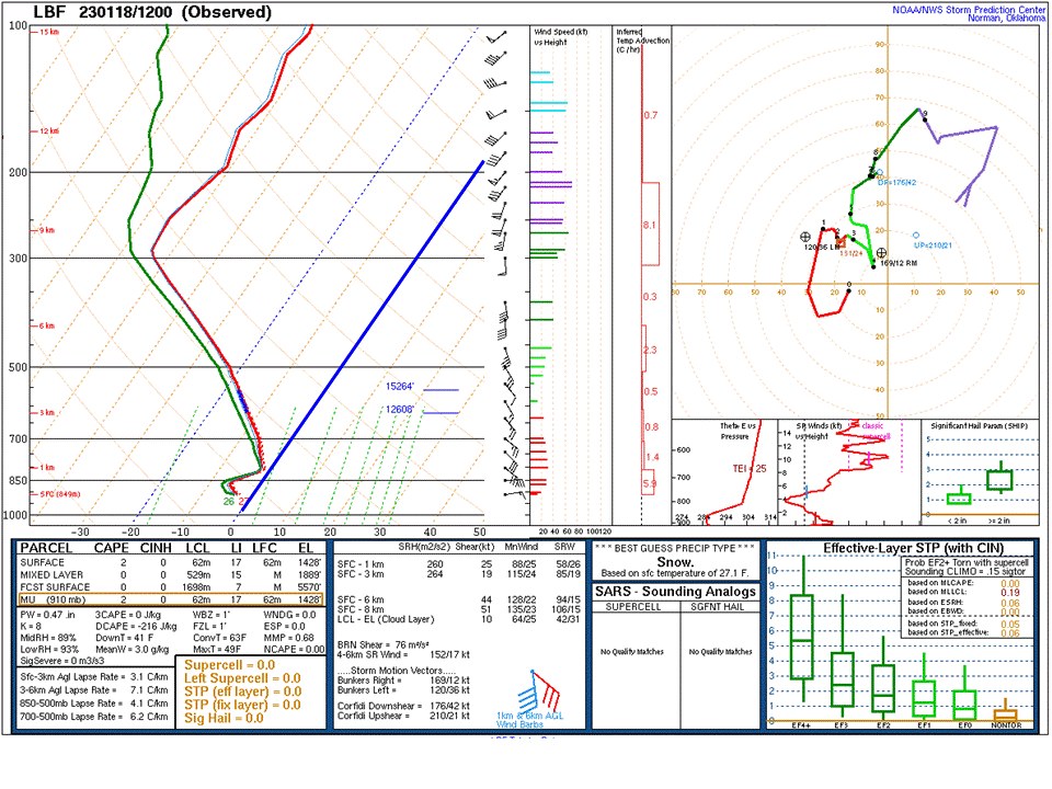
Nearby Upper Air Soundings (Balloon Measurements)
While we at NWS Hastings do not launch balloons for upper air observations, we can still glean information from nearby offices that do:
Balloon launches from NWS North Platte served as a good proxy for the environment in our W/NW areas that received heavy snow. LEFT of the blue line is BELOW FREEZING. RIGHT of the blue line is ABOVE FREEZING. Notice that the entire sounding remained below freezing through the entire day Wednesday and, in fact, cooled by Wednesday evening.
 |
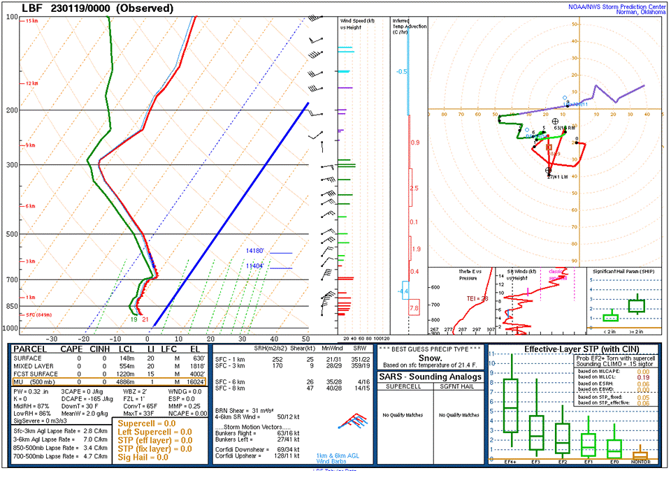 |
| 6AM Wenesday, January 18 (North Platte) | 6PM Wednesday, January 18 (North Platte) |
What about for areas that experienced a mix of freezing rain and sleet? Balloon launches from NWS Topeka and NWS Omaha served as a good proxy for these areas.
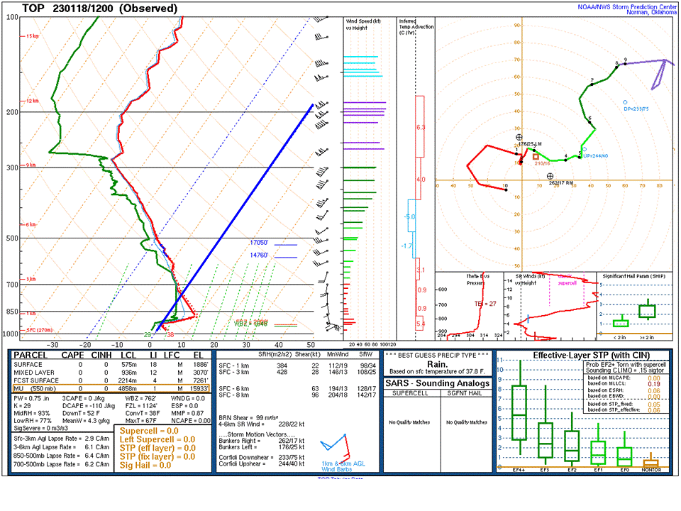 |
 |
| 6AM Wednesday, January 18 (Topeka, KS) | 6PM Wednesday, January 18 (Topeka, KS) |
Note HOW CLOSE to freezing that the layer roughly 5,000 ft above the ground remained. Even a half degree above freezing can result in sleet instead of snow!
 |
| Soundings from NWS Omaha at 5AM, 11AM, and 6PM Wednesday, January 18 |
Additional Information:
The Forecast Timeline:
Verification:
Generally speaking, this event verified well against the forecast issued on the afternoon of Tuesday, January 17th. Areas roughly along a line from Phillipsburg, KS to Hastings, NE received at or just above the high end of forecast amounts, likely due, at least in part, to extreme snowfall rates near 3"/hour. As expected, a sharp gradient from higher to lower snowfall amounts bisected the forecast area, as some areas in north central Kansas received less than 1".
*** Impressive fact to note: There was ~10" difference in snow amounts over only 20 to 25 miles along Highway 6 corridor between central Adams County and central Clay County in south central Nebraska!***
 |
Media use of NWS Web News Stories is encouraged! Please acknowledge the NWS as the source of any news information accessed from this site. |
|