Severe thunderstorms will be possible from the central Plains to the Mid-Atlantic and Northeast on Monday. Hazardous heat will linger across the southern U.S. and build across the West through mid-week. Hot and dry conditions will fuel fire weather concerns for Interior Alaska and the Four Corners region through Monday. Read More >
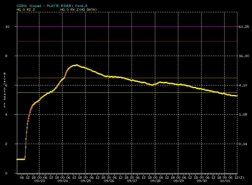
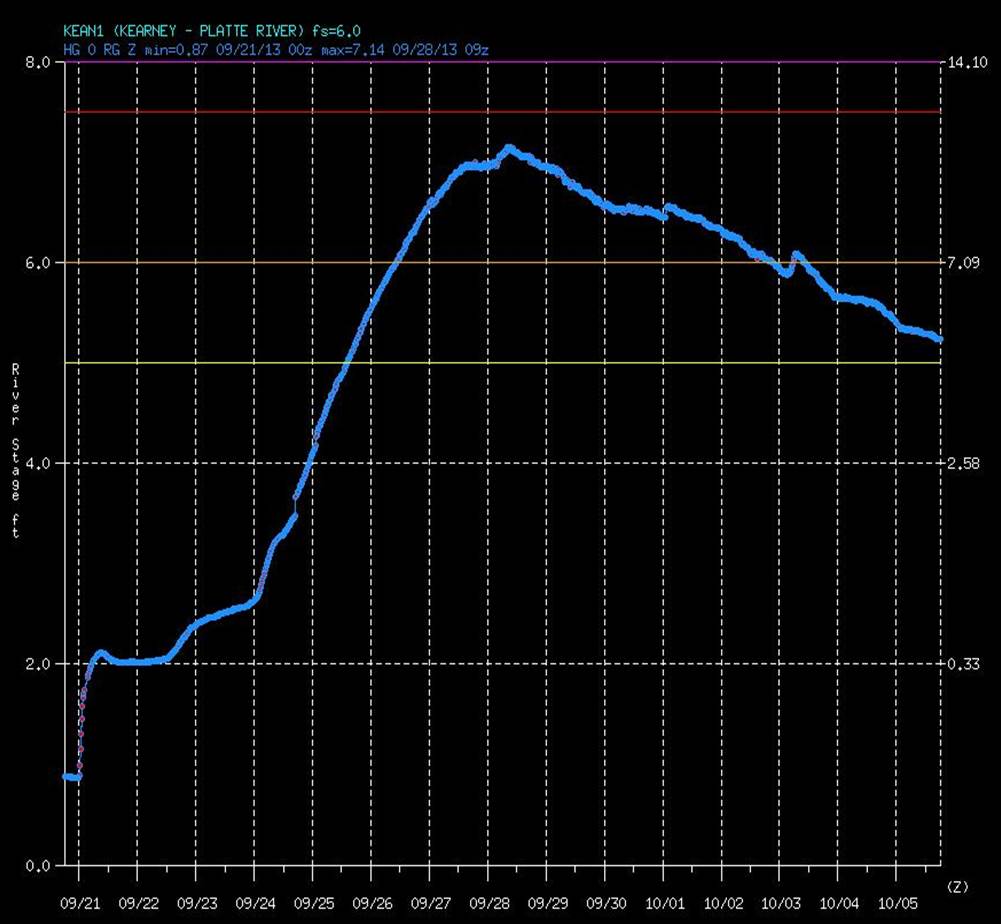
Below is more information about the basin that feeds into South Platte River, which meets up with the North Platte River just east of North Platte, Nebraska, then becoming the Platte River through the remainder of Nebraska. Then follows information about each of the river gages along the Platte that affect South Central Nebraska, located near Cozad and Overton in Dawson County, Kearney in Buffalo County and Grand Island in Hall County. A hydrograph showing the rise and fall of each gage as the water passed is shown, as well as "before and after" photos. |
||||||||||||||||
South Platte River Basin  |
||||||||||||||||
|
|
||||||||||||||||
|
|
||||||||||||||||
Platte River Gage @ Kearney
|
||||||||||||||||
Platte River Gage @ Grand Island(Nebraska)
|
||||||||||||||||
| For more information see the NWS Advanced Hydrologic Prediction Service Homepage | ||||||||||||||||