Severe thunderstorms will be possible from the central Plains to the Mid-Atlantic and Northeast on Monday. Hazardous heat will linger across the southern U.S. and build across the West through mid-week. Hot and dry conditions will fuel fire weather concerns for Interior Alaska and the Four Corners region through Monday. Read More >
|
Memorial Day Severe Weather Event Widespread Damaging Winds, Some Large Hail National Weather Service Radar loop (Click Radar Loop To Enlarge)
|
 |
|
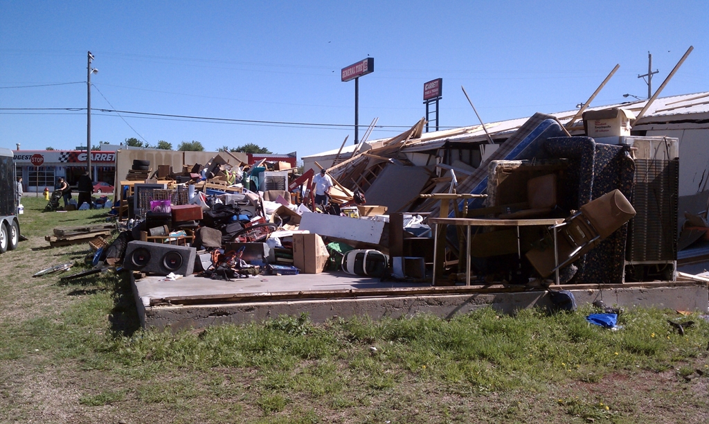
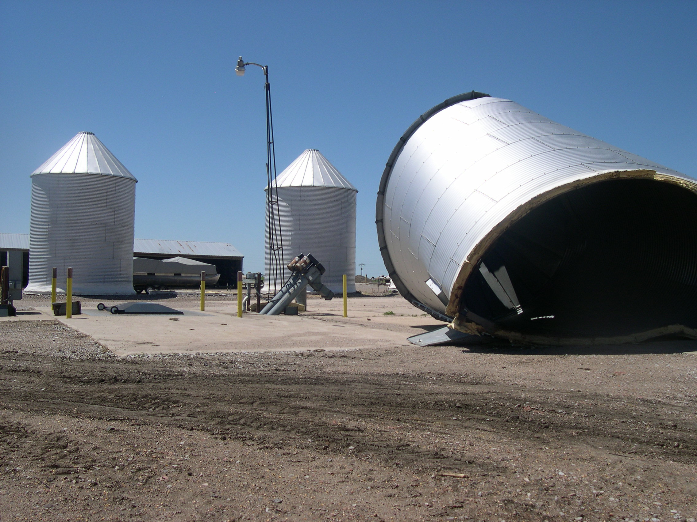
Severe Weather Summary: After a very windy Memorial Day that featured frequent southerly gusts of 45-55 MPH across much of the region, a strong cold front and upper level low pressure system took aim on South Central Nebraska and North Central Kansas during the evening hours, spawning an expansive line of strong to severe thunderstorms that marched across much of the NWS Hastings county warning area. Although there were some areas that saw hail to the size of quarters or larger, by far the biggest impact from these storms was widespread and very damaging straight-line winds, with gusts in the 60-90 MPH range in some areas, and possibly locally higher. Along the leading (front) edge of this line of storms, there were also several reports of tornadoes. However, based on accounts from storm spotters and chasers, many of these tornadoes were actually GUSTNADOES associated with small-scale circulations along the gust front at the leading edge of the storms. Gustnadoes are formed by very different processes than large, violent tornadoes such as the one that recently devastated Joplin, MO. The differences between gustnadoes and "true" tornadoes are not often clear cut, as both involve rotating columns of air, but one of the primary differences is that gustnadoes are NOT connected to a parent rotating cloud base above. Here is a brief definition of both: TORNADO: A violently rotating column of air, usually pendant (attached) to a cumulonimbus cloud, with circulation reaching the ground. In supercell thunderstorms, tornadoes are often associated with deep rotation in the updraft area of the storm, often on the south or southwest side of an east or northeast-moving storm. GUSTNADO: A typically small whirlwind which forms as an eddy in thunderstorm outflows. They do not connect with any cloud-base rotation. Like dust devils, some stronger gustnadoes can cause damage. Often, gustnadoes are observed miles out ahead of the parent storm and associated precipitation. Despite these "technical" and sometimes unclear differences, strong gustnadoes sometimes do cause damage similar to tornadoes, and this was likely the case across parts of the area during the evening of May 30th. However, the vast majority of wind damage was likely from very strong straight line winds. Here are a just a few "highlights" of the Memorial Day severe weather, based on reports from storm spotters/chasers, local law enforcement, emergency management, and the public:
For a complete listing of PRELIMINARY storm reports, please click the linked image below. Please keep in mind, this is likely only a small sampling of the widespread damaging winds that affected much of the area.
|