 |
|
|
The National Weather Service in Hastings conducted a storm survey in the Lexington, Nebraska area on June 8, 2010, for a storm that moved through just after midnight on June 8. A squall line thunderstorm complex moved across the state overnight, with the most significant damage occurring in and near Lexington.
It was determined that the damage was a result of straight line winds that peaked near 105 mph in Lexington. The main impact noted across town was tree damage with many large branches broken and a few trees uprooted. The most significant damage occurred at an apartment complex where several windows on the west side of the buildings were blown out. In addition, the roof to one of the buildings was uplifted and a small part of the roof covering was lost. The ceiling in one of the apartments on the top floor partially collapsed.
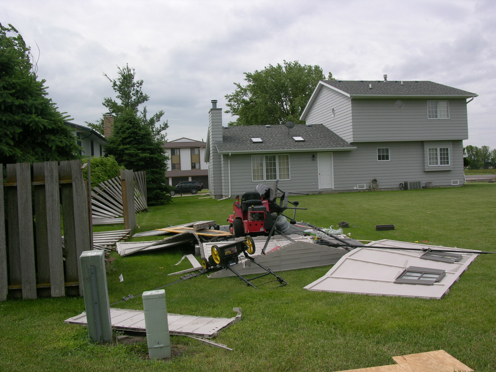
Other damage included; a small utility shed was destroyed, several wooden fences were blown down, two power poles in town were broken, and a large unattached garage had the door blown in and the north wall collapsed.
The first damage documented occurred approximately 1.5 miles west of town where tree damage occurred at a farmstead. A couple sections of a center pivot were flipped a little further east. The main path of destruction moved across the north part of town with a total path length of around 3 miles. The most significant damage occurred along Adams Street where the power poles and apartment complex were situated.
Several pictures and a map of the damage are attached to this story.
The NWS would like to thank Dawson County Emergency Manager Brian Woldt for his assistance in conducting this survey.
|
.png) |
Photographs of the Storm Damage. Click on any image to enlarge.
 |
 |
| Small Utility Shed Destroyed | Wooden Fence Toppled |
 |
 |
| Garage Wall Collapsed |
Garage Wall Blown Out |
 |
 |
| Uprooted Tree | Apartment Building |
 |
 |
| Apartment Ceiling Collapse | Apartment Roof Partially Gone |
Pictures taken by Rick Ewald.

