2022 Annual Weather Summary for NWS Hastings
Click on the Tabs Below for more information
Unusually Dry Winter
|
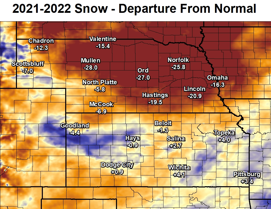
Winter 2021-2022 was particularly dry for most. Nearly all of Nebraska saw below-normal snowfall totals....and some locations were over 2 FEET below normal. Kansas was more of a "mixed bag" with some locations in western and north central Kansas receiving well above normal snowfall...although this was mainly the result of one or two very large snow events. The lack of snow cover and moisture provided challenges to agriculture and set the stage for continued drought into the summertime months. Additionally, the lack of snow cover allowed grasses and soil to become very dry by springtime, resulting in blowing dust and wildfires later in the spring. |
 |
|
Winter 2021-2022 snow totals ranged from 4.0" in Nance County, Nebraska to as much as 34.2" in Rooks County, Kansas. Keep in mind that "normal" snowfall totals are in the 16-36" range...with higher totals favoring our north.
The only stations that were above normal in our forecast area were Logan, Plainville, and Natoma.
See the map to the right for more details. |
 |
Wind and Dust
April is typically the windiest month of the year, but April 2022 was particularly windy with several days producing blowing dust across portions of the area. The graphic below shows that April 2022 was actually the windiest April since 1951 at Central Nebraska Regional Airport in Grand Island.
 |
| Plot courtesy of the Iowa Environmental Website - mesonet.agron.iastate.edu |
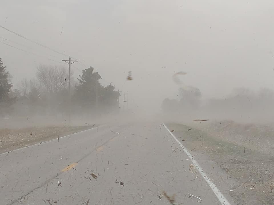
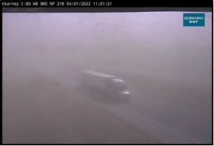
April 7th was a day where a strong low pressure system and tight pressure gradient were in place over Nebraska. High Wind Warnings were issued for northwest winds of 30 to 40 mph with gusts to around 60 mph. Soil had been dried out due to gusty winds and a lack of moisture. As winds continued to cross the region, they picked up and carried blowing dust from the Dakotas southeast into Nebraska. Several locations reported blowing dust and reductions to visibility across Kansas and Nebraska. The Kearney Airport recorded visibility down to under two miles. Blowing dust was detected on satellite and confirmed by a Nebraska DOT camera on the interstate. A Dust Storm Warning was issued for a portion of I-80 due to the reductions in visibility.
 |
 |
 |
|
Kearney, NE Photo By Jennifer Vondra |
I-80 at Gibbon, NE Photo From Nebraska DOT Camera |
I-80 at Kearney, NE Photo From Nebraska DOT Camera |
Wildfires
The windy spring, combined with the dry winter, led to several wildfires across the area through the spring.
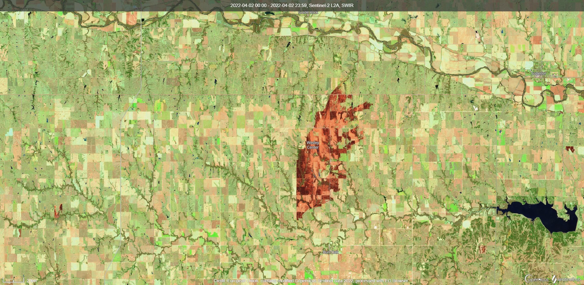
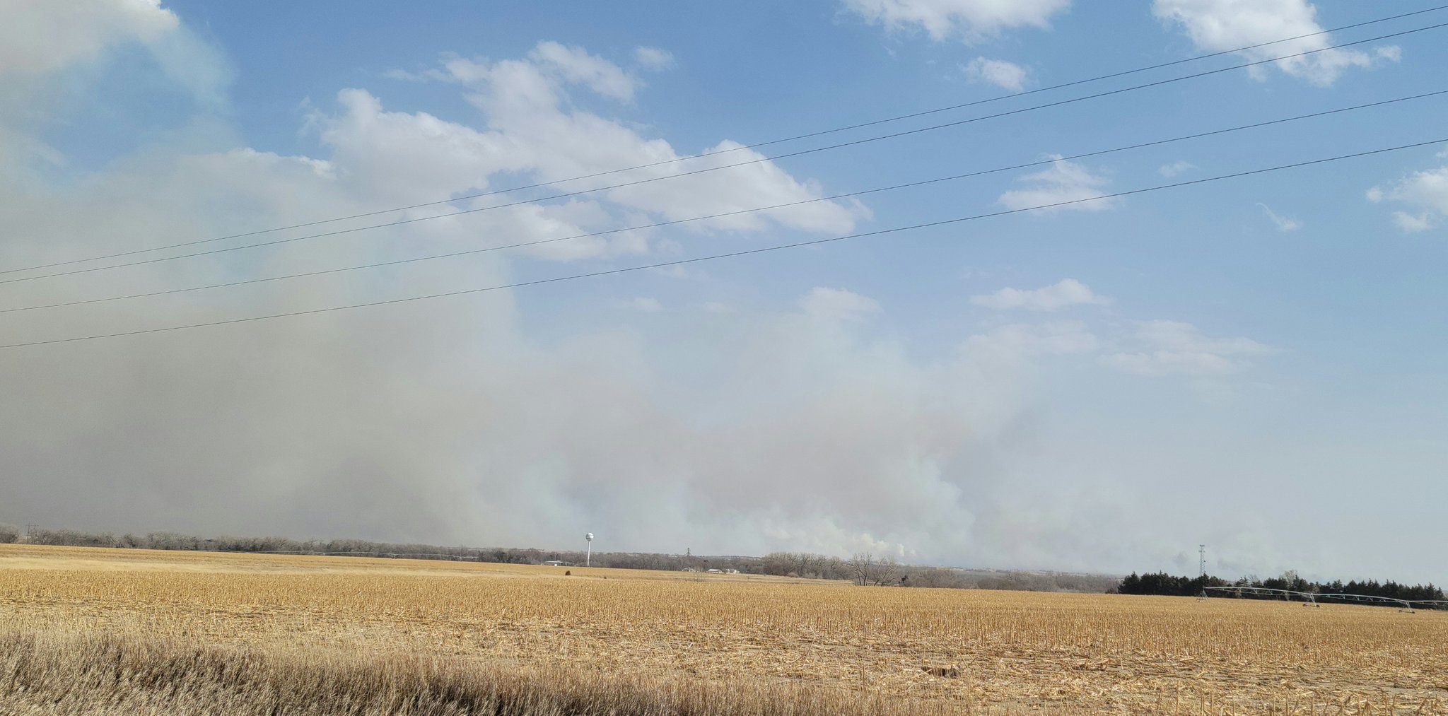
On March 29th, the "North Branch Wildfire" started just north of Burr Oak, Kansas and spread northward before being contained near the Kansas-Nebraska state line. In total, this burned roughly 8500 acres. Another relatively small wildfire burned in southern Adams County that day (pictured below).
 |
 |
 |
| Sentinel-2 Satellite Imagery of North Branch Fire - sentinel-hub.com | North Branch Fire Looking Towards Guide Rock - Ryan Pfannkuch |
Southern Adams County Fire - Angela Pfannkuch |
On April 7th, the "Road 739 Wildfire" started in Gosper County and spread southward into Furnas County. In total, this burned over 30,000 acres, including some farmsteads, but fortunately the fire was contained before reaching the towns of Arapahoe and Edison.
.jpg) |
.jpg) |
 |
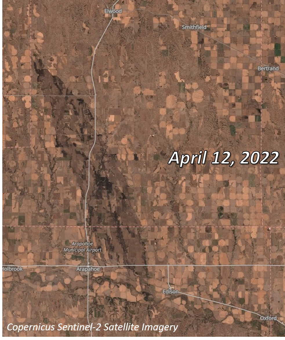 |
| Photo by Justin Wan of the Lincoln Journal Star | Photo by Justin Wan of the Lincoln Journal Star | Areal photo by Nebraska State Patrol | Sentinel-2 Image of the burn scar - sentinel-hub.com |
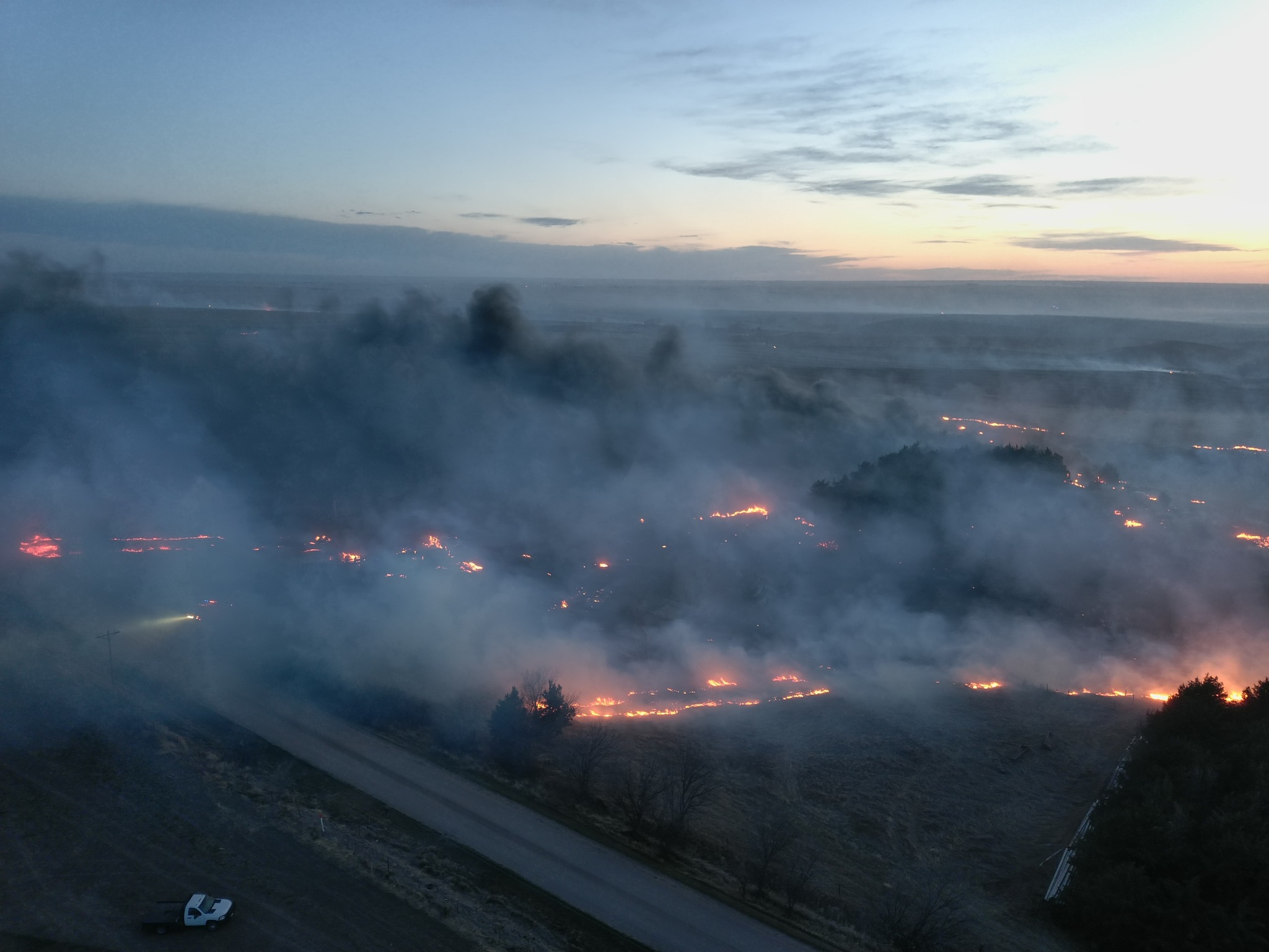
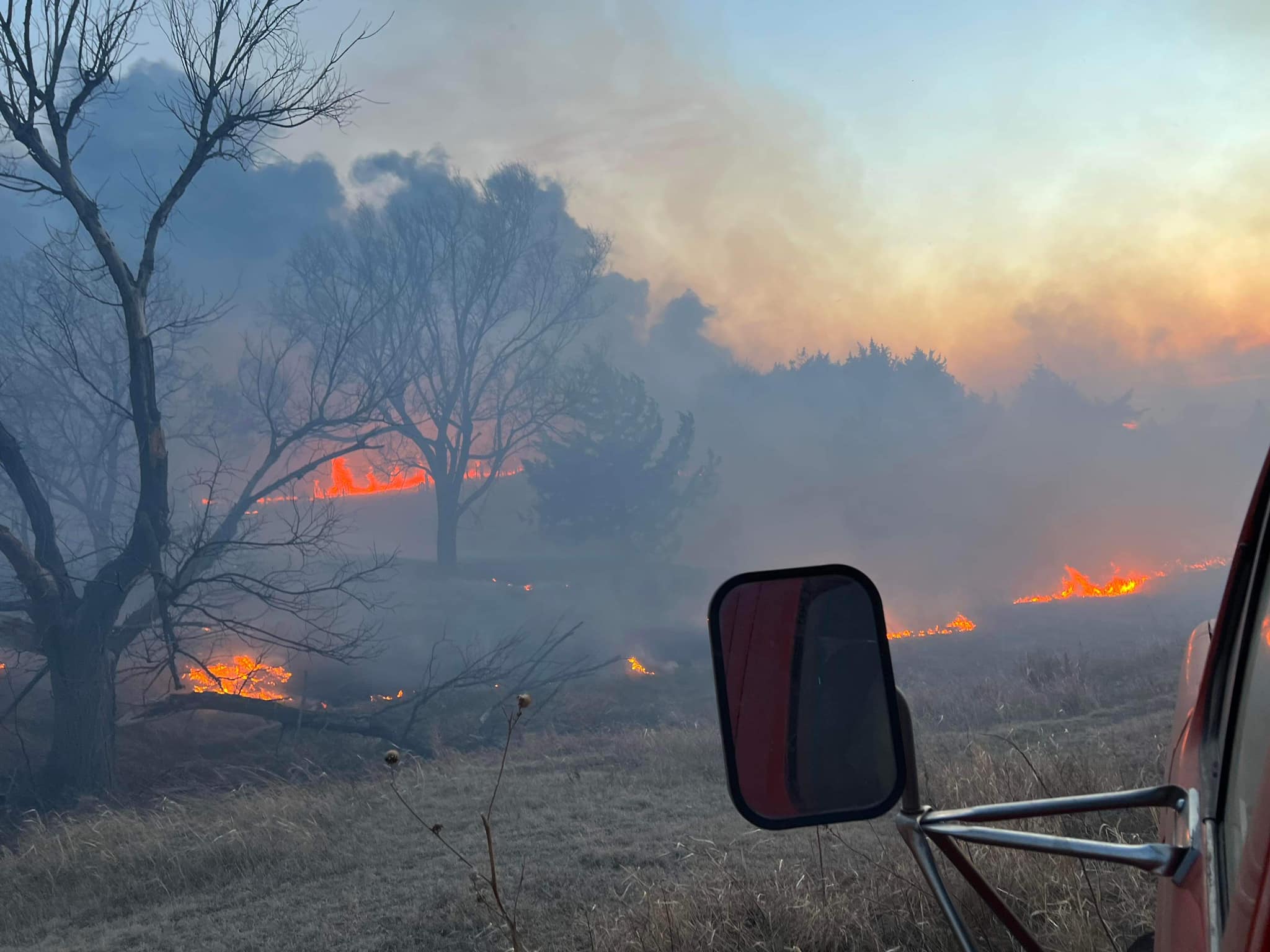
On April 22nd, the "Road 702 Wildfire" started in northern Norton County, Kansas and was able to quickly spread northward near the Red Willow and Furnas County line as southerly winds gusted to near 60 MPH. The fire even crossed the Republican River. This burned over 44,000 acres of land before being contained.
 |
 |
.jpg) |
 |
| Photo from Nebraska Emergency Management Agency | Near Cambridge - Photo by Loomis Fire Department | Near Wilsonville - Photo by Doug Cure | Near Cambridge - Photo by Loomis Fire Department |
With the continued drought, a few wildfires also occurred during the fall. The most significant date was October 23rd, when several wildfires developed over the local area. Most notable was a wildfire that burned over 10,000 acres in Nuckolls County, Nebraska, including a home and three agricultural buildings (Hastings Tribune). Another wildfire near Naponee, Nebraska (Franklin County), burned roughly 6,700 acres (NTV). A fire near Ravenna also burned an estimated 1,000 acres (NTV).
Severe Weather
April 28-29, 2022
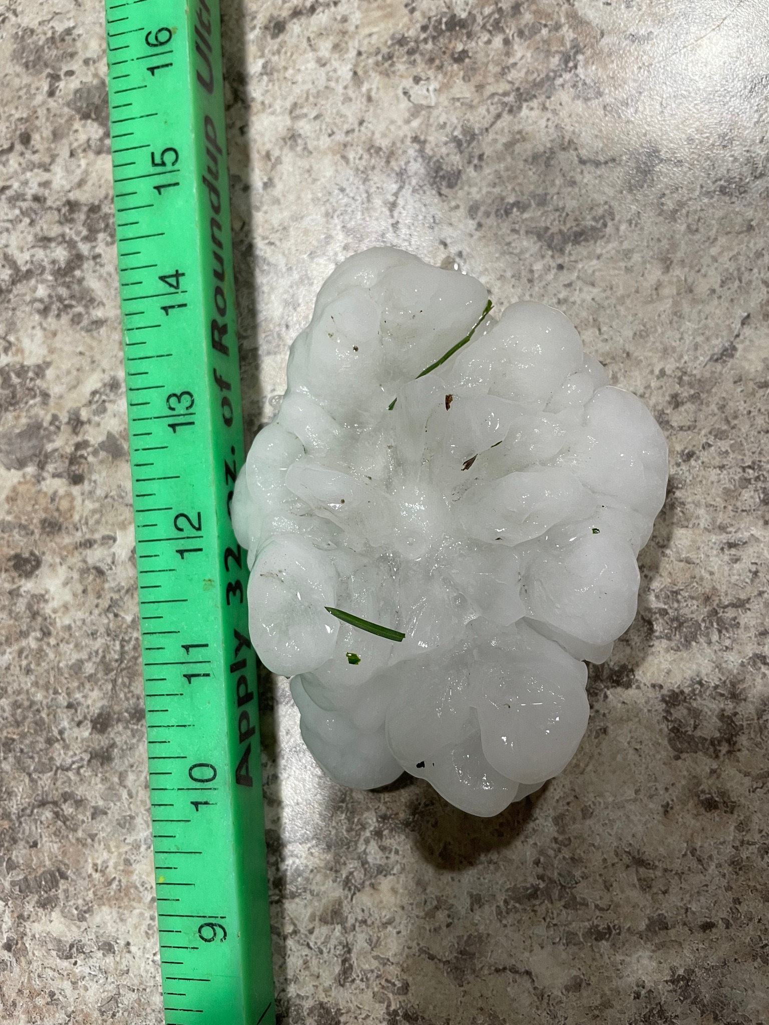
Severe storms on April 28th produced a fairly localized area of hail over Furnas, Harlan, and Phillips counties. That said, some of this hail was over 2 inches in diameter. Additionally, a brief tornado was observed over rural Harlan County. Map of Severe Reports
 |
 |
|
Oxford, NE on April 28th Photo from @MattBlueThunder |
8WSW of Minden, NE on April 29th Photo from Deb Leaders Lundeen |
May 12, 2022
Multiple rounds of thunderstorms occurred over south-central Nebraska on May 12th, producing large hail and damaging wind across much of central Nebraska over the course of the afternoon and evening. Some of the most intense storms tracked from the Dawson County area up through Custer, Sherman, Valley and Greeley counties, producing 70-90 MPH wind gusts along its path.
 |
 |
|
Wind damage near Arcadia, NE on May 12th Photo from Linda King |
Wind damage in Ord, NE on May 12th Photo from Scott Philbrick |
June 7, 2022
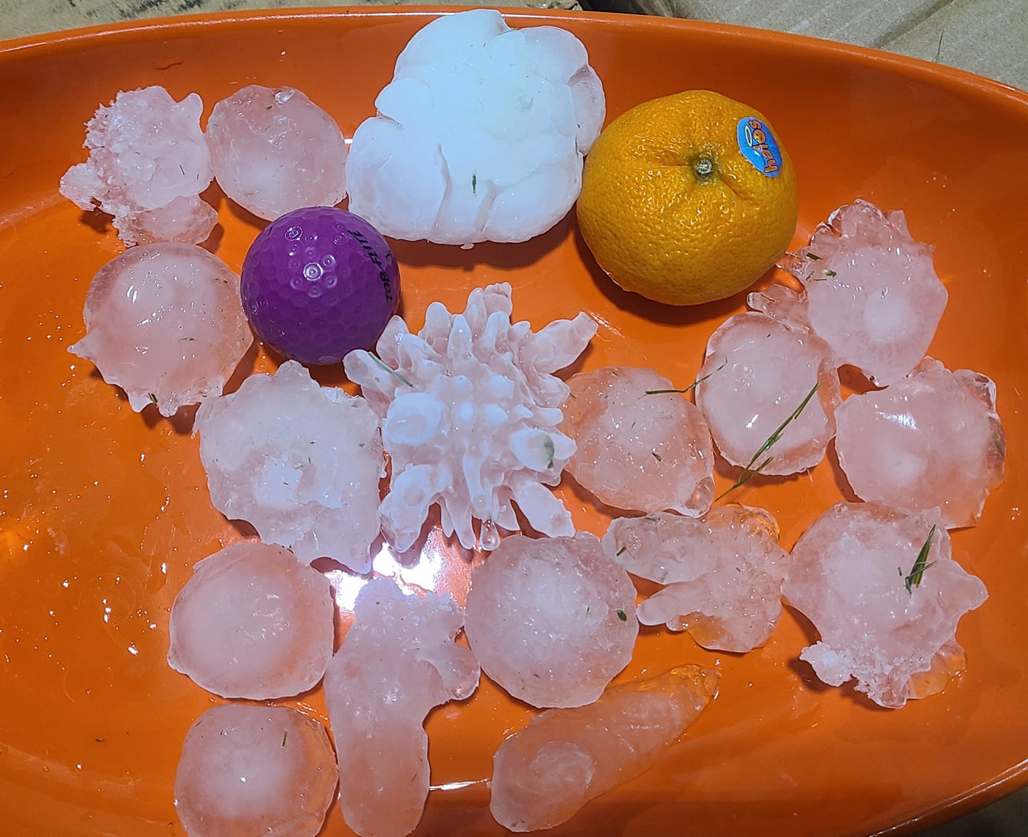
Supercell thunderstorms produced very large hail and wind damage over swaths of Nebraska and Kansas on June 7th. Some hail was reported to be as large as 4 inches in diameter! An EF-0 tornado also tracked over 10 miles across Thayer and Nuckolls counties.
 |
 |
|
Near Hazard, NE on June 7th Photo from Melissa Larsen |
Near Ravenna, June 7th Photo from Melissa Schroder |
June 14, 2022
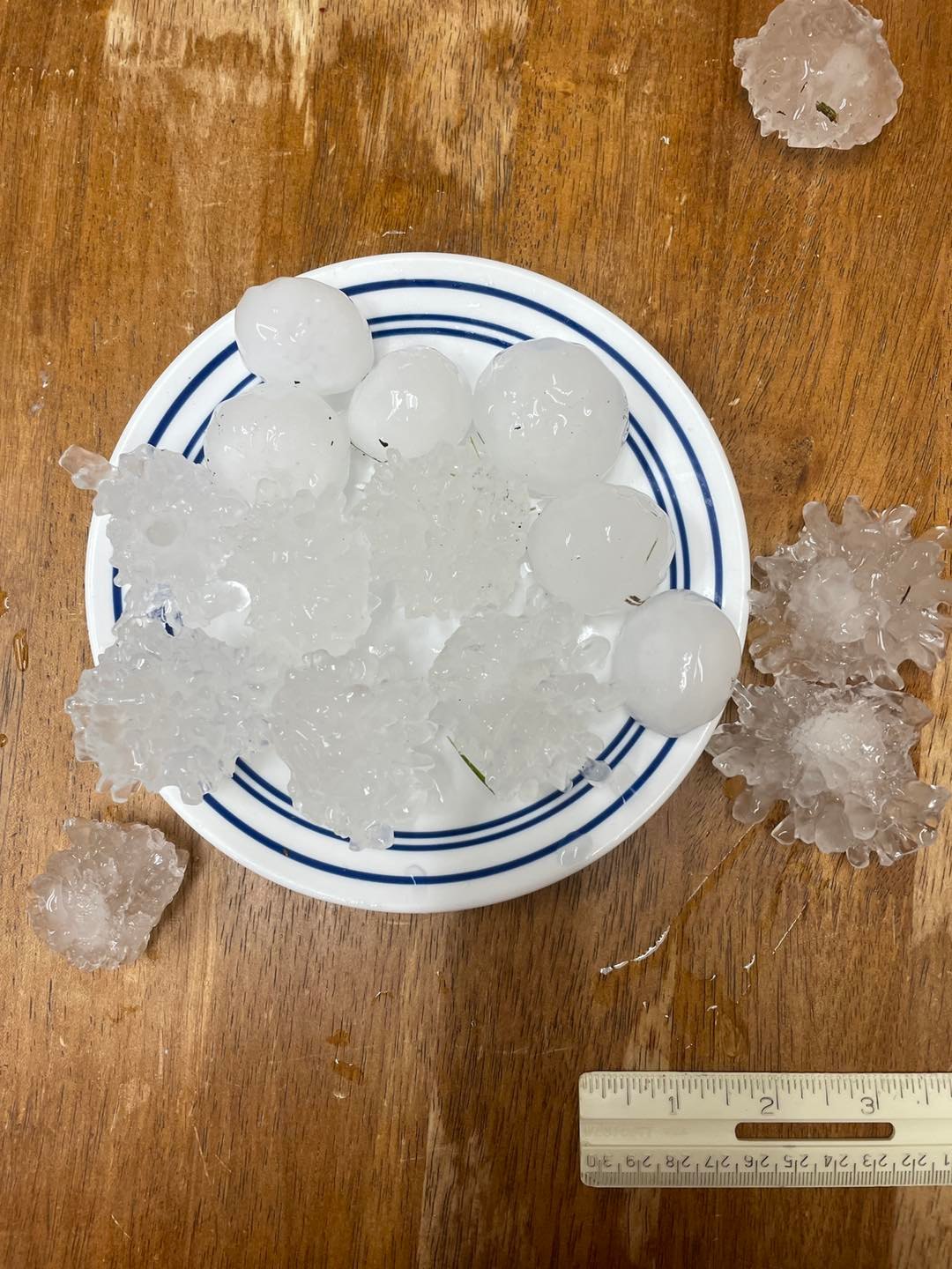
Several elevated supercell thunderstorms tracked over central Nebraska on the night of June 14th, producing very large hail, damaging wind, and an EF-2 tornado (near Lushton, NE). Some areas (including Hastings, NE) were hit by multiple rounds of severe hail over the course of the night. This is in addition to some very large hail that impacted parts of the area just a week earlier on June 7th!
 |
 |
 |
| Hail at National Weather Service Office, Hastings, NE on June 14th |
Trumbull, NE on June 14th Photo from Amy TerHarr |
Radar showing line of severe storms tracking over central Nebraska on June 14th. Some locations received multiple rounds of severe hail. |
July 3-4, 2022
Showers and thunderstorms moved across the area through the late evening and overnight hours of July 3rd into the 4th. Most of this activity was non-severe. The notable exception was an EF-1 tornado, occurring on the southeast side of Grand Island in the early morning hours of July 4th. A supercell embedded within an area of stratiform rain interacted with very strong low-level shear and produced this very isolated tornado. The atmospheric environment and timing of the tornado was quite unusual for summertime in the Great Plains and is actually more reminiscent of cool-season convection in the southeastern U.S.
.jpg) |
.jpg) |
.jpg) |
| EF1 Tornado Damage on southeast side of Grand Island on July 4th. |
EF1 Tornado Damage on southeast side of Grand Island on July 4th. |
EF1 Tornado Damage on southeast side of Grand Island on July 4th. |
Drought
For most of the area, 2022 was the driest year since at least 2012, which was a very significant drought year.
Grand Island only recorded 15.20" of total precipitation through the year. For reference, "normal" precipitation is 26.61". So 2022 is over 11.00" BELOW normal at Grand Island.
Hastings saw only slightly more precipitation at 16.09". This will go down as the driest year in Hastings since 1966!
Many spots across the area are similar (or even drier) conditions.
 |
 |
| Percent of normal precipitation for 2022. Nearly the entire area is below-normal. Data from water.weather.gov/precip | Severe and Exceptional Drought (red and dark red) expanded across the area during summer and fall 2022. For more information, visit droughtmonitor.unl.edu |
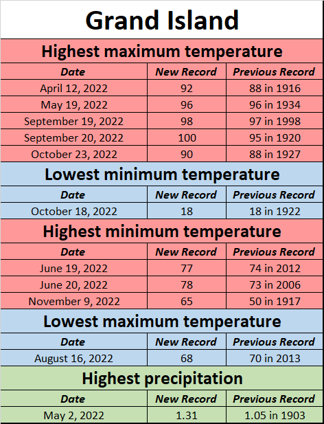
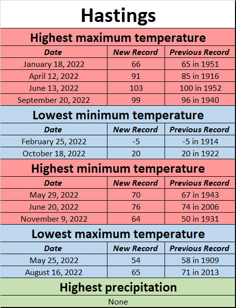
Daily Records Broken at Grand Island and Hastings during 2022
 |
 |
 |
Media use of NWS Web News Stories is encouraged! Please acknowledge the NWS as the source of any news information accessed from this site. |
 |