
Flash flooding threatens areas from the Tennessee Valley to the Carolinas as storms repeat along a stalled front. Monsoonal storms may trigger flooding in the Southwest. Dangerous heat expands across the Desert Southwest, Plains, mid-Mississippi Valley and Southern Tier. Critical fire weather for interior Pacific Northwest. Cooler, drier air brings brief relief to the Great Lakes and Northeast. Read More >
Overview
|
Tuesday, June 3,1980 marked one of the most unique tornado events to ever impact Nebraska, if not the entire United States. It is arguably an unparalleled event in meteorological history. This tornado outbreak provided the basis for a book and television movie, as well as tornado and engineering research. |
 This is the only known photo of the tornadoes from June 3, 1980. This is Tornado #2 (left) and #3 (right), looking north from North Johnson Drive, or roughly Webb & Faidley. Photo was taken about 9 p.m. by Rod Gartner. |
Below is a summary of the tornadoes that touched down in and around Grand Island on June 3, 1980.
Click on the image below to enlarge.
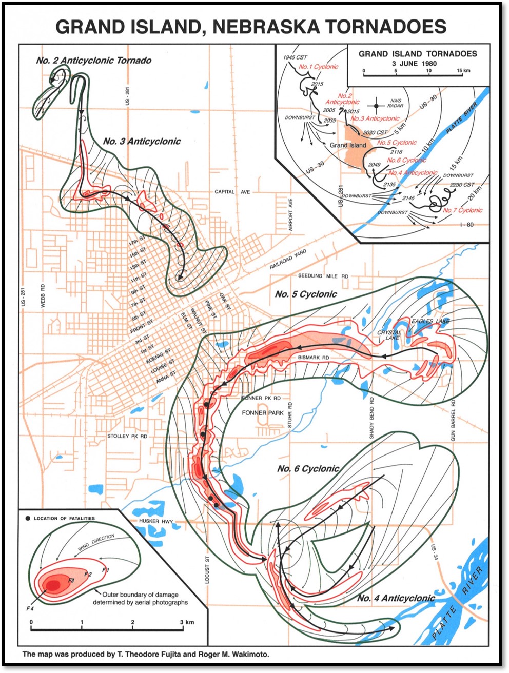 |
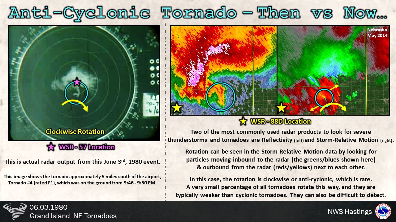
The majority of tornadoes in the northern hemisphere are cyclonic, meaning they spin counterclockwise. One of the unusual aspects of this event was that 3 of the 7 tornadoes were anti-cyclonic, meaning they rotate clockwise.
Another interesting tidbit about this event is that there were times where multiple tornadoes were on the ground simultaneously!
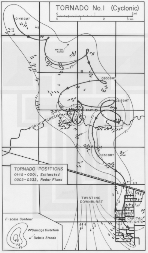 |
Tornado #1
Left: Tornado schematic by Ted Fujita and Roger Wakimoto. |
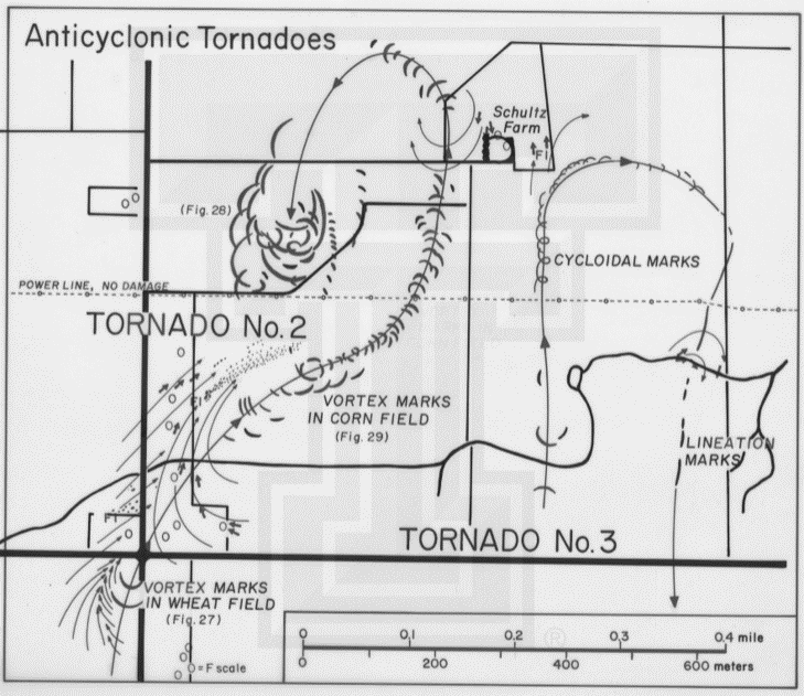 |
Tornado #2
Left: Tornado schematic by Ted Fujita and Roger Wakimoto. |
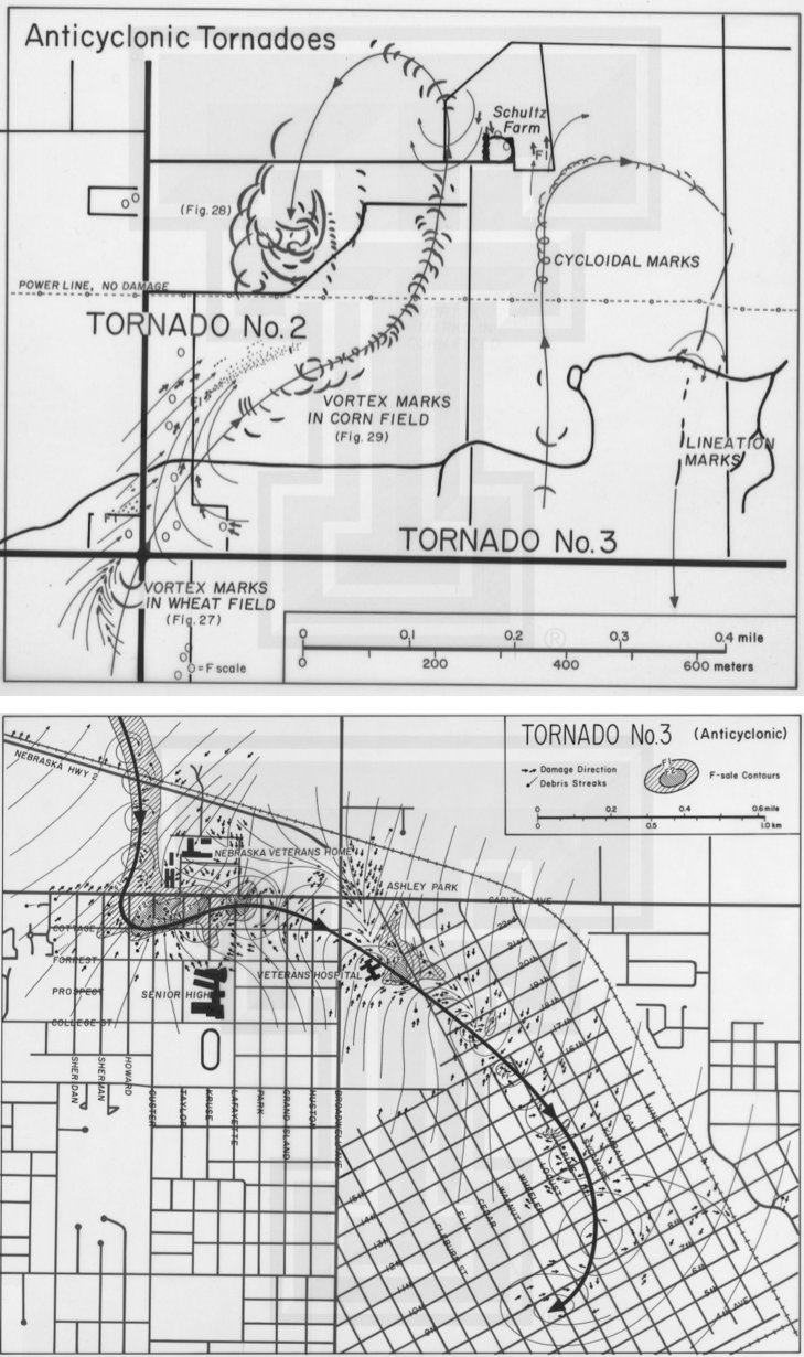 |
Tornado #3
Left: Tornado schematic by Ted Fujita and Roger Wakimoto. |
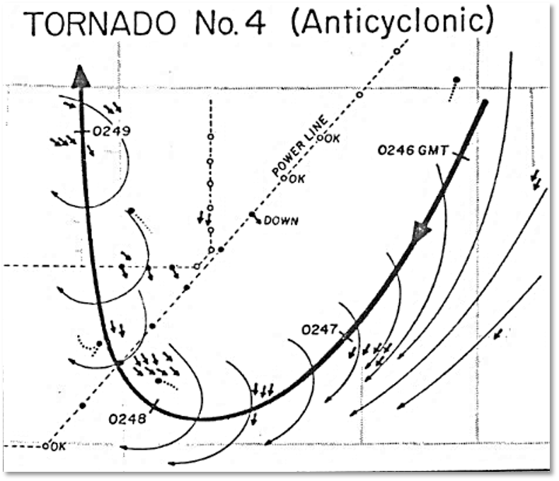 |
Tornado #4
Left: Tornado schematic by Ted Fujita and Roger Wakimoto. |
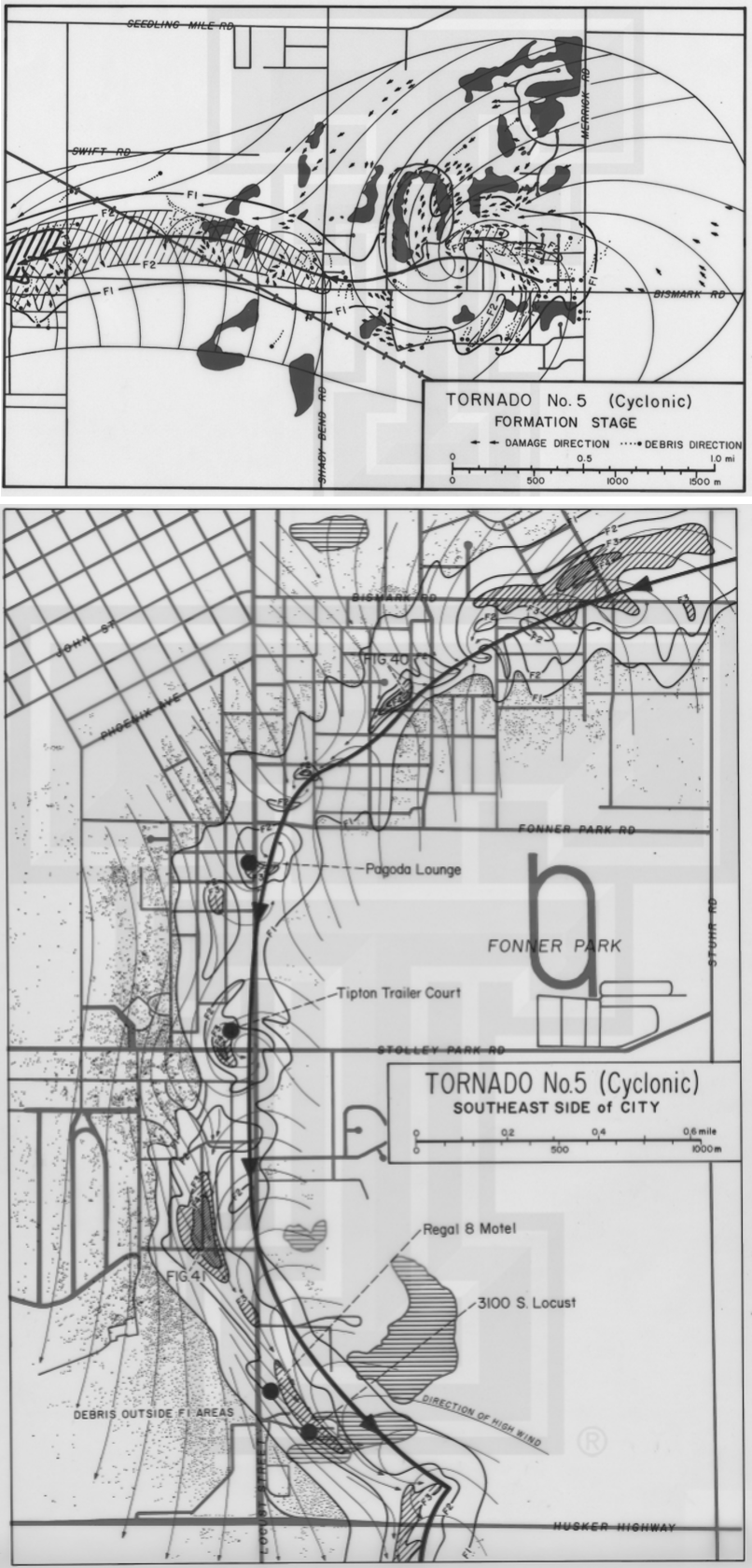 |
Tornado #5 - The "South Locust" Tornado
Left: Tornado schematic by Ted Fujita and Roger Wakimoto. |
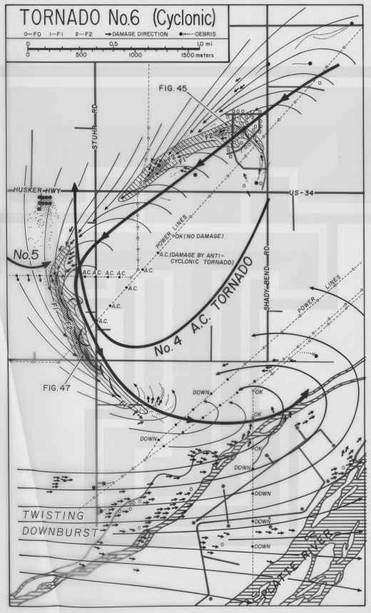 |
Tornado #6
Left: Tornado schematic by Ted Fujita and Roger Wakimoto. |
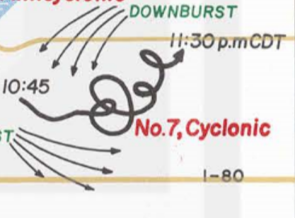 |
Tornado #7
Left: Tornado schematic by Ted Fujita and Roger Wakimoto. |
Here is a top-down view of the atmosphere behind the June 3rd tornado outbreak. Click images to enlarge.
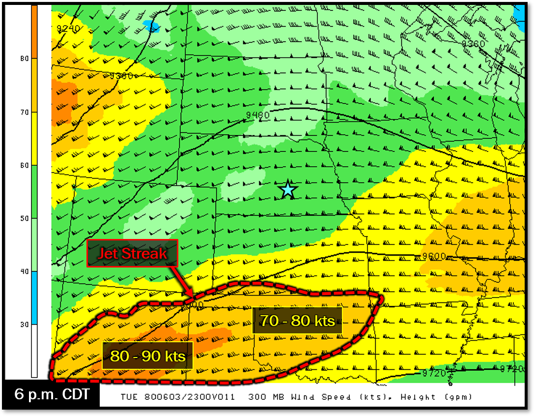 |
| Upper air analysis shows a jet streak of 70-90 knots nosing into portions of the Central Plains from the southwest. |
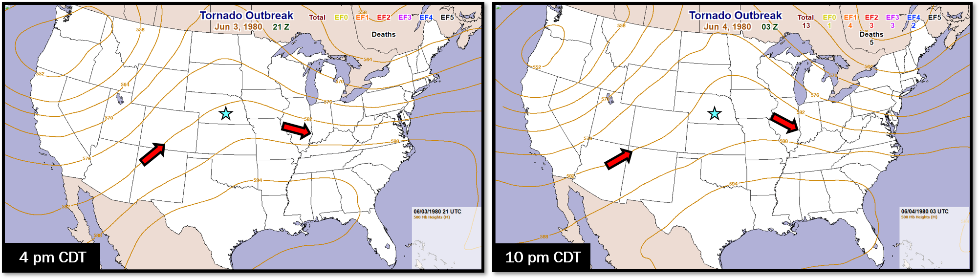 |
| 500mb analysis shows ridging across the interior U.S., migrating east of the Missouri River ahead of a low pressure system and trough pushing onto the West Coast. |
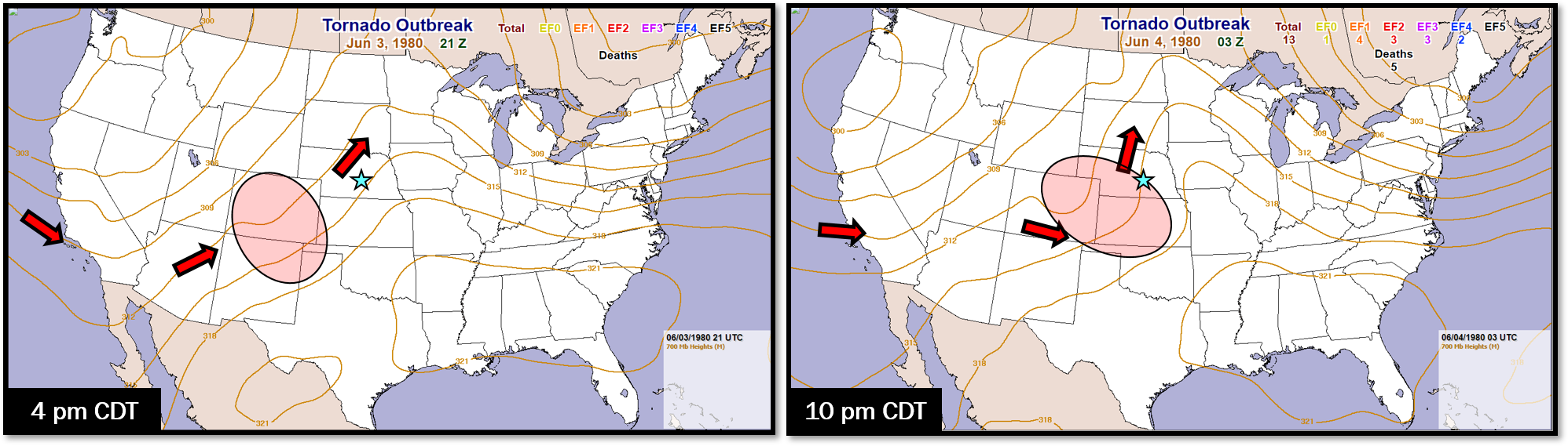 |
| 700mb analysis shows flow across the Central Plains was southwesterly, with a 'kink' in the flow indicating a shortwave trough lifting out of Colorado and Kansas. |
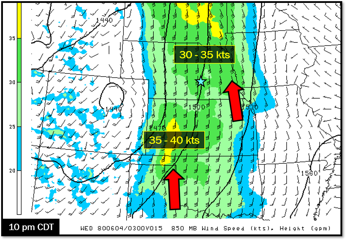 |
| 850mb analysis shows increased southerly flow (low-level jet) developing during the evening hours, helping sustain thunderstorm activity. |
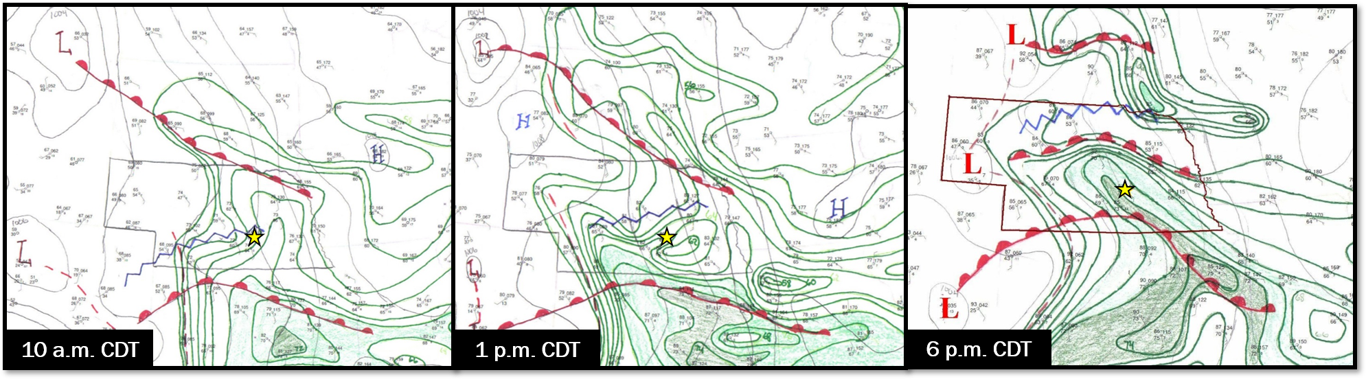 |
| Surface analysis shows a warm front lifting north into the region during the day. This frontal boundary provided a focusing mechanism for thunderstorm development. Analysis is courtesy of Brian Barjenbruch. |
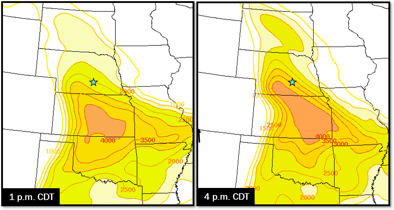 |
| As that surface warm front lifted north, it brought along warm and moist air, increasing the instability across the area. These images show surface based Convective Available Potential Energy, otherwise known as CAPE (J/kg). |
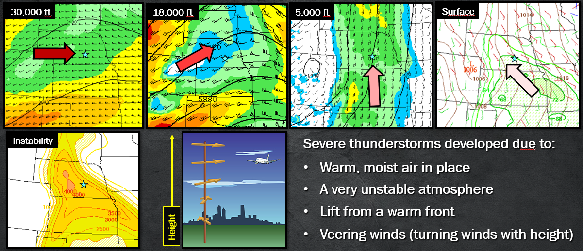 |
| Putting these features together, the environment was favorable for any thunderstorms which developed to become severe. |
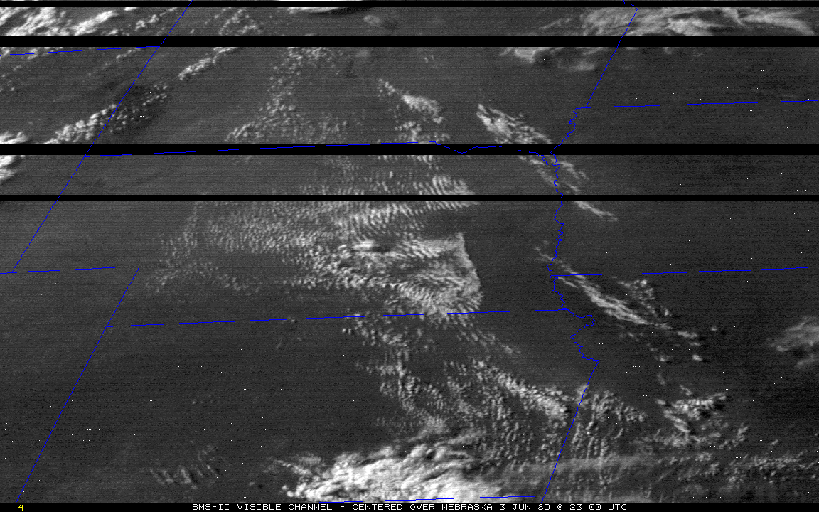
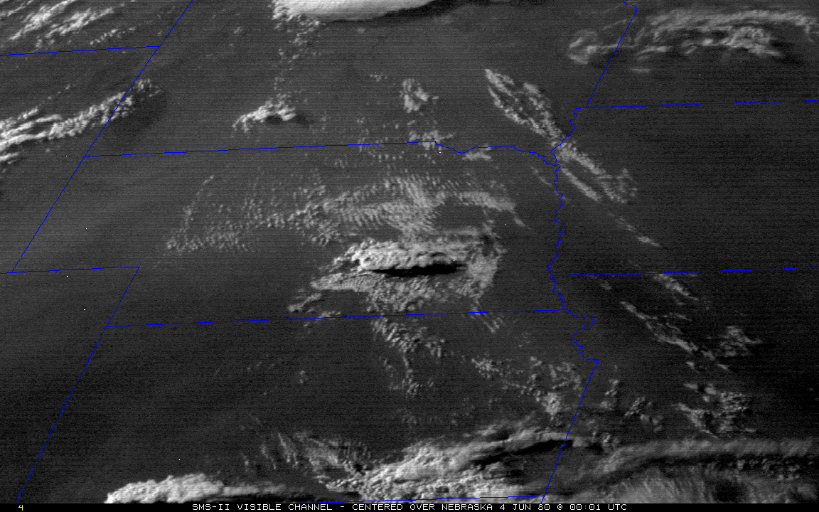
The images below show Visible (VIS) SMS-II (pre-GOES) data. While VIS satellite imagery can show great details in the evolution of clouds, a limitation is the fact it is dependent on sunshine to view. Once the sun sets (seen in the gradual darkening of the images below), VIS is no longer usable until the next morning. On days where severe weather is a threat, the behavior of clouds (or the lack of clouds period) can provide insight on where thunderstorm development is (or is not) likely. During the afternoon hours, the development of cumulus clouds can show where instability is available and the cap (atmospheric conditions preventing storm initiation) is weakening. Note the rapid development of the storm between 6-8 p.m. CDT.
 |
 |
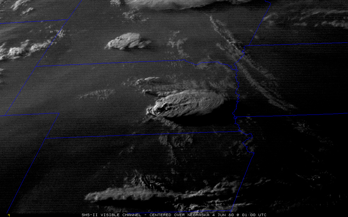 |
| Visible - 6 p.m. CDT June 3rd | Visible - 7 p.m. CDT June 3rd | Visible - 8 p.m. CDT June 3rd |
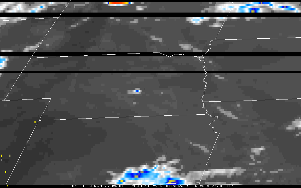
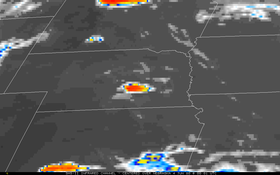
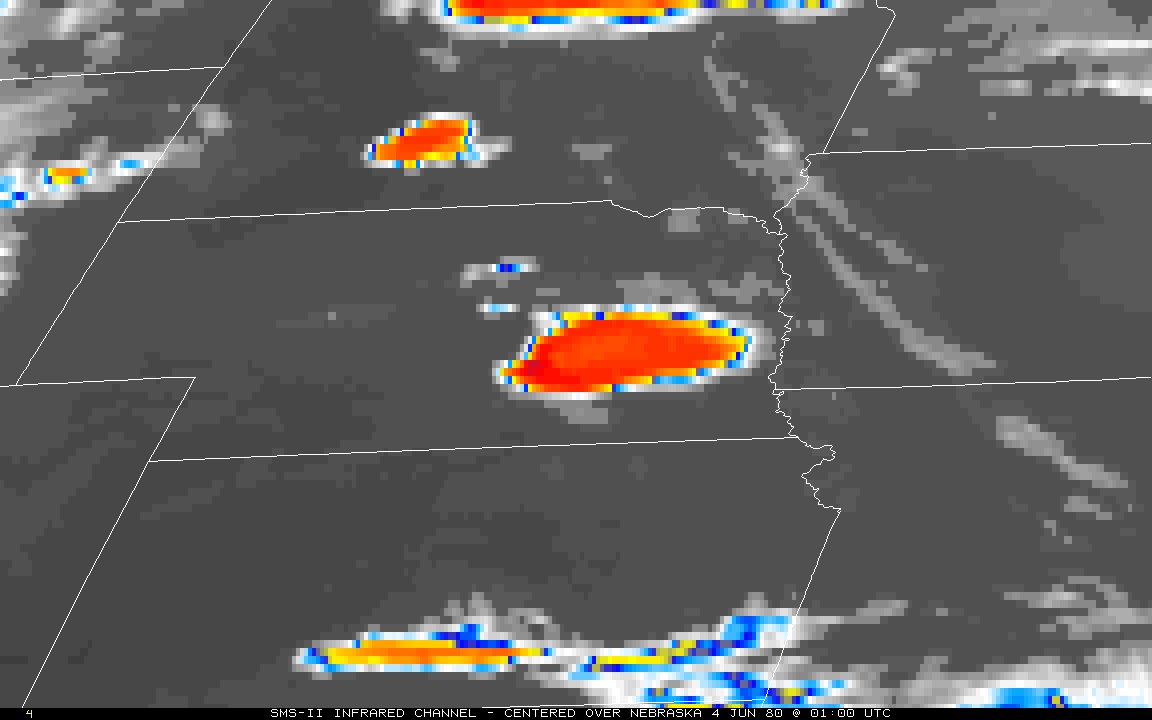
The images below show Infrared (IR) SMS-II (pre-GOES) data. Unlike Visible satellite imagery, IR satellite data is not dependent on sunlight and is available 24-hours a day. The various colors show the temperatures of the earth's surface and clouds, and can clue you in to the heights a storm is reaching. In convective situations, such as June 3rd, the rapid development and expansion of the brighter colors (especially the reds) between 6-8 p.m. CDT shows the storm's explosive growth. This complex continued to grow through the evening, shown by the 11 p.m. CDT image.
 |
|||
 |
 |
 |
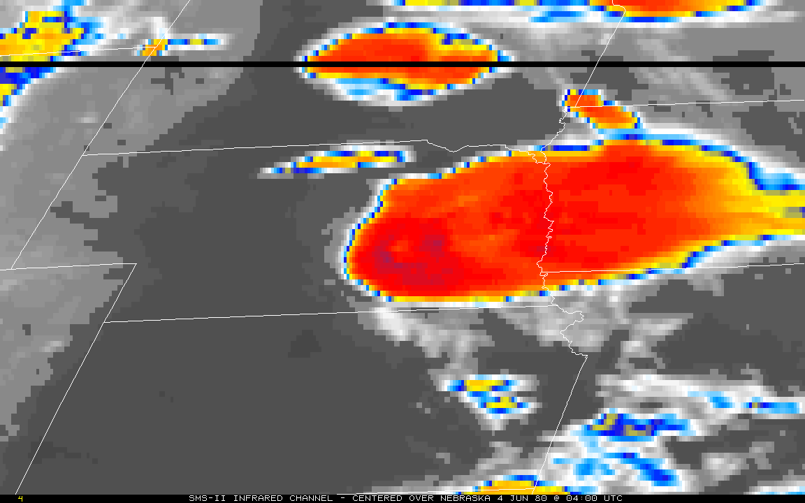 |
| IR - 6 p.m. June 3rd | IR - 7 p.m. CDT June 3rd | IR - 8 p.m. CDT June 3rd | IR - 11 p.m. CDT June 3rd |
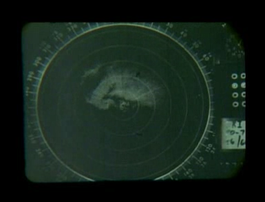
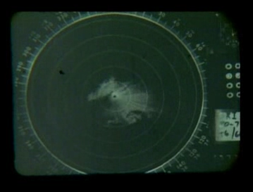
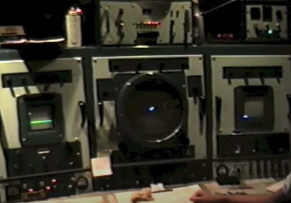
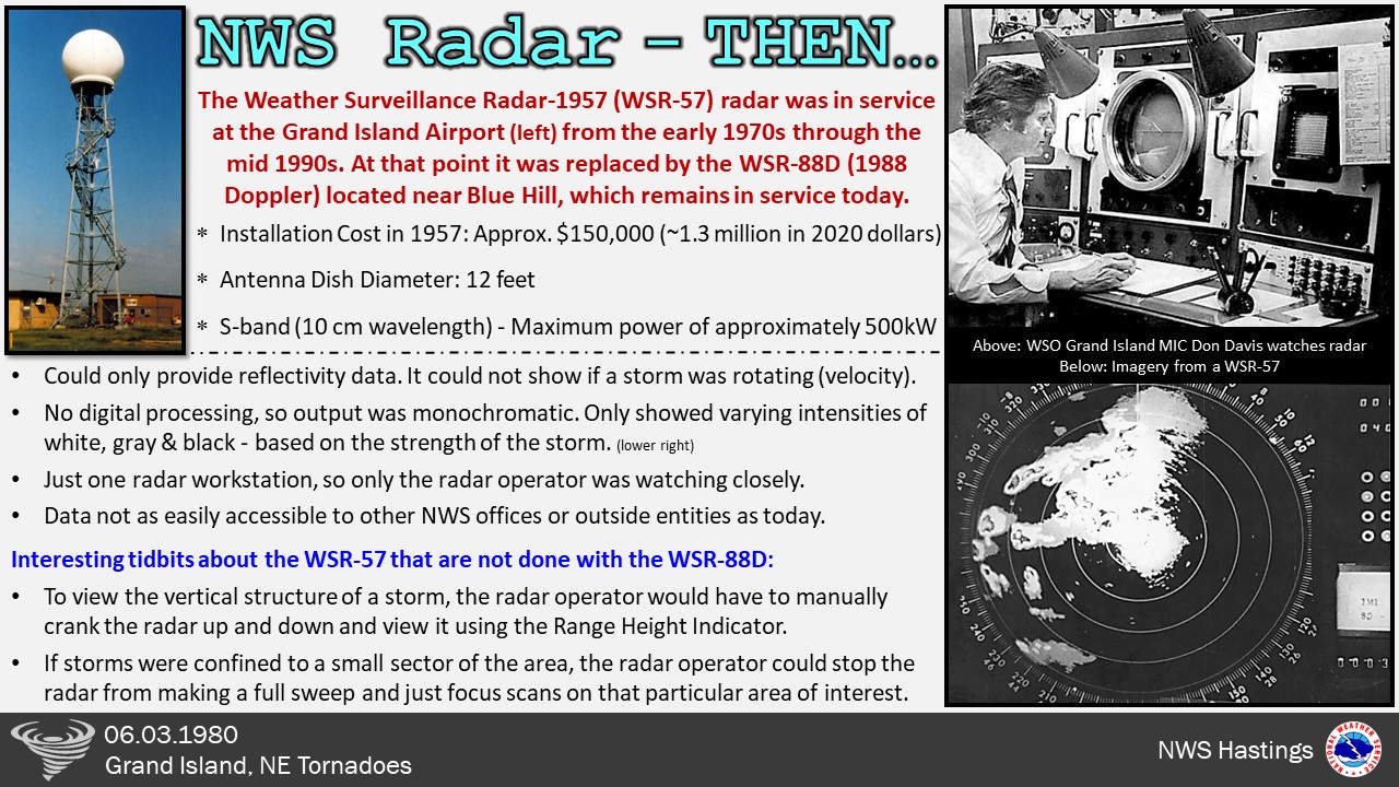
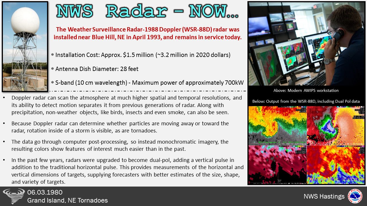
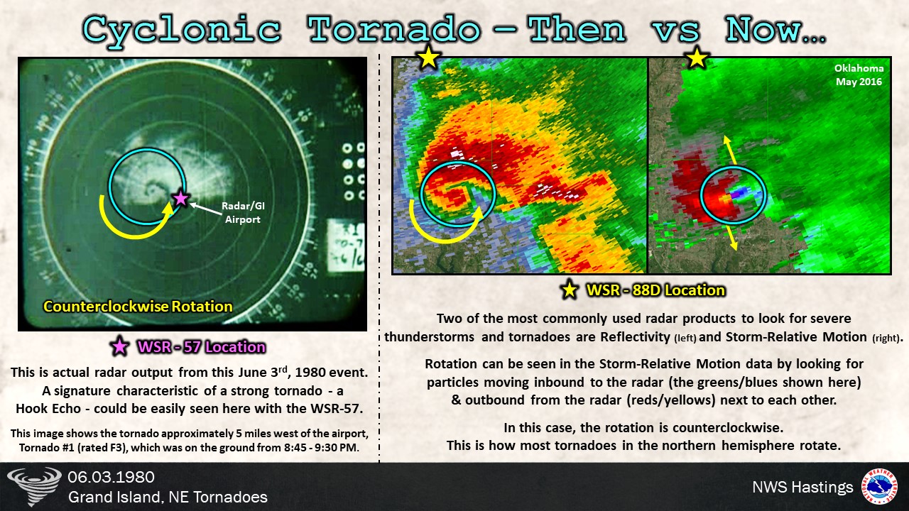
The images below are radar images taken from the Weather Serveillance Radar-1957 (WSR-57) which was in service at the Weather Service Office at the Grand Island Airport from the early 1970s through the mid 1990s. Tornado warnings were issued for Grand Island and surrounding areas based on the radar signatures and storm spotter reports.
 |
 |
 |
| Radar loop of the NW Grand Island tornado: https://youtu.be/rTTSVANU-Rs |
Radar loop of the SE Grand Island tornado: | Curious to learn more about the WSR-57? Check out this video from NWS Paducah: https://www.youtube.com/watch?reload=9&v=YmFnNmiWdlo&t=10s |
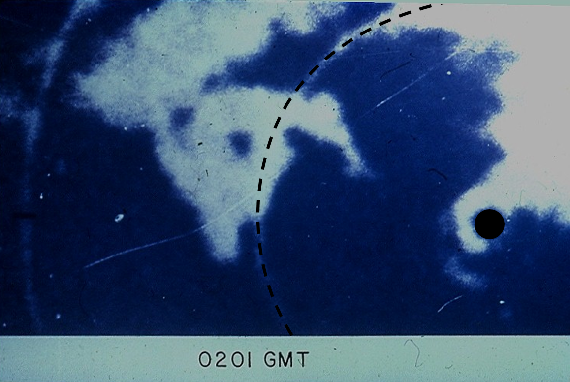
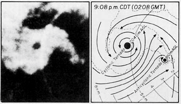
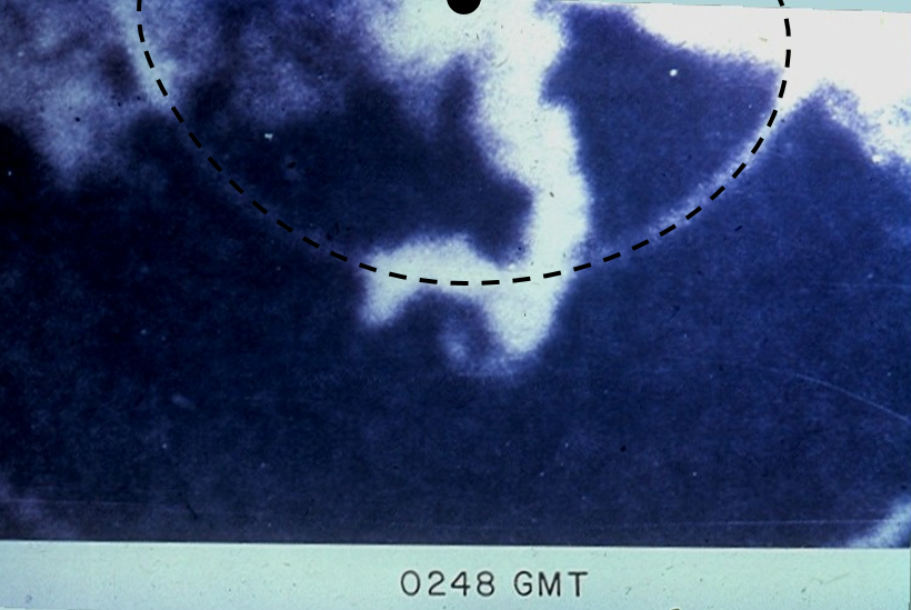
| The images below are screen captures of radar imagery. Click to enlarge. | |||
 |
 |
 |
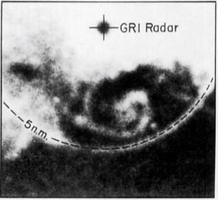 |
| Tornado #1 located WNW of the radar at 9:01 p.m. The tornado center is the large hole just left of center. | Tornadoes #1 (left) & 2 (right, anti-cyclonic) located just west of the radar at 9:08 p.m. | Tornado #4 (anti-cyclonic) located south of the radar at 9:48 p.m. CDT. Dashed line shows 5 mi from the radar site. | Formative stages of tornado #5 at 10:16 p.m. The tornado is the spiral feature SSE of the radar. |
Radar technology has changed tremendously in the years since this event. The WSR-57 located at the Grand Island Airport was decommissioned in the mid 1990s, replaced by the new Weather Surveillance Radar-1988 Doppler (WSR-88D), which remains in service today near Blue Hill, NE. Additional advances in computing power and equipment improvements over the past several years have given meteorologists powerful tools to assess anything from drizzle to freezing rain to tornadoes. The images below show some of the differences between then and now. Click on the images to enlarge.
 |
 |
| A quick comparison of the WSR-57 (in service on June 3, 1980) and the WSR-88D (currently in service). Click to enlarge. | |
 |
 |
| A quick comparison of the WSR-57 (in service on June 3, 1980) and the WSR-88D (currently in service). Click to enlarge. | |
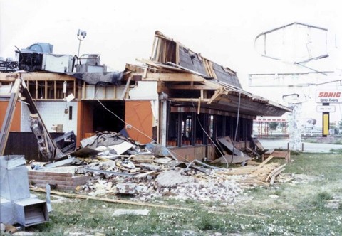
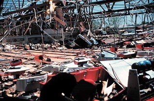
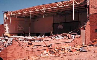
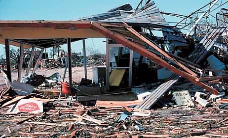
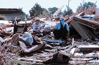
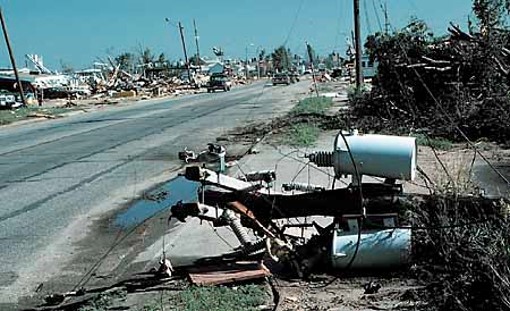
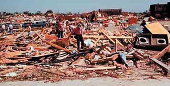
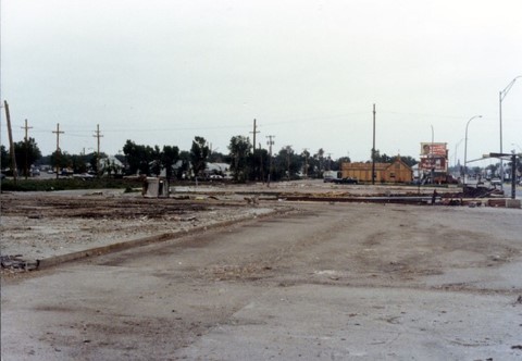
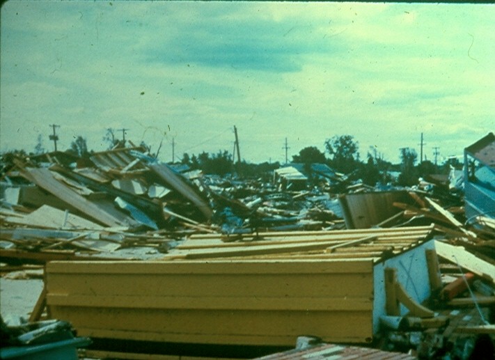
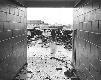
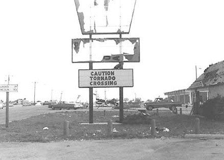
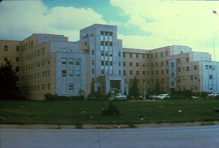
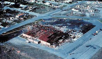
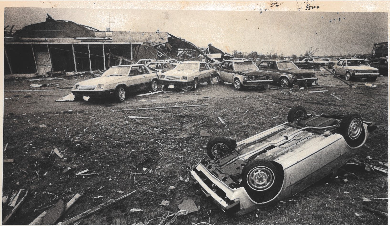
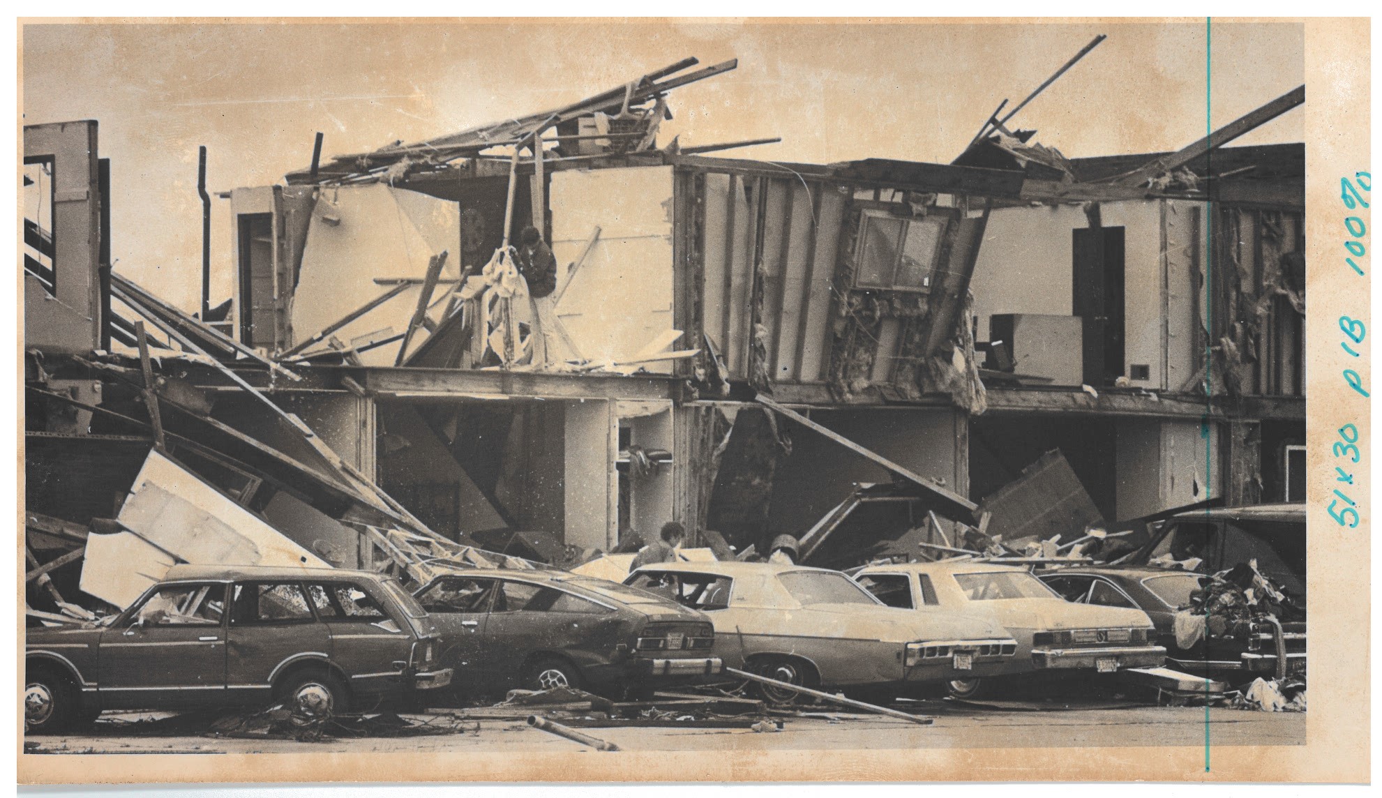
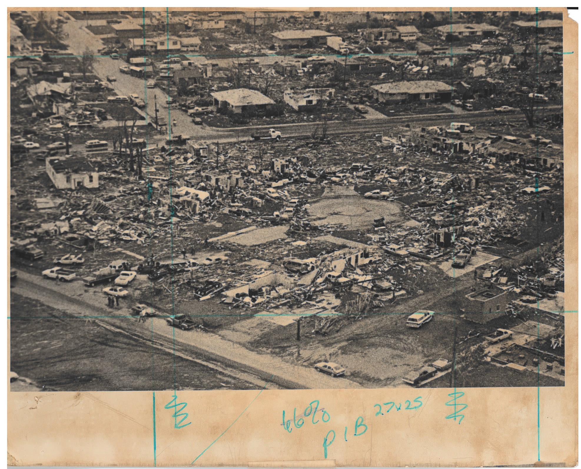
Below are images of the damage and aftermath caused by the tornadoes. Click on images to enlarge.
 |
 |
 |
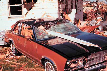 |
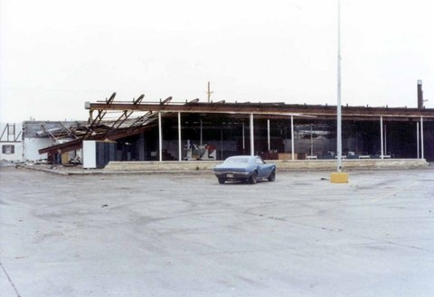
| Tommy's Restaurant | Meaves Bowl | Star School | Destroyed car and debris |
 |
 |
 |
 |
| Dairy Queen | Residential damage | South Locust Street | South Locust Street |
 |
 |
 |
 |
| Residential damage | Street view | Residential damage | Star School |
 |
 |
 |
 |
| Village Inn South Locust | Broken windows at the Veteran's Hospital |
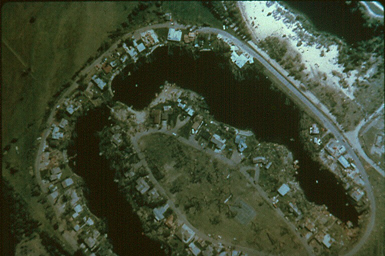
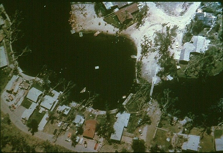
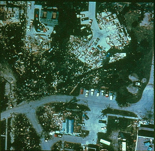
Meaves Bowl | Aerial view of damage from tornado #5 in the Eagles & Crystal Lake areas. |
 |
 |
 |
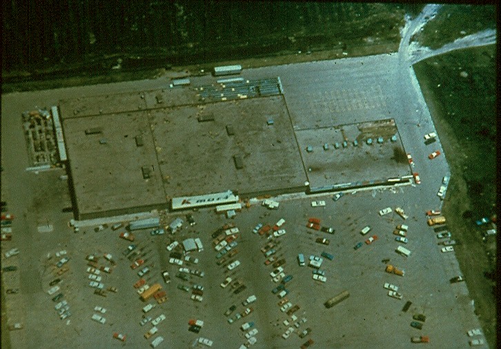 |
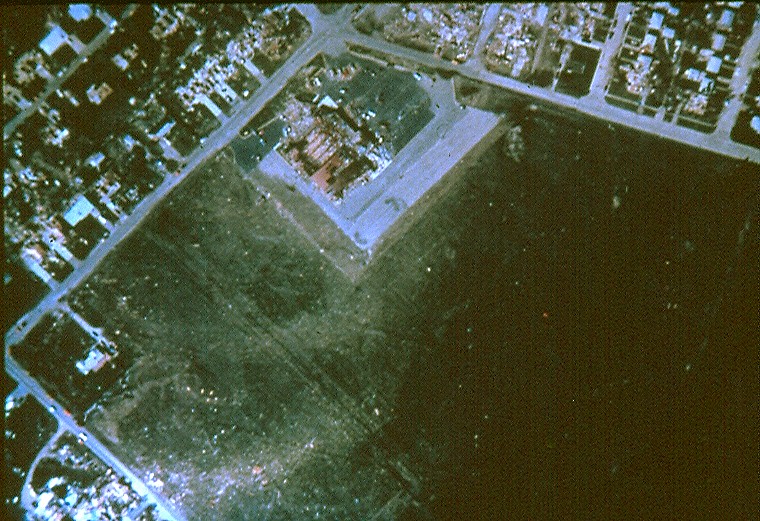
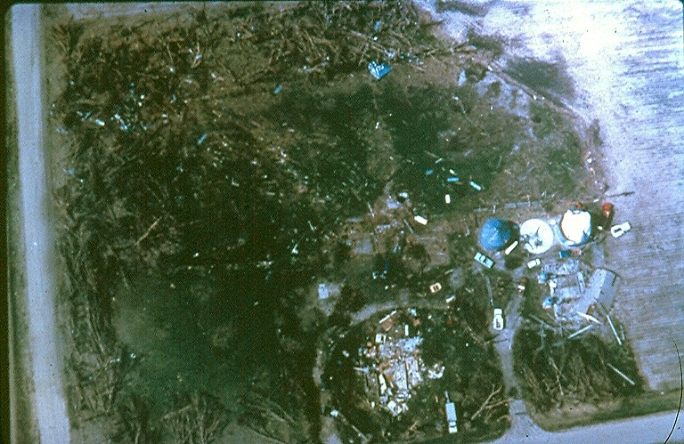
| Aerial view of damage from tornado #5 in the Eagles & Crystal Lake areas. | Aerial photo of the bowling alley (Meves Bowl) on East Bismark Road | Farmstead destroyed | K-Mart building on South Locust Street was spared major damage and served as a command post for post-storm operations. |
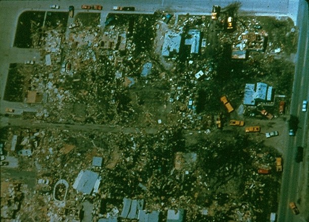
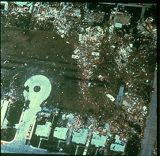 |
 |
 |
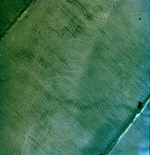 |
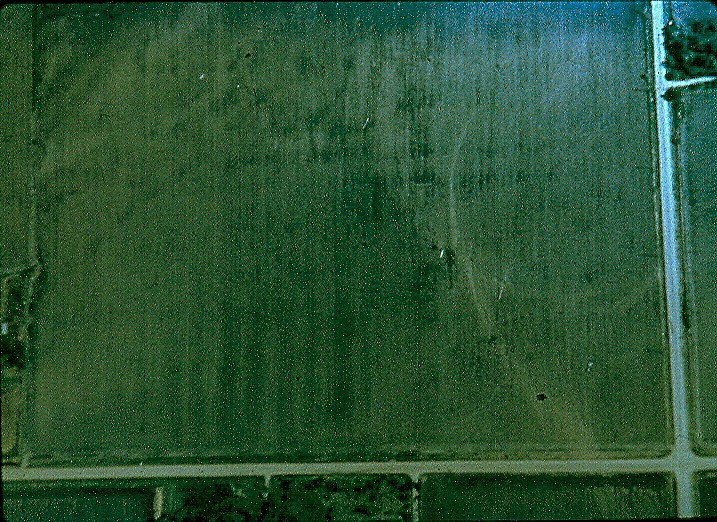
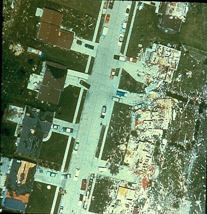
| Aerial view of extensive damage in northwest Grand Island | Aerial view of extensive damage in northwest Grand Island | Damge to a house with debris along tornado path. Prairie Creek runs along the left side of the photo. | Aerial photo of tornado path through a field. A 'swirl' pattern of the tornado circulation is visible. |
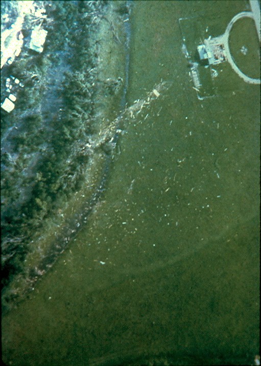
 |
 |
 |
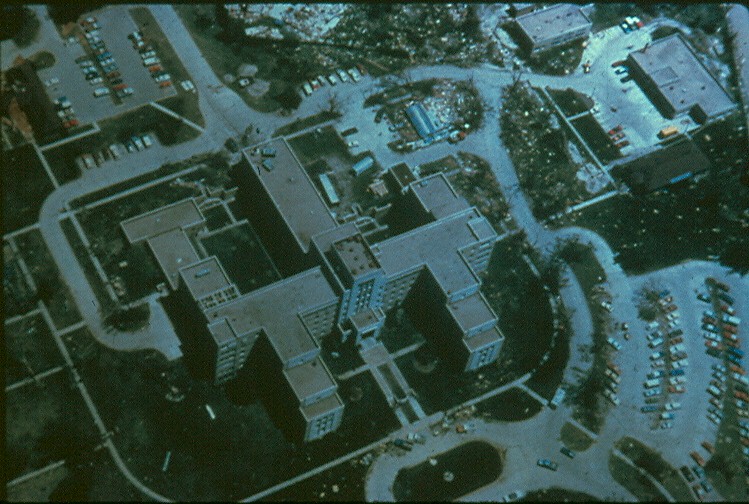 |
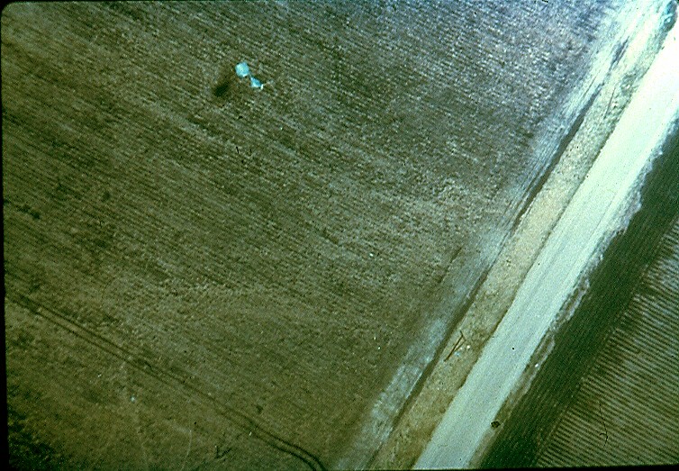
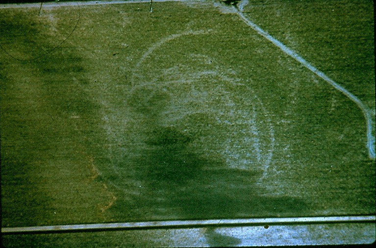
| Aerial view of scour marks from a tornado just southeast of Grand Island. | Damage in rural areas just southeast of Grand Island | More scour marks from one of the tornadoes southeast of Grand Island | Aerial view of the Veteran's Hospital |
 |
 |
 |
 |
| Residential Damage | Aerial damage view | Car dealership | Hotel and parking lot |
 |
 |
 |
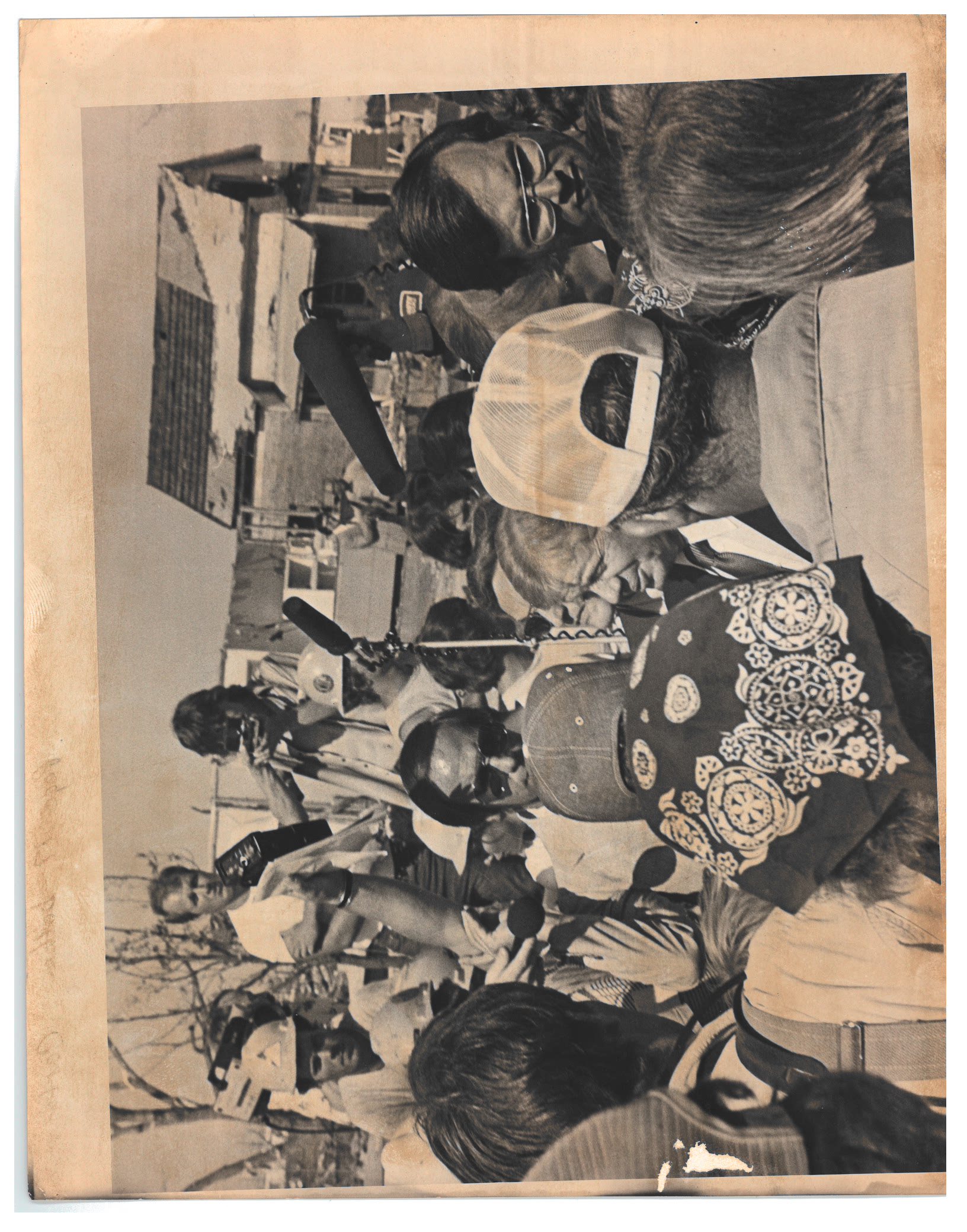 |
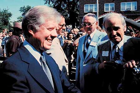
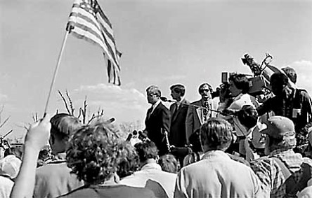
| Aerial photo of damage | President Carter Visit | President Carter Visit | President Carter Visit |
Damage by the numbers in Grand Island:
Cost:
Damage by the numbers in rural areas outside of Grand Island:
Cost:
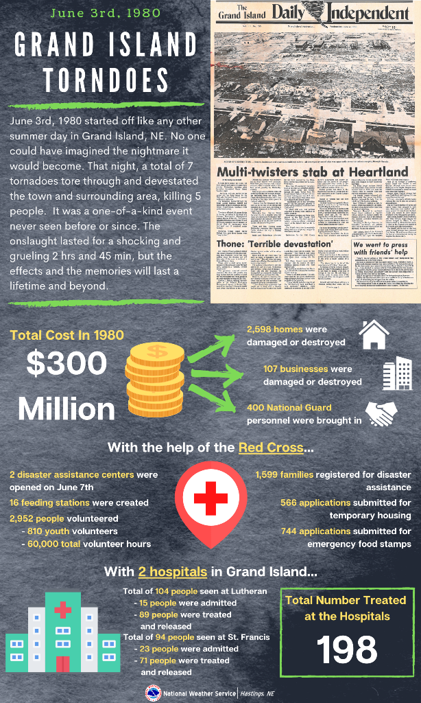 |
| Statistics from the June 3rd event. Click to enlarge. |
Model reanalysis data from the SPC Tornado Outbreak Interface: https://www.spc.noaa.gov/exper/outbreaks/#
Grand Island Independent event page: http://gitwisters.com/gitwisters/
More information about the F-Scale and Enhanced F-Scale can be found here: https://www.spc.noaa.gov/faq/tornado/f-scale.html
| F-Scale (1971-2006) | Enchanced F-Scale (2007-present) | |||
| Scale | Wind Estimate (mph) | Scale | Wind Estimate (mph) | |
| F0 | <73 | EF0 | 65-85 | |
| F1 | 73-112 | EF1 | 86-110 | |
| F2 | 113-157 | EF2 | 111-135 | |
| F3 | 158-206 | EF3 | 136-165 | |
| F4 | 207-260 | EF4 | 166-200 | |
| F5 | 261-318 | EF5 | >200 | |
 |
Media use of NWS Web News Stories is encouraged! Please acknowledge the NWS as the source of any news information accessed from this site. |
|

