National Weather Service United States Department of Commerce

Severe Weather and Flash Flooding Potential for the Center of the Nation

An upper level trough coinciding with surface frontal boundaries will focus showers and thunderstorms from the Great Lakes region into the Ohio and Tennessee Valley's, central and southern Plains. Instances of flash flooding, damaging winds and large hail are possible. Meanwhile, increasing waves and rip currents for portions of the eastern seaboard this week as tropical Atlantic is active. Read More >

Click a location below for detailed forecast.

Last Map Update: Mon, Sep 22, 2025 at 6:38:54 am MST

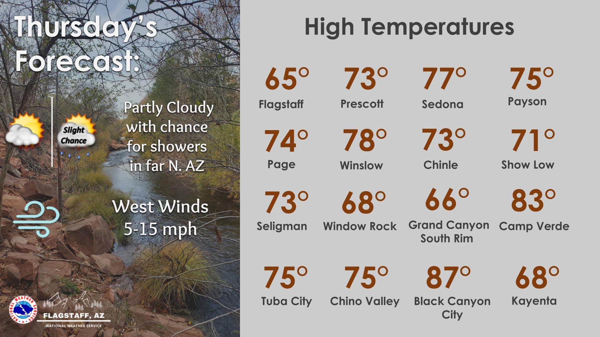
Showers and storms will spread north and east and become more numerous. Locally heavy rain possible. Most of the storm activity shifts to eastern Arizona by the afternoon, with coverage diminishing during the evening.
For today, look for scattered to numerous showers and thunderstorms along and south of a line extending from the Grand Canyon to the Four Corners. Unsettled conditions are forecast to continue through the end of the week.


Text Product Selector (Selected product opens in current window)