
Pacific storms will continue to bring strong winds, heavy rain with a risk for flooding to northern and central California, and heavy mountain snow in the Sierras, southern Cascades, and northern Rockies through Friday. Winter storm to impact the Midwest to Mid-Atlantic, with a combination of snow, sleet and freezing rain later today through Thursday. Hazardous travel is expected. Read More >


Media is free to use the NWS Flagstaff Event Summary information. Please acknowledge the NWS as the source of any information accessed from the site unless otherwise noted.
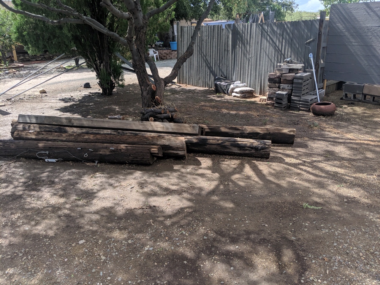
In the early morning hours (just before 4am MST) of September 26, 2019, a strong thunderstorm moved through the Spring Valley area in Yavapai County. A Severe Thunderstorm Warning was issued by the National Weather Service office in Flagstaff at 3:48 AM MST, continuing through 4:15 AM MST. Damage to several mobile homes and at least one power pole has been reported. A storm survey was conducted and it was determined that straight line winds around 75 mph was the likely culprit. Along with the strong storm, a Flash Flood Watch was in effect for Yavapai County. There were reports around the county of localized flooding throughout the morning hours.
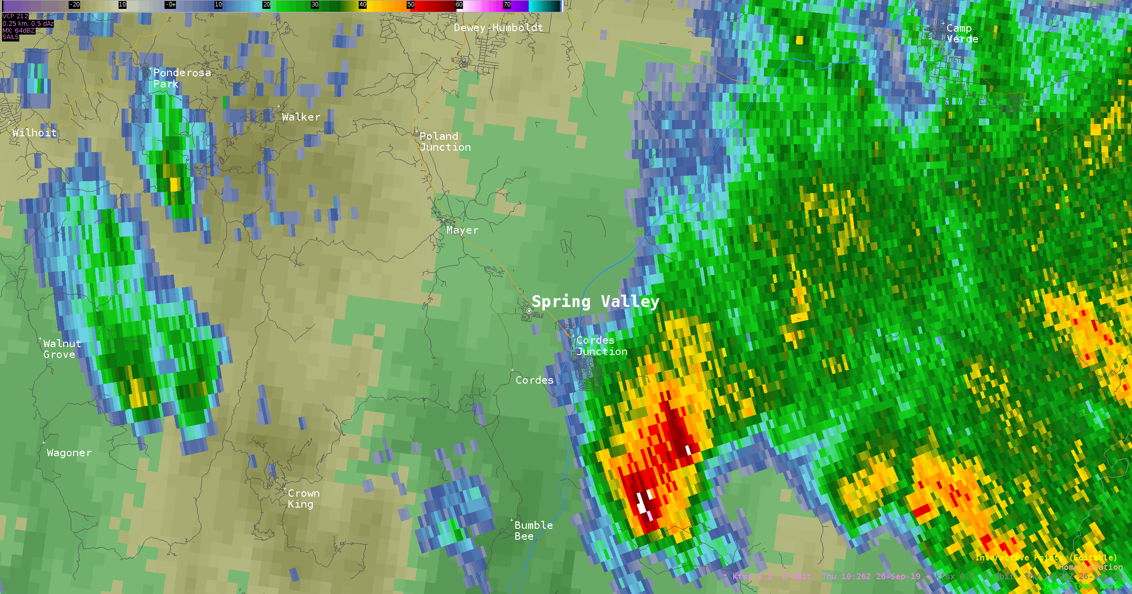
Radar Reflectivity from 3:28am MST to 4:02am MST as the storm moved through Spring Valley.

Radar velocity of the storm as it moved through Spring Valley. There was some weak rotation noted on the radar with this storm as it approached Spring Valley.

Trampoline destroyed in Spring Valley
A power pole was snapped in half in Spring Valley
.JPG)
Dry tall grass is seen in the foreground with considerable damage to the roof of a mobile home in the distance

The awning of a mobile home was separated from the main structure

Arial photo of damaged mobile home. Courtesy of Yavapai County Development Services
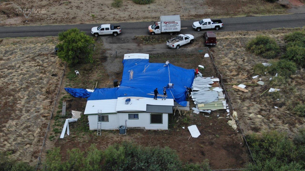
Arial photo of damaged mobile home. Courtesy of Yavapai County Development Services

Arial photo of damaged mobile home. Courtesy of Yavapai County Development Services

Arial photo of damaged mobile home. Courtesy of Yavapai County Development Services
A low pressure system which had been centered over southwest Arizona lifted north, bringing increased moisture into the area. This helped generated shower and storm activity in central Arizona late in the evening on September 25th. The storms spread to the northwest into Yavapai County in the early morning hours of September 26th. Enough instability and wind shear was in place for the development of a strong thunderstorm which tracked through Spring Valley around 4am MST.
For more information on impacts and general inquiries about this event, please reference the contacts below:

