
SKYWARN is a program that trains volunteers to help keep their local communities safe by providing timely and accurate reports of monsoon season weather to the National Weather Service Read More >

Media is free to use the NWS Flagstaff Event Summary information. Please acknowledge the NWS as the source of any information accessed from the site unless otherwise noted.
A cluster of strong thunderstorms with intense rainfall moved across the Sedona area between 1:45 – 3:00 PM MST. Most of Sedona received between 0.5 to 3 inches of rain in less than one hour. The runoff from the intense rain resulted in flash flooding at several locations, with the worst reported flooding at Tlaquepaque and West Sedona.

Radar Loop September 10th, 2009 From 1:29pm To 2:59pm

Infrared Satellite Loop September 10th, 2009 From 11:00am To 3:00pm
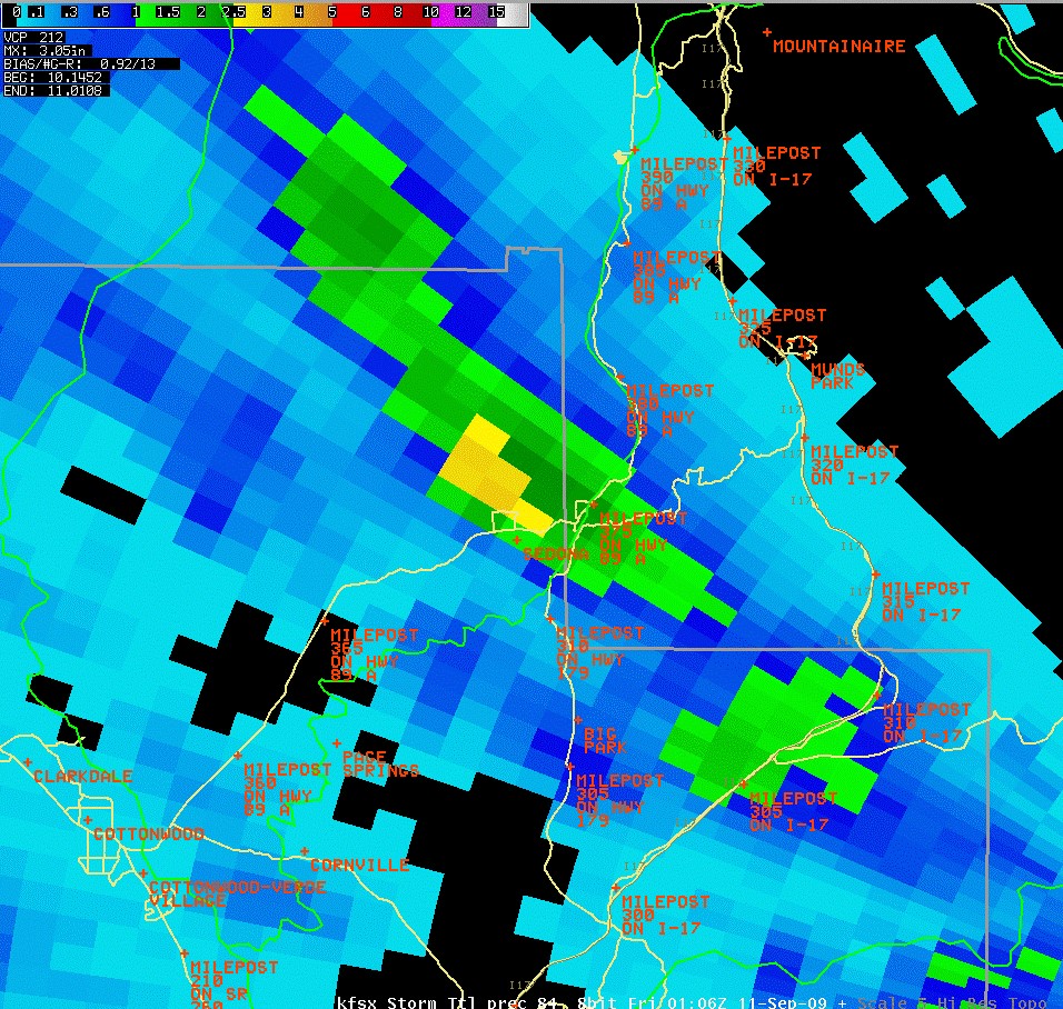
Radar Estimated Rainfall at 6:06 PM on September 10, 2009.

Water rushed off the Mogollon Rim and areas of other high terrain before converging in Sedona at Tlaquepaque Village. The water primarily flowed from northwest to southeast.

Mud, debris, and cars by Oak Creek Brewers (building on the left)

Mud in parking lot at Los Abrigados

Car removed from Soldier Pass Wash near Los Abrigados

Significant flood waters seen flowing in the Tlaquepaque area
The combination of abundant moisture, an unstable air mass, and a compact upper level low moving south across the region set the stage for scattered showers and thunderstorms over northern Arizona during the afternoon of September 10, 2009. A few of these thunderstorms produced intense rain and small hail.
For more information on impacts and general inquiries about this event, please reference the contacts below:

