
Showers and thunderstorms will accompany a cold front that will move across the eastern third of the country through Sunday. In the wake of this front, cooler temperatures will follow for most areas east of the Rockies. A wet pattern is expected to unfold across most of Florida this week with a persistent onshore flow and increase rip currents. For Hawaii, a return toward more rain the week ahead. Read More >


Media is free to use the NWS Flagstaff Event Summary information. Please acknowledge the NWS as the source of any information accessed from the site unless otherwise noted.
The Mangum Fire was first reported around 3 pm MST on June 8th, 2020 southwest of Jacob Lake, Arizona within the Kaibab National Forest. A Type 4 Incident Management Team responded that evening and began suppression efforts. The fire spread northeastward over the next few days due to low relative humidity and southwesterly winds. A Type 2 Southwest Incident Management Team replaced the Type 4 team on June 11th. Strong southwesterly winds spotted embers over US Highway 89A. The fire eventually spread out of the Kaibab National Forest and into pinyon juniper and sage brush grasslands northeast of Jacob Lake. Impacts from the Mangum Fire were felt throughout northern Arizona. The North Rim of Grand Canyon National Park, the town of Jacob Lake and residences along House Rock Road were evacuated. Much of Kaibab National Forest and Bureau of Land Managment public lands located on the Kaibab Plateau and across the Arizona Strip were closed. The North Rim of Grand Canyon National Park was closed during this period. Smoke from the Mangum Fire could be seen well into central Utah.

Mangum Fire perimeter as of June 30th, 2020.

The Mangum Fire progressed mainly northeast through the first week and a half before westerly winds pushed the fire eastward and downslope off the Kaibab Plateau.
×

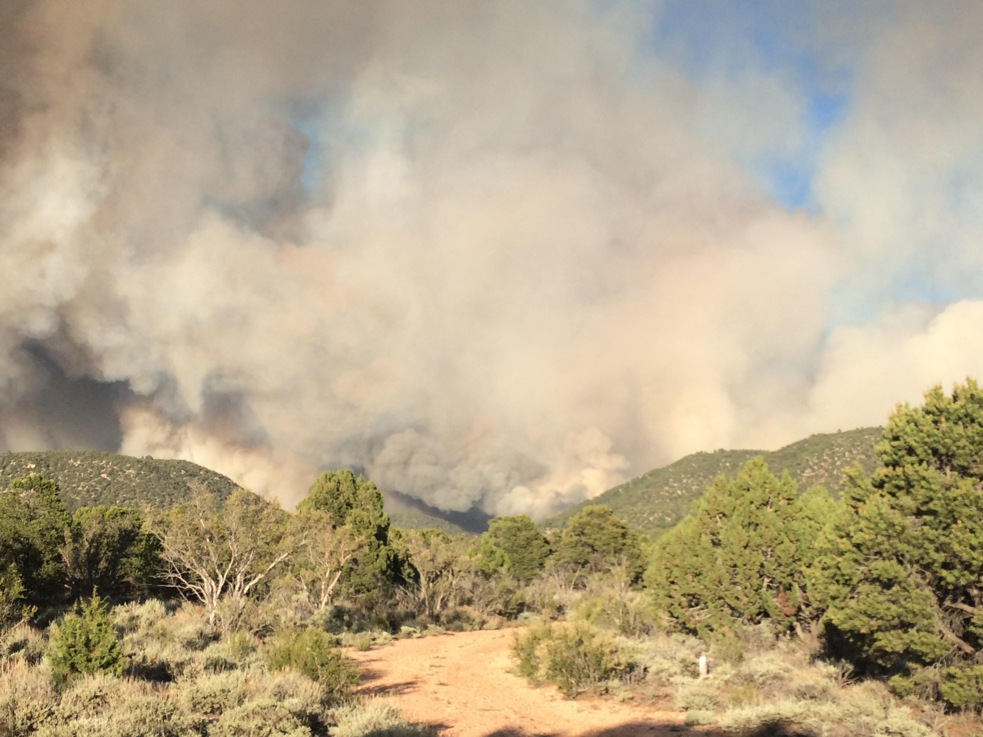
A large smoke plume could be seen from the town of Jacob Lake during the afternoon of Saturday June 13th, 2020. Photo Credit: Brian Schnee

Initial Mangum Fire smoke plume as seen on Wednesday June 8th, 2020. Photo Credit: Tyler Detwiler

Extreme fire behavior on the Mangum Fire throughout June 12, 2020 produces a large column of smoke. Photo Credit: Kaibab National Forest
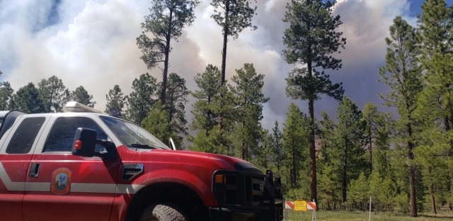
Multiple agencies, both local and regional, repsonded to the Mangum Fire. The Sedona, Arizona Fire Department sent a group of EMTs to the fire scene. Photo Credit: Sedona Fire Department

Satellite infrared imagery showing fire hotspots across Arizona on Saturday June 13th, 2020 with the Mangum Fire circled in yellow. Photo Credit: Wildfire Today using GOES-17 imagery

Smoke from Mangum Fire as seen from Fredonia, Ariz., on June 8, 2020. Photo by C.J. Adams. Credit Kaibab National Forest

Residents and visitors to the Kaibab Plateau were evacuated as the Mangum Fire grew in size. The Jacob Lake and the northern rim of Grand Canyon National Park were the primary evacuation areas. Photo Credit: Brian Schnee
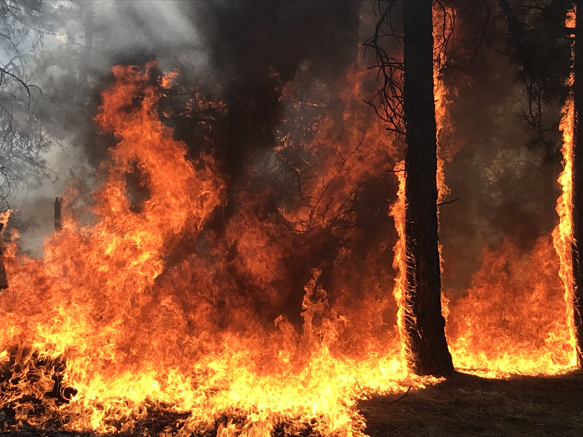
Extreme fire behavior on the Mangum Fire which took place on June 12, 2020. Photo Credit: Kaibab National Forest

Sun rises behind smoke produced from Mangum Fire in the early morning hours of June 12, 2020. Photo Credit: Kaibab National Forest
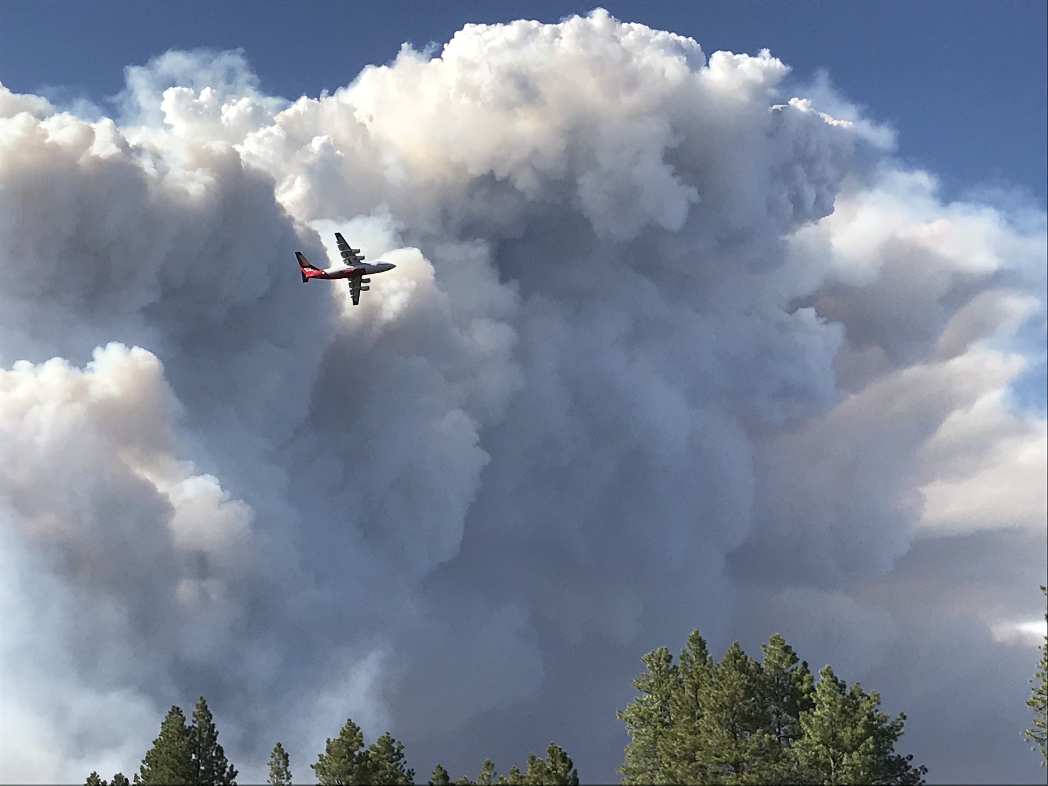
Very large air tanker flies past the Mangum Fire smoke column on June 12, 2020. Photo Credit: Kaibab National Forest

View of the Mangum Fire smoke column from the Fredonia High School. Photo Credit: Kaibab National Forest
Smoke produced from the Mangum Fire on June 12, 2020. Photo Credit: Kaibab National Forest
Fuels (grasses, shrubs, etc.) in early to mid-June are typically very dry and this held true in June 2020. The Drypark Remote Automatic Weather Station recorded Energy Release Component values above the 90th percentile in early June. The dry fuels combined with typical low relative humidity and breezy southwesterly afternoon winds during the first few days allowed the fire to spread northeastward across the Kaibab Plateau. By June 11th, winds began to increase out ahead of a Pacific Northwest low pressure system. The increased winds (Figure 1) and very low relative humidity values (Figure 2) created critical fire weather conditions on June 12th and 13th. The Mangum Fire rapidly expanded in size these two days. Elevated afternoon mixing heights on the 12th and 13th allowed for smoke created by the fire to reach 17,000 feet above ground level (about 24,000 feet MSL). The smoke column and plume were easily depicted on KICX radar imagery as the smoke was transported north-northeastward, mainly into Utah. Although, smoke was observed in Page, Arizona during the morning hours on June 14th and caused temporary reductions in visibility at Page Airport (KPGA). A shift in wind direction to the west/northwest occurred on June 17th and 18th. The change in wind direction drove the fire in a more east-southeastward direction versus the previous north-northeastward fire direction.
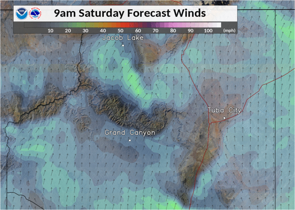
Figure 1. A strong low pressure system centered off the Washington state coast between June 11th and June 14th created tightened gradients aloft. Gusty winds mixed to the surface each afternoon. Wind gusts upwards of 40 mph were forecast and observed.

Figure 2. A typical very dry low and mid-level air mass setup over far northern Arizona in mid-June. Forecast afternoon minimum relative humidity values were in the low teens and single digits with very little overnight recovery.
For more information on impacts and general inquiries about this event, contact by sending an email to or by calling .
Media is free to use this event summary information. Please acknowledge the National Weather Service as the source of any information accessed from the site unless otherwise noted.

