Strong to severe thunderstorms will continue this evening from eastern Texas into the lower Mississippi and Tennessee Valleys/southern Appalachians. The strongest storms could produce a few strong tornadoes (EF2+), damaging wind gusts, large hail, and locally heavy to excessive rainfall which may results in flash and urban flooding. Read More >
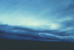
Clouds![]()
Clouds form when the temperature of the air reaches the condensation point, which is the point at which water vapor becomes a liquid. When it reaches this point, the liquid collects on the dust particles in the air and become visible.
We call the results clouds, unless the clouds form at the ground surface, in which case we call it fog. Various factors influence the exact point at which condensation can occur, such as the air pressure at a given altitude, the moisture content of the air, and the air temperature. In most cases, air temperature is the most important factor.
Clouds held a particular fascination for a young Englishman named Luke Howard (1773-1864). His father had sent him to grammar school at Burford, a village to the west of London. But Luke was more interested in the books about nature than in volumes of the Greek and Latin classics.
Before 1800, observers spoke of clouds only as "essences" floating in the sky. Clouds had no names and were not well understood.  The nature and behavior of atmospheric gases, such as oxygen and nitrogen, were just being investigated in the laboratories of Great Britain and Europe.
In Luke Howard's school years, high-level dust from volcanic eruptions in Iceland and Japan caused brilliant sunrises and sunsets. To Howard's logical mind, clouds and complicated halos must be the result of cause and effect in the natural order. Luke wanted to know more.
At the age of 20, Howard returned to London to work as a pharmacist. As a hobby, he joined a group of scientists, known then as "natural philosophers," who called themselves the Askesians (searchers after knowledge). Each member, in turn, read a scientific paper to the others. Luke Howards turn came one night during the winter of 1802-03. His paper was titled, "On the modification of clouds." In our current language, modification means classification. This paper was so well received that it was published and it has become a classic in the history of science. Today we still use the basic scheme that Howard presented that night and the Latin names he assigned to the clouds.
Howard noted that there are three basic shapes to clouds:
To clouds generating precipitation, he gave the name nimbus (Latin for rain).
Clouds are found in three layers in the lower atmosphere. Thus, with four types of clouds and three layers, we come up with 12 major cloud types that have evolved from Howard's pioneering work.
As we know, temperature typically doesn't vary dramatically in the horizontal, but temperature does vary with height. In fact, temperature typically decreases with height, as can be found when climbing a mountain. This fact means that the condensation point is also horizontally uniform at a given alt itude. Above this altitude, water vapor will condense out to form clouds, below it water will remain in its gaseous state. Therefore, because the point at which condensation occurs tends to be about as uniform as surface temperature, the bottoms of most clouds will appear flat.
Even though the condensation point tends to be at a constant altitude, the cloud will continue to grow vertically after condensation. How high it will grow depends again on the three factors discussed above. However, as the cloud grows vertically, it will draw in drier air from the surrounding atmosphere. The cloud will then start to evaporate along the edges and erode, leading to the "fluffy" look.
Not all clouds, however, have a rounded, fluffy appearance on top. Those that do are called cumulus clouds. They are formed as warm, moist air rises and cools to the condensation point. The air stops rising when it cools to the temperature of the surrounding air in the atmosphere. In contrast, stratus clouds form when the ambient temperature of the air reaches the condensation point by being forced aloft, such as over a warm frontal boundary. There is little vertical motion of the air, so the clouds form in place and have a flat bottom AND top. Both types have "flat" bottoms though, formed through the process discussed above.
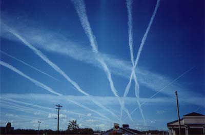
What is a contrail and how does it form?![]()
To answer this question, lets first identify what a contrail is. A contrail is the condensation trail that is left behind by a passing jet plane. Contrails form when hot humid air from jet exhaust mixes with environmental air of low vapor pressure and low temperature. Vapor pressure is just a fancy term for the amount of pressure that is exerted by water vapor itself (as opposed to atm ospheric, or barometric, pressure which is due to the weight of the entire atmosphere above you). The mixing occurs directly behind the plane due to the turbulence generated by the engine. If condensation (conversion from a gas to a liquid) occurs, then a contrail becomes visible. Since air temperatures at these high atmospheric levels are very cold (generally colder than -40 F), only a small amount of liquid is necessary for condensation to occur. Water is a normal byproduct of combustion in engines.
This cloud formation is very similar to the process that occurs when you breath on a cold winter day and you can see your own breath in the form of a "cloud". You may have noticed that on some days this "cloud" you produce lasts longer than on other days where it quickly disappears. The length of time that a contrail lasts is directly proportional to the amount of humidity that is already in the atmosphere. A drier atmosphere leads to a more short-lived contrail, while an atmosphere that has more humidity will lead to longer-lived contrails. However, if the atmosphere is too dry, no contrails will form. Occasionally a jet plane, especially if ascending or descending, will pass through a much drier or more moist layer of atmosphere which may result in a broken pattern to the contrail, with it appearing in segments rather than in one continuous plume.
Contrails can be found over most of the planet. Now that jet plane traffic, both civilian and military, can be at anyplace over the globe at anytime, contrails are becoming more and more common. This picture was taken by the NOAA-12 satellite as it passed over portions of Europe in 1995. It is very obvious from this color enhanced satellite image that the atmosphere was very conducive to the development of contrails on this date (5 April 1995) and that these contrails were long-lived enough to accumulate with many criss-cross patterns over the same heavily travelled portion of air space.
Contrails have been recorded throughout the history of jet plane travel. Many re ports exist from World War II of situations where the accumulations of contrails was so extensive that pilots were unable to keep visual contact with neighbor or enemy planes during combat. Contrails have been recorded from the Sahara Desert to the South Pole indicating that contrails are not constrained to only populated regions of the Earth.
If contrails persist for a long enough period of time, say on the order of an hour or more, they can spread out across the sky due to the prevailing winds at the level at which they formed. The two figures show how contrails generated on this particular day spread out fairly quickly due to the stronger jet stream of air aloft. Persistence of contrails is neither an indication that they contain some kind of chemical, nor that it is some kind of spray. As a matter of fact, sailors have known for some time to look specifically at the patterns and persistence of jet contrails for weather forecasting. On days where the contrails disappear quickly or don't even form, they can expect continuing good weather, while on days where they persist, a change in the weather pattern may be expected.
Contrails are a concern in climate studies as increased jet traffic may result in an increase in cloud cover. Several scientific studies are being conducted with respect to contrail formation and their climatic effects. Cirrus clouds affect Earth's climate by reflecting incoming sunlight and inhibiting heat loss from the surface of the planet. It has been estimated that in certain heavy air-traffic corridors, cloud cover has increased by as much as 20%. Since contrails can spread out and essentially become cirrus clouds, it is felt that contrails may affect the planetary climate in similar ways. Other studies are underway to better understand the role that jet exhaust itself plays in modifying the chemistry of the upper levels of the atmosphere.