
A late-season winter storm continues to bring heavy snow, significant sleet, and disruptive icing to the Upper Midwest and western Great Lakes into the morning; and will be followed by another storm. Severe thunderstorms continue across the Midwest to the lower Great Lakes through tonight, before bringing a round of freezing rain and sleet Friday morning across northern New England. Read More >
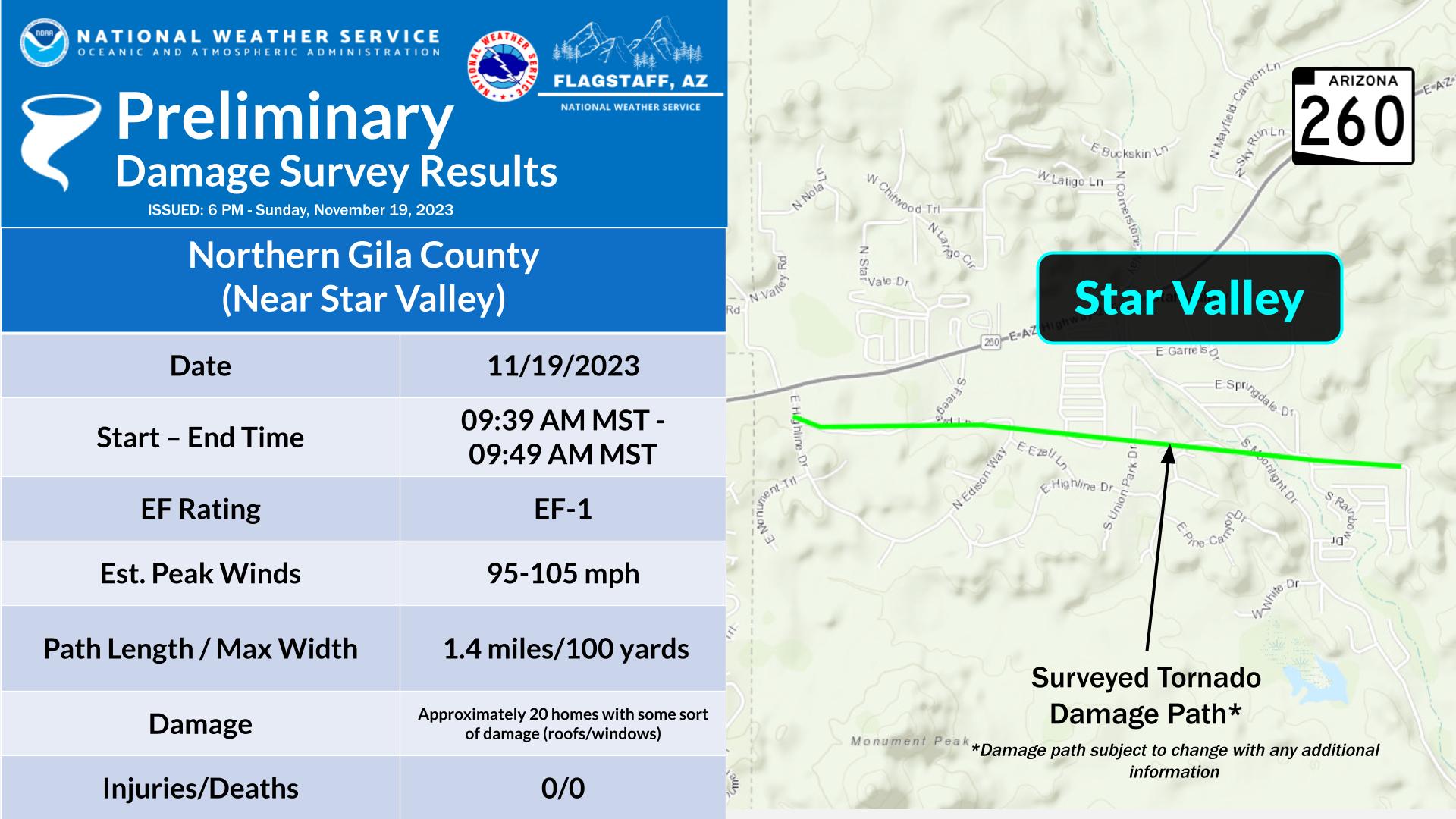
Scattered showers developed ahead of a cold front over Arizona's High Country on the morning of November 19th, 2023. One storm near Star Valley (east of Payson in northern Gila County) developed within a favorable environment and produced a short-lived EF-1 tornado around 9:35 AM MST. No injuries or fatalities have been reported with damage limited mostly to trees and residential structures.
| 9-9:35 AM MST: |
Showers organize to the west of Payson, and move toward the area at around 20 mph. |
| 9:39 AM MST: |
Tornado begins southwest of Star Valley. |
| 9:49 AM MST: |
Tornado lifts southeast of Star Valley |
 |
 |
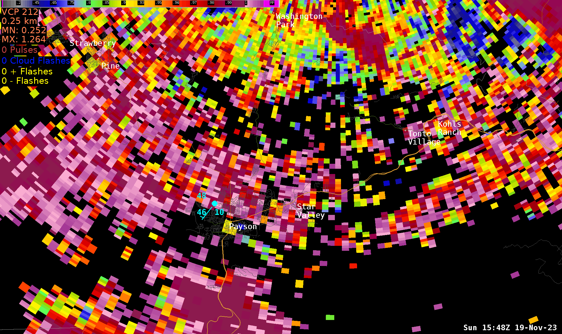 |
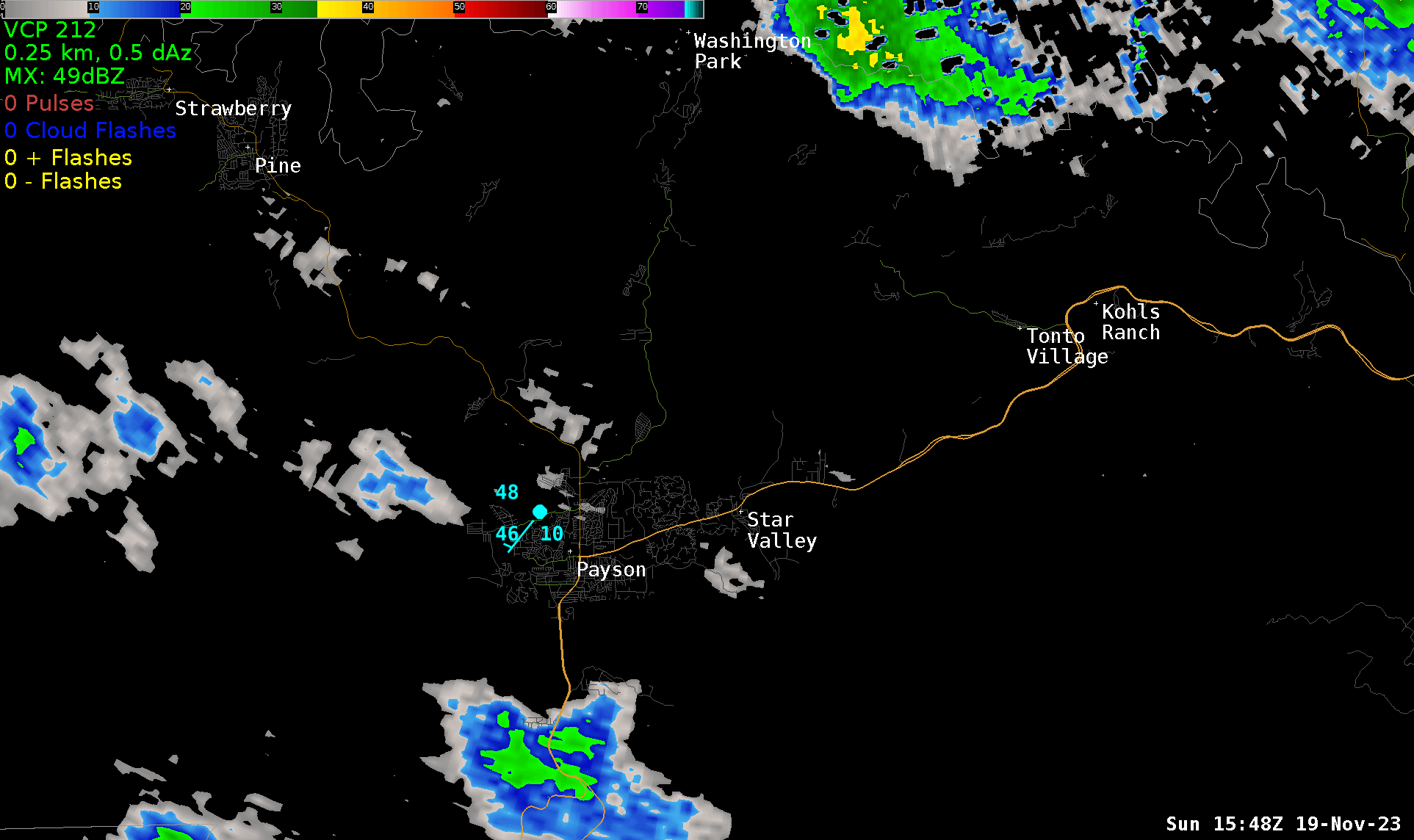
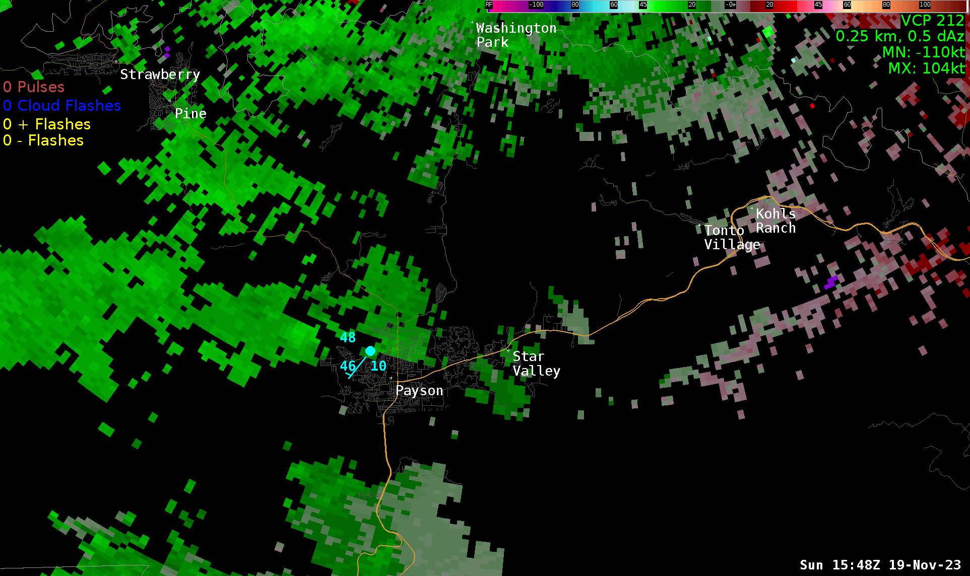
| Loop of radar reflectivity from 8:48 AM to 10:00 AM MST on November 19, 2023. The blue colors indicate light rain, while the green and yellow indicate areas of steadier rain. Orange and red shading indicate areas of heavy rain. | Loop of storm-relative velocity from 8:48 AM to 10:00 AM MST on November 19, 2023. The red and green colors indicate winds away (red) and towards (green) the radar, which is to the north in this image. The areas of red and green close to each other over Star Valley show the area of rotation that produced the tornado. | Loop of correlation coefficient from 8:48 AM to 10:00 AM MST on November 19, 2023. Red and orange colors indicate areas of meteorological targets while the blue and green are non-meteorological targets. Note the sudden drop over Star Valley indicates the lofted debris from the tornado being detected by the radar. |
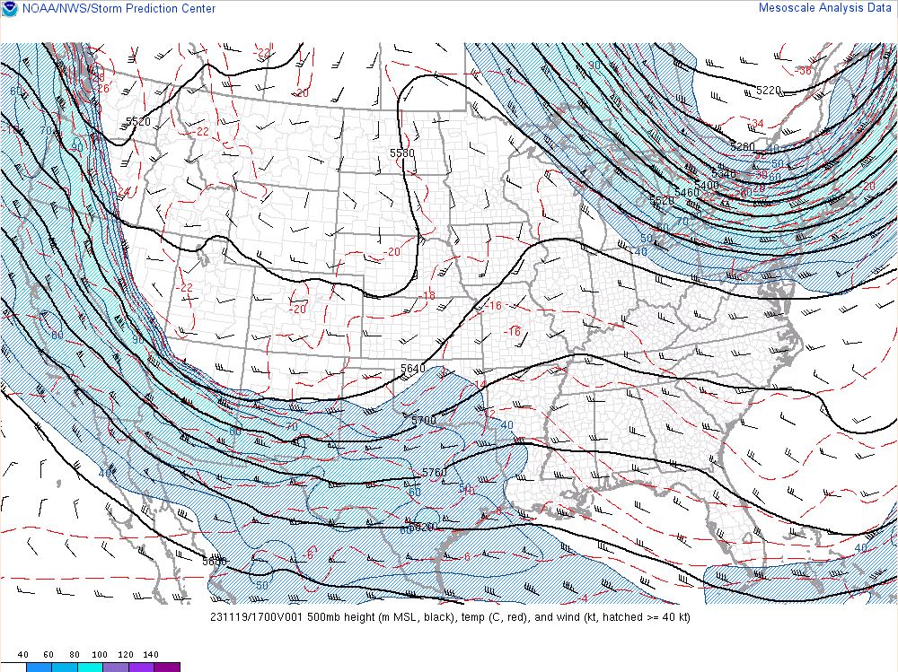
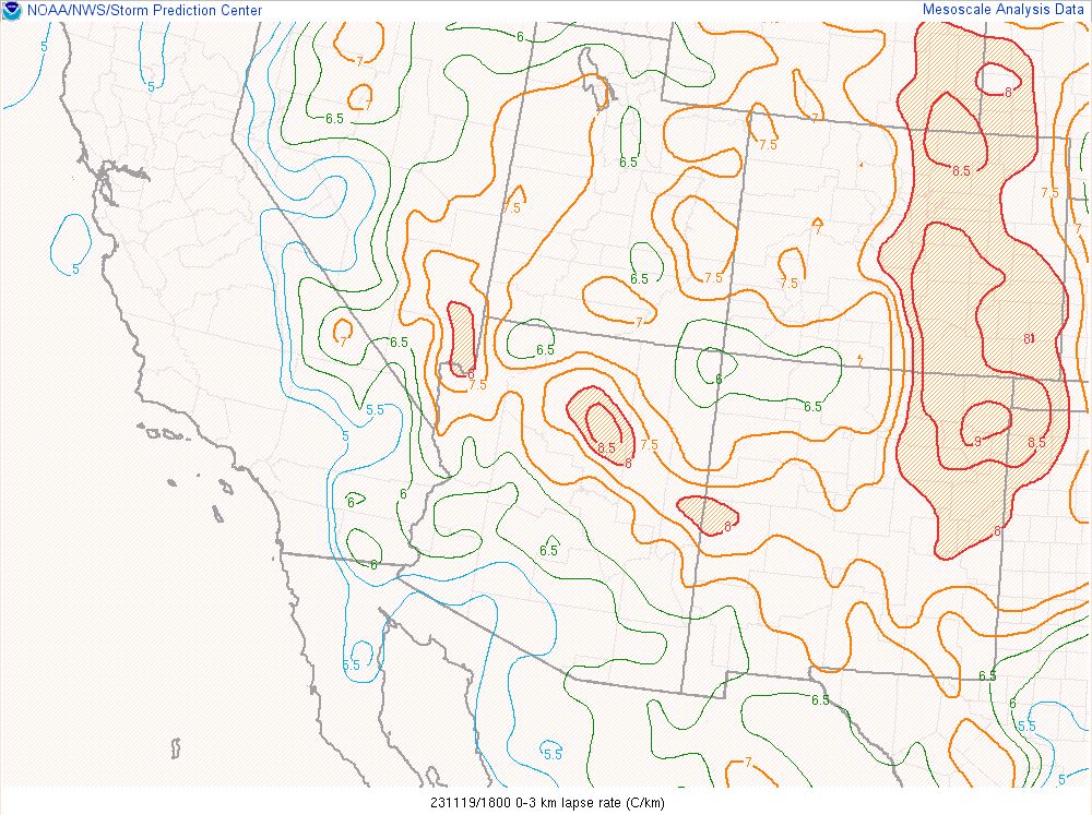
A fast-moving cold front (associated with a broad trough across the western US) approached Arizona from the north on the morning of November 19, 2023. The environment ahead (south) of the front was moist and somewhat unstable. Much of the instability was due to a very cold air mass aloft, resulting in steep low-level lapse rates. Areas of rain showers and high-elevation snow showers developed ahead of the front over the High Country of northern Arizona by mid-morning. In the Payson area, showers first developed between 8:45 and 9:00 am. The storm that produced the tornado developed around 8:50am MST, about 10 miles southwest of Pine. Over the course of the next 30 minutes, the storm developed a weak rotation and moved to the east at 20-25mph, toward Payson and Star Valley. As the storm moved east of Payson, the rotation within the storm strengthened significantly, producing the tornado that caused the damage in the Star Valley area. The tornado appeared to have surface impacts for about 1.5 - 2.0 miles (duration was about 10 minutes). By 9:49am, the tornado appears to have dissipated. Lofted debris carried into the storm could still be observed on Doppler radar at 10:04 am, when the storm was well east of the area.
 |
 |
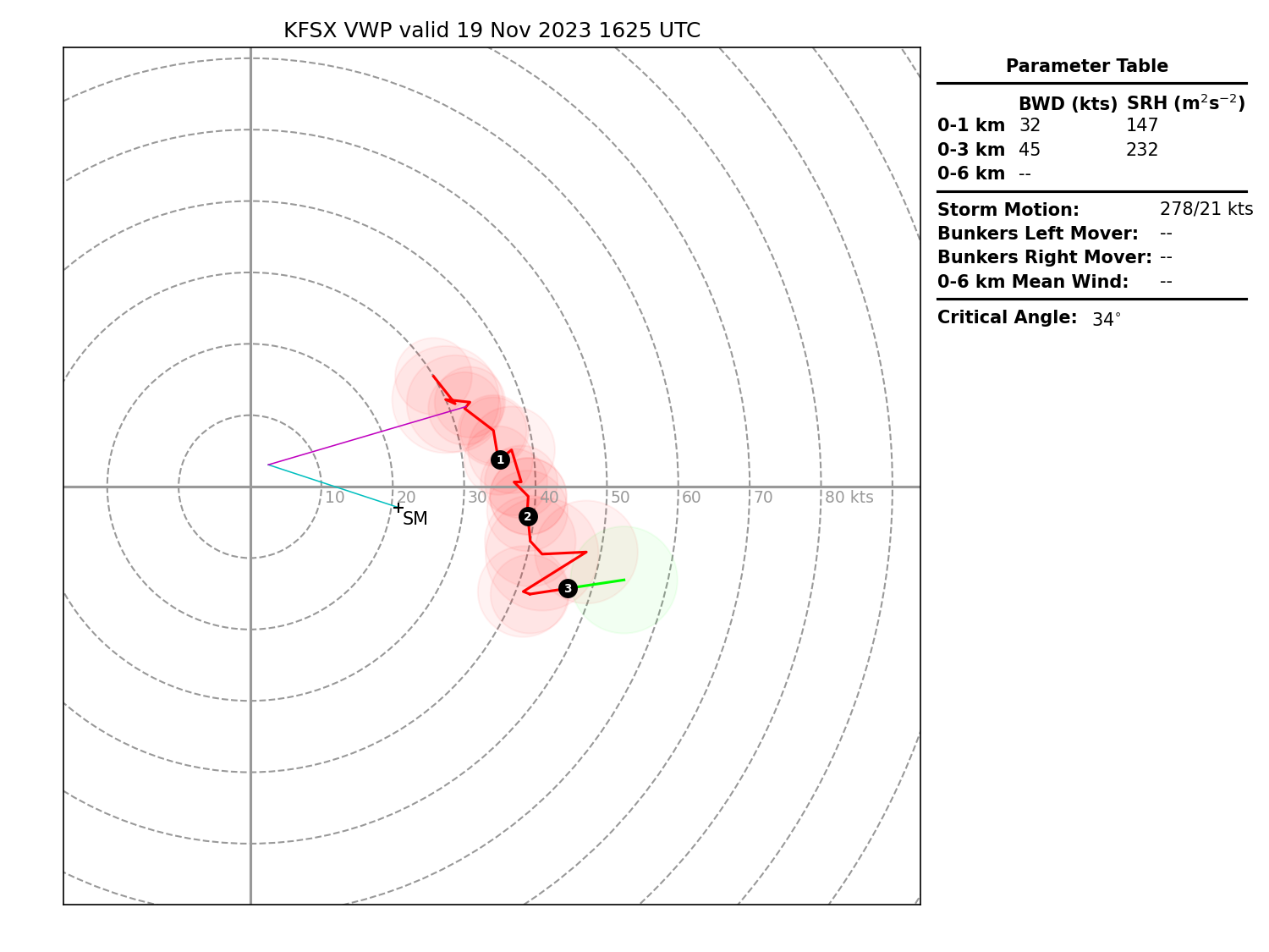 |
| 500mb analysis at 10:00 AM MST on November 19, 2023 showing a broad trough over the west, with the axis approaching Arizona. | 0-3 km lapse rates at 10:00 AM MST on November 19, 2023 showing steep low-level lapse rates along and north of the Mogollon Rim, indicative of a destabilized environment. | Velocity Azimuth Display (VAD) from the Flagstaff (KFSX) radar at at 9:25 AM MST on November 19, 2023 showing some low-level curvature and fairly strong low-level wind shear. |
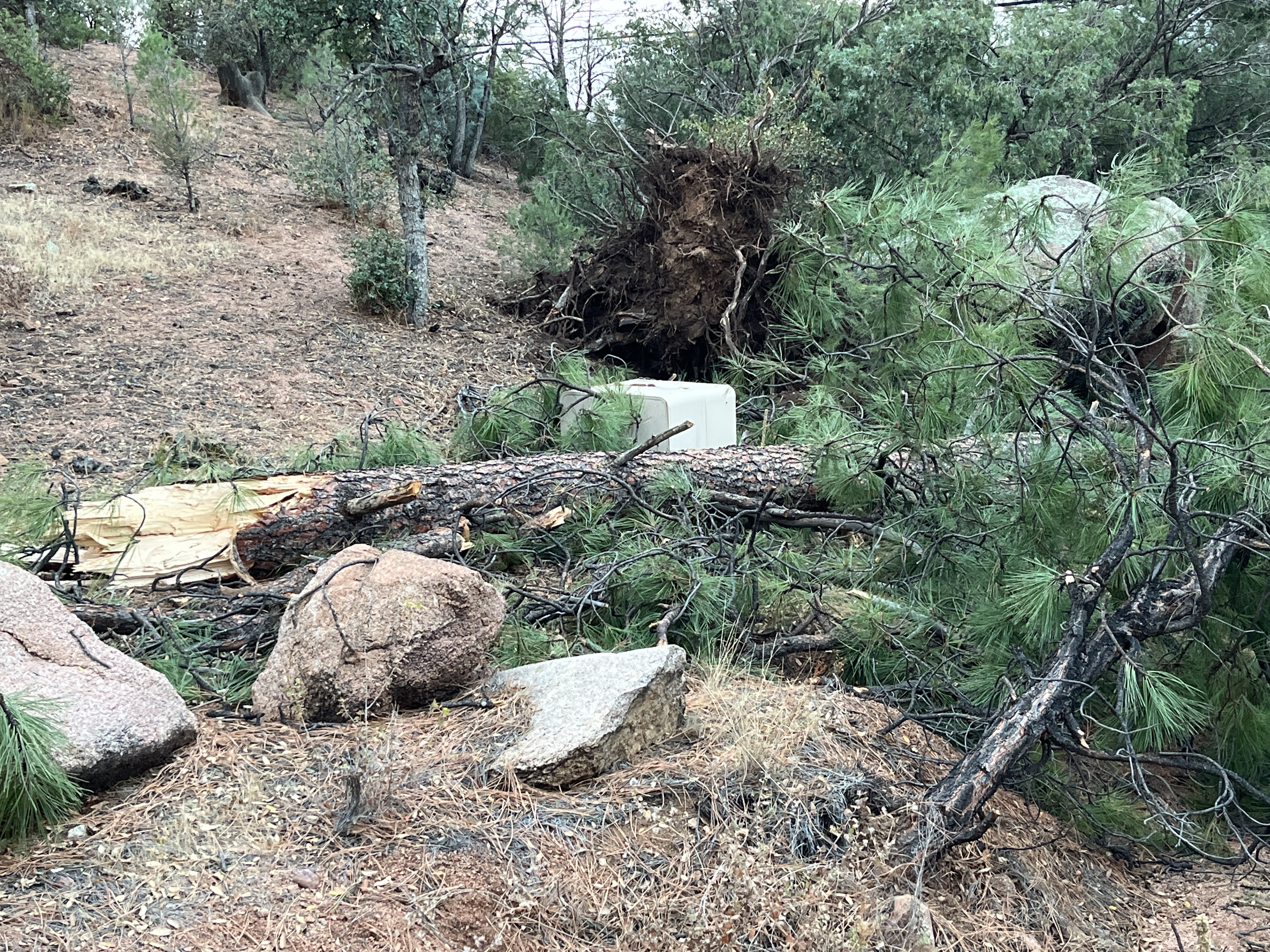
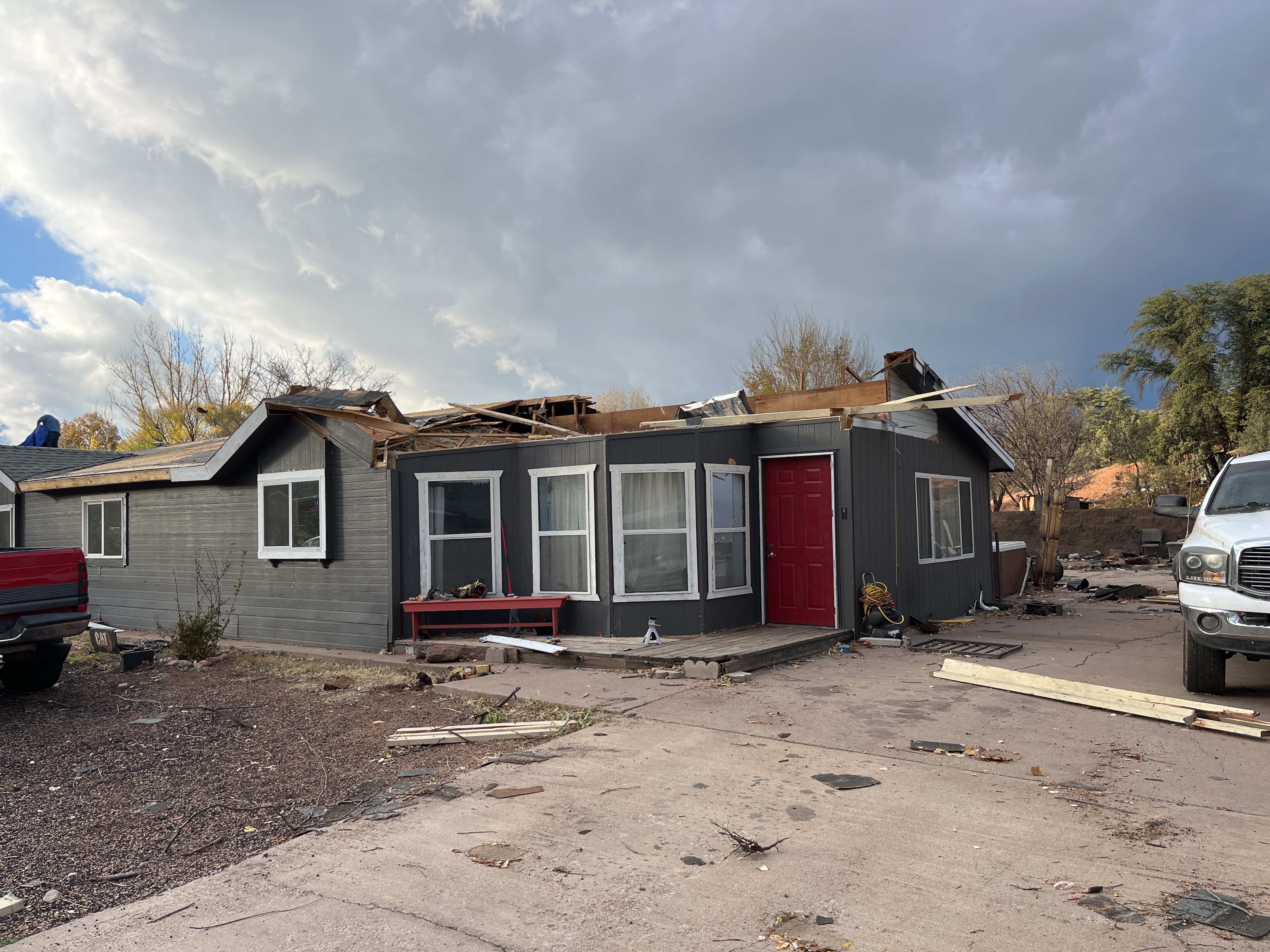
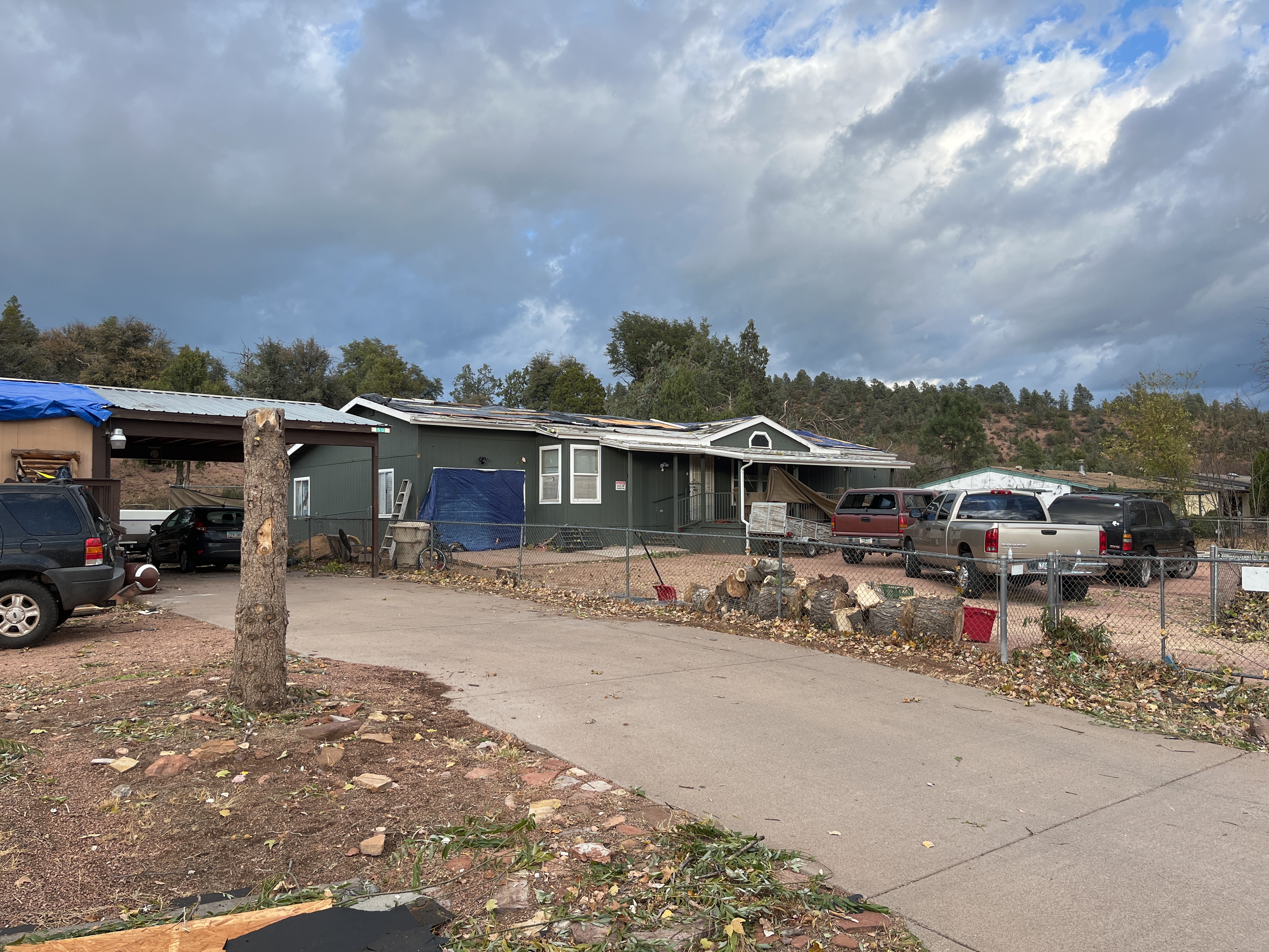
The first sign of damage associated with the tornado was just south of Arizona Route 260 roughly 1 mile southwest of Star Valley. There was noteworthy damage to a few homes, an outbuilding, and additional damage to multiple softwood and hardwood trees during the first one-fourth to one-third mile portion of the damage path. The tornado moved eastward for a mile towards Houston Creek where the damage to residential structures (mostly manufactured homes) was most concentrated. At least 20 structures were impacted, with damage to roofs, windows, and the landscaping associated with the properties. A couple roofs were nearly entirely removed by the storm. The damage path then diminished just under one-half mile east of Houston Creek. No injuries or fatalities have been reported from this tornado. Based on damage indicators, the tornado estimated peak wind speed was placed at 105 mph (EF1).
Click on an image to view the full size.
 |
 |
 |
| Snapped trees at the start of the damage path near E. Highline Drive and E. Saddleback Trail. | Manufactured home with roof uplifted on E. Quail Hollow Drive. | Manufactured home with uplift of roof deck and loss of significant roof covering material on E. Quail Hollow Drive. |
For more information on impacts and general inquiries about this event, contact by sending an email to or by calling .
Media is free to use this event summary information. Please acknowledge the National Weather Service as the source of any information accessed from the site unless otherwise noted.

