
SKYWARN is a program that trains volunteers to help keep their local communities safe by providing timely and accurate reports of monsoon season weather to the National Weather Service Read More >
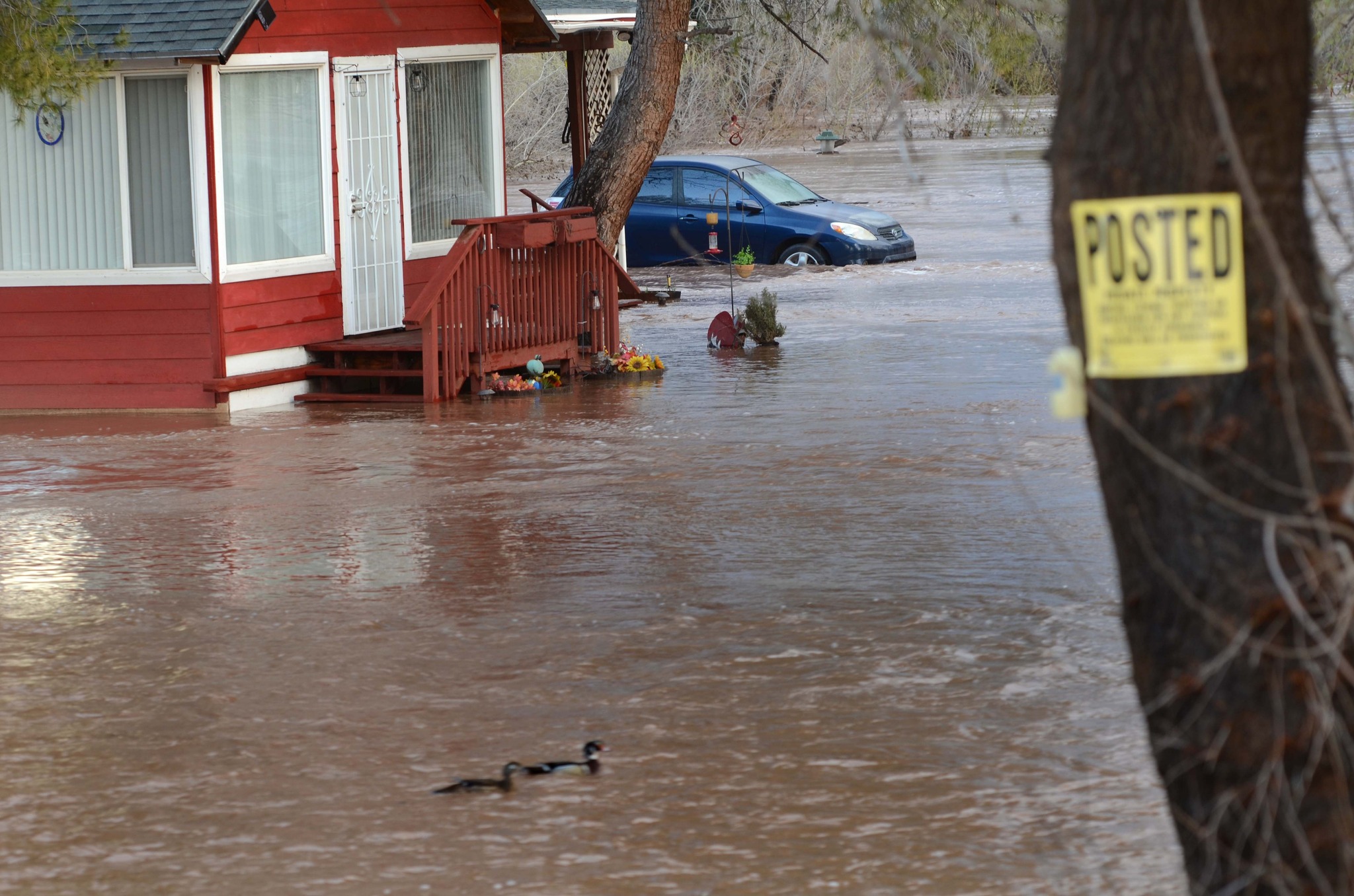
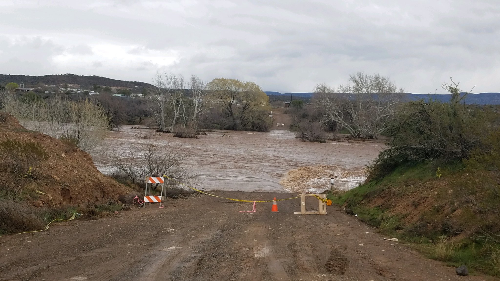 Dry Beaver Creek at Cornville Rd and E Kimberleys Way on March 22nd. Photo courtesy of Yavapai County Flood Control District.
It had already been a record wet and snowy Winter across northern Arizona when one of the wettest storms of the year hit the area late in March, causing some of the worst, and most widespread flooding in decades. A strong, broad and slow-moving low pressure system brought copious moisture to central and northern Arizona from March 20th through March 22nd. A mix of rain and snow allowed for existing snowpack to increase at the higher elevations, but rapidly melt at the lower elevations. Creeks, streams, and rivers that had already been at elevated levels from previous storm systems were amplified from this storm. Precipitation (mostly rain) began during the late evening hours on Monday, March 20th and continued throughout Tuesday, March 21st. Rain began to transition to snow for many higher elevation areas on Wednesday, March 22nd. Stream gauges quickly started to rise Tuesday morning with the start of the heavier precipitation. Most of the streams and rivers south of the Mogollon Rim reached their maximum levels before 12 (noon) on Wednesday, while areas to the north saw their peaks later on Wednesday and into Thursday morning.
 |
 |
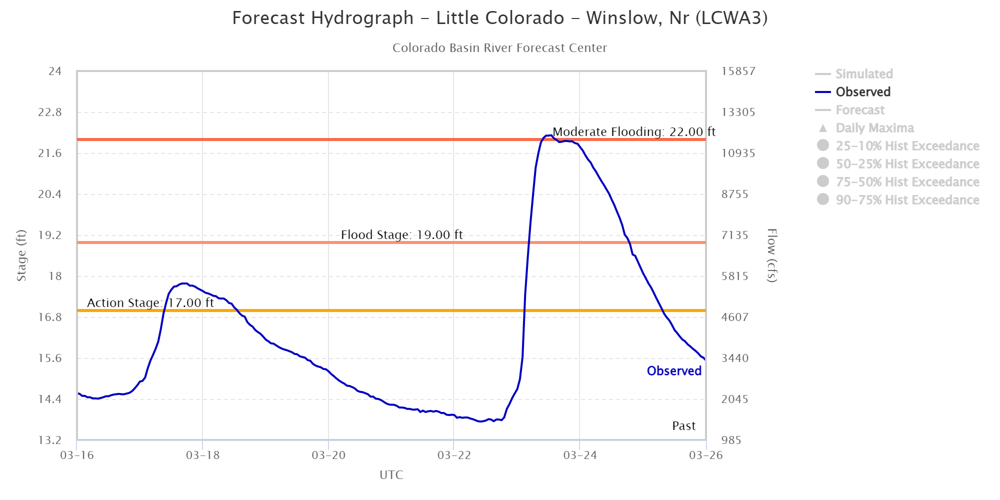 |
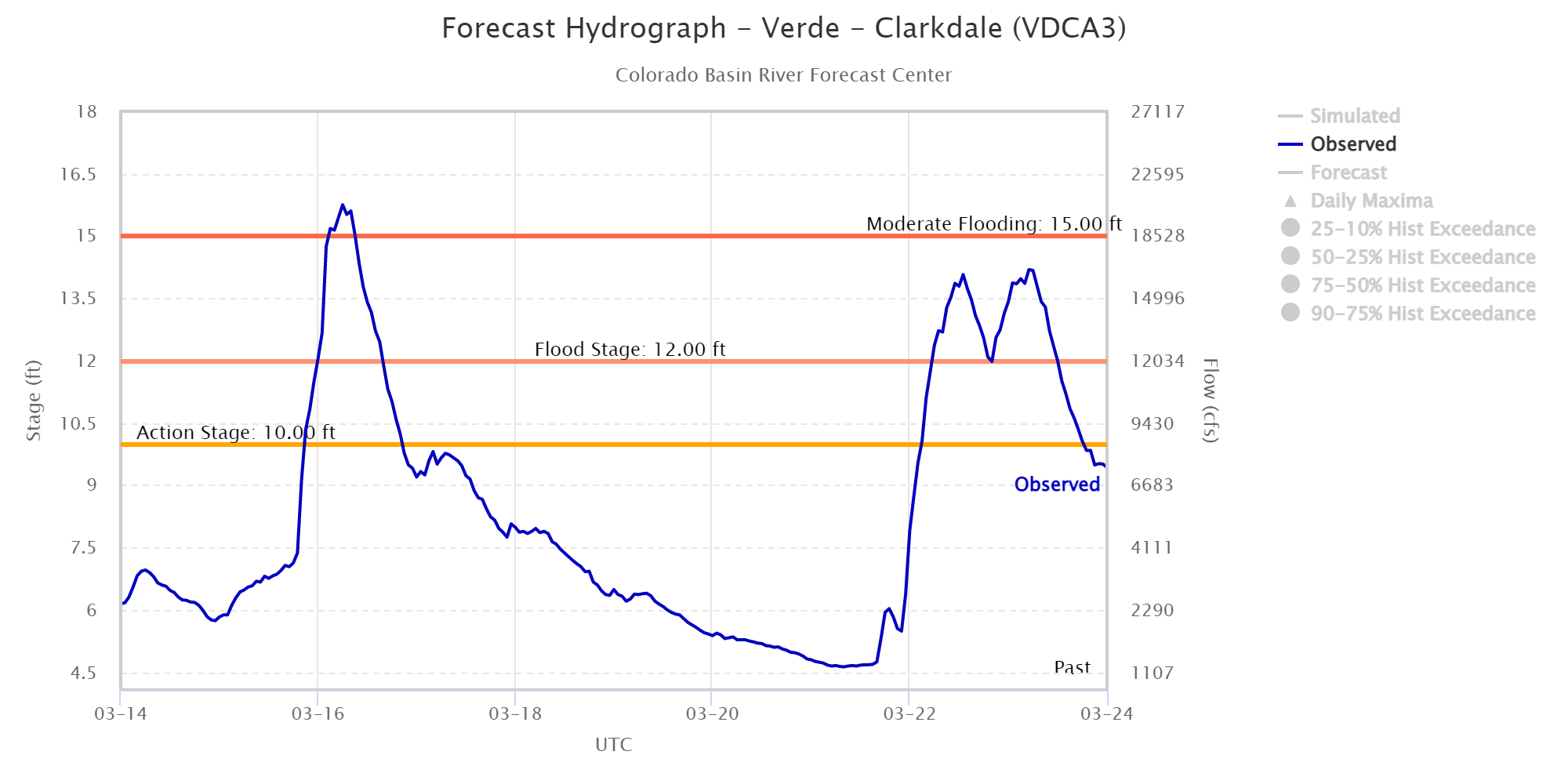
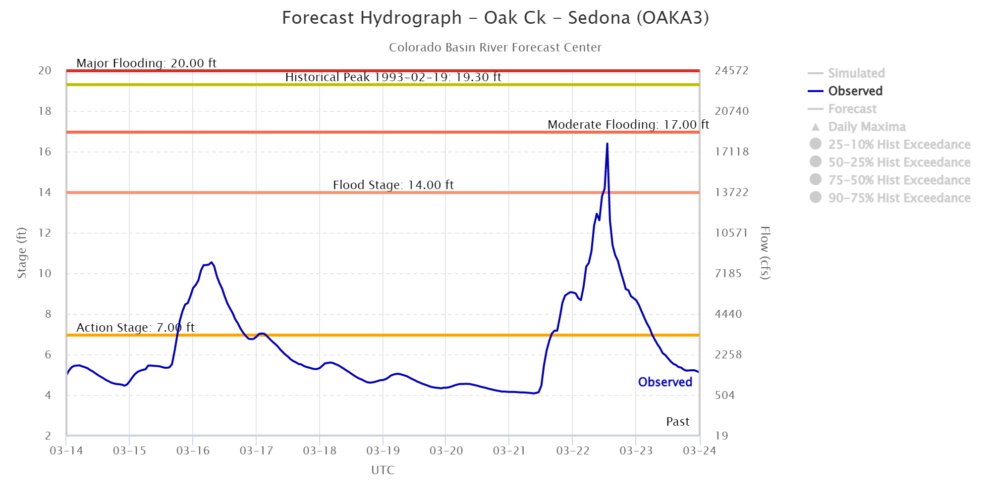
| Hydrograph of the Verde River at Clarkdale from March 14-24. | Hydrograph of Oak Creek near Sedona from March 14-24. | Hydrograph of the Little Colorado River near Winslow from March 16-26. |
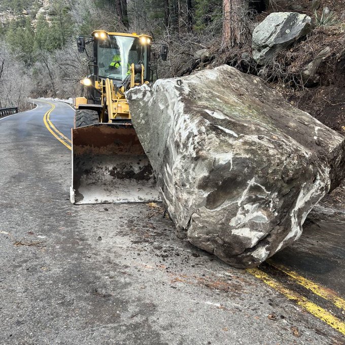
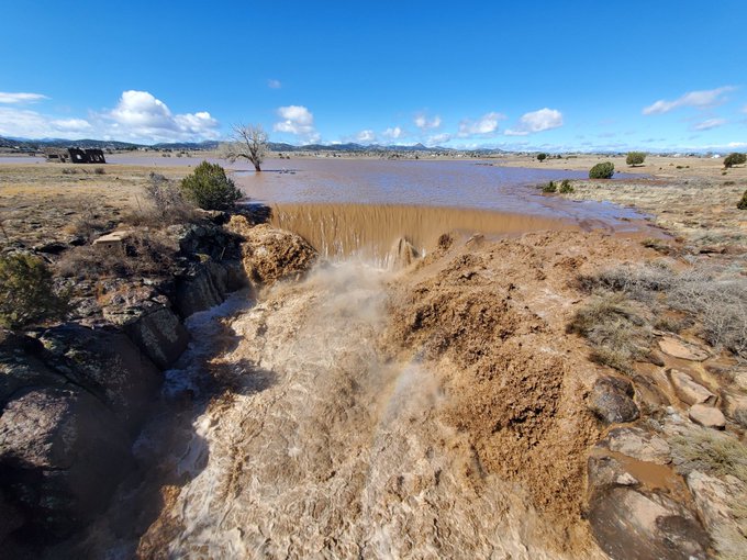
Many flood related impacts were reported from this storm system. Evacuations were in place for low-lying areas of Black Canyon City and along portions of the Verde River, including Camp Verde. There were multiple reports of flooding in Camp Verde, including water entering many homes, and reports of people having to be rescured from their property. A road was washed out in Doney Park, leaving a school bus stranded across the gap in the road. State Route 89A was also closed for several days between Sedona and Flagstaff due to mutiple rock slides along Oak Creek Canyon. Unfortunately, three fatalities were reported from this widespread flooding event.
During this event, many record or near-record crests were measured along area waterways, including:
Location |
Stage |
Date/Time |
Flow |
Historical Ranking |
Oak Creek |
||||
| Oak Creek Sedona | 16.4 ft | NA | NA | 4th highest* |
| Oak Creek Cornville | 15.1 ft | 3/22/2023 6:00 AM | 15,559 cfs | 9th highest |
Verde River |
||||
| Verde River Paulden | 13.2 ft | 3/22/2023 4:00 PM | 16,003 cfs | 2nd highest |
| Verde River Clarkdale | 16.2 ft | 3/15/2023 11:45 PM | 21,806 cfs | 7th highest |
| Verde River Above Camp Verde | 19.7 ft | 3/22/2023 5:15 PM | 32,084 cfs | Highest |
| Verde River near Camp Verde | 25.0 ft | 3/22/2023 4:30 PM | 78,863 cfs | 3rd highest |
| Verde River Above Horseshoe Reservoir | 23.6 ft | 3/22/2023 10:35 PM | 99,633 cfs | Highest |
| East Verde River near Childs | 19.5 ft | 3/21/2023 9:15 PM | 5,093 cfs | 2nd highest |
Little Colorado River |
||||
| Little Colorado River near Winslow | 22.1 ft | 3/22/2023 5:45 AM | 11,939 cfs | Highest |
Agua Fria River |
||||
| Agua Fria near Mayer | 12.1 ft | 3/22/2023 9:45 AM | 10,910 cfs | 9th highest |
Wet and Dry Beaver Creek |
||||
| Wet Beaver Creek near Rimrock | 14.0 ft | NA | NA | 3rd highest* |
| Dry Beaver Creek | 10.0 ft | 3/22/2023 8:45 AM | 11,397 cfs | 8th highest |
West Clear Creek |
||||
| West Clear Creek | 10.3 ft | 3/22/2023 8:15 AM | 14,592 cfs | 5th highest |
Havasu Creek and Cataract Creek |
||||
| Cataract Creek below Heather Wash | 9.3 ft | 3/23/2023 4:30 PM | 1,153 cfs | 3rd highest |
* indicates preliminary USGS estimated due to data quality issues
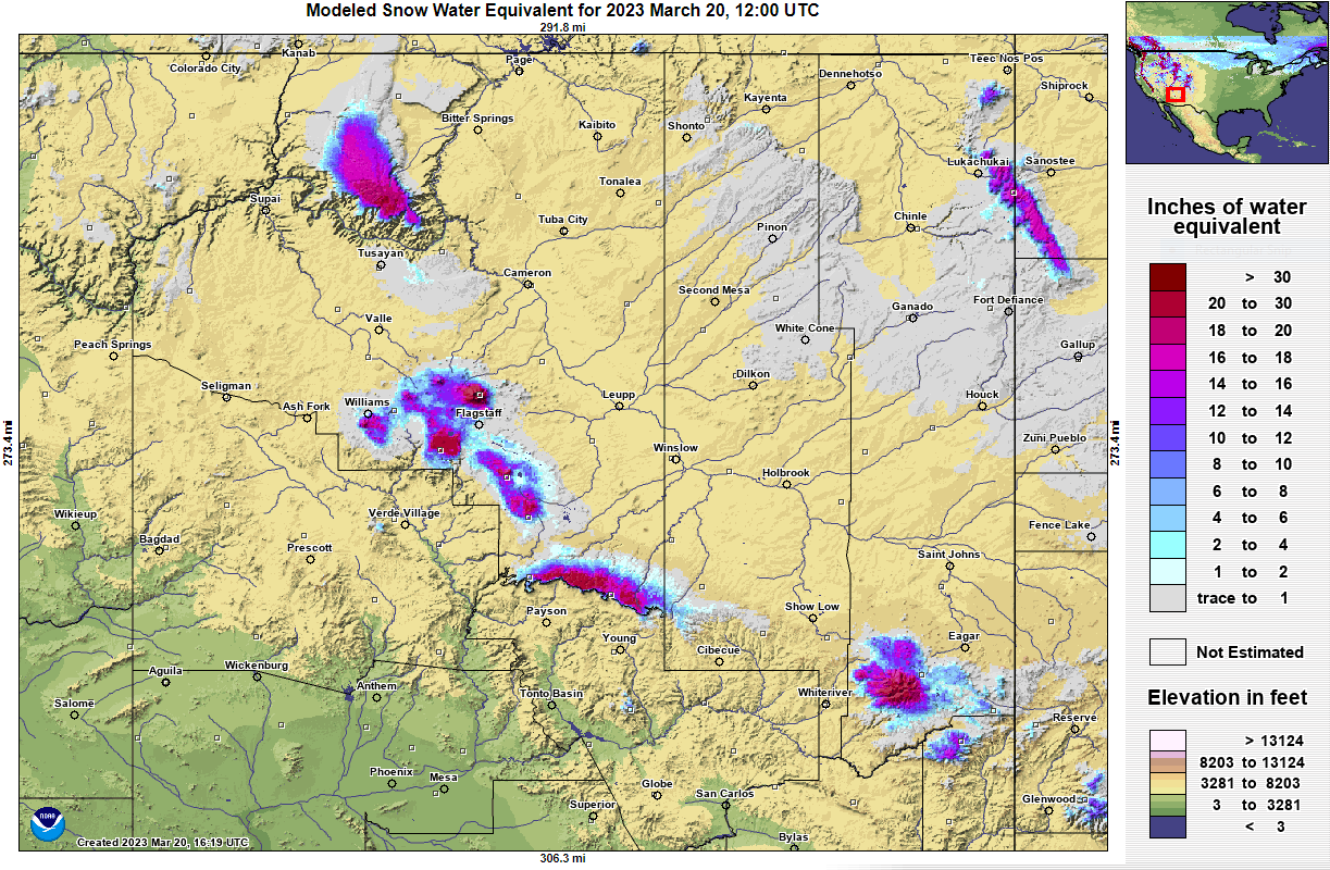
A exceptionally moist, broad and strong trough impacted the southwest United States from March 20th - 22nd. This storm hit the area at the end of what had already been a very moist and snowy Winter. With many areas already being saturated and with significant snow pack, the concern for impactful flooding was noted many days prior to the onset of the March 21st-22nd storm. Rain and high elevation snow began during the late evening hours on March 20th and continued into March 22nd. Snow levels early in the event were around 7000', and allowed for over 10" of wet, heavy snow to accumulate in the Flagstaff area. Snow levels then rose on the 21st to over 8500', and generally stayed over 7000' for the rest of the event. The primary trough impacted the area late on the 21st, and brought heavier rain to the area causing streams, creeks, and rivers to rise rapidly. The precipitation and rapid snowmelt brought widespread flooding and elevated flows which continued for several days.
Precipitation totals (rain and melted snow) for the event included: Mormon Mtn: 5.2" Flagstaff Airport: 3.43"; Tonto Natural Bridge: 3.09"; Jerome: 2.55"; Payson 2.58"; Prescott City 1.87"; Prescott surrounding areas 2-3"; Show Low area 1-2".
 |
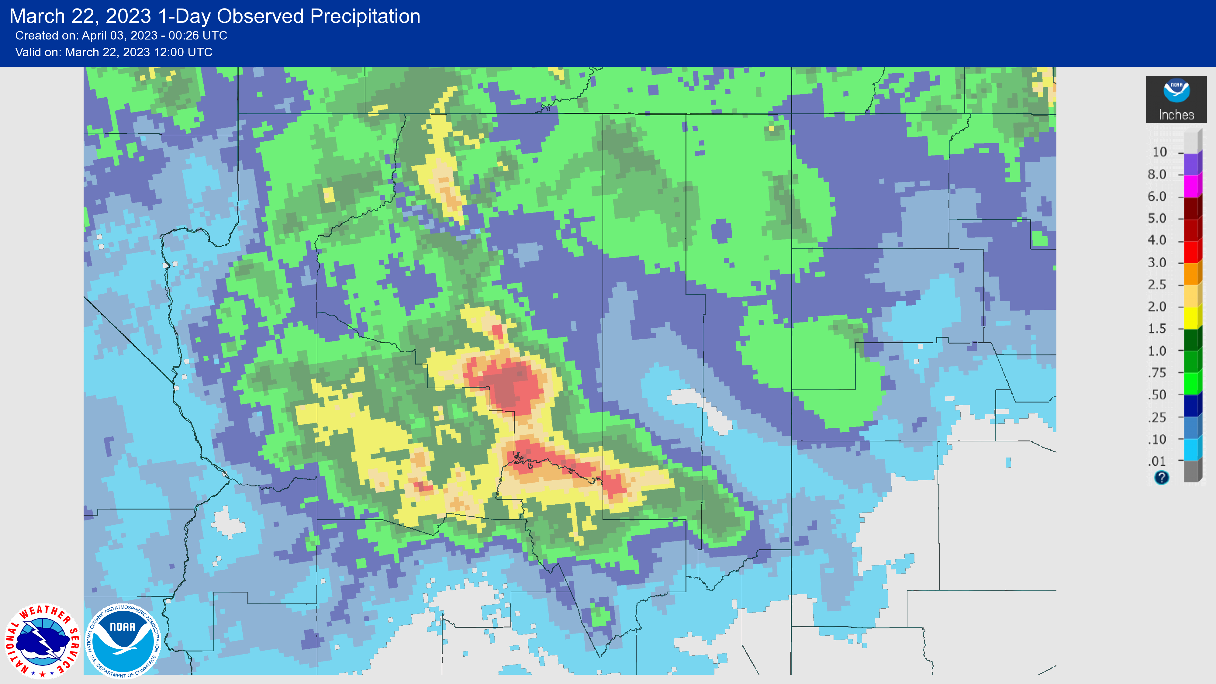 |
| NOHRSC analysis of snow-water equivalent on March 20, 2023 showing a high volume of moisture still contained within the snow pack over the High Country. | AHPS analysis of the rainfall that well on March 22, 2023 showing a large swath of 2 to 4 inches of precipitation falling along the Mogollon Rim. |
Click an image to view the full size.
 |
 |
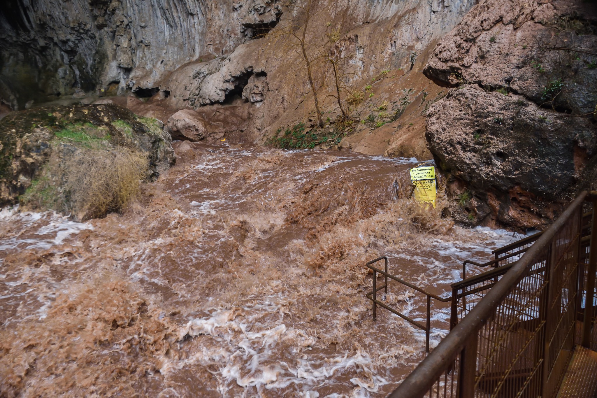 |
| One of several large rock slide along State Route 89A. Photo courtesy of Arizona DOT. | Flooded home along Bates Rd in Cottonwood along the Verde River. | High flow along Pine Creek beneath Tonto Natural Bridge. Photo courtesy of Micah Kipple. |
 |
 |
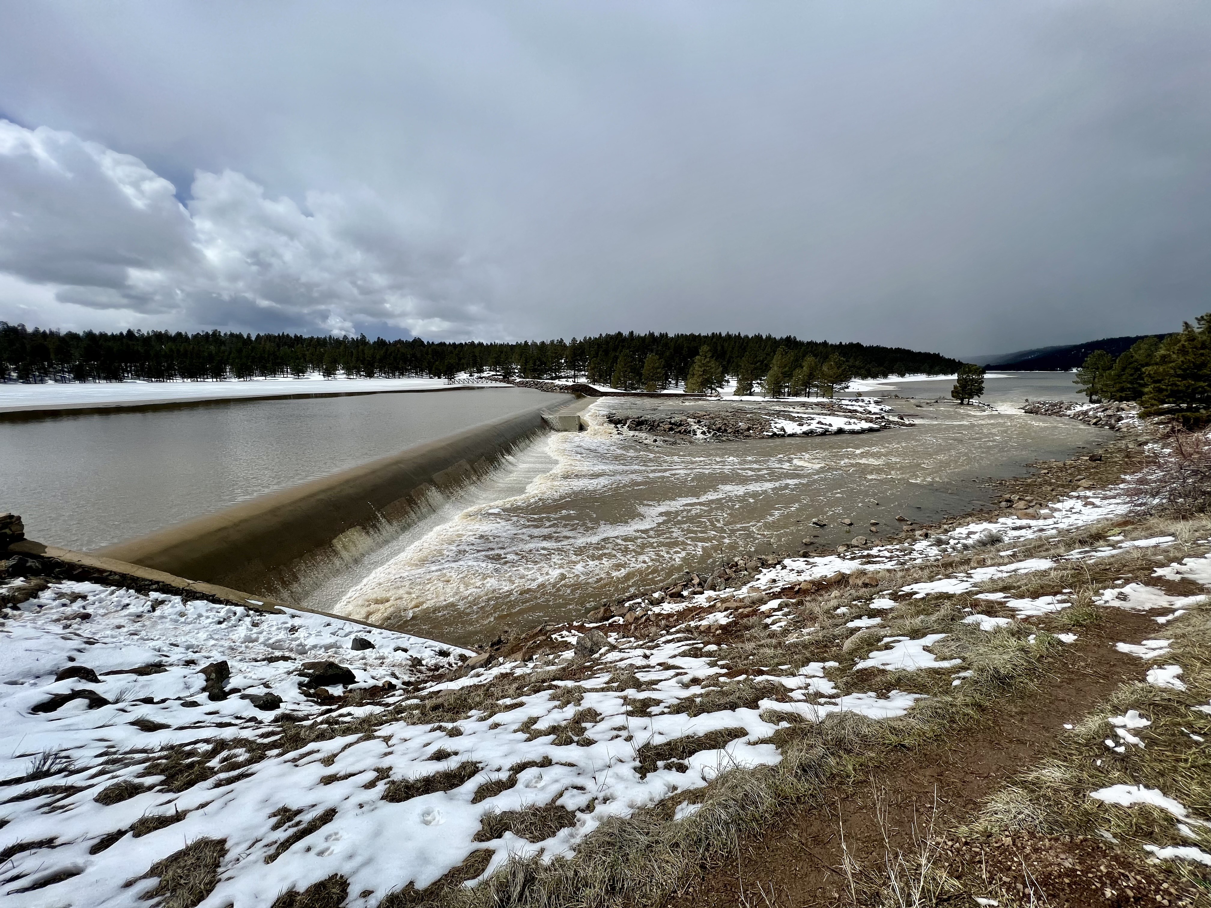 |
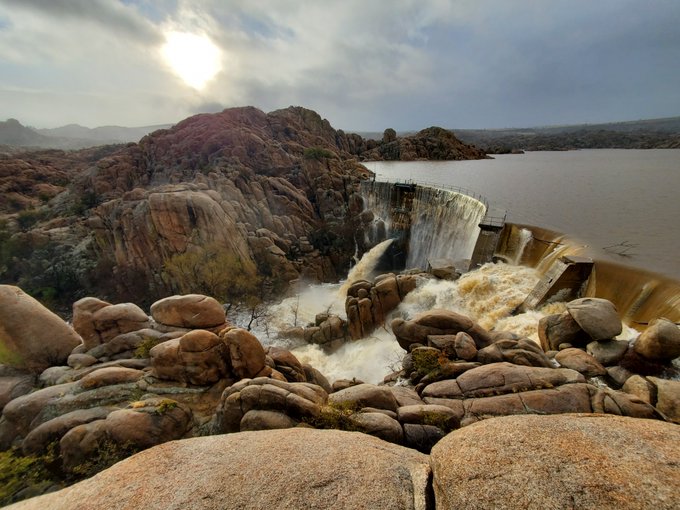
| Granite Creek at Watson Lake Dam. Photo courtesy of Yavapai County Flood Control District. | Sullivan Lake Dam. Photo courtesy of Yavapai County Flood Control District. | Water flowing over the Upper Lake Mary dam into Lower Lake Mary on March 23rd. |
For more information on impacts and general inquiries about this event, please reference the contacts below.
National Weather Service:
Media is free to use this event summary information. Please acknowledge the National Weather Service as the source of any information accessed from the site unless otherwise noted.

