
SKYWARN is a program that trains volunteers to help keep their local communities safe by providing timely and accurate reports of monsoon season weather to the National Weather Service Read More >

A series of strong to severe thunderstorms erupted late morning across the western Coconino Plateau on October 3rd, 2022. One storm roughly, 7 miles north of Williams, Arizona attained super cellular characteristics and produce copious amounts of quarter size hail. This same storm then went on to produce a short-lived EF-1 tornado between 12:40 PM and 12:53 PM MST.
| 11:42 AM MST: |
A strong thunderstorm develops about 16 miles west of Valle, moving southeast. NWS Flagstaff issues a Special Weather Statement through 12:15 PM MST for a gusty winds, small hail, and heavy rainfall. |
| 12:14 AM MST: |
NWS Flagstaff issues another Special Weather Statement through 1:00 PM MST for a gusty winds, small hail, and heavy rainfall on the same storm. |
| 12:40 PM MST: |
Tornado is estimated to have touched down, about 7 miles north of Williams. |
| 12:41 PM MST: |
NWS Flagstaff issues Severe Thunderstorm Warning until 1:30 PM MST, which included messaging of a possible tornado. |
| 12:53 PM MST: |
Tornado likely lifts. |
 |
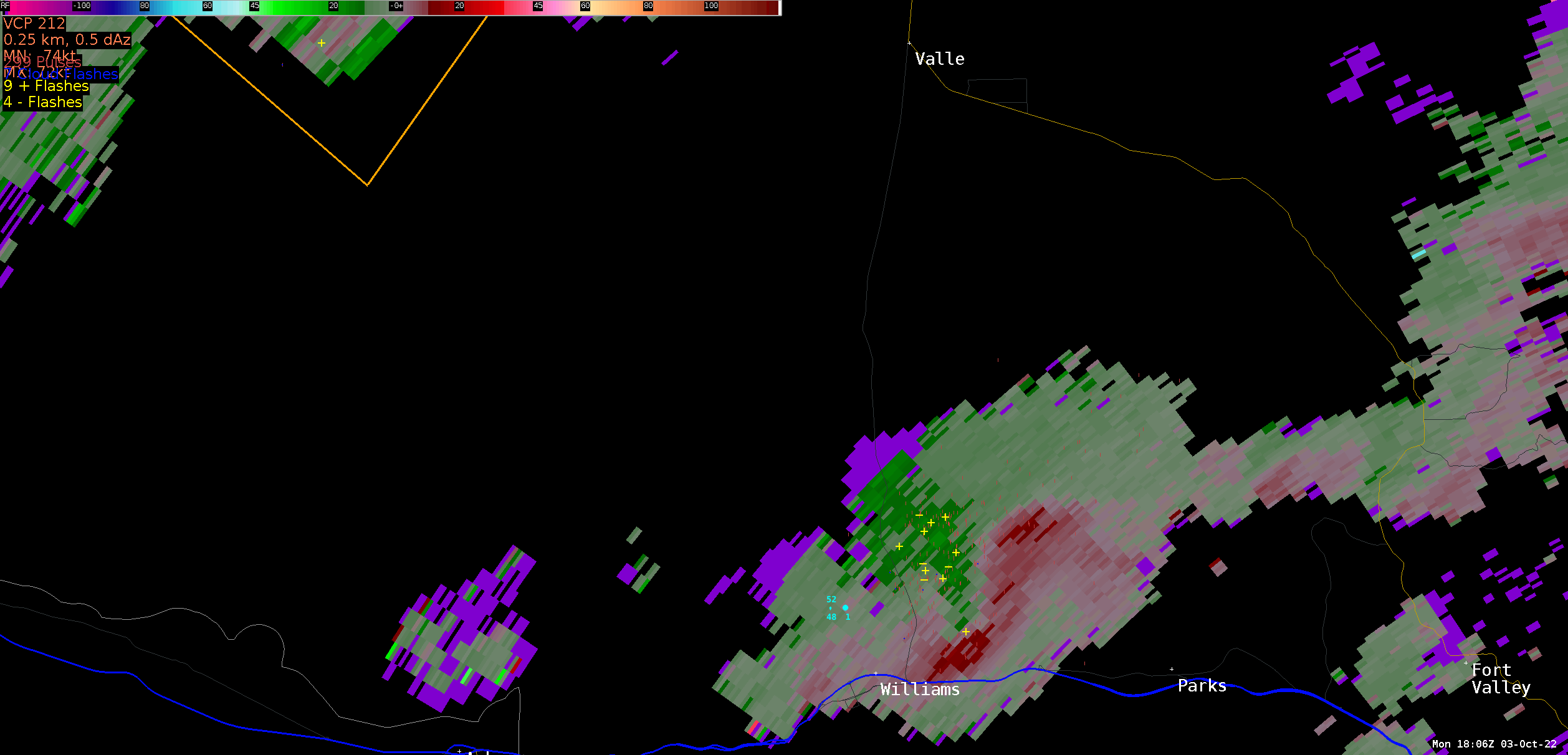 |
| Loop of radar reflectivity from 11:07 AM to 1:26 PM MST on October 3, 2022. Orange and red shading indicate areas of heavy rain, while the pink and purple values indicate hail. The orange boxes show the areas alerted in the Special Weather Statements and the yellow box shows the Severe Thunderstorm Warning that was issued. | Loop of storm-relative velocity from 11:07 AM to 1:26 PM MST on October 3, 2022. The red and green colors indicate winds away (red) and towards (green) the radar, which is to the southeast in this image. The areas of red and green close to each other just north of Williams show the area of rotation that went on to produce the tornado. |
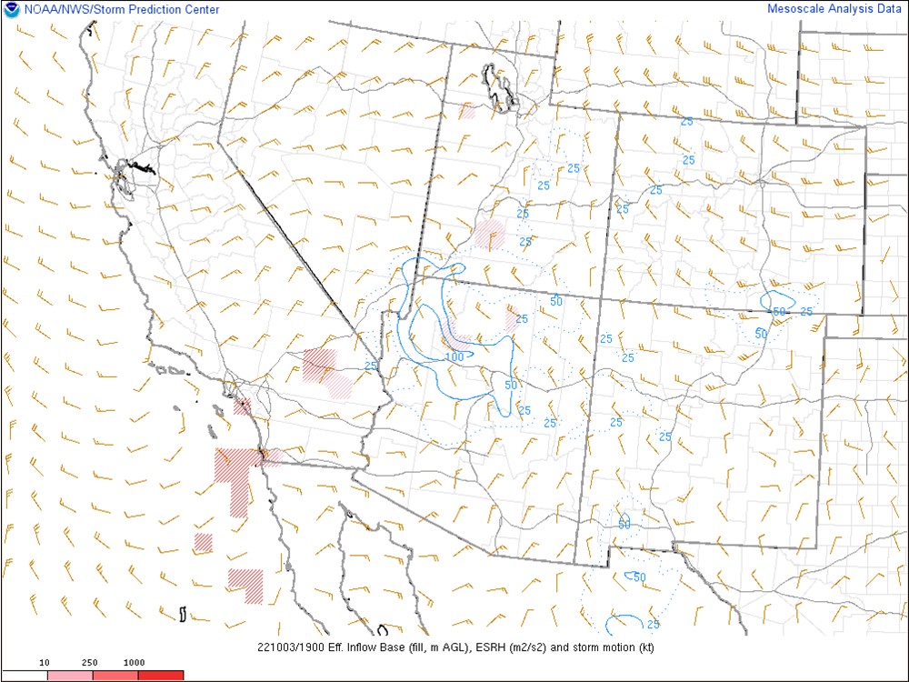
Thunderstorms fired along the western Coconino Plateau during the pre-dawn hours on Monday morning, moving from northwest to southeast across central and northern Arizona. While initially the environment was not overly impressive, daytime heating allowed for destabilization of the atmosphere and an approaching trough axis provided locally enhanced shear. This environment allowed for storms to develop and rapidly intensify during the late morning hours over the region. Shortly before noon, a strong thunderstorm developed several miles east of Valle, the storm slowly progressed southeastward, producing gusty winds and small hail. Around 12:40 PM MST, the storm strengthened becoming severe, producing large hail and damaging wind gusts. Additionally, the storm developed super cellular characteristics with brief rotational radar signatures became apparent. Additional storms went on to produce damaging winds, hail, and flash flooding across Yavapai County later that afternoon.
 |
 |
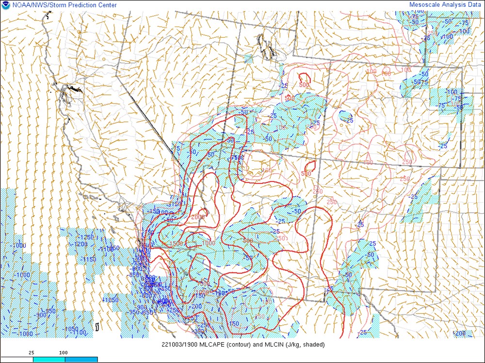 |
| 500mb analysis at 12:00 PM MST on October 3, 2022 showing a trough axis extending from the Northern Plains into Northern Arizona. | Effective Storm Relative Helicity (SRH) at 12:00 PM MST on October 3, 2022 showing locally enhanced shear ahead of the trough axis. | Mixed-Layer Convective Available Potential Energy (MLCAPE) at 12:00 PM MST on October 3, 2022 showing destabilization occurring across the western Coconino Plateau with daytime heating. |
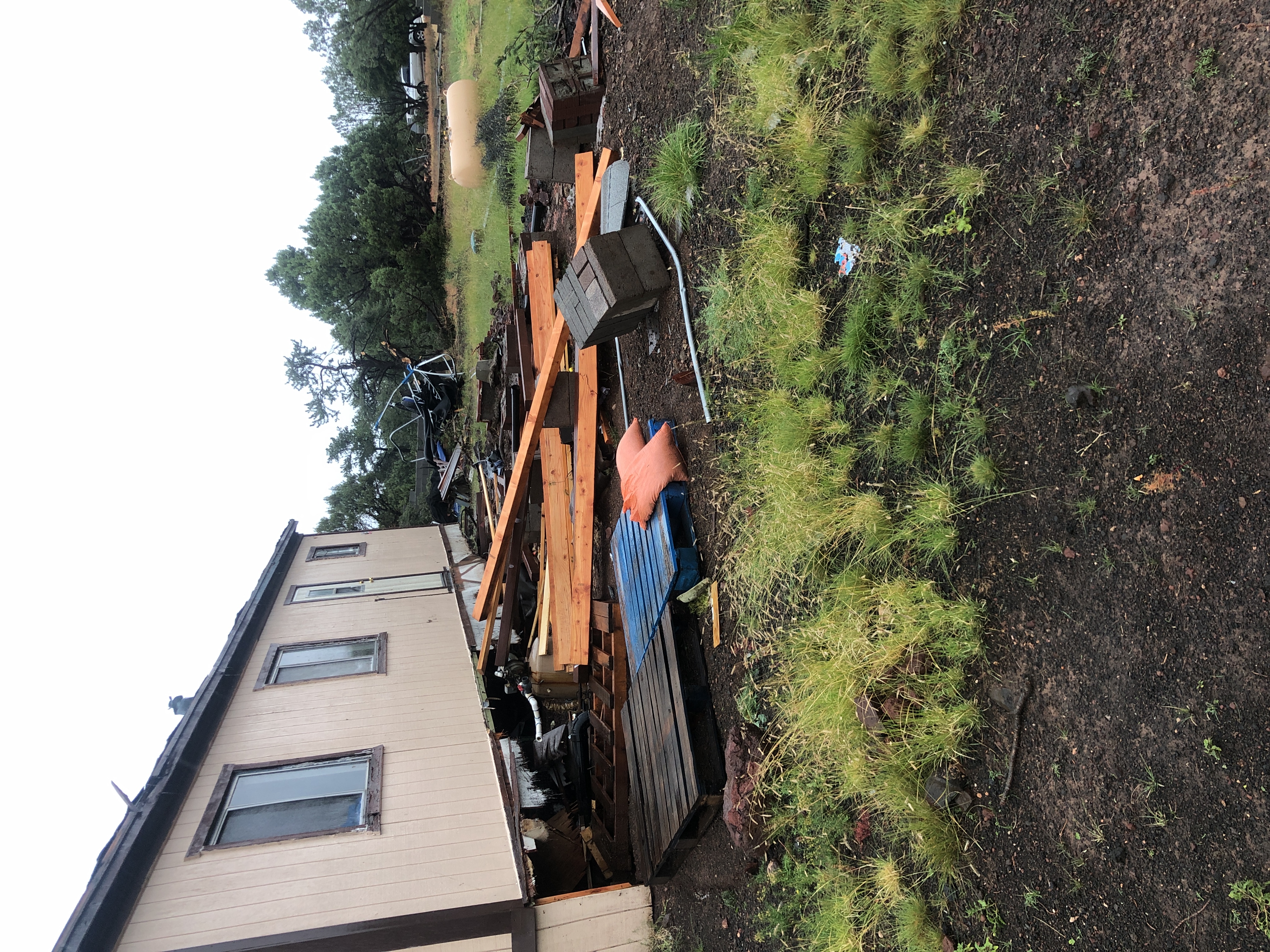
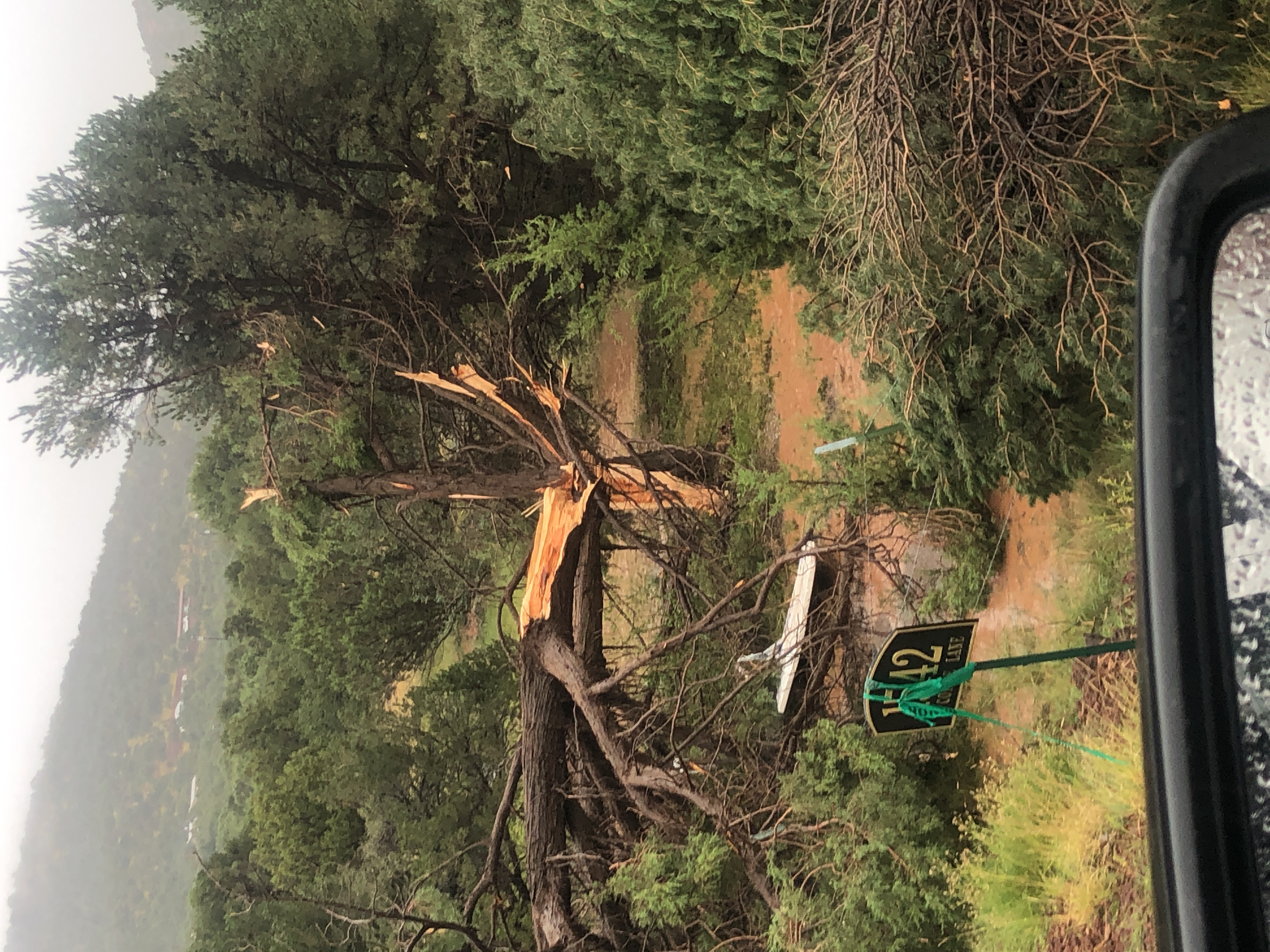
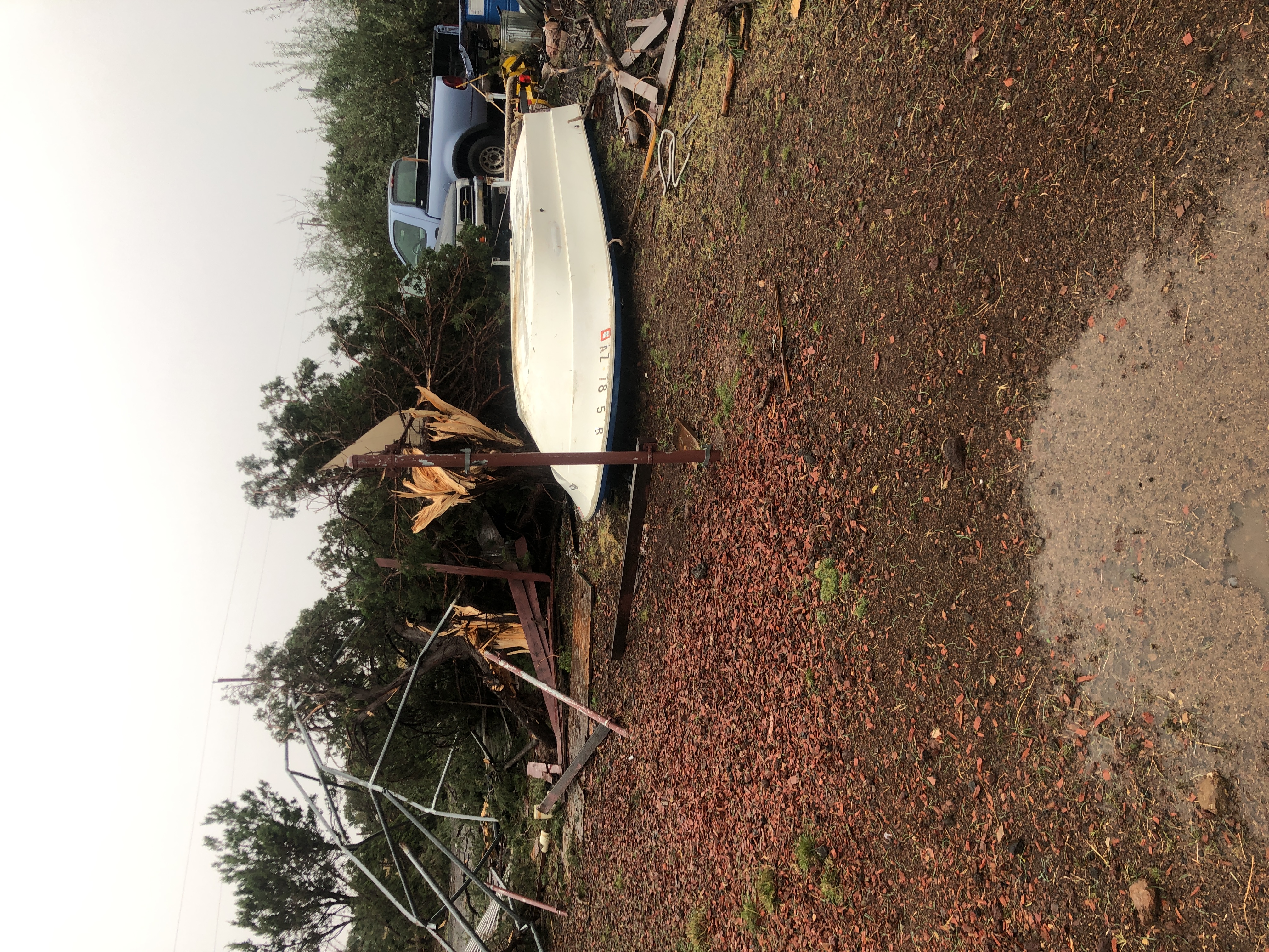
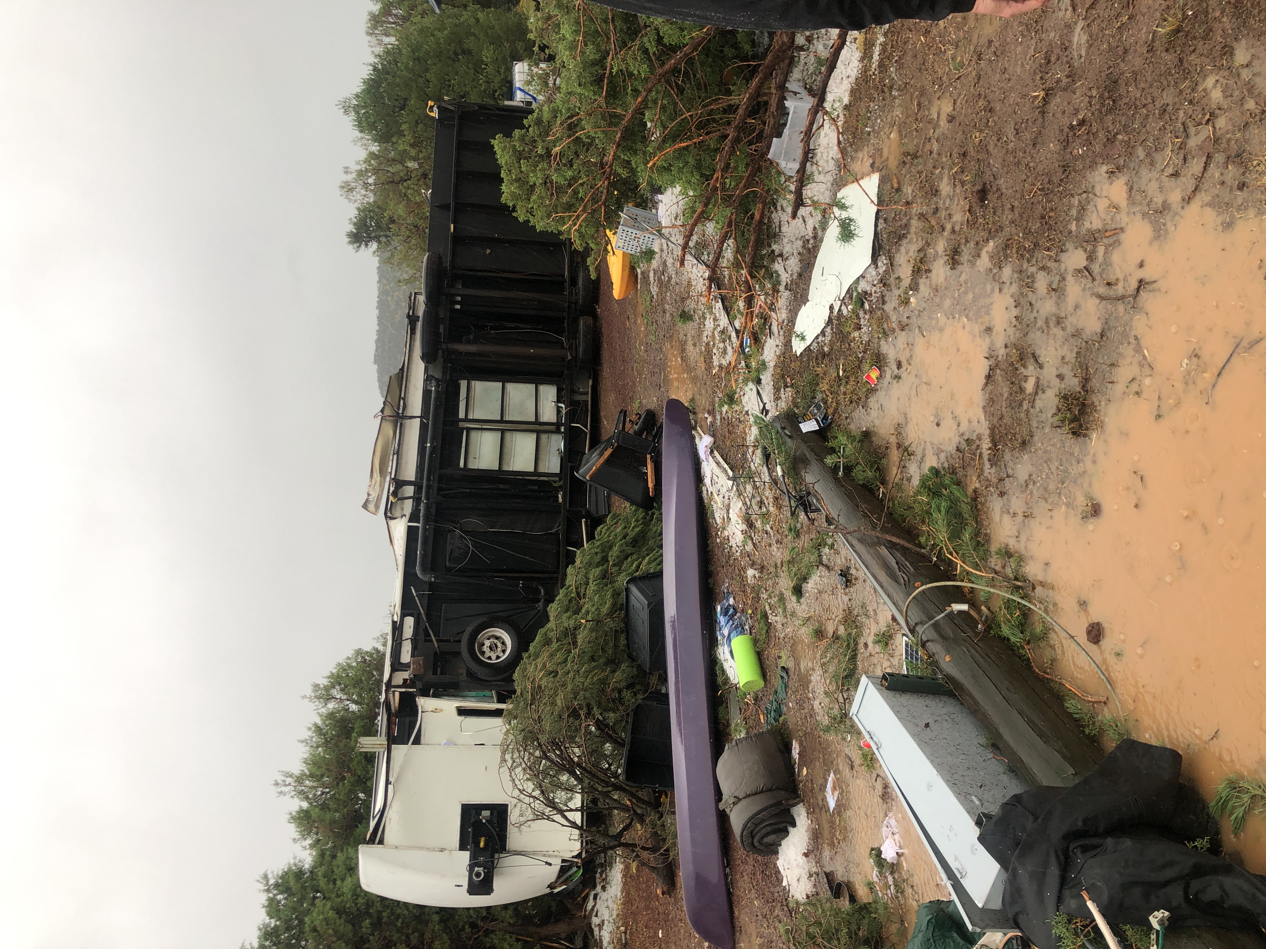
A very narrow corridor of damage to trees, outbuildings, recreational vehicles, and residential structures were noted. The narrow nature of the damage path, orientation of the wind damage in conjunction with radar evidence yields high confidence to attribute the destruction to that of an EF-1 tornado with peak winds estimated around 95 to 100 mph. No injuries or fatalities have been reported with the tornado. In addition to the tornado, the storm produced copious amounts of quarter size hail, with a few residents noting hail to the size of golf balls.
Click on an image to view the full size.
 |
 |
 |
| Manufactured home slid off of its foundation. | Large tree trunk snapped. | Broken electrical line. |
 |
 |
 |
| Snapped tree trunks. | Overturned RV. | Destroyed shed. |
For more information on impacts and general inquiries about this event, please reference the contacts below.
National Weather Service:
Media is free to use this event summary information. Please acknowledge the National Weather Service as the source of any information accessed from the site unless otherwise noted.

