
One-two punch of winter will bring two rounds of snow, one beginning this evening into Thursday, and another, stronger system on Friday and Saturday. Read More >
Grand Forks, ND
Weather Forecast Office
This page will explain how to use the Lake Wave Forecasts Page.
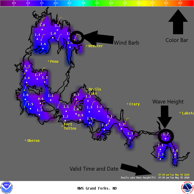
Three lakes are covered by our Lake Wave Forecasts Page: Devils Lake, the Upper and Lower Red Lakes, and Lake of the Woods. The forecasts cover both the wind (speed and direction) and wave height. There are two sections of the Lake Wave Forecast Page:
While we only make these forecasts for the larger lakes you can apply the forecasts to nearby lakes as well. A high wave day on the larger lakes means the potential for higher waves on the smaller lakes. Smaller lakes will be more sheltered with less fetch so the waves will not be as high as the larger lakes.
Notice: Wave height forecasts represent the average of the highest one-third (33%) of waves (measured from trough to crest) that occur in a given period. Since the Significant Wave Height is an average of the largest waves, mariners should be aware that many individual waves will probably be higher.
US Dept of Commerce
National Oceanic and Atmospheric Administration
National Weather Service
Grand Forks, ND
4797 Technology Circle
Grand Forks, ND 58203-0600
701-772-0720
Comments? Questions? Please Contact Us.


