Hodographs and Soundings
A hodograph is a graphical representation of wind speed and direction with height in the atmosphere.
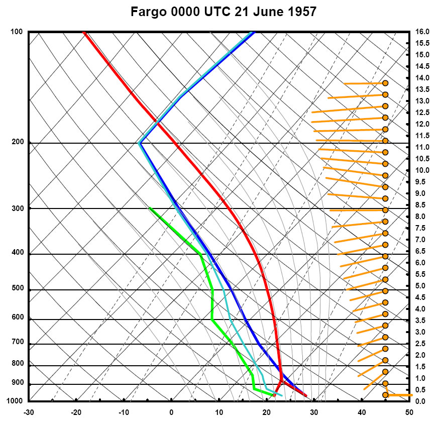
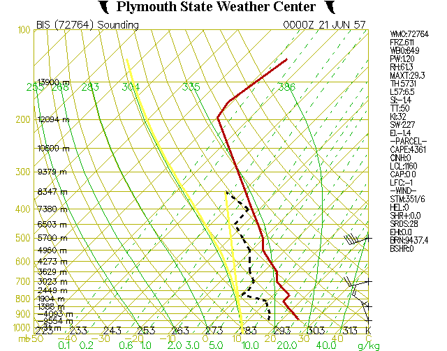
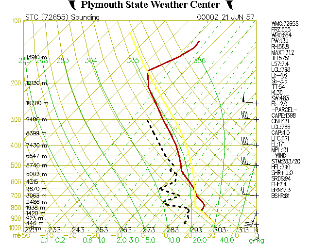
All modified hodographs and soundings were created with the use of Matt Bunkers programs. These profiles utilized all available upper air and sounding data that could be obtained. In addition, subjective interpolation was performed to come up with a "best guess" for these modified profiles. These are the only known profiles available for this tornado, and are subject to some debate, but are based on the authors' best estimates given the limited data available in 1957.
Meteorologists use hodographs to monitor the environment and determine if the potential exists for thunderstorms to rotate. Rotating thunderstorms are known as supercells and can produce large and devastating tornadoes if conditions are right, like the 1957 event in Fargo.
Soundings are vertical profiles of temperature, dewpoint, and wind in the atmosphere. Radiosondes (weather balloons) are typically launched twice daily and measure the variables which determine a sounding. Not all weather offices launch radiosondes. In 1957, Bismarck (BIS) and St. Cloud, MN (STC) did launch weather balloons. The modified Fargo soundings are an averaged approximation to the conditions there given the actual information from BIS and STC.
.
|
Hodographs |
|||
|
|
|||
|
|||
|
Soundings |
|||
|
|
|||
|
|


