Overview
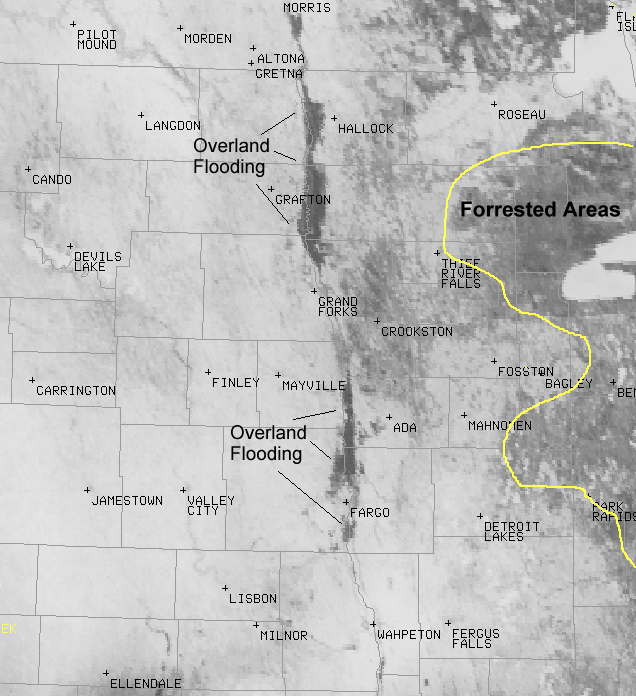
On Monday April 6th, 2009, the skies across the Red River Valley were almost perfectly clear. This allowed forecasters with the NWS to have an unobstructed view of the overall Valley and Lakes region, particularly the extent of the areal flooding. Below are visible satellite photographs from the NOAA Geosynchronous Observation Environment Satellite (GOES) platform. The white areas are all snow, with the darker areas representing the overland flooding. Please note the forested areas to the east also have snow on the ground, but the larger number of trees appear dark in comparison. Residents were advised to pay close attention to the river forecasts through the week, as warmer weather will again initiate the snow melt, causing area rivers to rise.
Satellite Images:
 |
 |
 |
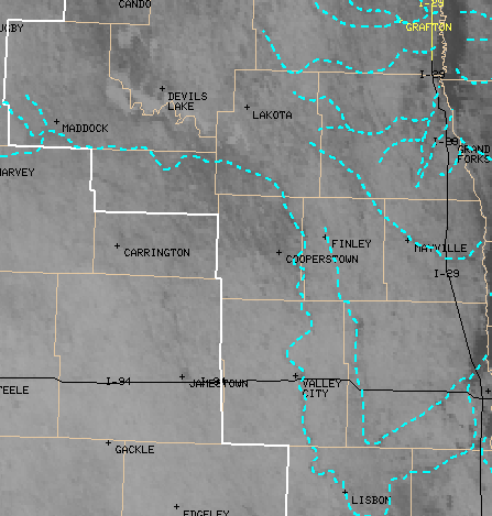 |
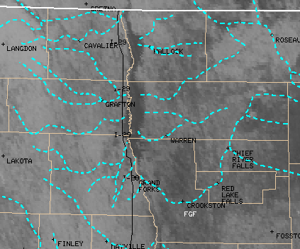
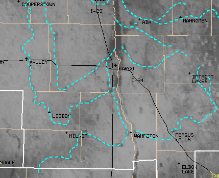
| This is a visible satellite image from the NOAA GOES taken around 10am Monday April 6th 2009. | A close up of the northern Red River Valley from Monday April 6th 2009. The blue dashed lines represent the approximate location of the primary river channels. | A close up of the southern Red River Valley from Monday April 6th 2009. The blue dashed lines represent the approximate location of the primary river channels. | A close up of the Devils Lake and Sheyenne River Valley from Monday April 6th 2009. The blue dashed lines represent the approximate location of the primary river channels. Devils Lake and Stump Lakes are ice covered and plainly visible. |
 |
Media use of NWS Web News Stories is encouraged! Please acknowledge the NWS as the source of any news information accessed from this site. |
|

