Grand Forks, ND
Weather Forecast Office
Event Summary
Mid to late June climatologically is the peak season for strong tornadoes across the northern plains. One of the most significant tornado outbreaks to impact our region occurred 5 years ago on June 17, 2010. A total of around 70 tornadoes occurred over North Dakota and Minnesota that day, including 4 violent EF-4 tornadoes. The images below show the tornado tracks across the region and locally for the day.


Radar
Atmospheric conditions were quite favorable for rotating supercell thunderstorms, with distinct clusters of tornadic supercells lifting north and east over the region.
Below is a radar animation as thunderstorms developed.
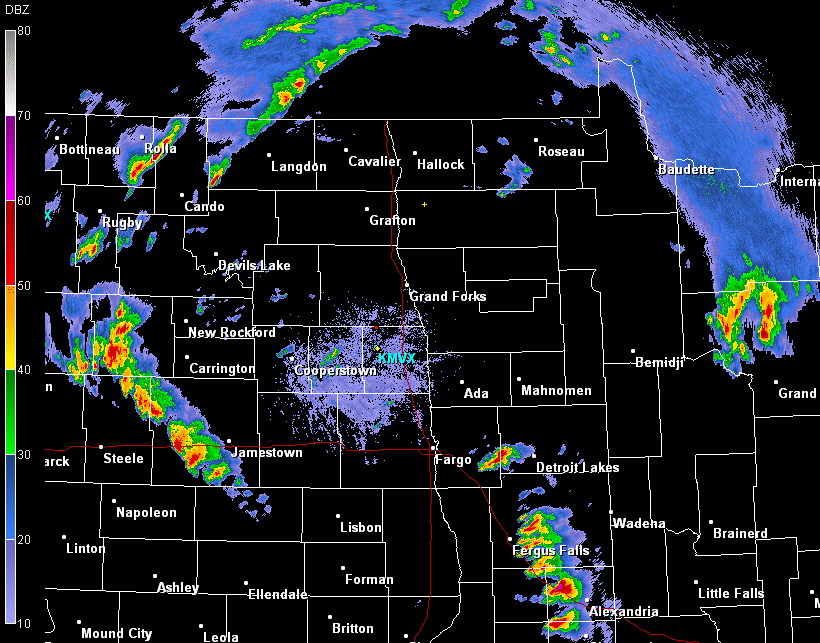
The below images from 4:29 pm CDT show two intense supercell thunderstorms across Otter Tail and Wadena Counties. These storms spawned violent EF-4 rated tornadoes that impacted the Almora-Bluffton and Wadena areas. A third EF-4 rated tornado occurred farther west across parts of Traill and Grand Forks Counties.


Photos


Above: Damage across Otter Tail and Wadena Counties.
US Dept of Commerce
National Oceanic and Atmospheric Administration
National Weather Service
Grand Forks, ND
4797 Technology Circle
Grand Forks, ND 58203-0600
701-772-0720
Comments? Questions? Please Contact Us.

