Overview
A weak surface Low tracking along the international border with an attendant warm front sparked off severe storms near the warm front and in the warm sector. The day started with a few severe storms, but 50 knot bulk shear, and MUCAPE near 1500 J/kg contributed to storms with supercellular characteristics in northwestern Minnesota in the afternoon and evening hours of June 12th.Tornadoes:
In addition to the tornado below, there was another tornado that tracked through an open field. No damage was reported, so no survey was conducted.
|
Tornado - Spruce Valley
Track Map 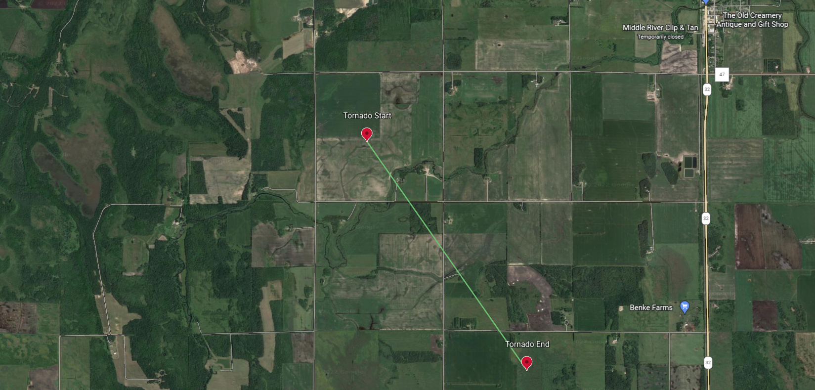 
|
||||||||||||||||
The Enhanced Fujita (EF) Scale classifies tornadoes into the following categories:
| EF0 Weak 65-85 mph |
EF1 Moderate 86-110 mph |
EF2 Significant 111-135 mph |
EF3 Severe 136-165 mph |
EF4 Extreme 166-200 mph |
EF5 Catastrophic 200+ mph |
 |
|||||
Photos & Video
Here are some tweets from June 12th's storms
Video NE of Holt by 7.5 miles taken right as the hail core was overtaking me at 4:03pm. It was packing some decent winds as well. #mnwx pic.twitter.com/NZePcpsHNA
— Nick Camp (@NickCampMN) June 12, 2022
Swamp Monster.
— Weather Unrated (@WxUnrated) June 13, 2022
Pic of the wicked #supercell moving through the swamps west of Red Lake, MN this afternoon. The structure and colors were awesome as it moved into the swamps and a funnel even poked out of the bottom for a bit in this pic. #mnwx #nikon #StormHour #ThePhotoHour pic.twitter.com/vQN1sVM5sa
Some video from the gnarly supercell near Goodridge, MN this afternoon. Saw some possible #tornadoes but never anything definitive. Was spinning like a top in multiple places. Followed it into the Red Lake marshes. Full video to come eventually! #mnwx @NWSGrandForks #nikon pic.twitter.com/LtezIzKkOg
— Weather Unrated (@WxUnrated) June 13, 2022
Supercell east of Goodridge #mnwx eating dust pic.twitter.com/hrDoL4fAD4
— James Hooker (@jstormlogger) June 13, 2022
Radar
Composite Reflectivity from June 12th, 2022
Storm Reports
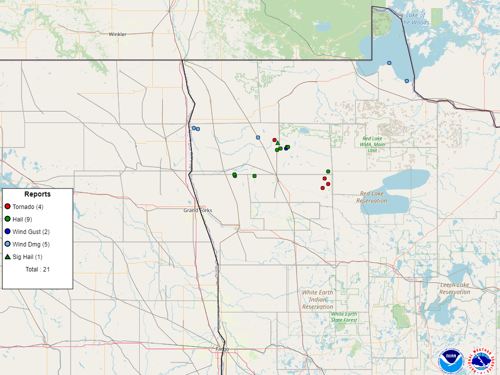 |
| Storm Reports across the area on June 12th, 2022 |
PRELIMINARY LOCAL STORM REPORT
NATIONAL WEATHER SERVICE GRAND FORKS ND
721 PM CDT MON JUN 13 2022

..TIME...   ...EVENT...      ...CITY LOCATION...     ...LAT.LON...
..DATE...   ....MAG....      ..COUNTY LOCATION..ST.. ...SOURCE....
            ..REMARKS..

0801 AM     HAIL             5 SSW RADIUM            48.16N 96.65W
06/12/2022  E1.00 INCH       Polk               MN   PUBLIC

0205 PM     TSTM WND DMG     11 WNW STEPHEN          48.51N 97.10W
06/12/2022                   Marshall           MN   NWS STORM SURVEY

            WIND DRIVEN HAIL STRIPPED AN ALFALFA FIELD AND DENTED AN
            ALUMINUM TRUCK TRAILER PARKED IN A FARMYARD. WINDS
            ESTIMATED TO 60 MPH AND HAIL ESTIMATED TO QUARTER SIZED.
            PILES OF HAIL WERE STILL EVIDENT IN THE YARD THE
            FOLLOWING MORNING. TIME ESTIMATED BASED ON RADAR.

0227 PM     TSTM WND DMG     9 WNW STEPHEN           48.50N 97.06W
06/12/2022                   Marshall           MN   NWS STORM SURVEY

            A FEW TREES BROKN DOWN IN SHELTER BELTS ACROSS
            SOUTHEASTERN EAGLE POINT TOWNSHIP. TIME RANGED BETWEEN
            225 AND 229 PM CDT BASED ON RADAR.

0331 PM     TSTM WND DMG     4 SE STRANDQUIST        48.44N 96.40W
06/12/2022                   Marshall           MN   NWS STORM SURVEY

            A FEW POPLAR AND ASH TREES SNAPPED NEAR INTERSECTION OF
            HWY 59 AND CR6. TIME ESTIMATED BASED ON RADAR.

0335 PM     TSTM WND DMG     8 NNE GRACETON          48.85N 94.77W
06/12/2022                   Lake Of The Woods  MN   PUBLIC

            VERY STRONG WINDS AND WIND DRIVEN WAVE ACTION TUMBLED
            DOCKS AT MORRIS POINT.

0348 PM     TORNADO          3 WSW MIDDLE RIVER      48.42N 96.22W
06/12/2022  F1               Marshall           MN   NWS STORM SURVEY

            THE TORNADO WAS LIKELY WRAPPED IN HEAVY RAIN, HAIL, AND
            DAMAGING WINDS AS IT TRACKED FOR ROUGHLY 2.5 MILES TO
            AROUND 3 MILES SSW OF MIDDLE RIVER BY 353 PM CDT. IT
            SNAPPED OR UPROOTED NUMEOUS ASH, POPLAR, AND SPRUCE TREES
            AT HOMESTEADS AND GROVES ALONG ITS PATH. A TOTAL OF 6
            WOODEN POWER POLES WERE SNAPPED ON NORTH-SOUTH LINES
            ALONG 120TH AND 130TH AVE NE. HAIL RANGED IN SIZE FROM
            ONE TO TWO INCH DIAMETER. PEAK WINDS ESTIMATED TO 105
            MPH. MAX WIDTH TO 300 YDS.

0352 PM     HAIL             3 SSW MIDDLE RIVER      48.40N 96.18W
06/12/2022  E2.00 INCH       Marshall           MN   NWS STORM SURVEY

            WIND DRIVEN HAIL PUNCHED HOLES IN SIDING AND BROKE OUT
            SEVERAL WINDOWS ON THE WEST/NORTHWEST WALLS OF A HOUSE.
            HAIL STONES UP TO GOLF BALL SIZED WERE FOUND IN MELTING
            PILES EARLY THE FOLLOWING MORNING.

0353 PM     HAIL             5 NNE HOLT              48.36N 96.15W
06/12/2022  M1.75 INCH       Marshall           MN   LAW ENFORCEMENT

            DEPUTY REPORTED LARGE GOLF BALL SIZED HAIL AT THE
            INTERSECTION OF HWY 59 AND CR28.

0407 PM     HAIL             6 SE MIDDLE RIVER       48.37N 96.07W
06/12/2022  M1.50 INCH       Marshall           MN   TRAINED SPOTTER

            QUARTER TO PING PONG BALL SIZED HAIL WAS ACCUMULATING ON
            THE GROUND.

0407 PM     TSTM WND GST     7 NE HOLT               48.36N 96.09W
06/12/2022  M65.00 MPH       Marshall           MN   TRAINED SPOTTER

0442 PM     TORNADO          6 E GOODRIDGE           48.14N 95.67W
06/12/2022  F0               Pennington         MN   TRAINED SPOTTER

            TORNADO TRACKED FOR LESS THAN A MINUTE THROUGH AN OPEN
            FIELD. THE GROUND BASED DUST SWIRL WAS FILMED OR
            PHOTOGRAPHED BY AT LEAST THREE SPOTTERS. A PERSISTANT AND
            LOW WALL CLOUD STRUCTURE WAS TRACKED INTO THE AREA AND
            WAS ABOVE THE SWIRL, THOUGH NO CONDENSATION CONE WAS
            READILY APPARENT. FIRST REPORTED VIA SOCAL MEDIA AND
            TROUHGH BROADCAST MEDIA SOURCES. TIME ESTIMATED BASED ON
            RADAR, VIDEO, AND NEARBY WIND SENSOR REPORTS.


&&

$$

GREGORY.GUST
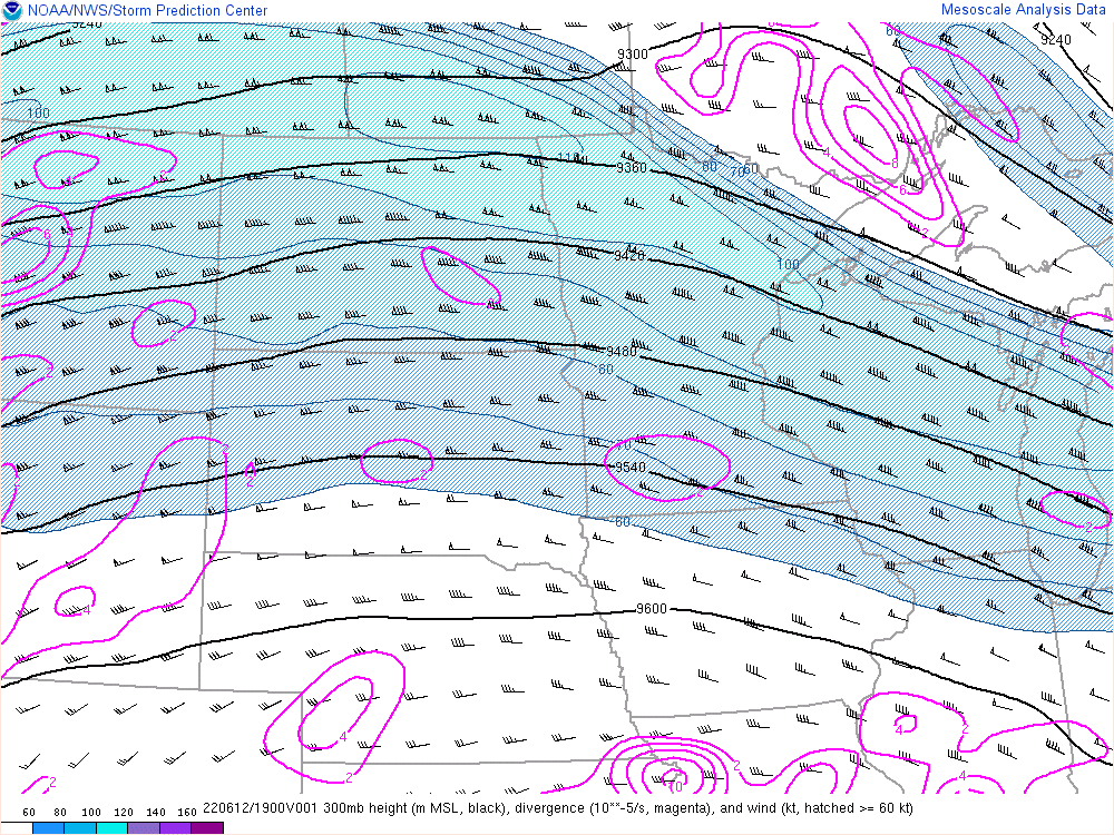
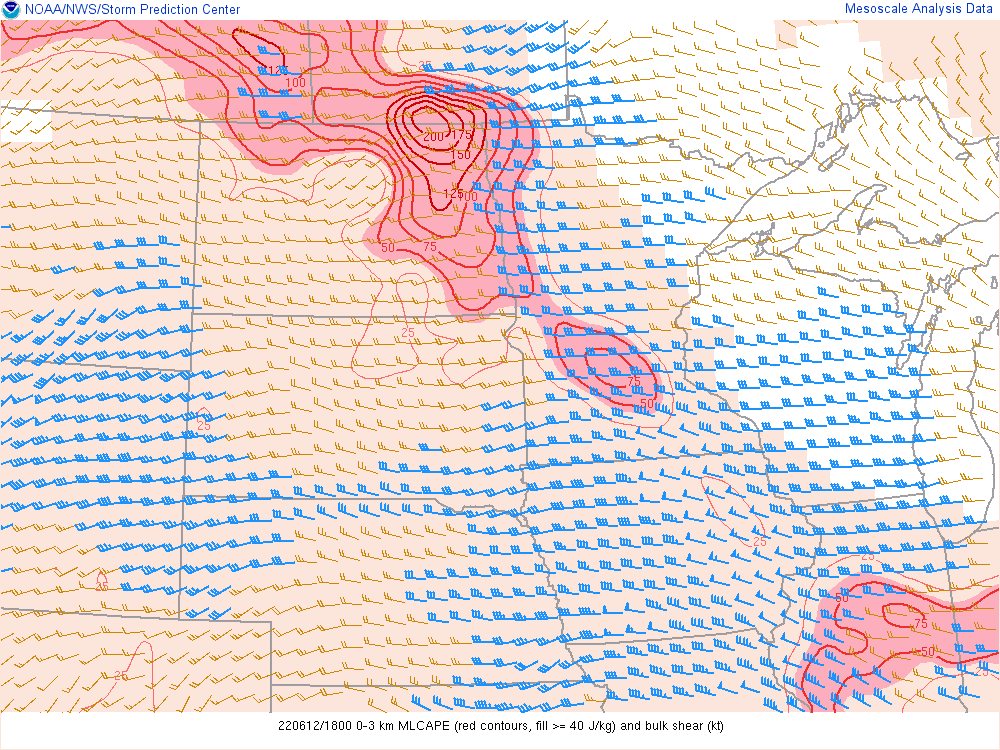
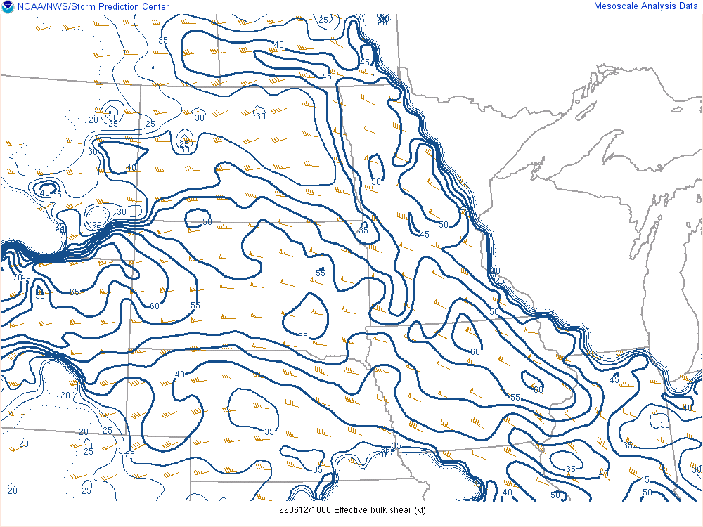
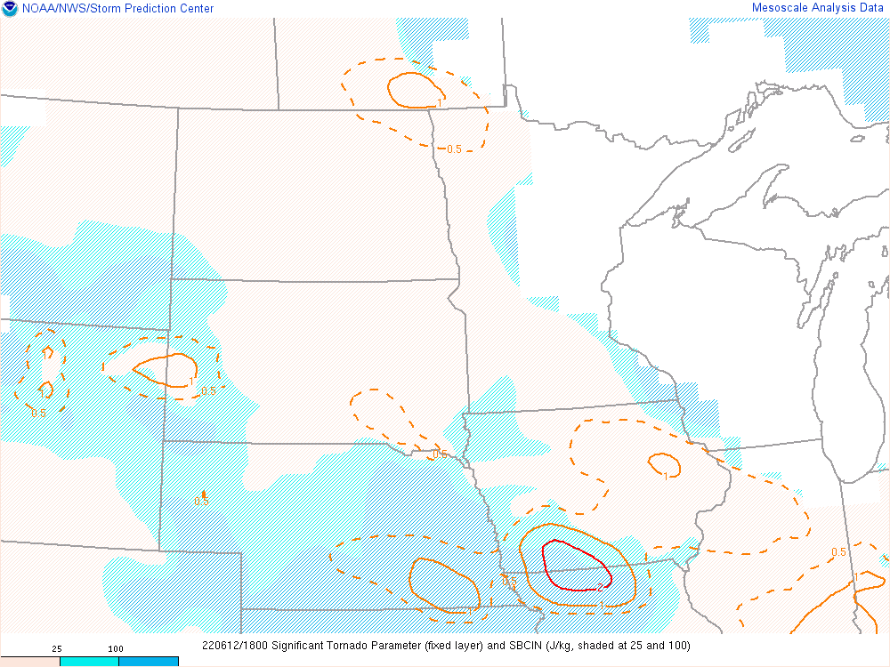
Environment
 |
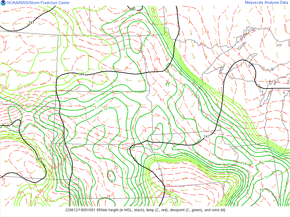 |
| Figure 1: 300mb Loop | Figure 2: 850mb Loop |
 |
 |
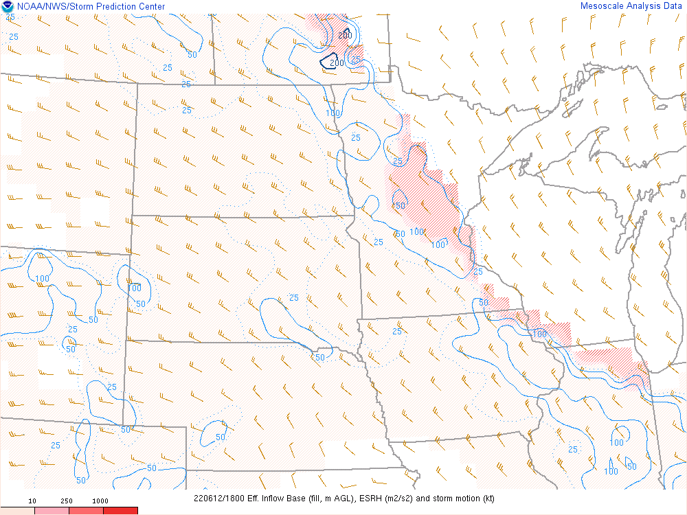 |
| Figure 3: 0-3km MLCAPE and Bulk Shear Loop | Figure 4: Bulk Shear Loop | Figure 5: Effective Storm Relative Helicity Loop |
 |
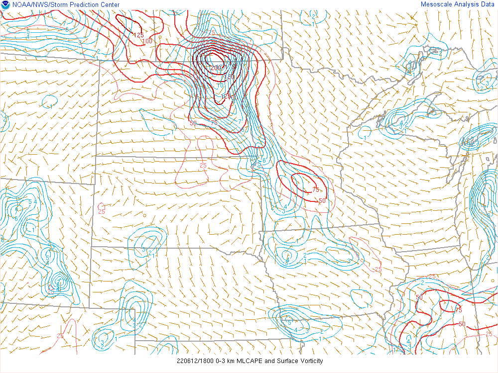 |
| Figure 6: Significant Tornado Parameter Loop | Figure 7: MLCAPE and Surface Vorticity Loop |
 |
Media use of NWS Web News Stories is encouraged! Please acknowledge the NWS as the source of any news information accessed from this site. |
|

